
- Fremont.small.JPG (136 KiB) Viewed 4381 times
Wyoming 13ers Quest
Forum rules
- This is a mountaineering forum, so please keep your posts on-topic. Posts do not all have to be related to the 14ers but should at least be mountaineering-related.
- Personal attacks and confrontational behavior will result in removal from the forum at the discretion of the administrators.
- Do not use this forum to advertise, sell photos or other products or promote a commercial website.
- Posts will be removed at the discretion of the site administrator or moderator(s), including: Troll posts, posts pushing political views or religious beliefs, and posts with the purpose of instigating conflict within the forum.
Re: Wyoming 13ers Quest
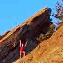
The hike from Elkhart Park provides a good view of Fremont....
"A couple more shots of whiskey,
the women 'round here start looking good"
the women 'round here start looking good"

Re: Wyoming 13ers Quest
Great. Thanks to you and Eli. I’ll look at Fremont and the others in list. This is just what I needed! R
The summit is a source of power. The long view gives one knowledge and time to prepare. The summit, by virtue of the dizzying exposure, leaves one vulnerable. A bit of confidence and a dash of humility is all we get for our work. Yet to share these moments with friends is to be human. C. Anker
-
Eli Boardman
- Posts: 661
- Joined: 6/23/2016
- 14ers: 58 1 15
- 13ers: 18 1
- Trip Reports (16)
- Contact:
Re: Wyoming 13ers Quest
At last--I am done with the 13ers in the Northern Wind Rivers. There are several remaining summits in different parts of the state, but I finally finished the tight grouping of 31 peaks that constitutes the heart of the Wyoming 13ers.
After taking 2 midterms on Friday, I spent Saturday solo backpacking the ~22 miles up my beloved Glacier Trail to camp above treeline in the Dinwoody. I weathered a big thunderstorm that evening, and was thankful to be dry and relatively safe in my tent. The next morning, I followed an edge of the Dinwoody moraine in the dark, climbing to Backpacker's Pass in the morning twilight. From there, I worked out a convoluted and devious route up the north side of Turret Peak. This ended up being probably the 2nd most difficult of the Wind River 13ers (after Spearhead), as I pulled some steep, exposed slab moves on nasty lichen-covered semi-loose rock that felt comparable to 5.2 in the Flatirons (albeit sketchier for the reasons just listed). I scrambled the impressive north face of the summit tower, which despite looking like the hardest part of the climb, was actually one of the better sections and only 4th class. I was elated to sit atop this elusive and forbidding mountain, looking out across a sea of peaks I climbed previously, but I was nervous for the descent.
I ended up downclimbing a different variation than I took on the way up. It was slightly easier and less exposed, but still involved tenuous slab moves and horribly loose rock. A belayed party could take the ridge direct, which appears to be a much better route, albeit considerably harder. Anyway, after returning to Backpacker's Pass, I scrambled the fun north ridge of Sunbeam Peak and relished in the wonderful views. I continued down its easy standard route to Blaurock Pass and climbed talus to the summit of Mount Febbas, a strange mountain, as it is really just the termination of the 10-mile-long Horse Ridge, the massive peneplain remnant that forms the southeastern wall of upper Dinwoody Valley. As a bonus, I visited the very high altitude Knoll Lake (or Noel Lake depending on which map you consult) and descended its outlet stream back to camp.
At this point, my parents joined me at high camp, having taken a more-standard 2 days for the approach. Monday morning, my dad and I crossed the Dinwoody moraine in the dark and navigated some tricky crevassed regions on one of the central lobes of the Dinwoody Glacier. He waited on a shoulder of the glacier around 12,500 ft. while I made a quick ascent of Pinnacle Ridge, a fun snow climb ending with a hundred feet of 4th class to reach the massive summit boulder. Insane views abounded in all directions.
After rejoining my dad, we climbed the southeast couloir on Gannett, a nice alternative to the Gooseneck that facilitated my side-trip to Pinnacle Ridge. This route is a bit steeper and at least twice as long as the Gooseneck, and it felt a bit more serious because other climbers hadn't kicked steps the way they do on the Gooseneck. Ultimately, we joined the summit ridge of Gannett and enjoyed sharing the summit of my 31st thirteener of the year. We descended the crowded Goosneck (which is in great condition by the way), and I spent the afternoon and evening hiking back out to the cars in just under 9 hours (over 22 miles from camp above treeline to the road).
So, that's a wrap on the core Wind River 13er region!
-
Eli Boardman
- Posts: 661
- Joined: 6/23/2016
- 14ers: 58 1 15
- 13ers: 18 1
- Trip Reports (16)
- Contact:
Re: Wyoming 13ers Quest
Summit view from Turret; left to right the 13ers are Jackson, Fremont, Sacagawea, Helen
Turret (left) and Warren (right) as seen while ascending Sunbeam
Gannett and the central Dinwoody peaks from the summit of Febbas
- 20200728_094320.jpg (137.55 KiB) Viewed 4217 times
- 20200728_094915.jpg (113.56 KiB) Viewed 4203 times
- 20200728_095425.jpg (148.66 KiB) Viewed 4217 times
Last edited by Eli Boardman on Tue Jul 28, 2020 10:44 am, edited 1 time in total.
-
Eli Boardman
- Posts: 661
- Joined: 6/23/2016
- 14ers: 58 1 15
- 13ers: 18 1
- Trip Reports (16)
- Contact:
Re: Wyoming 13ers Quest
Mount Woodrow Wilson and an impressive arm of the Dinwoody Glacier as viewed from the summit of Pinnacle Ridge (Warren on far left)
Summit view from Gannett, looking west over Scott Lake (milky, central) and Desolation Peak (snowy, on the right)
Descending the mega-classic summit ridge of Gannett with the line of Febbas-Sunbeam-Turret-Warren in the central background
- 20200728_103036.jpg (106.01 KiB) Viewed 4212 times
- 20200728_103335.jpg (122.08 KiB) Viewed 4212 times
- 20200728_103455.jpg (78.34 KiB) Viewed 4207 times

Re: Wyoming 13ers Quest
Incredible, you should write a guidebook with those photos, and a photo book, you're an expert on them by now. I still need to check out the Winds.
http://www.listsofjohn.com/m/cougar
"If we don't change direction, we'll end up where we're going."
"Bushwhacking is like a box of chocolates - you never know what you're gonna get."
"Don't give up on your dreams, stay asleep"
"If we don't change direction, we'll end up where we're going."
"Bushwhacking is like a box of chocolates - you never know what you're gonna get."
"Don't give up on your dreams, stay asleep"
-
Eli Boardman
- Posts: 661
- Joined: 6/23/2016
- 14ers: 58 1 15
- 13ers: 18 1
- Trip Reports (16)
- Contact:
Re: Wyoming 13ers Quest
Thanks guys! On another forum-community-related note, I actually got to meet a couple 14ers.com members planning to attempt Gannett with a LoJ/Peakbagger group that was just arriving in Floyd Wilson Meadows when I was headed out. Small world!
Haha, funny you should say that, as I plan on doing exactly that if things work out. I'd like to make a small pocketable field guide to the easiest 13er routes, with a level of detail somewhere between Roach's extensive descriptions and Kelsey's terse phrases. I'm also hoping to make a coffee-table-type photo book with a bunch of summit panoramas and sunrise shots mixed in with narrative on climbing the peaks.
Re: Wyoming 13ers Quest
Outstanding effort and photos! Again thanks for sharing!
I have a very similar photo of a partner ascending the summit ridge of Gannett with the Warren skyline in the background.
I have a very similar photo of a partner ascending the summit ridge of Gannett with the Warren skyline in the background.
"A couple more shots of whiskey,
the women 'round here start looking good"
the women 'round here start looking good"
-
The Android

- Posts: 93
- Joined: 8/16/2008
- 14ers: 38
- 13ers: 5
- Trip Reports (3)
- Contact:
Re: Wyoming 13ers Quest
This is all great stuff, thanks for sharing!
I am looking forward to your report on Black Tooth. I hiked Cloud Peak in 2014, and was very impressed by the look of that mountain. Not a lot of information about it either.
I am looking forward to your report on Black Tooth. I hiked Cloud Peak in 2014, and was very impressed by the look of that mountain. Not a lot of information about it either.
-
Eli Boardman
- Posts: 661
- Joined: 6/23/2016
- 14ers: 58 1 15
- 13ers: 18 1
- Trip Reports (16)
- Contact:
Re: Wyoming 13ers Quest
Yesterday I completed the first dayhike of the quest: my mom and I hiked a 30-mile loop out of the Worthen Meadows trailhead, summiting Wind River Peak in the middle.
We followed a trail to Sheep Bridge, then followed trails to the beautiful Deep Creek Lakes in the middle of the Popo Agie Wildwrness. A use trail offered access to a broad grassy ramp which we followed past Chimney Rock, finally boulder hopping the last bit to the summit. Descent was via the south slopes to Tayo Lake, then back to the car via a pass above Stough Creek, making an exactly 30-mile loop with zero repeated ground.
This was my second time climbing Wind River Peak, as I also tagged the summit on the 2nd day of our 26-day traverse in 2016. My parents waited just below the summit that day, so this was also a redemption hike for my mom to finally get the summit! Oh, and I'm now finished with all of the Wind River 13ers.
Last edited by Eli Boardman on Sat Aug 01, 2020 9:31 am, edited 1 time in total.
-
Eli Boardman
- Posts: 661
- Joined: 6/23/2016
- 14ers: 58 1 15
- 13ers: 18 1
- Trip Reports (16)
- Contact:
Re: Wyoming 13ers Quest
Ascent ramp (left) and Surveyor's Notch (center) above one of the uppermost Ice Lakes
Summit view from Wind River Peak, with Wind River Glacier in center (Northern Winds 13ers barely visible in haze left of center in background)
A last look at the now-distant Peak from a pass still 4 miles from the car
- 20200801_092236.jpg (179.09 KiB) Viewed 4359 times
- 20200801_092300.jpg (179.6 KiB) Viewed 4359 times
- 20200801_092325.jpg (135.04 KiB) Viewed 4359 times
-
Teresa Gergen
- Posts: 247
- Joined: 8/12/2012
- Trip Reports (0)
Re: Wyoming 13ers Quest
I hope you appreciate the fact that your parents rock : -)
You're really close! Stay safe and get it done!
You're really close! Stay safe and get it done!

