Abandoned vs. closed

Items that do not fit the categories above.
Forum rules
  • This is a mountaineering forum, so please keep your posts on-topic. Posts do not all have to be related to the 14ers but should at least be mountaineering-related.
  • Personal attacks and confrontational behavior will result in removal from the forum at the discretion of the administrators.
  • Do not use this forum to advertise, sell photos or other products or promote a commercial website.
  • Posts will be removed at the discretion of the site administrator or moderator(s), including: Troll posts, posts pushing political views or religious beliefs, and posts with the purpose of instigating conflict within the forum.
For more details, please see the Terms of Use you agreed to when joining the forum.
letitbeirie
Posts: 65
Joined: 6/26/2015
14ers: 16 
Trip Reports (0)
 

Abandoned vs. closed

Post by letitbeirie »

Do any of you know of a good way to tell undesignated routes that have been intentionally closed for environmental reasons etc. vs. ones that have just become less popular and less known over time?

My motivation is basically this: as much as I appreciate what the CFI/RMFI trails do for the 14ers environmentally and enjoy the relaxed grades on descent, I find a lot of them to be rather uninspiring ways to climb mountains. That's hardly a complaint though - most 14ers have several alternate routes available and I don't mind putting in quite a lot of extra effort to get a more adventurous experience, especially knowing their trail will save my knees on the way down.

Here's where it gets thorny.
usfs_preface.png
usfs_preface.png (71.01 KiB) Viewed 1855 times
At some point in the 1990s they (understandably) started encouraging people to use the most resilient trails instead of finding their own way up. The above excerpt is from the 3rd (1998) edition of Bourneman & Lampert, and it's... a lot lighter on information than the 2nd.
Again, understandable - you don't want to tell the public not to do something and then publish an instruction manual for how to do it - but a side effect of this is that a lot of alternate route info is confined to books which are now very old.
The unfortunate result of that (and reason for my question) is that it's hard to tell whether beta for any particular route was dropped from guides because of the general push to concentrate use onto 1-2 trails or whether that route, specifically, was problematic.

Here's what I mean (all images from Ormes 6th, 1973):

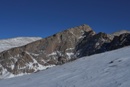
This one is Oxford, which has/had a route from Belford Gulch, still visible above treeline on Google Earth. Beta for it is scarce, but there's one trip report for it on this site and it appears to otherwise be okay to explore. I assume this one was dropped because there was a better trail up Missouri Gulch and a bridge so hikers could avoid a bath in Clear Creek before they set off.
bel_ox.png
bel_ox.png (187.63 KiB) Viewed 1855 times

But then you have ones like this. This is Yale's old route up Denny Gulch, and it's probably safe to presume this one was dropped because using it was officially forbidden by the USFS.
yale.png
yale.png (201.88 KiB) Viewed 1855 times

(continued)
User avatar
justiner
Posts: 4412
Joined: 8/28/2010
14ers: 58  8 
13ers: 138
Trip Reports (40)
 
Contact:

Re: Abandoned vs. closed

Post by justiner »

I think if it's legal, and you tread lightly, then go wander around. Belford Gulch does include having to navigate Belford Falls, which is the setting of a few mishaps - you could probably find mention of them even here on this forum.

Not sure about Denny Gulch - coulda been that the current trail is just a 1.5 mile reroute on an actual trail.
letitbeirie
Posts: 65
Joined: 6/26/2015
14ers: 16 
Trip Reports (0)
 

Re: Abandoned vs. closed

Post by letitbeirie »

(continued)

But there also routes so old they're just... lost, like this route up Elbert's north/northwest ridge. I can't find any newer beta on this one at all, let alone any indication as to why it was lost.
elbert.png
elbert.png (233.49 KiB) Viewed 1832 times

This one's even more interesting. It climbs Tab using the ridge from the old, officially closed Jennings Creek route, but it appears to climb that ridge from McCoy Creek instead (following this route it looks like). It also dips into McCoy Gulch, the bane of local SAR, before climbing back up and re-descending the ridge, so it's hard to tell whether this one was dropped because it runs too close to the burned area or whether hikers were getting lazy and SAR was having to pick them off the top of McCoy Falls after they didn't want to re-climb the ridge.
tab_loop.png
tab_loop.png (328.51 KiB) Viewed 1832 times
User avatar
Scott P
Posts: 9447
Joined: 5/4/2005
14ers: 58  16 
13ers: 50 13
Trip Reports (16)
 
Contact:

Re: Abandoned vs. closed

Post by Scott P »

The McCoy Gulch Trail does exist and can be seen on Google Earth. I imagine most people don't use that route is because so many people ended up getting rescued and use of the route is usually discouraged in guidebooks. Since a trail is either there or used to be, the route should still be reasonable I would think, though I can't say that I have done it.

At least some of the trail appears to have either been washed out or been covered by rockslides.

Image
Last edited by Scott P on Thu Nov 04, 2021 12:11 pm, edited 1 time in total.
I'm old, slow and fat. Unfortunately, those are my good qualities.
User avatar
justiner
Posts: 4412
Joined: 8/28/2010
14ers: 58  8 
13ers: 138
Trip Reports (40)
 
Contact:

Re: Abandoned vs. closed

Post by justiner »

The Elbert route up the North Ridge looks similar to the route in the second to last Roach guidebook - he does mention there being tundra to not trample on (although I forget where his route starts - might be on the east side?). I've gone up the West Ridge, which is sort of similar, as you start on the Iron Mike 4WD, then jump up to the summit ridge - but you do so right at the summit. Never on the hike up Iron Mike did I think it would be a good idea to get onto the north ridge of Elbert earlier. But again, would be fun to explore.

Also it would be fun what Nolans 14 route segments are listed in this guidebook, that were then, "lost" to just be "found" later.
User avatar
Trotter
Posts: 1409
Joined: 6/5/2013
14ers: 58  5 
13ers: 220 2 8
Trip Reports (10)
 

Re: Abandoned vs. closed

Post by Trotter »

Sounds like you are ready for doing 13ers. Typically no official route, and you can choose which way to summit.
After climbing a great hill, one only finds that there are many more hills to climb. -Nelson Mandela
Whenever I climb I am followed by a dog called Ego. -Nietzsche
User avatar
CaptainSuburbia
Posts: 1102
Joined: 10/7/2017
14ers: 58  35 
13ers: 125 9
Trip Reports (44)
 

Re: Abandoned vs. closed

Post by CaptainSuburbia »

Oxford has a great route from Clear Creek reservoir that's never done.
Some day our kids will study Clash lyrics in school.
Nothing drives people crazy like people drive people crazy.
Save Challenger Point
User avatar
Jorts
Posts: 1122
Joined: 4/12/2013
14ers: 58  4  2 
13ers: 102 12 5
Trip Reports (11)
 

Re: Abandoned vs. closed

Post by Jorts »

If there isn't a sign that reads closed for restoration, etc. it's good to go IMHO. A lot of wilderness areas have old trails that have just become neglected over time.
Traveling light is the only way to fly.
IG: @colorado_invasive
Strava: Brent Herring
User avatar
rijaca
Posts: 3389
Joined: 7/8/2006
14ers: 58  4 
13ers: 244 1 2
Trip Reports (1)
 

Re: Abandoned vs. closed

Post by rijaca »

I've done Yale's old route up Denny Gulch, and it was miserable.

I've done the old Jennings Creek route (3x) for Tabeguache. The old route /"trail" did a traversing ascent of SW slopes of Pt 13198 to the saddle between PT 13198 and the west ridge of Tabeguache. Miserable scree (think Bross or Columbia). It would be easy to get sucked down into McCoy Gulch on the way back.

I've done the west slopes of Elbert. Miserable scree/talus all the way.

I've descended the south slopes of Oxford to Pine Creek. Talus with some grassy slopes.

There's a reason why the 'standard' routes are standard.

Borneman and Lampert were brief in their route descriptions, but Ormes was even more so.
"A couple more shots of whiskey,
the women 'round here start looking good"
User avatar
madmattd
Posts: 241
Joined: 12/2/2017
14ers: 37  14 
13ers: 81 4
Trip Reports (2)
 

Re: Abandoned vs. closed

Post by madmattd »

CaptainSuburbia wrote: Thu Nov 04, 2021 1:08 pm Oxford has a great route from Clear Creek reservoir that's never done.
I descended this way a couple years ago at the tail end of a 3-day backpack. Great route, just stay on the ridge near Oxford, traversing the talus just to the North is as annoying as it usually is. I did actually see 2 or 3 other people ascending that route interestingly.
letitbeirie
Posts: 65
Joined: 6/26/2015
14ers: 16 
Trip Reports (0)
 

Re: Abandoned vs. closed

Post by letitbeirie »

Thanks for the replies, everyone. Naturally as soon as I posted we botched an upgrade at work and took all day to fix it, so I didn't get a chance to reply to anyone. Sounds like apart from the trails which are conspicuously marked as closed I've got some exploring to do though.
justiner wrote: Thu Nov 04, 2021 12:10 pm The Elbert route up the North Ridge looks similar to the route in the second to last Roach guidebook - he does mention there being tundra to not trample on (although I forget where his route starts - might be on the east side?). I've gone up the West Ridge, which is sort of similar, as you start on the Iron Mike 4WD, then jump up to the summit ridge - but you do so right at the summit. Never on the hike up Iron Mike did I think it would be a good idea to get onto the north ridge of Elbert earlier. But again, would be fun to explore.

Also it would be fun what Nolans 14 route segments are listed in this guidebook, that were then, "lost" to just be "found" later.
I fanned through it again and it doesn't look like there are a ton (that aren't also in modern guides), but I think I found one: Grouse Canyon. The Nolans 14 route looks like it shares the start of the route with Ormes' book by climbing the old road bed from Wendon Gulch instead of the trail from the bottom of Grouse Creek like most TRs and route descriptions.

It looks like the similarities end there though, because the Ormes book follows the road to the top and up the 3rd draw starting around 11,000, then up to the saddle with Pt 13,626 and SE down the ridge from there.
prince_ant.png
prince_ant.png (388.44 KiB) Viewed 1178 times
There are a few in there that cut distance off the Nolans route too (like that one up Antero from the NW), but I would be very, very surprised if any of them saved time.
Trotter wrote: Thu Nov 04, 2021 12:42 pm Sounds like you are ready for doing 13ers. Typically no official route, and you can choose which way to summit.
13ers (and lower) have been my jam the past few summers for that exact reason. I think about these alternate routes from time to time mostly because I do kinda want to finish the 14er list at some point and I know that given the choice between, say, Antero's standard vs. doing the Arapaho traverse again, that list is never getting finished.
rijaca wrote: Thu Nov 04, 2021 2:00 pm I've done Yale's old route up Denny Gulch, and it was miserable.

I've done the old Jennings Creek route (3x) for Tabeguache. The old route /"trail" did a traversing ascent of SW slopes of Pt 13198 to the saddle between PT 13198 and the west ridge of Tabeguache. Miserable scree (think Bross or Columbia). It would be easy to get sucked down into McCoy Gulch on the way back.

I've done the west slopes of Elbert. Miserable scree/talus all the way.

I've descended the south slopes of Oxford to Pine Creek. Talus with some grassy slopes.

There's a reason why the 'standard' routes are standard.

Borneman and Lampert were brief in their route descriptions, but Ormes was even more so.
Mt. Yale up Denny Gulch was my first ever 14er! I don't remember a ton from it because I was only like 9 or 10, but I do remember a bunch of creek crossings, a ton of flowers, and wishing I'd worn my cleats from soccer because I kept sliding back on the steep dirt.

It's a shame to hear the ascending traverse part of the old Jennings route is that nasty. I was looking into the lower part of that ridge (from the McCoy side) and the old trail Scott P mentioned for a canyoneering trip last summer. That trip never happened, but I'd been thinking about that route ever since for when I get around to climbing Tab/Shav.
User avatar
CaptainSuburbia
Posts: 1102
Joined: 10/7/2017
14ers: 58  35 
13ers: 125 9
Trip Reports (44)
 

Re: Abandoned vs. closed

Post by CaptainSuburbia »

madmattd wrote: Fri Nov 05, 2021 10:13 am
CaptainSuburbia wrote: Thu Nov 04, 2021 1:08 pm Oxford has a great route from Clear Creek reservoir that's never done.
I descended this way a couple years ago at the tail end of a 3-day backpack. Great route, just stay on the ridge near Oxford, traversing the talus just to the North is as annoying as it usually is. I did actually see 2 or 3 other people ascending that route interestingly.
Nice! Glad to see others using this route. It's much more avy friendly too than the standard.
Some day our kids will study Clash lyrics in school.
Nothing drives people crazy like people drive people crazy.
Save Challenger Point
Post Reply