Anyway, it's well outside of my ability level, but I figured I'd share it here in case anyone wants to give it a shot at some point:
So 20 peaks total, 39.5 miles, and 15,630 feet of gain (note I haven't mapped this out myself, so this may be inaccurate). It's certainly not the most difficult traverse out there, but it still looks like it would be a pretty good push! Let me know if I missed a TR of someone who has taken this on, I'd love to read it!Once upon a time, a July trip to the Never Summer Mountains turned into winter camping practice when dawn revealed five inches of snow outside the tent! The Never Summer Mountains lived up to their name that day. Ever since then, the Never Summer Mountains have been referred to in shushed tones as "The Unmentionables." The lengthwise traverse of the Never Summer Mountains has been named in memory of that summer snowstorm.
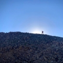
There are several possible itineraries for a lengthwise traverse of the Never Summer Mountains. This section describes the longest traverse with some shorter plans given as variations. These peaks are lined up on the Continental Divide just waiting for you to mow them all down! Get in shape before attempting this traverse!
Day 1. Three peaks, 10.5 miles, 3,730 vertical feet of elevation gain. Start at the Colorado River Trailhead on Trail Ridge Road. Head north along the Colorado River Trail to La Poudre Pass. Climb west over Mount Neota, Thunder Mountain and Lulu Mountain. Descend west to Thunder Pass and Michigan Lakes. Camping is allowed at Michigan Lakes with a permit from Colorado State Forest. For extra credit you can hike up Point 12,018 feet, alias "The Electrode", before dinner. There are no technical difficulties this day.
Day 2. Five peaks, 6 miles, 3,500 vertical feet of elevation gain. Ascend the East Ridge Route on Static Peak, traverse to Mount Richthofen and get ready to point it down range. Traverse south over Tepee Mountain, Lead Mountain and Mount Cirrus. The Class 4 north ridge of Lead is the most difficult part of the entire traverse. Other portions of the ridge require some Class 3 scrambling.
From the Mount Cirrus-Howard Mountain col, descend to one of the designated campsites in Hitchens Gulch below Lake of the Clouds. This is a significant descent and you may wish to camp on the Continental Divide. Since the divide is the Rocky Mountain National Park boundary, it is legal to camp west of the ridge crest on national forest land, although water can be difficult to find.
Day 3. Five Peaks, 7 miles, 4,600 vertical feet of elevation gain. Climb back up to the Cirrus-Howard col and continue south over Howard Mountain, Mount Cumulus, Mount Nimbus and Mount Status to Baker Mountain at the end of the ridge. This ridge is rough but non-technical. Descend west from Baker Mountain to the Baker Gulch Trail and follow the spur trail west up to Parika Lake. This lake is in Routt National Forest and no camping permit is needed.
Day 4. Seven Peaks, 16 miles, 3,800 vertical feet of elevation gain. Climb north to Point 12,253 feet, alias "Paprika Peak," and follow the Continental Divide south over Parika Peak, Farview Mountain, Point 12,442 feet, alias "Never Summer Peak," to Point 12,280+ feet. Take a side trip out to Bowen Mountain and back if desired. Descend southwest to Bowen Pass, continue south over Ruby and Point 12,198 feet, then climb Cascade Mountain. Descend to Bowen Lake and follow the Bowen Gulch Trail down to the Bowen/Baker Trailhead.
Escape
The traverse can be easily escaped by descending the South Slopes Route of Mount Cirrus to the Colorado River Trailhead.
Variations
1. Day one can be eliminated by starting at the Lake Agnes Trailhead and following the West Ridge Route on Richthofen. This version of the traverse requires a long vehicle shuttle but, when combined with Variation 2, reduces the traverse to the heart of the range.
2. Day four can be eliminated by following the Baker Gulch Trail down to the Bowen/Baker Trailhead.
3. Day four can be shortened by eliminating the ascent of Bowen Mountain and/or by descending the Bowen Gulch Trail from Bowen Pass.


