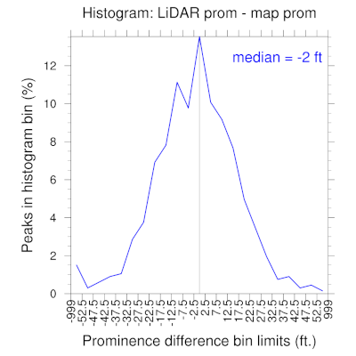
As you can see the mode of the distribution is centered on zero (map prominence = LiDAR prominence), although the distribution is skewed toward the left, so that there are a few more LiDAR prominences less than map prominences than vice versa (i.e., LiDAR prominence is typically slightly less than map prominence.) Also, the distributions sharply tail to near zero by +/-50 ft difference (while many of the extreme tails of the distribution are peaks that replace nearby ranked peaks, rather than brand new ranked peaks. This confirms my perception that peaks with map prominences < 250 ft have a very low probability of being ranked (<1% chance) unless they are a possible candidate to replace an existing nearby ranked peak. I should note, though, that I found one peak Hayden Spire whose map prominence was 87 ft off, so there do exist extreme anomalies, especially in very rugged terrain.
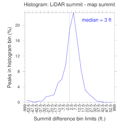
In case it's of interest, here are the histograms for summit elevation difference,
and saddle elevation difference
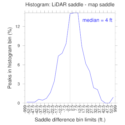
both of which show that LiDAR data is on average slightly higher than map data for summits and saddles.
Please let me know if you would like to see any other analyses.