geojed wrote: ↑Thu Dec 01, 2022 7:57 am
The first article says her body was found on NW face and the map incorrectly has the dot for the location her body was found on the NE face. The route they have highlighted jives with the route/scenario madmattd described.
Yep, that first article is in-line with other articles I had seen, and is what I based my scenario off of (once moving the pin to the area consistently described as where the body was found). That is by a huge amount the most common way to do those peaks (Little Haystack-Lincoln-Lafayette), and the missed left turn off Lafayette has happened many times before (the article briefly mentions one of those incidents):
“This has happened before in the exact same area where she went off track in 2021. Luckily those guys got through by thawing their cell phones under their armpits and SAR found them before they froze,” her friend and fellow hiker Brian Garvey said.
Obviously she could have opted to do this loop CW (Lafayette-Lincoln-Little Haystack), and it is totally doable that way as well, just not the common way to do them. Liberty and Flume are usually done as their own separate day hike, of roughly similar stats to the other loop. However, if she was planning to add Liberty and/or Flume, then CW would be the logical route to take: once at Little Haystack you can evaluate time, conditions, etc and decide to continue to Liberty/Flume or head down the Falling Waters Trail. I've done all 4 main peaks in a day numerous times, it's a far bigger day than the Lincoln-Lafayette Loop, but great fun on a nice weather day. The best option is to have a car spot at Lincoln Woods and descent the Osseo Trail from Flume. Descending the Flume Slide Trail (Westward) is generally not advised at any time of the year (a few in this thread have referenced that trail), but backtracking to Liberty and descending the Liberty Springs Trail to the West is an option (with ~500' of reascent up Liberty mind you). There's a bike path that connects back to the Old Bridle Path Trailhead if you don't have a car spot. All 4 peaks done without a car spot in this fashion is a ~15mi/5500' day as I recall. Not something most "newer" hikers attempt, especially in such conditions, but it's not unheard of.
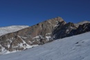
Out west is obviously a different animal than hiking in the east due to the elevation. However, finding good days to hike in the east, particularly the northeast, aren’t as common as in the west. In the colder months out west it is often windy. In the colder months in the east it is almost always windy. There are plenty of sunny days out west. In the east, sunny days are very rare in the colder months.
Yes. Many of us back East had a term we referred to as "Presi Day". Such a day would be calm enough, clear enough, and warm enough to entertain lengthy treks above treeline in the Presidential Range (or similar alpine sections such as the Lincoln-Lafayette Loop, Bonds). There are very few of those days most winters.