Download Agreement, Release, and Acknowledgement of Risk:
You (the person requesting this file download) fully understand mountain climbing ("Activity") involves risks and dangers of serious bodily injury, including permanent disability, paralysis, and death ("Risks") and you fully accept and assume all such risks and all responsibility for losses, costs, and damages you incur as a result of your participation in this Activity.
You acknowledge that information in the file you have chosen to download may not be accurate and may contain errors. You agree to assume all risks when using this information and agree to release and discharge 14ers.com, 14ers Inc. and the author(s) of such information (collectively, the "Released Parties").
You hereby discharge the Released Parties from all damages, actions, claims and liabilities of any nature, specifically including, but not limited to, damages, actions, claims and liabilities arising from or related to the negligence of the Released Parties. You further agree to indemnify, hold harmless and defend 14ers.com, 14ers Inc. and each of the other Released Parties from and against any loss, damage, liability and expense, including costs and attorney fees, incurred by 14ers.com, 14ers Inc. or any of the other Released Parties as a result of you using information provided on the 14ers.com or 14ers Inc. websites.
You have read this agreement, fully understand its terms and intend it to be a complete and unconditional release of all liability to the greatest extent allowed by law and agree that if any portion of this agreement is held to be invalid the balance, notwithstanding, shall continue in full force and effect.
By clicking "OK" you agree to these terms. If you DO NOT agree, click "Cancel"...
In Attendance: Derek, Clay, Jon, Bret and Nate
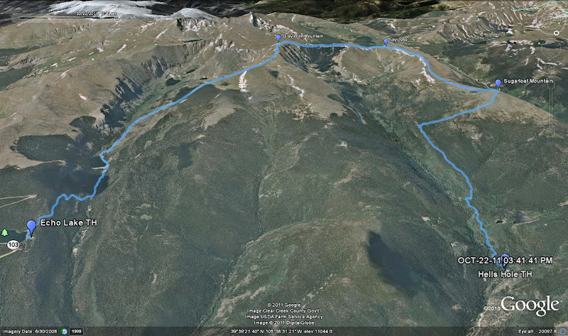
Gray Wolf Mountain (Bi-Centennial 13er) Peak Info
UN 12959 (Soft Ranked 12er) Peak Info
Sugarloaf Peak (Ranked 12er) Peak Info
Start: Echo Lake Trailhead Trailhead Link
Finish: Hells Hole Trailhead Trailhead Link
14 Miles
4,400' Elevation
Around 8 hours
With a lot of questions regarding easy and close 13er hikes floating around the forum lately, I figure that it might be worth writing up a quick report on this trip.
Gray Wolf Mountain is a bi-centennial 13er (highest 200 in CO) located inside the Mount Evans Wilderness. For some reason or another, I had never made my way to its summit despite being close to it multiple times. The most popular route for this mountain is from Guanella Pass to the west, however we were looking to try a different route that involved ascending from the east and descending from the north. It would involve a short car shuttle, but it would prevent us from repeating any ground through the day. We were able to gather a group of five for the trip.
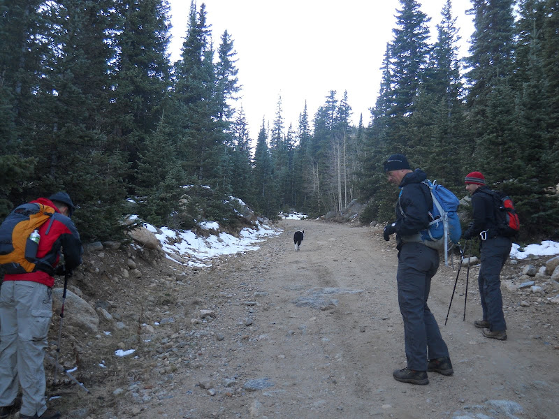
Clay, Bret and Nate met me at the Hells Hole Trailhead around 7 AM. I left my truck here and we packed into Clay's vehicle for the short drive to the Echo Lake Trailhead. After meeting Jon at Echo Lake, we geared up and headed out on our way along the Chicago Lakes Trail. The trail begins by dropping 300 or so feet down to Chicago Creek. After crossing the creek, we took a left on the dirt road that leads a short distance up to the Idaho Springs Reservoir. The road ends and changes back into a trail just after passing a few cabins on the south end of the reservoir. This is also the point where the route enters into the Mount Evans Wilderness.
Following the road portion up to the Idaho Springs Reservoir
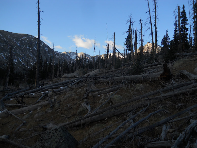
Views ahead after passing the wilderness boundary.
Once passing the wilderness boundary, the trail begins ascend steadily away from the creek below. It is a nice portion of trail with some nice views, and I will admit that I have a bit of a soft spot for this area. As I was telling the others on the hike in, it was near this area that I spent my first (rough) overnight backpack many years ago after moving to Colorado from Michigan.
Flashback time!
At the time of my first "backpack" to Chicago Lakes, I had zero gear and zero experience. I don't even recall what time of year it was, but I assume it was late spring. I carried only a 20L pack (the only pack I had) so I obviously was unable to carry much of my camping supplies in the pack itself. My sleeping bag was a giant puff bag that you would normally see at a middle school sleepover, not for camping. I strung a length of rope through the center of the rolled up bag, tied the rope into a giant loop, and slung it over my shoulder like a giant purse. Sleeping bag: check. My tent, well, I couldn't figure out how I was going to carry that beast of a thing. It was an enormous Wal-Mart style tent that rolled up into a nice manageable roll roughly the size of a VW bus. I figured I had to use my arms for something, so I decided to just carry it. The trek to the lower lake was an adventure to say the least. It started to rain on me, which caused my sleeping bag purse to get wet. After setting up the tent, I crawled into a damp bag for the night. Then the temperatures dropped, causing the sleeping bag to freeze to the point of stiffening. Finally, at around 3 AM I heard animals circling and sniffing my tent (probably coyotes) and I said screw it...I'm going home. So I packed up, trudged back to the car in the dark, and drove home. And there you have my first backpacking experience.
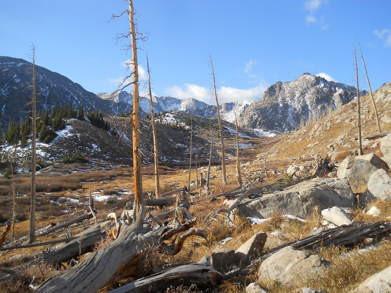
Anyway, enough of that embarrassing stuff. We continued along the Chicago Lakes Trail for another mile from the boundary to a point just before the trail crosses a creek. At this spot, we could see a clear route to the ridge to the west. We left the trail at N39 37 45.4 W105 37 44.9, around an elevation of 11,340' and began the ascent to the ridge. Clay, Bret and Nate headed due west and gained the ridge at a lower point while Jon and I headed slightly SW to a large ramp that put us up a bit higher on the ridge. Both ways work fine. The path that Jon and I took would probably be a better option on a windy day as it keeps you off the ridge a bit longer. Once we all met back up with each other on the ridge, we stopped for a quick break. It took us just under 2 hours to reach the 12300' point on the ridge from the trailhead.
Leaving the trail, aiming for the ridge above.
Nice views on the ascent to the ridge.
The large ramp that Jon and I used to gain the ridge.
The other three taking a more direct route.
Ptarmigans already taking on their winter colors.
The route ahead once reaching the ridge.
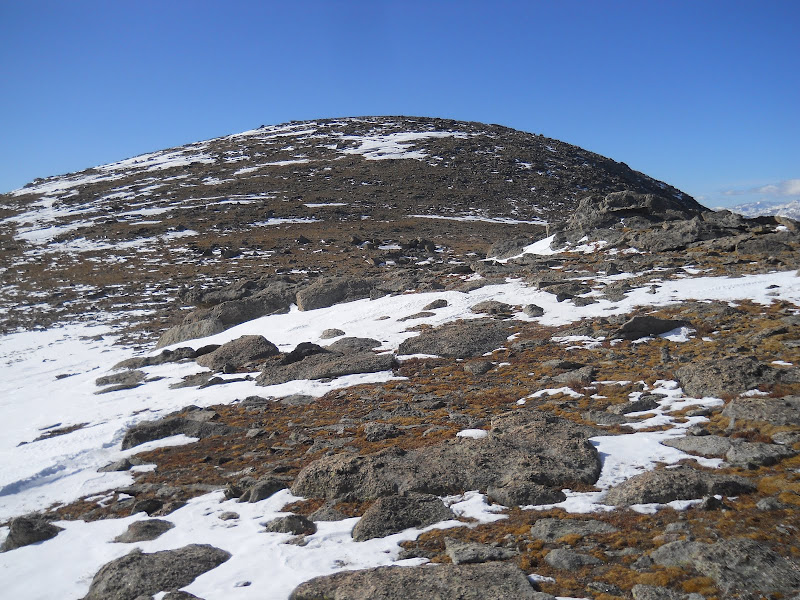
After our break, we continued west along Gray Wolf's long NE ridge. The first small point that we came to is labeled 12831 on the topo. We passed this point on the south side. This required the only talus hopping that we would encounter all day. Nothing exceeding easy class 2. We continued the easy terrain all the way to the false summit, which is only .25 miles from the true summit. After tagging the summit, we dropped down a ways to get out of the wind. (The wind had been pretty brisk since we gained the ridge.) It was here that Jon decided to part ways and head over to Mt. Spalding before descending back to the Chicago Lakes area. The rest of us decided to continue on towards UN12959 that was located about 2 miles west of the Gray Wolf summit.
Nice views for a ridgewalk.
Approaching the first point on the ridge (12831) that we traversed on the left.
Jon ascending with Rogers Peak in the background.
True summit of Gray Wolf from near the false summit.
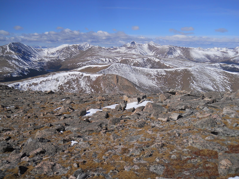
Mount Evans (left distant) Mt. Spalding (near center) and Bierstadt (right distant) from the summit of Gray Wolf.
Squaretop, Argentine, Wilcox, Grays, Torreys in the background. Our route ahead in the foreground.
The long ridge to looked to be long and mellow, and it was. The traverse to 12959 was filled with views of the familiar Guanella Pass peaks: the Sawtooth, Bierstadt, Squaretop, Argentine, Wilcox, etc. We passed point 12988 to the south and followed the easy SE slope of 12959 all the way to the summit. UN12959 is a soft ranked peak which is a mere 1 foot short of being a ranked peak. (It has 299' of prominence.) Poor guy. After a quick stay on 12959, we turned north and began to make our way to Sugarloaf Peak which was a bit over 2 miles away. The ridge to the saddle of 12959 and Sugarloaf followed suit from the rest of the day and was a nice easy stroll minus a tiny bit of gain over ridge point 12836. From the saddle, the final 500' to the top of Sugarloaf is steep but straightforward. Ironically, I had just climbed Sugarloaf a few weeks prior so everything was pretty familiar. (In fact, it was that hike that gave me the urge to descend the way we had.)
Descending the gentle west slopes of Gray Wolf.
Unique view of the Sawtooth from the traverse to 12959.
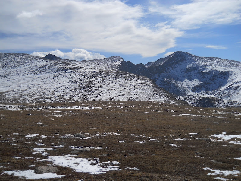
Gray Wolf from UN12959.
Apple time!
Along the ridge between 12959 and Sugarloaf.
Sugarloaf from the saddle with UN12959.
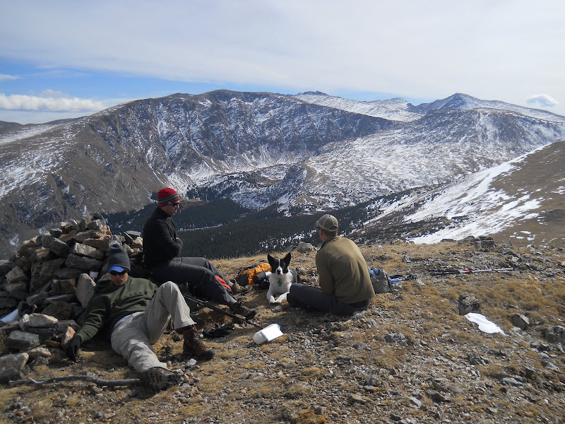
Crashing on the summit of Sugarloaf with Gray Wolf and a chunk of the days route in the background.
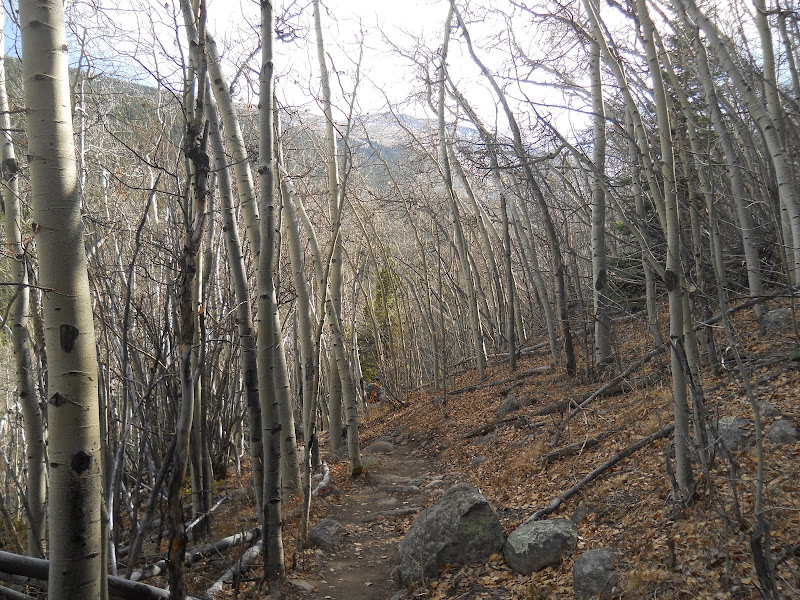
We relaxed on the summit of Sugarloaf a bit longer than the other summits. The view here was the best of the day, and we were all starting to feel the miles in our legs. For the descent of Sugarloaf, we followed my same track from a few weeks ago that was still stored in my GPS. This involved bushwhacking due east just over 1 mile until we crossed the West Chicago Creek Trail. The bushwhacking is mellow, and we had no issues finding the path. Once on the trail, we headed north for the final 2.5 miles to the Hells Hole Trailhead and my truck that we had left earlier that morning. We passed by the first people we had seen all day about 1 mile from the trailhead. Not too bad for a 13er hike only a short drive from Denver!
Terrain between Sugarloaf and the West Chicago Creek Trail.
Some interesting sights on the way off Sugarloaf.
West Chicago Creek Trail.
More trail views.
Googleearth track from the day.
Our total trip had taken us just over 8 hours, and it felt like a full day. During our drive back up to Echo Lake to get Clay's vehicle we passed Jon on his way back down the highway. Evidently we must have reached our vehicles right at the same time. Good timing. It was a great fall day and a great time out.
Map.
Profile.
My GPS Tracks on Google Maps (made from a .GPX file upload):
It was fun to join everyone as far as Gray Wolf. That does look like it was an interesting way down. Even better you got to avoid the ~400 feet back out at the very end of the day! I ran into quite a few people on the way down from Chicago Lakes.
I like that route. I really wish I could have gotten out, but I had to stick close to home because it was a chemotherapy weekend for Carolyn. I shampooed carpets, mopped floors, cleaned the kitchen, cleaned bathrooms, and did yard work. All in all, you probably had a better weekend than I did.
After your flashback experience, I'm surprised you even got on a trail again; but glad you did! Nice shots of the surrounding peaks, birds, etc. Looked like it was a fabulous day for a hike! Thanks for the post!
I really enjoy your TR's (though not a prolific commenter!) - appreciate the google earth track and gps track, both very helpful. This is a very nice option close to home.
Well done!
Nice alternate route, Derek. And you're not the only Michigander who has some Rocky Mountain backpacking horror stories.
Caution: The information contained in this report may not be accurate and should not be the only resource used in preparation for your climb. Failure to have the necessary experience, physical conditioning, supplies or equipment can result in injury or death. 14ers.com and the author(s) of this report provide no warranties, either express or implied, that the information provided is accurate or reliable. By using the information provided, you agree to indemnify and hold harmless 14ers.com and the report author(s) with respect to any claims and demands against them, including any attorney fees and expenses. Please read the 14ers.com Safety and Disclaimer pages for more information.
Please respect private property: 14ers.com supports the rights of private landowners to determine how and by whom their land will be used. In Colorado, it is your responsibility to determine if land is private and to obtain the appropriate permission before entering the property.