Download Agreement, Release, and Acknowledgement of Risk:
You (the person requesting this file download) fully understand mountain climbing ("Activity") involves risks and dangers of serious bodily injury, including permanent disability, paralysis, and death ("Risks") and you fully accept and assume all such risks and all responsibility for losses, costs, and damages you incur as a result of your participation in this Activity.
You acknowledge that information in the file you have chosen to download may not be accurate and may contain errors. You agree to assume all risks when using this information and agree to release and discharge 14ers.com, 14ers Inc. and the author(s) of such information (collectively, the "Released Parties").
You hereby discharge the Released Parties from all damages, actions, claims and liabilities of any nature, specifically including, but not limited to, damages, actions, claims and liabilities arising from or related to the negligence of the Released Parties. You further agree to indemnify, hold harmless and defend 14ers.com, 14ers Inc. and each of the other Released Parties from and against any loss, damage, liability and expense, including costs and attorney fees, incurred by 14ers.com, 14ers Inc. or any of the other Released Parties as a result of you using information provided on the 14ers.com or 14ers Inc. websites.
You have read this agreement, fully understand its terms and intend it to be a complete and unconditional release of all liability to the greatest extent allowed by law and agree that if any portion of this agreement is held to be invalid the balance, notwithstanding, shall continue in full force and effect.
By clicking "OK" you agree to these terms. If you DO NOT agree, click "Cancel"...
The Union of the Snake is on the climb
Moving up it's gonna race it's gonna break
Through the borderline
(Yeah! Take that, Duran Duran haters!)
I GPS-ed Culebra and Red Mtn because by the request of Cielo Vista Ranch management, these peaks are supposed to be "scatter" hikes and I was curious to find out what I actually ended up doing. We were requested to refrain from pounding trails into the hillside and to be as vigilant as possible to walk only on durable surfaces. As a consequence, there is no easily visible trail through the tundra although bits of trail appear on the crests of ridges.
Route Beta: the NW part of my route is not important. Please ignore the small gap on the ascent track where I must have teleported ahead a short distance. I believe that there is not an obviously superior/inferior track on the ascent to Culebra. Enjoy the lush tundra and stop a few times just to look around and realize how fortunate you are to be there, albeit $100 lighter in the wallet. The only advice I'd give is to remember is that Culebra's summit is SOUTH of where you might think it is looking up from the road terminus, so gently hew to climber's right when you ascend. On the descent, you can see I clipped the Culebra summit and traversed along the SW face. For once, I think my shortcut actually worked -- actually saved time and effort vs. reascending to Culebra's summit. It also gets you off the sensitive tundra and onto blocky rock.
July 13, 2013 - Transit (post San Luis)
Driving from Creede after running off San Luis in advance of a t-storm, we arrived at the Cielo Vista Ranch gates about 45 minutes before dark. I took no pictures of this, but wish I had. There is a lone porta-potty, but it is located INSIDE the fence line which bearing signs warning against trespassing. Hmmm.... Most of us ended up setting tents just inside the fence line rather than take our chances tenting on the road. Unfortunately, wandering cattle did not have this flexibility in choosing their rest spots and they found themselves on opposite sides of the locked gate (some numbskull let a few cattle out earlier that afternoon?). what, me worry?
What do herd animals do when they find themselves divided by a physical barrier? They mill about and grunt and low in panic and frustration...for 4 STRAIGHT HOURS Initially, this brought snickers from several tents, but it really stopped being funny after about 10 minutes. Sleep was hard to come by, even with earplugs.
July 14, 2013 - Summit Day 5 Culebra, Red Mtn
Ranch hands show up at 5:45 am. The 6:00 am mark is when you're supposed to be DONE packing up and ready to go, not when you wake up. Okay then!
The 14ers.com-famous and always-dapper cowboy "Carlos" ran us through orientation and sent us on our way. I learned after-the-fact that Carlos, the star of several Culebra trip reports, no longer works for the ranch and was helping out on our day as a one-off favor. Sadly, I did not snap any pictures of the Culebra Keeper.
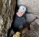
Up up up... Beautiful Actually, I meant ME. I'm only wearing this beard while I work on a new look that will put Blue Steel to shame. YoungMasterWilliam
2 min of heavily-cut video of the type of terrain on the ascent to Culebra's serpentine ridgeline
Some more:
A few people topped out on this thing. I don't know if that was a mistake or intentinal Marmot chums courtesy of Altidude - summit of Culebra Culebra summit Growing posse on Culebra
Red Mountain Will topping out on Red Mtn Red Mtn summit with Culebra in the background The Spanish Peaks - Easternmost high mountains (>10,000 ft) in the USA Red Mtn summit - we still think the weather will remain east of us at this point Today's Red Mtn posse (only 4 of us): Altidude, *lost name*, zinj, YoungMasterWilliam
The June 2013 weather in the Sangres continued to confound my predictions. Apart from the fact that the "normal" summer weather pattern in Colorado was setting up "late" this summer, the Sangres are wildcards in and of themselves. This time, we were watching the distant clouds over the mountains over the Eastern San Juans well west of our position -- expected this to give us hours of leadtime on any imminent weather change. Not so. While those westerly clouds did advance on us as per usual, they never reached us because we were assaulted from the EAST with hail and thunder (no, not graupel, it was true hail this time).
My video cam batteries were dead, so I can't offer comical video of us running off of Culebra, but I did snap some of photos before the storm was upon us.
*lost name* leading us back toward Culebra No sense of urgency yet Altidude isn't actually posing here -- he's just that photogenic without even trying (or something) still time to goof off? looking back at Red Mtn (and the angry weather coming from the EAST!!!)
Run away! Run away! It's ON! (attach to next photo attach to previous photo)
Preceding Report: 2013 Summer Trek: Rpt 4 of 7 - San Wheezer Subsequent Report: 2013 Summer Trek: Rpt 6 of 7 - Oye Como Va?
My GPS Tracks on Google Maps (made from a .GPX file upload):
Great trip report... and looks like you guys had fun! In case you're curious, that ”thing” that people were topping out on is called ”Punta Serpiente” (Snake Point). It's not ranked... not even officially named... but it has unofficial references, so us Peak Baggers have to touch the summit anyway. :-)
Thanks for the kind words. I regret I didn't get snap a shot of uber-architype clean-cut cowboy ”Carlos”. The guy is perfect. He's in some other, older reports, but since he no longer works regularly at Cielo Vista, future Carlos sightings may be few and far between
Caution: The information contained in this report may not be accurate and should not be the only resource used in preparation for your climb. Failure to have the necessary experience, physical conditioning, supplies or equipment can result in injury or death. 14ers.com and the author(s) of this report provide no warranties, either express or implied, that the information provided is accurate or reliable. By using the information provided, you agree to indemnify and hold harmless 14ers.com and the report author(s) with respect to any claims and demands against them, including any attorney fees and expenses. Please read the 14ers.com Safety and Disclaimer pages for more information.
Please respect private property: 14ers.com supports the rights of private landowners to determine how and by whom their land will be used. In Colorado, it is your responsibility to determine if land is private and to obtain the appropriate permission before entering the property.


 in the USA")

: Altidude, *lost name*, zinj, YoungMasterWilliam")


")

")


")
 Up up up...")
 Beautiful")
 Actually, I meant ME. I'm only wearing this beard while I work on a new look that will put Blue Steel to shame.")
 YoungMasterWilliam")
 A few people topped out on this thing. I don't know if that was a mistake or intentinal")
 Marmot chums courtesy of Altidude - summit of Culebra")
 Culebra summit")
 Growing posse on Culebra")
 Will topping out on Red Mtn")
 Red Mtn summit with Culebra in the background")
 The Spanish Peaks - Easternmost high mountains (>10,000 ft) in the USA")
 Red Mtn summit - we still think the weather will remain east of us at this point")
 Today's Red Mtn posse (only 4 of us): Altidude, *lost name*, zinj, YoungMasterWilliam")
 *lost name* leading us back toward Culebra")
 No sense of urgency yet")
 Altidude isn't actually posing here -- he's just that photogenic without even trying (or something)")
 looking back at Red Mtn (and the angry weather coming from the EAST!!!)")
 still time to goof off?")
 Run away! Run away!")
 It's ON! (attach to next photo")
 attach to previous photo)")
 what, me worry?")