Download Agreement, Release, and Acknowledgement of Risk:
You (the person requesting this file download) fully understand mountain climbing ("Activity") involves risks and dangers of serious bodily injury, including permanent disability, paralysis, and death ("Risks") and you fully accept and assume all such risks and all responsibility for losses, costs, and damages you incur as a result of your participation in this Activity.
You acknowledge that information in the file you have chosen to download may not be accurate and may contain errors. You agree to assume all risks when using this information and agree to release and discharge 14ers.com, 14ers Inc. and the author(s) of such information (collectively, the "Released Parties").
You hereby discharge the Released Parties from all damages, actions, claims and liabilities of any nature, specifically including, but not limited to, damages, actions, claims and liabilities arising from or related to the negligence of the Released Parties. You further agree to indemnify, hold harmless and defend 14ers.com, 14ers Inc. and each of the other Released Parties from and against any loss, damage, liability and expense, including costs and attorney fees, incurred by 14ers.com, 14ers Inc. or any of the other Released Parties as a result of you using information provided on the 14ers.com or 14ers Inc. websites.
You have read this agreement, fully understand its terms and intend it to be a complete and unconditional release of all liability to the greatest extent allowed by law and agree that if any portion of this agreement is held to be invalid the balance, notwithstanding, shall continue in full force and effect.
By clicking "OK" you agree to these terms. If you DO NOT agree, click "Cancel"...
I went on a week long mountain-hobo rompineer through the San Juans and Sangres so this will suffice as Part One.
Estimated Total:
25 miles
10,000 ele gain
32 hours
With a loose plan I tore down 285 in the red speed machine on a Thursday afternoon. It was no coincidence I was headed toward Wetterhorn Basin. One year ago while thumbing through Roach's book this alternate route caught my eye and has haunted me since. I was not in a peak bagging mind set. I was in a, "I want to marinate in a beautiful natural place and if I get some summits, great" kind of mind set. I also wanted to see if I could spend the night alone in the middle of no where. Being afraid of the dark I knew this would be a real challenge. I wish I was kidding.
I had two looks on the way to Gunnison:
I'm not behind an RV going 25 miles below the speed limit! I'm behind an RV going 25 miles below the speed limit.
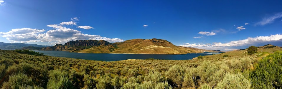
Part of the allure of mountain climbing (for me at least) is intimately getting to know Colorado. By traveling to far away lands I accidentally stumble upon places like the gorgeous Curecanti National Recreational Area (in between Gunnison and Montrose) where I totally geeked out on how beautiful water is.
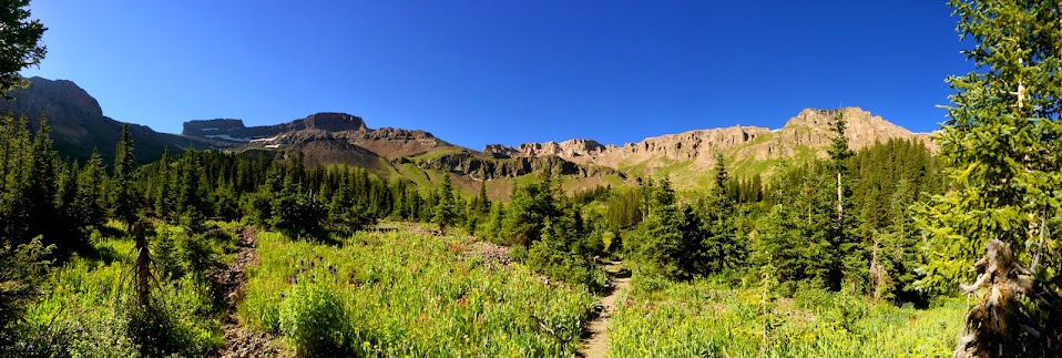
After wasting an appropriate amount of time splashing about I made the left hand turn on to Cimarron Rd. (858) and began the 27.8 mile dirt road drive toward the West Cimarron trailhead. The drive alone is SO beautiful, I knew I was in for something special.
It is a good dirt road, easy to navigate, and obvious where 2WD low clearance vehicles should hault.
Idiot Proof.
I crawled in my trunk around 10 p.m. with wild dreams of a 7 a.m. start time.
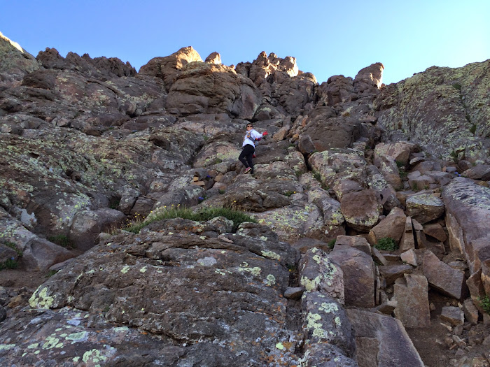
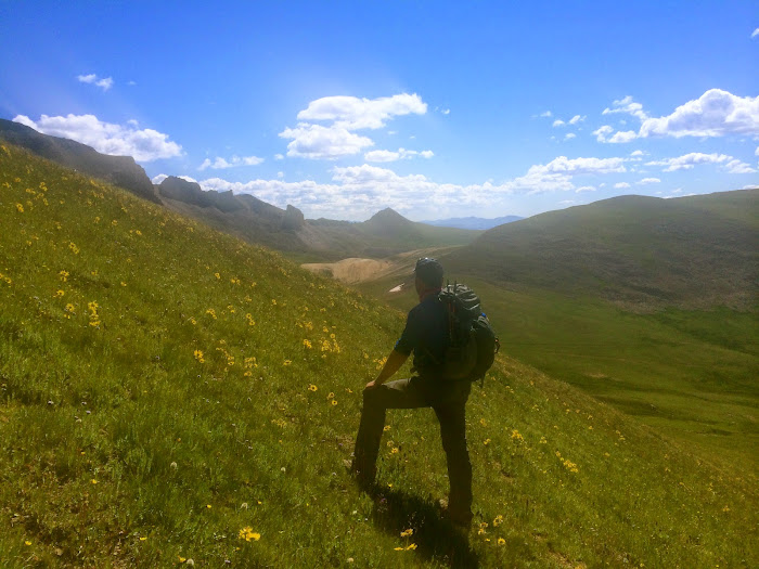
My alarm went off for a solid two hours on Friday before I even considered tackling morning chores. By the time I strapped the 51.6 pound pack (I did not really learn a lesson in Chicago Basin) to my back it was close to 9 a.m. Go me! I said goodbye to Lola and started up the 4WD road. Soon enough there was a silly creek crossing that took my feeble mind fifteen minutes to figure out. It was 1.8 miles from my car to the actual West Cimarron TH and the start of the West Fork trail. Who loves extra mileage? This girl I signed in and started the trek up and over West Fork Pass.
I found the trail difficult to follow through the trees because of gnarly washouts. There were cairns but they blended in with endless rock.
For once in my life I am at a loss for words. Simply put, this is the most beautiful place I have ever been.
There were bones EVERYWHERE
Getting up and over West Fork pass was grueling. There is one very unpleasant steep loose dirt section to gain a head wall. It was here I fell backwards landing on the giant pack and like a turtle flipped over on its shell, I sat there flailing about. I was mad for like half a second before I started cracking up. How ridiculous I must have looked I took my turtle break down to rest and cloud watch.
Turtle Power. There is a "trail" in that.
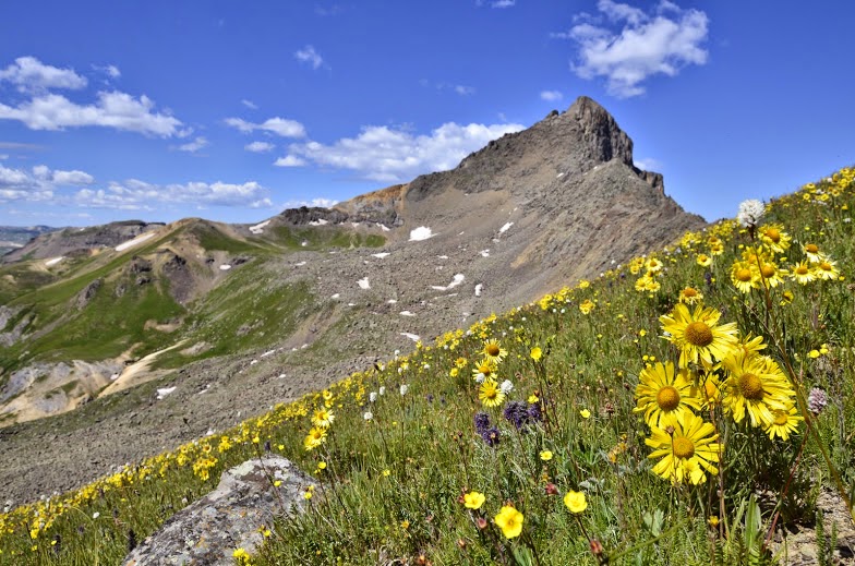
I was ecstatic to crest the 12,500 foot pass, I was even more ecstatic when I descended and rounded a corner to see this would be my home for the next 24+ hours.
Wets
And this is how I felt about it...
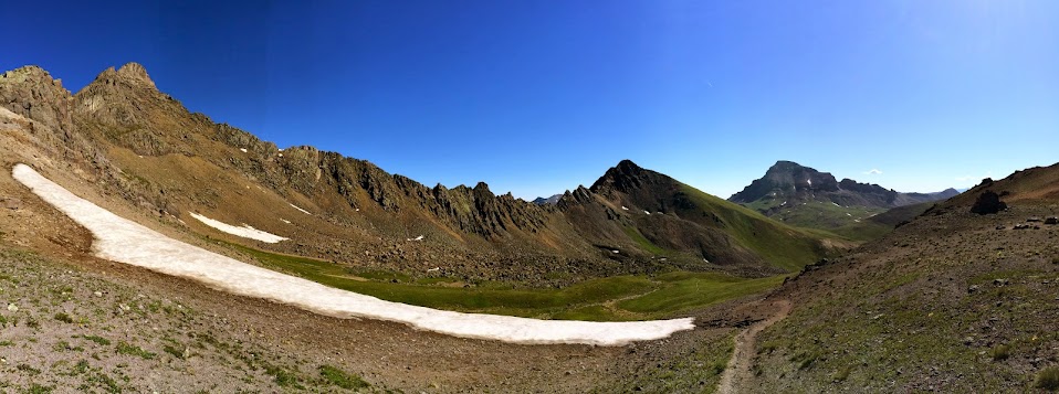
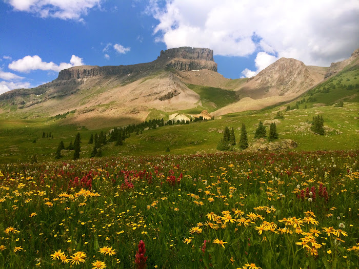
The flower population devoured the trail and I relied on sticks and cairns to direct me through Wetterhorn Basin. I was on the hunt for a good camp spot and found one near the first creek crossing at a low point of 11,720 feet. To my absolute delight I had the entire basin to myself.
Home base A million dollar view. The best things in life are free (ish)
From car to camp was 6.5 miles with 2,200 feet of gain.
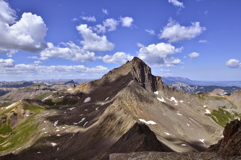
After tent set up and food consumption I decided I would lazily laze my way up something. I shot towards the southwest slopes of PT 13,206 with the intent of running the ridge out to PT 13,377. Gaining 13,206 was steep wildflowered grass. When I arrived at a false summit the intensity that is Wetterhorn peak and its surrounding ridge lines became apparent. The traverse over to 13,377 appeared to be a little bit more fun than I was looking for but the views of Wetterhorn's north face captivated every sense, my arm hairs stood on end.
The side of Wetterhorn no one ever sees. Who wants to traverse that ridge?
I signed the summit register (a paper towel with a small pencil inside a miniature plastic container) underneath the only other name, Ryan Marsters (monster5). I was truly inspired by the views.
Heisenhorn
From 13,206 I decided to push northwest to the happening summit of 13,092. The descent of 13,206 was a steep loose (but short) gully.
From left to right, the sad looking hump is 13,092, Coxcomb, Redcliff
I was not feeling especially ambitious but from the summit of 13,092 I thought I would attempt to penetrate Redcliff.
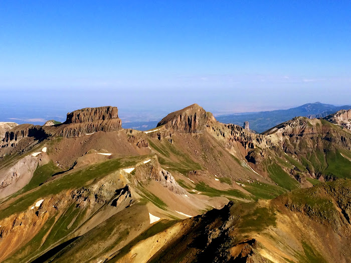
Heisenhorn, Uncompahgre, PT 13,206, Wetterhorn
I dropped down in to the Middle Fork basin on the east side of Coxcomb Peak and started eyeing possible routes up Redcliff. From the east side I saw nothing but a gully full of snow and since I had no snow gear I decided to jump ship and head back to camp. I later came to find out that Redcliff can be easily attained by skirting around Coxcomb, who woulda thunk?
No summit but I got some views, photos, and bonus vert because I had to go up and over Coxcomb pass to get back to the correct basin.
Redcliff Coxcomb
The trail off of Coxcomb pass was overgrown and confusing to follow. It led me off of this and I blindly followed.
Because it led to this...
My afternoon exploration tacked on another 4 miles and 2,100 feet of gain bringing the days total to 10.5 miles and 4,300 feet of gain.
I arrived back at camp around 4:30 p.m. and made dinner. The sun did its thing and set.
Good night Friday.
Coyotes (or so I thought) howled around my tent all night and since I am the size of a baby deer I "slept" with my bear mace in hand. I was becoming a real pro at hitting the snooze button and started my trek over Wetterhorn pass at 6:30 a.m., forty five minutes later than I would have liked. The plan was to meet Senad in the saddle of the standard southeast ridge route in between 7:15 and 7:30. Good thing I am a runner.
The sun touching Coxcomb.
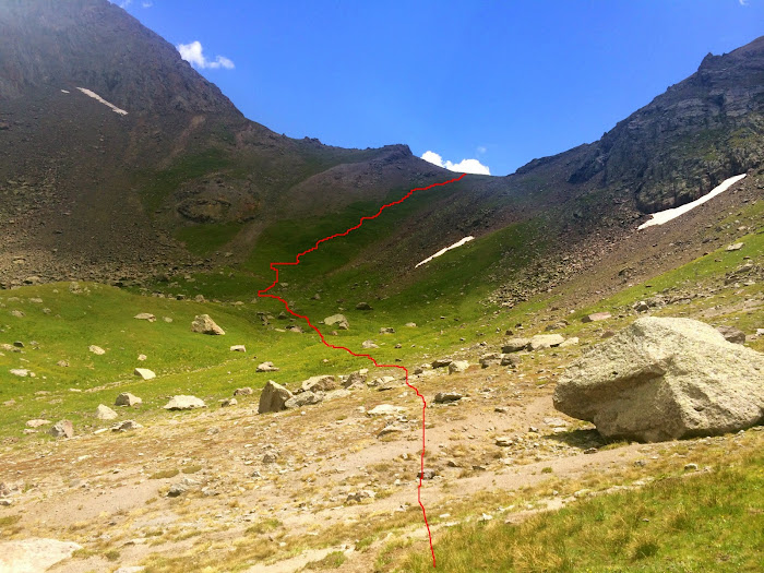
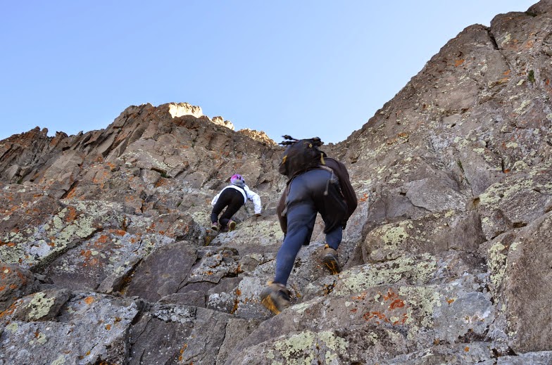
Since I was hauling serious tail I took very few pictures of the route but it is fairly obvious. I headed southeast towards Wetterhorn pass through endless hip deep wildflowers. The trail was impossible to follow, occasionally I would see a stick and realize I was too far left but it did not really matter, the pass was unavoidable. There was the main creek crossing and another headwall to gain. It's a lot of gain in a short amount of mileage.
Taken on the way back after the creek crossing and headwall.
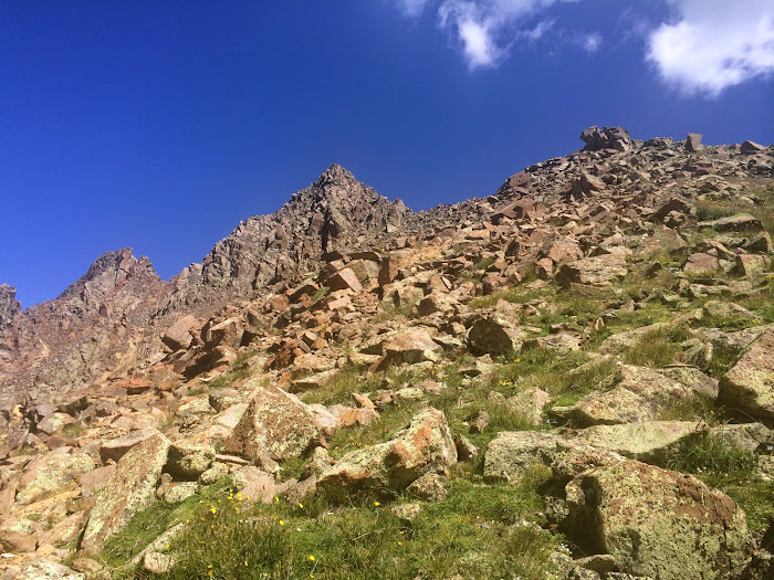
Once atop the 12,860 foot pass there is more descent-ion and more ascent-ion. I was beginning to understand why people do not climb Wetterhorn from its basin, it is A LOT of work. There was large snow patches, large enough that if I slipped while crossing I would go for a ride so I stuck above the Wu-tang symbol and side hilled some steep grass dirt to reach the saddle between the saddle I needed to be in and PT 12,819 (which I later tagged). I was confused for a mili-second but soon realized I had to move steeply northeast to end up in the meeting place Senad and I agreed upon. It was exactly 7:30 when I heard my name through the thin morning air. I looked up and there was Senad, I was SO happy to see another human!
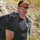
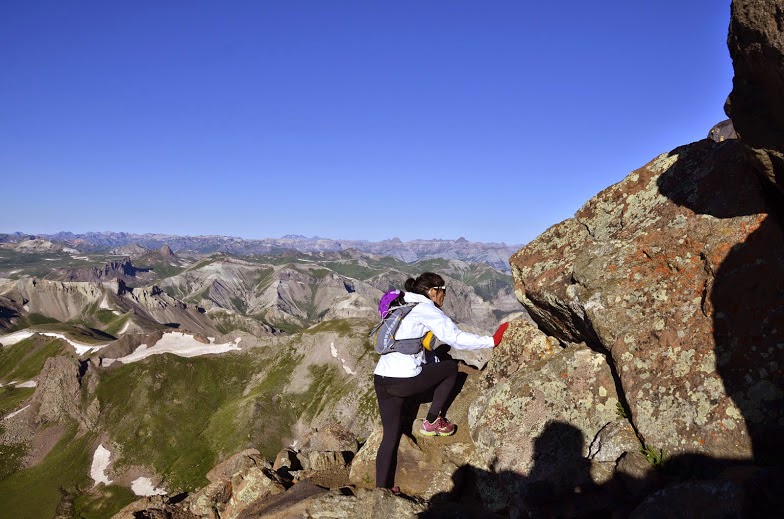
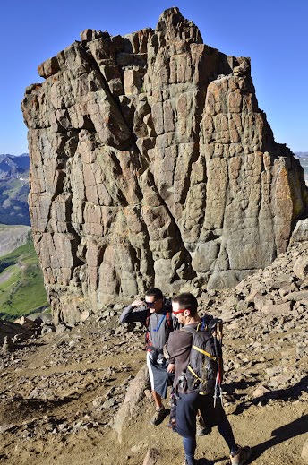
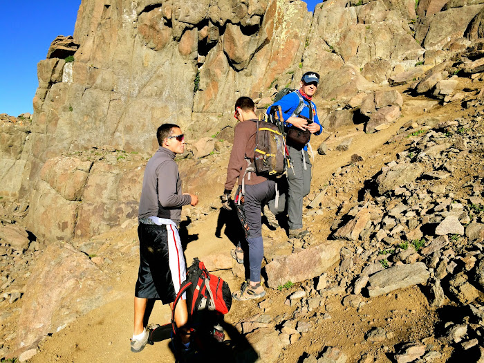
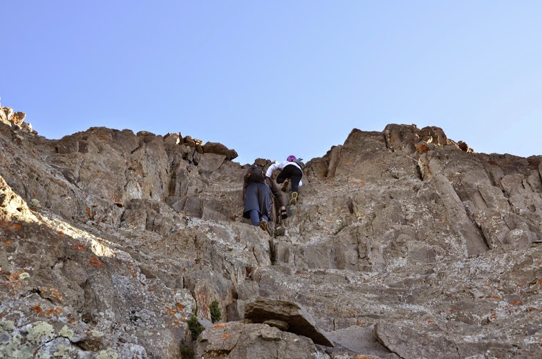
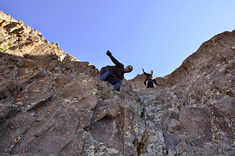
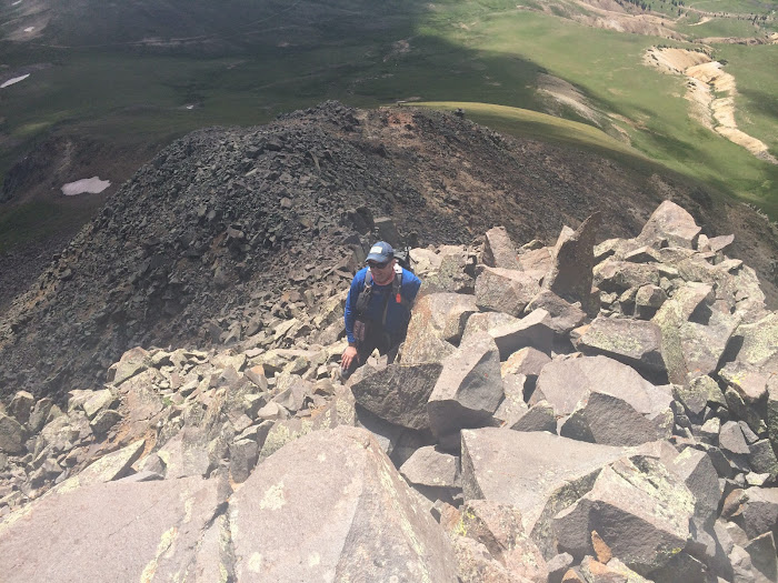
Senad had made two friends, Colby and Brandon and we would end up climbing to the summit with them. The four of us set out to navigate Wetterhorn's solid walls. From here on out if I am in a photo, Senad took it. This route is well documented so my words of wisdom are, have fun, this is a GREAT mountain.
The start Solid rock towards the Ships Prow
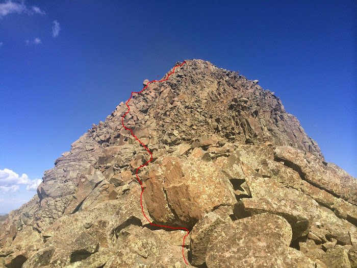
Brandon and Colby with the Ships Prow Brandon, Colby and Senad The climb into the eastern most gully. The slab before the final climb.
The final climb is exposed but really solid and fun. Small ledge right before final climb. Take eastern most gully to the right. About to summit.
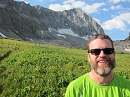
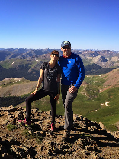
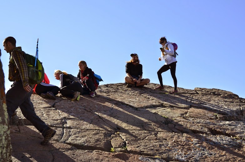
The summit of Wetterhorn was raging. There was a group of runner girls who I enjoyed talking to, a group of younger men, and the sage of Wetterhorn Peak. He stood on the outskirts and doled out advice like how I was going to die if I took ibuprofen during my runs.
The sage looming in the background. Territory Run Co. Runners of the wild, another great company. It's called Cottoneering. BFF's reunited... A summit headstand.
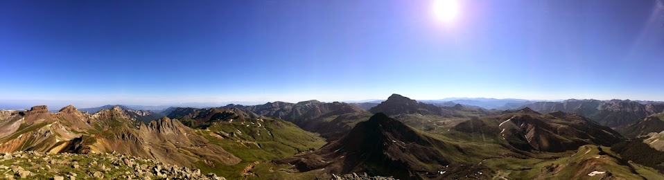
These views are my favorite from any 14er thus far...
Coxcomb and Redcliff Heisenhorn
I thought because of the verticalness of the final pitch to the summit the down climb would be tricky but it was not. I had my heart set on scrambling up the ''Ships Prow." It is accessible via the north side on some exposed class 3.
View from top featuring the slab and the Ships Prow. Slab Party! Top of the Ships Prow. Top of Ships Prow, Wetterhorn summit can be seen in the background.
The day was beautiful so Senad and I decided to go for Matterhorn. We descended Wetterhorn's standard route and used Matterhorn's steep grassy south slopes to ascend. I hear that traverse is loose.
A hung over marmot. Wetterhorn to Matterhorn traverse. Wetterhorn.
Once we gained the ridge we turned left or northwest and it became bumpy, from here there is some class three scrambling to reach the summit.
I love the summits of 13ers, not only do they give the most fantastic views of the 14ers but they are generally void of people. This was a fun one.
From the summit Senad pointed down in to Middle Fork Basin where there were a bazillion sheep being herded by dogs. Not coyotes but dogs. I suppose thinking I was going to be eaten if I fell asleep was a healthy distraction from the fear of darkness.
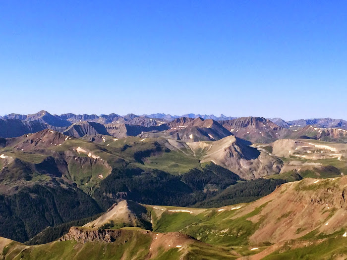
Uncompahgre Wetterhorn
I was far away from home...like really really far away. The reality and monstrosity of the ground I needed to cover just to get back to my tent began to set in. But how could I fret.........
I bid Senad a farewell and jogged up to the summit of unranked PT 13,117 (connects with Wetterhorn).
Pano from the summit of 13,117
From there I followed my footsteps back to my tent. I grappled with going for 13,300 C but in the end decided to leave it for another day. From tent to tent it was 9 miles with 4,500 feet of vertical gain. Again SO much hot up and down action.
Back at the tent I ate everything I had left and packed up. I was super excited to put that giant pack on and go up and down West Fork pass because there is nothing like steep loose dirt with a second back. I moved with intent and made it to my car by 5 p.m. Totals for the day were 14 miles with 5,500 feet of vertical gain. I will say it again, from start to finish this is the most beautiful place I have ever been in my entire life.
Braless, shoeless, and seatbelt-less, I tokyo drifted down 30 miles of dirt road through endless cow plops as the sun went down. Destination Unknown....
TO BE CONTINUED............
Thumbnails for uploaded photos (click to open slideshow):
Another great Trip Report!
I was so glad to see you alive and well Saturday morning!
I had great time with you and other guys I met hiking this beautiful mountain. I wish you could join us at Packers in Lake City.
This report brought back so many good memories, both recent and not so recent. The views and solitude of Matterhorn are really tough to beat, and you're spot on concerning Wetterhorn: Fun, solid and gorgeous. I've long wanted to see it from Wetterhorn Basin. Great TR!
Awesome trip report Kay! Really great to meet and hike with you and Senad, Hopefully I can do some more climbing with you 2 in the future. I am actually setting out to hopefully climb Capitol this weekend, keep me posted on your upcoming adventures!
Likewise brought back great memories. It is absolutely the most beautiful place I have been in Colorado and maybe anywhere. I was lucky enough to have the summit to myself that day due to a strange confluence of scary weather and apparent bear sightings in the night! Thanks for the memories and the beautiful pix!
The combination of your great storytelling and picture taking makes for superb trip reports. Thank you for sharing another adventure! If I repeat Wetterhorn I would like to follow your footsteps with this less traveled route, it looks AMAZING!
These are some of the best pictures I have seen on this site. I climbed Wetterhorn a week ago and found that my camera was broken as I started up into the basin. Took a few phone pictures but your post includes all the pictures I would like to have taken and a whole lot more. Nice.
Funny, fantastic pictures, ... , great pics. Sage of Wetterhorn. Oh my. I think I must go this weekend. Quick little story but my son and I were bopping way back on Middle Cimarron and I was taking in Coxcomb about 1/3 mi away on the pass and the boy says ”Dad ... Look down” and it was a baby deer. Had died but very recently. So little deers need to be careful up there. Again, great read and great pics.
Not sure how I missed this, but great write up of one of the fourteeners worth repeating and of the awesome West Cimarron area. Also, loved your wildflowers – you’re not off route if the side trip takes you to beauty! Enjoyed the report.
Looks like a nice way to do Wetterhorn, Kay! Was in that basin only briefly recently, so it would be nice to go back to see it with the wildflowers. I still think Weminuche is my favorite hands down, but this area and Ice Lakes basin are close runner-ups!
p.s. Great photos
views (25, 30) of Wetterhorn must have been somethin' to see in person, and a ridge to eye as you traversed around it!
Caution: The information contained in this report may not be accurate and should not be the only resource used in preparation for your climb. Failure to have the necessary experience, physical conditioning, supplies or equipment can result in injury or death. 14ers.com and the author(s) of this report provide no warranties, either express or implied, that the information provided is accurate or reliable. By using the information provided, you agree to indemnify and hold harmless 14ers.com and the report author(s) with respect to any claims and demands against them, including any attorney fees and expenses. Please read the 14ers.com Safety and Disclaimer pages for more information.
Please respect private property: 14ers.com supports the rights of private landowners to determine how and by whom their land will be used. In Colorado, it is your responsibility to determine if land is private and to obtain the appropriate permission before entering the property.


")


 I'm not behind an RV going 25 miles below the speed limit!")
 I'm behind an RV going 25 miles below the speed limit.")
")
")
")
")
 Idiot Proof.")
 THREAT LEVEL WILDFLOWER")
")
")
")
")
 There were bones EVERYWHERE")
")
")
 Turtle Power.")
 There is a \"trail\" in that.")
")
")
 Wets")
")
")
 Home base")
 A million dollar view. The best things in life are free (ish)")
 The side of Wetterhorn no one ever sees. Who wants to traverse that ridge?")
")
 Heisenhorn")
 From left to right, the sad looking hump is 13,092, Coxcomb, Redcliff")
")
 Heisenhorn, Uncompahgre, PT 13,206, Wetterhorn")
 Redcliff")
 Coxcomb")
")
")
")
")
")
")
 Good night Friday.")
 The sun touching Coxcomb.")