Download Agreement, Release, and Acknowledgement of Risk:
You (the person requesting this file download) fully understand mountain climbing ("Activity") involves risks and dangers of serious bodily injury, including permanent disability, paralysis, and death ("Risks") and you fully accept and assume all such risks and all responsibility for losses, costs, and damages you incur as a result of your participation in this Activity.
You acknowledge that information in the file you have chosen to download may not be accurate and may contain errors. You agree to assume all risks when using this information and agree to release and discharge 14ers.com, 14ers Inc. and the author(s) of such information (collectively, the "Released Parties").
You hereby discharge the Released Parties from all damages, actions, claims and liabilities of any nature, specifically including, but not limited to, damages, actions, claims and liabilities arising from or related to the negligence of the Released Parties. You further agree to indemnify, hold harmless and defend 14ers.com, 14ers Inc. and each of the other Released Parties from and against any loss, damage, liability and expense, including costs and attorney fees, incurred by 14ers.com, 14ers Inc. or any of the other Released Parties as a result of you using information provided on the 14ers.com or 14ers Inc. websites.
You have read this agreement, fully understand its terms and intend it to be a complete and unconditional release of all liability to the greatest extent allowed by law and agree that if any portion of this agreement is held to be invalid the balance, notwithstanding, shall continue in full force and effect.
By clicking "OK" you agree to these terms. If you DO NOT agree, click "Cancel"...
Way back in 2002 when I climbed Handies for the first time I remember looking over at Half Peak and was fascinated by it. The huge flat summit surrounded by cliffs looked crazy from that vantage point. As I continued my journey through the 14ers and the centennials I just never seemed to get back to Lake City to actually climb it. Eventually it was the only remaining centennial I had left around Lake City and it was time to finally climb the mountain I'd looked at years ago. A few weeks prior to this trip I attempted Half from Cataract Gulch. Even though the weather was good that day the fatigue from climbing the previous few days ended up turning us back about 1600 feet from the summit. When my friend wanted to do a climbing trip over Labor Day weekend the opportunity came to try again.
This time I decided to try the shorter way from Cuba Gulch. I knew the route finding would be more difficult this direction but the length of the Cataract Gulch route made me wary of trying it again. Plus I always enjoy trying something new. My friend was up for the challenge and after driving up the 4wd road to the trailhead we geared up with my dogs and set off about 6am.
The lower trail started out better than we expected. We had no trouble with the first creek crossing as there are some nice logs to walk across. We then made our way up the trail and crossed the gorge on a nice wooden bridge. Roach describes 4 creek crossings in his route description and we kept wondering if we were counting them correctly as some of the crossings didn't amount to much. After 45 minutes or so we crossed what we thought was the 3rd creek and started looking for the trail that heads up into Cuba Gulch. We found a strong looking trail headed up and assumed that it must be the right one. The trail eventually started to fade as we neared treeline and we had some trouble figuring out which way to go. We saw the edge of the trees and the start of the willows and debated the best place to venture into the giant valley of willows.
Leaving the trees
Into the valley of willows
Eventually I found what seemed to be a trail heading into the willows so we followed that. I can't describe the next part of the route in any detail except to say somehow we bashed our way higher up into the basin. All I can say is that you need to stay high on the right side of the valley. Resist any temptation to drop down and cross the stream early. Eventually you will find an area of open tundra on the right side of the valley and make easier time. There is still some willow bashing but at least the alleys are more obvious and the torture less frequent. At this point there is supposed to be a stronger trail in upper Cuba Gulch. We found it on the way down but it's really not worth the time and at least for a while isn't much of a trail. There are plenty of ways to get to the saddle between Half and PT 13,164 without the trail.
Open ground
Maya scouts the way forward
View looking back
The saddle is actually relatively close now
Good view of Half
About 3 hours from the car we reached the saddle and had a snack before continuing.
PT 13,164
Looking towards Cataract Gulch and Carson Peak
We had 1000 feet to go and about 1.25 miles according my GPS. The weather was fantastic and the views as we continued higher were breathtaking. The upper slopes of Half are gigantic and you can't really see the upper summit plateau until you are almost there. Instead you are treated to a giant featureless slope of tundra in front of you and a spectacular view of the San Juans in every other direction. Finally I reached a point where I could see the narrow ridge to the summit.
The view back
Up across the tundra
Still quite a ways to go
View back down from near the narrow section
There is the summit
I waited for my friend to catch up and put one of the dogs on leash since his judgement with exposure isn't as solid as Maya. Then we set off across. There are trail segments most of the way but we ended up doing a few easy Class 3 moves as we crossed. At one point Maya scampered up a gully that I wasn't sure about and it turned out that she had definitely picked an easier route than if we had stayed lower. Her route finding skills are starting to be rather impressive.
View from the start of the narrow section
After making it across we continued up the last 100 feet to the summit and soaked in the views. We couldn't see any tents in Cataract Gulch and we hadn't seen a single person anywhere as we ascended. We had miles and miles of San Juan beauty all to ourselves as far as we could tell. After a rather nice summit stay we started down.
Quite the view
Cataract Lake
Last 100 feet to the summit
Quarter Peak
Epic view
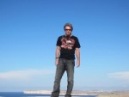
Dogs and I on the summit
We had no trouble getting back across the narrow section and made quick time down to the saddle. We considered doing PT 13,164 but decided that since we had a long way back to the car and the clouds had started to build a bit that it was better to just start heading down. We saw a backpacker going somewhere in a hurry across the saddle and were a bit startled to see another human after being alone all this time.
Coming down from the summit
Maya poses in front of the scenery
Trail headed towards Cataract Lake
We followed the trail around PT 13,164 towards the valley and eventually left it and headed back the way we had come. At one point we found the 'trail' that Roach had described. It's barely a trail at all. There's a bit of a beaten down path and a few cairns but the trail is basically a waste of effort to find.
Trail heading back
It is a decent trail for a while
Looking down to the willows
Maya and Jasper in front of Half
The "trail"
We found ourselves back near the trees and contemplated another round of willow bashing. Again, our path was basically whatever we could find that got us through. I had GPS points marked and tried to reach them but it was a maddening effort to get through the mess and back to the forest.
At this point I really thought we were home free. We'd made it back to treeline in one piece. Everyone was more or less unscathed by the willows. And then it started to suck. We tried to find the trail we had ascended. We couldn't find it. We went left. We went right. We followed what looked like might be it. We were within a few hundred feet of GPS points I had marked on the way up but nothing looked familiar. There were downsloping pine needles on mud on top of rocks. We both slipped multiple times. Then we started to cliff out. We were about 100-150 feet above safety but I couldn't get there. Then it started to rain. Now the downsloping muddy paths I was trying to follow were even more slippery.
The GPS at one point said I needed to be 300 feet left. But how? I wound my way up and down to the left and eventually saw a way down that didn't end up in a cliff. I yelled over that I'd found a way and we made our way down to the level of the creek in the valley. Now we had another problem. We started north through the trees trying to find the trail but didn't see anything. Again, the GPS said we were close but apparently not close enough. We ended up in a marshy area of willows and had to bash our way back up to the trees. Then ended up in more willows. Then we hit a creek crossing. Maybe we were on the right track? I got across the creek and finally saw the trail across the clearing. I breathed a huge sigh of relief.
Now back on familiar ground we cruised down to the TH and made it back at about 3pm. The dogs were exhausted. We were exhausted. We were all wet. We'd had a hell of a day in Cuba but it was an awesome summit that I'll never forget.
(no, I will never do this route again, once was definitely enough)
Thumbnails for uploaded photos (click to open slideshow):
Nice TR and pix! Cuba Gulch is definitely the way to climb Half. When I did this route in July '07 (hard to believe it was that long ago), the first mile up from the trailhead, after a sporting creek crossing, was one of the prettiest miles I've hiked in Colorado.
Did you guys see one? I didn't. Congrats on getting it done. I know you wanted it.
Caution: The information contained in this report may not be accurate and should not be the only resource used in preparation for your climb. Failure to have the necessary experience, physical conditioning, supplies or equipment can result in injury or death. 14ers.com and the author(s) of this report provide no warranties, either express or implied, that the information provided is accurate or reliable. By using the information provided, you agree to indemnify and hold harmless 14ers.com and the report author(s) with respect to any claims and demands against them, including any attorney fees and expenses. Please read the 14ers.com Safety and Disclaimer pages for more information.
Please respect private property: 14ers.com supports the rights of private landowners to determine how and by whom their land will be used. In Colorado, it is your responsibility to determine if land is private and to obtain the appropriate permission before entering the property.


")
")
")
")
")
")
")
")
")
")
")
")
")
")
")
")
")
")
")
")
")
")
")
")
")
")
")
")
")
")