Download Agreement, Release, and Acknowledgement of Risk:
You (the person requesting this file download) fully understand mountain climbing ("Activity") involves risks and dangers of serious bodily injury, including permanent disability, paralysis, and death ("Risks") and you fully accept and assume all such risks and all responsibility for losses, costs, and damages you incur as a result of your participation in this Activity.
You acknowledge that information in the file you have chosen to download may not be accurate and may contain errors. You agree to assume all risks when using this information and agree to release and discharge 14ers.com, 14ers Inc. and the author(s) of such information (collectively, the "Released Parties").
You hereby discharge the Released Parties from all damages, actions, claims and liabilities of any nature, specifically including, but not limited to, damages, actions, claims and liabilities arising from or related to the negligence of the Released Parties. You further agree to indemnify, hold harmless and defend 14ers.com, 14ers Inc. and each of the other Released Parties from and against any loss, damage, liability and expense, including costs and attorney fees, incurred by 14ers.com, 14ers Inc. or any of the other Released Parties as a result of you using information provided on the 14ers.com or 14ers Inc. websites.
You have read this agreement, fully understand its terms and intend it to be a complete and unconditional release of all liability to the greatest extent allowed by law and agree that if any portion of this agreement is held to be invalid the balance, notwithstanding, shall continue in full force and effect.
By clicking "OK" you agree to these terms. If you DO NOT agree, click "Cancel"...
Monitor - 13 (unranked) - Animas - with Amy and Dave
Peak 15 - with Amy, Dave, Eddie and Randy
Peak 12 - with Amy and Dave
Peak 11 & "Twin Thumbs South" (unranked)- solo
Peaks 5, 4 and Heisspitz - solo
Leviathan and Vallecito - solo
Peak 7 & Storm King - solo
Peaks 2 & 3 - solo
10 days (August 2nd - August 11, 2015), 16 peaks
Team for Days 1-4: Amy (Blazintoes), Dave (CarpeDM), Eddie (Mtnman200) and Randy Mack; solo thereafter
After visiting Vestal and Ruby basins in the summer of 2013, the potential for backpacking was clear to me. It was really fun to connect different basins and see different scenery. Last year we were done with our Jagged adventure in only 4 days, and the trip felt entirely too short. This year, I started dreaming about a long trip to Weminuche back in February. Sometime in the spring Dave and Eddie came along with the idea of Peak 15. It was a good excuse to start with the Ruby basin.
Day 1 - approach to Ruby basin
~3,800 ft, 6 miles, over 6 hours
Amy, Dave and I at the start of our adventure
Dave and Amy near the columbine tree
I didn't remember the trail to be that steep (but of course I was coming down it last time). Saddled with heavy packs (I had almost full set of BD cams in mine + 10 days worth of food), this made for a trying experience. About half way up, it started raining. First, a light drizzle, then a real downpour. There are few less pleasant things in life than navigating through tall, wet willows weighted down by 50 lb packs. With all the moisture in the recent months, the trail was far more overgrown than back in 2013, but at least we could still find it. Soaked to the bottom of our packs despite the rain pack covers, we found Eddie, Randy and the camp near 11,600 ft and promptly set up our tents, just as the downpour intensified. Once in the tent, Amy and I discovered most of our gear wet, including the down sleeping bag in my case, which made for a rather uncomfortable and cold night. What we didn't know at the time was that Weminuche made us pay the stiff entrance tariff upfront, and we were in the clear from now on.
First view of the upper basin in the downpour on the approach
Day 2 - Monitor, Peak 13 and Animas
~2,800 rt, <3 miles, ~7 hours
In the morning, the mood was rather somber as we woke up to foggy views - what if the weather never clears up and we will end up sitting in the tents for days? Somehow, we were undeterred - since Peak 15 was out of question today, we would at least try for the other 13er trio in the basin. Time to capitalize on the short approach and light packs. Amy, Dave and I set out from camp just before 9 am to clearing skies. We were hoping our wet gear and tents would have a chance to dry out a bit. This was the first day Dave and I ever hiked with the speedster Amy. She always appeared to be in front, scouting the route. We never seemed to catch up, except for that short section when she and Dave missed the turn on the descent from Monitor and ended up getting cliffed out. Whew, I finally got to catch my breath.
Climbing wet slabs to gain the saddle between Pk 13 and Monitor
Dave is following Amy en route to Monitor
Amy is leading the way up Monitor
Lo and behold we found the summit around 11 am. We were pleased - weather seemed to be holding up, so onto Pk 13. Somehow we missed the correct traverse on the way back (edited GPS track doesn't show our path of "most resistance") and dropped a bit too low. Realizing it by looking at my GPS, I backtracked, got to the saddle and waited for Amy and Dave to find their way around, which didn't take long. Some fun scrambling up Pk 13 followed.
Dave on exposed ledges
Amy cruising up Pk 13 - fun scrambling on solid rock
Dave and Amy on the Pk 13 summit
Weather was still holding up, besides we couldn't see a good bailout gully anyway, so we pushed on to Animas. On the descent off Monitor, we goofed off a bit again, taking a more direct route. Only Amy was able to navigate the Class 5 downclimb, while myself and Dave climbed back up and traversed right until we found a more reasonable Class 3 downclimb to the saddle. By that time, the weather was definitely building up, so we decided to wait it out a bit. Not seeing a major threat after a few minutes, we pushed on. Class 4 chimney was fun, and we had really cool clouds on the summit.
"That way", says Dave
Amy and Dave downclimb the Class 4 chimney - there are 2 options
Once at the Animas-Pk 13 saddle, we scree skied for about thousand feet, and then traversed right a couple of gullies, finding a cairn or two along the way.
Find (scree) skiing opportunity
Once on the grass, weather finally caught up to us and we got a little wet on the descent back to the camp. Wildflowers were stunning though.
Day 3 - Peak 15
~3,000 feet, 3 miles)
Eddie has already covered the climb in his excellent trip report.
Day 4 - Peaks 12, 11 and "Twin Thumb South", traverse to NoName creek basin
~4,500 ft, ~ 8 miles, 13 hours
After saying goodbyes to Eddie and Randy (who gave us a major scare by showing up a few hours later after we had expected them the night before), Amy, Dave and I decided to tag Peak 12 before parting ways. The trail in the upper Ruby basin is extremely faint or non-existent this year with so much overgrown vegetation. It certainly helped to have been there before, so we had no major route finding issues.
Amy's summit pose
Amy made me do that
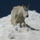
Back at the camp - yoga and the camp pet goats
Amy and Dave heading out
Too soon it was time to say goodbyes. Amy and Dave were heading back to the train, while for me the adventure was just beginning. I didn't know how many peaks or even which route I would take (just a general outline), so it was all very exciting. Note the 2nd pack on Amy's back - that's my trad rack and climbing gear, which she graciously offered to haul out for me, using next to none of it. Dave was hauling his rope out. Having backpacked the rest of the route, I will say that having any extra gear would have detracted significantly from the enjoyment factor for me. So, thank you again!
Still, hauling a 40 lb pack over 13,000 foot high mountain passes is no piece of cake. I went back and forth on which route to take, but ultimately decided to go for Pk 11, especially since I brought an ice ax and microspikes for crossing the snow on Twin Thumbs pass.
Saying good-bye to the Ruby basin
Hello, the Twin Thumbs pass
After stashing my overnight pack, I made my way over Twin Thumbs pass and to the base of Peak 11. I read beta from both Furthermore and Darin Baker and ended up using both routes.
Grassy ramp up Peak 11
Gully with "Class 4" boulder choke. I thought it was a bit harder than the implied difficulty (I am short), but fun nonetheless.
I was really hoping to see the old register that Derek talked about in his report, but alas, the new one only went back to 2011. The weather was still holding up and the ridge towards Twin Thumbs pass looked really inviting, so I decided to check it out.
Looking back at Pk 11 and Sunlight
I downclimbed to the saddle via the C3 route, which I presume was described in Darin Baker report. Why stop now? So I continued towards a fun looking spire, which turned out to be "Twin Thumbs North". My progress was interrupted by a Class 5 hand crack. In trailrunners and over a lot of air, I wasn't comfortable making a few committing moves and retreated ~50 ft away from the summit. Strange to be missing my trad rack, just as it was getting on the train at Needleton.
Handcrack that stopped me
Lots of air on both sides below the crack
I decided to continue and check out the last interesting looking feature on the ridge before the pass. Although intimidating looking, it turned out to be a fun Class 3 scramble, increasingly exposed, to the top of "Twin Thumbs South".
At least now I know why it's called "Twin Thumbs"
From there, I scree skied down towards Twin Lakes via loose gully to my stash, then made my way over Twin Thumbs pass, where I was expected.
Scree skiing towards Twin Lakes
Beeeeh, I am expecting you!
Once reunited with my big pack and filtering water near 12.6k, it suddenly hit me - it's already 5pm and I still have a largely unknown descent to NoName basin. Rats! I sprang up into action and started the descent around 5.30pm. It wasn't easy and I was holding my breath a few times.
First, I encountered slabs, then snow, then cliffbands, then steep canyon walls, then off-trail bushwhacking, then willows and (very) tall flowers, then extra 300 ft of uphill. Thankfully, Amy told me to stay away from the right side, so I didn't get cliffed out. Eventually, I made it to my new camp at the confluence of Sunlight creek and NoName near 11k by 8pm. Whew!
"Mushroom lake" and the sufferfest ridge of tomorrow - Peaks 5,4 and Heisspitz
Cliffbands are not so fun with the heavy pack
Creek
Day 5 - Peaks Five, Four and Heisspitz from the camp in NoName
~4,600 ft, ~8 miles, <11 hours
I was already feeling pretty fatigued from the last couple of days, but a nice day was shaping up, once again. Time to get moving - one cannot waste a bluebird day in Weminuche. After oatmeal with raisins, hot chocolate and coffee breakfast, I rolled out of camp around 8.30 am. Last year, after climbing Jagged, I was able to tag Peak 6 as well, but ran out of time, energy and weather for Peak 5. It was time to pick up where I left off. Always nice to tackle the unfinished business. I set out on the already familiar trail towards the unnamed, but oh-so-beautiful lake at 12,552 ft. I picked my way through the swampy areas in the upper basin and very steep grass to arrive just above the lake. Instead of going to the saddle with Pk 6, I took the more direct route, which turned out to be a delightful scramble on solid rock.
Back at the lake
Peak 5 ahead with Grenadiers behind
From reading Furthemore and Kevin Baker's reports, once again, I wasn't expecting anything too difficult, but got stumped on the descent from Peak 5. Instead of taking the rocky gully, I ended up downclimbing the face and ran into some interesting Class 4 - maybe even low 5 - terrain. It was some good climbing, but I expended too much energy which I didn't have.
Downclimb
Some views off the ridge
After a few additional ups and down, I finally figured out that Peak 4 summit is not the next bump, but one a few bumps over, so I dropped to the right of the ridge, finding a very faint trail through the boulder field.
Just keep going, it's a long way out there (Pk 4 is the highest bump on the far right)
After arriving on Pk 4 two hours after leaving Pk 5, I had serious doubts about continuing. I was tired! But weather looked stellar, and I was "so close", so I somehow convinced myself to continue on to Heisspitz. Initially, I decided to stay on top of the ridge, as Derek's report suggested, but very soon I ended up getting cliffed out. Tired of constant "ups and downs" of the ridge, I decided to do the "low" traverse and top out just before the Heisspitz summit. Not sure if it was the best way, but I was too tired and running low on water on a hot day.
Grenadiers lineup from the (long) ridge
Heisspitz (far) ahead
Staying on the ridge and it's getting cliffy
It's cliffy everywhere! I am too tired to enjoy any sort of scrambling. The ridge seems never ending. It's a hot day and I am running out of water
(Subsummit) of Heisspitz from the low traverse
Scrambling to reach the summit ridge
After some pretty fun Class 3-4 scrambling (and another false summit), I reached the summit around 4pm three hours after leaving Pk 4. I clearly was not moving fast that day. Out of water, and feeling dehydrated, I wanted to find a mellow way down. The thought of dealing with cliff bands on the descent was not welcome. I didn't see any good bailout gullies from the ridge between Pk 4 and Heisspitz, so I decided to continue down the Heisspitz west ridge.
Heisspitz west ridge
To my delight and relief, I found a fairly solid Class 2+ ridge that brought me to the grassy saddle. A few hundred feet of talus, and I was on steep grass.
West ridge
The grassy gully, although steep, didn't cliff out, and about 2 hours after leaving the summit I was back on the NoName trail. Another mile, and the Jagged cabin appeared. Another mile and I staggered back into the camp.
Day 6 - Traverse to the base of Jagged over the Jagged pass
~2,100 ft, ~2.5 miles, ~4.5 hours
I woke up the next morning and could barely move my fingers and toes. Thankfully, it was drizzling lightly. The very thought of hiking was repulsive. So I decided to give it a couple hours. I ate a nice breakfast (more oatmeal with dehydrated fruit, coffee and hot chocolate) and took a nap. After waking up, I did the food and peak inventory (still lots). In order to hit all the peaks I had on the "wish-list", I actually needed to move the camp that day. Duh! I decided to eat lunch and see if I could find some motivation. Eventually I convinced myself to pack up the camp, and departed a quarter past 1pm. Hauling the pack over the Jagged pass was pretty brutal, but the rest in the morning definitely helped.
Jagged pass ahead
Once over the pass, with the lateness of the day and deteriorated weather, getting Leviathan and Vallecito was out of question, so I decided to camp at the lake, positioning myself for the morning attempt.
Camp at the lake with the view of Jagged (taken the next day)
As soon as I set up the camp around 7 pm, it started pouring, and didn't let up until 2 am. I was getting worried that I'll get shut down on Leviathan and Vallecito for the 2nd year in a row, but thankfully, the rain eventually stopped.
Day 7 - Leviathan, Vallecito and traverse to the base of Peak Seven
~2,600 ft, ~5 miles
Despite the soggy morning, I was motivated to take advantage of the break in clouds and departed the camp around 6.40 am. The approach was non-existent, and I was making good time towards Leviathan, gawking at the view of Jagged at the same time.
NE ridge of Leviathan
The ridge was pretty straightforward and I got to the summit around 8 am or so. For the descent, I decided to take a NW ridge towards Vallecito. It was pretty exciting class 3-4 downclimb on a solid and slabby Flatironesque type rock. I'd probably prefer to upclimb that ridge, but it worked out just fine as a downclimb.
Vallecito was just a "light" version of Leviathan, and by 10.30 am I was back at the camp, ready for the next leg of the journey - moving camp towards Peak Seven. Up to this point, I was in the familiar territory, revisiting the basins I had been before. Traverse to Peak Seven via Leviathan lake would be an uncharted territory (for me). Traverse to the lake started with a steep 1,000 ft descent, mostly on talus. I thought this was the most tedious part of the whole trip.
Talus descent
Looking back at the descent
The lake was beautiful though
From the lake, using faint game trails and a few cairns, I found my way towards Peak 7. Again, I decided to get a good rest and attempt it in the morning.
Peak 7 ahead
Day 8 - Peak Seven, Storm King and moving camp to Trinity lake
~3,200 ft, ~6 miles
Next morning, around 7.30 am, I left the camp and was soon enjoying the front row view of the Grenadiers from Peak 7 summit ridge.
Peak 7 summit. Summit had reception, so I spent some time catching up on emails and text messages, which killed my phone battery pretty quick
Descent off Pk 7
After packing up camp, I headed towards Silex lake, curious to see what other peaks I could get. I decided to scramble up Storm King peak, leaving the rest of Lake Silex group for another trip, as I was starting to run low on time. Long, but fairly easy and on very good trail traverse to the Trinity basin followed.
Silex from the Storm King-Pk 9 saddle
Lake Silex
Hello, Trinity creek basin
Enjoyable trail that made uphill backpacking quite manageable, even at the end of a long day
Campsite ~12.6k
The reward was setting up a campsite with a spectacular view of Silex and Storm King.
Day 9 - Peaks Two and Three and hikeout to the Elk Park
~2,900 ft ascent, ~6,000 ft descent, ~13 miles
In the morning I packed up the camp and it was a short skip and hop over into the Elk Creek basin. Decisions, decisions. Do I go for Peaks One and White Dome first or deal with them later? Ultimately, I decided to start with Peaks 2 & 3 and see how far I'd get.
Silex and Storm King from the top of Trinity creek basin
Descent into the Elk creek basin. I'll leave my big pack near the lake
After stashing the pack, I headed up the mellow gully towards Pk 2-3 saddle
The hike to Pk 2 was rather uneventful and unremarkable, except for the views of the Grenadiers. I was hoping the views would only improve on the way to Peak 3, and I wasn't disappointed.
Hello, Ruby basin, looking pretty far away
Trinities from Peak 3
Views from Pk 3 were exceptional, but with peaks so close, it was difficult to get them all into the frame. Weather was clearly moving in at that point, and one of my knees started slightly bothering me on the traverse from Pk 2, so I decided to make Pk 3 the final peak of the trip. I descended the south ridge of Peak 3, admiring some unique volcanic rock, and making a full loop back to the top of the pass and then back to the pack. As I was repacking the big pack for the long hike out and making lunch, the rain started to fall. To my surprise, I noticed a bunch of tents by the lake, that were not there in the morning, as well as bumped into another party of two and chatted for a bit - the first humans since Vallecito. Civilization must be close! I hit both groups for beta and they reported no discernible trail and a couple of waterfalls to deal with on the descent to the Colorado trail.
Lunch in the rain before the hikeout. A group of tents in the background
On the hikeout
Waterfall
Colorado trail is at the end of this valley
This indeed proved to be another long hike, predominantly on talus, which took me almost 3 hours. So when I finally did find the Colorado Trail around 5.30 pm, I was only too happy to turn on the afterburners and enjoy the great wide trail for almost ~7 miles. My goal was to make it to the Elk park and to camp by the Animas river that night.
Colorado Trail
Good-bye, Grenadiers
By the time I got to the campsites by the Animas river it was getting dark (~8.30ish). Without cell reception most of the week, I was unaware about the chemical spill into the Animas, but I did get the message that the water was unsafe to drink, without further explaining why. I figured it probably had something to deal with E-coli or Giardia. I needed water for dinner, so I decided to throw at it everything I had, hoping it would help (purification tablets, Steripen, Aquamira drops) - no idea I had to deal with toxic metals at that time. This would only come to light the following day.
Despite having the return train ticket, I decided to hike out in the morning via the Molas pass, checking off another item on my bucket list. Besides, I figured, it would be much faster to get to my car parked in Durango that way.
Day 10 - Hikeout via the Molas pass
~1,800 ft ascent, ~4 miles, ~2 hours
After breakfast and packing up the camp, it was time to hit the trail one more time, which I did around 7.45 am. The famed switchbacks didn't fail to appear and nearly 2 hours later I was crossing Hwy 550 in hopes to thumb a ride to Durango. After about 10 min wait, two guys I met in the Elk creek basin finished their hike and were kind enough to give me a ride to my car.
Trip totals: ~31,300 ft, ~58.5 miles, 16 peaks
My GPS Tracks on Google Maps (made from a .GPX file upload):
WarningBOLD TEXT: Drinking martian colored metallicity water from the infamous "Animosity" will fly you to the highest Grenadier tops, grow extra toes and cause you to shout things like, "I shall take over the Weiminuche, but first I must have my poor man’s coffee!" I know what you put in your coffee and cereal bowl..all good energized stuff.
You really can cruise, good strong woman you!
The photo of the downclimb on Peak 5 is delish...
See you soon...
You are a mountain-climbing machine, Natalie! I can’t believe how much you were able to accomplish on your peakbagging rampage. I wish I had half your energy. What a great trip (other than the extra ’vitamins’ in the water at the very end).
I haven’t been into this area since the mid 80s, but it is on my list to get back to. I climbed peak two in 1971 and attempted to climb Storm King from the Trinity Lake side. We couldn’t find a walk up route for Storm King from this side and turned around. Some of your photos were taken from the same spots as some of my old photos. I have to get this done soon. Maybe next summer with my grandson.
Thank You for this report!
Matt – the set of microspikes I bought from REI was no good, so I got a high quality set from Jaaron, you know, that dude from Blanca and Tab. I didn’t know you’d be interested in some dry hill walking? Is Monarch open yet? Amy – thanks for the nod, the downclimb from Pk 5 was legit, I also enjoyed Leviathan and Storm King for similar reasons. Look forward to getting out soon! rajz06 and MtnHub – Thanks! and this TR was indeed exhausting to write. I was regretting half–way after a couple day already invested. It took me a full day just to clean the GPS track and to get all the splits. Arghh! Greg – Good TR writing help is hard to find nowadays! I feel your pain. Dave – lovely excuse... it’s similar with getting to Carnegie Hall, just takes practice, practice, practice...I now write better than UofC graduate? Sweet! Kansan – I didn’t have any beta on Storm King, except I knew there was a hiking route somewhere. When I got to the saddle with Pk 8, I could see the route. Really fun scrambling on very good rock that could probably be kept at Class 3. Abe – I didn’t starve! Made a mistake falling short on food 2 years ago, so took extra care this time. Amy and Dave saw my 3 huge food bags in the beginning. I had at least couple additional days worth of food, which worked out fine when I realized in NoName I was running low on calories. I also foregone Mountain House completely and ended up subsisting on tuna and mashed potatoes, hot chocolate, and oatmeal with dry fruit, which worked out fine. I wish I knew how to cook mushrooms, as this would have been another great source of protein, there were tons of them in NoName. Darin – not sure about "trekking machine". Ha. Felt kinda slow/lazy/weak. Got pretty lucky with the weather, had no major route–finding issues and was able to move at a steady, albeit slow pace every day. It was hard to get out of sleeping bag in the mornings, especially towards the end. Definitely not the most efficient way to get peaks, but I really wanted to see the "backside" of Weminuche. This trek out of my system, I think I’ll take a more focused approach (e.g. Silex group) and out–and–back next time.
Thanks again for the comments everyone! Much appreciated.
The Weminuche is such an amazing place, especially for those willing to step into the areas less traveled, which I’d say you certainly succeeded in doing here! That’s a nice lineup of peaks. Way to stick with it and congrats again on Fifteen and the rest after it .
Nice report and nice job on all of those peaks! You are not a true 13er climber until you spend at least a week in the Weminuche traversing multiple drainages
Mtnman200 - Eddie, I think I drank just a day before Gov Hickenlooper. Maybe the worst was over by then. Waters kinda looked muddy the next morning in the daylight, but I didn’t even given it another thought. It was quite shocking to see the earlier photos of the river later! Ben - the suspense is building! I really wonder if we’ll have another Centennial finisher this year. Congrats on your own recent Wemi Über trip and good luck with the 2 remaining ones! and thanks for Pk 15 beta. CT - I might even add - "solo". DArcyS - thanks, Pk 15 was fun. Smaller group would be more efficient, for sure. Wish we had time for Pk 16.
Hey SnowAlien, so i recently started reading Weminuche trip reports trying to plan a trek for this summer. As I was reading your post, I thought "this trek looks familiar, someone explained this to me once on my map." Sure enough, I was the guy with my buddy up by the Elk Creek source. The next day I was fortunate enough to give you a ride and pick your brain on the way back to Durango. I am looking at driving up again from El Paso for another trek this summer (hopefully twice), think I will start at Beartown this time. I enjoy reading your trip reports... thanks! -Joe
Caution: The information contained in this report may not be accurate and should not be the only resource used in preparation for your climb. Failure to have the necessary experience, physical conditioning, supplies or equipment can result in injury or death. 14ers.com and the author(s) of this report provide no warranties, either express or implied, that the information provided is accurate or reliable. By using the information provided, you agree to indemnify and hold harmless 14ers.com and the report author(s) with respect to any claims and demands against them, including any attorney fees and expenses. Please read the 14ers.com Safety and Disclaimer pages for more information.
Please respect private property: 14ers.com supports the rights of private landowners to determine how and by whom their land will be used. In Colorado, it is your responsibility to determine if land is private and to obtain the appropriate permission before entering the property.