Download Agreement, Release, and Acknowledgement of Risk:
You (the person requesting this file download) fully understand mountain climbing ("Activity") involves risks and dangers of serious bodily injury, including permanent disability, paralysis, and death ("Risks") and you fully accept and assume all such risks and all responsibility for losses, costs, and damages you incur as a result of your participation in this Activity.
You acknowledge that information in the file you have chosen to download may not be accurate and may contain errors. You agree to assume all risks when using this information and agree to release and discharge 14ers.com, 14ers Inc. and the author(s) of such information (collectively, the "Released Parties").
You hereby discharge the Released Parties from all damages, actions, claims and liabilities of any nature, specifically including, but not limited to, damages, actions, claims and liabilities arising from or related to the negligence of the Released Parties. You further agree to indemnify, hold harmless and defend 14ers.com, 14ers Inc. and each of the other Released Parties from and against any loss, damage, liability and expense, including costs and attorney fees, incurred by 14ers.com, 14ers Inc. or any of the other Released Parties as a result of you using information provided on the 14ers.com or 14ers Inc. websites.
You have read this agreement, fully understand its terms and intend it to be a complete and unconditional release of all liability to the greatest extent allowed by law and agree that if any portion of this agreement is held to be invalid the balance, notwithstanding, shall continue in full force and effect.
By clicking "OK" you agree to these terms. If you DO NOT agree, click "Cancel"...
Trailhead: CDT/CT trail at the top of Marshall Pass
Route: CDT/CT north to Cochetopa Creek trail then east to the saddle, then north to the summit
Length: About 9 1/2 miles
Vertical: 3000 feet
Partners: Mike N
After doing Mount Kiamia a couple weeks back (trip report here ), I wanted to catch the "new" Chipeta Peak from the pass. Much has been written about the renaming of 13472A to Chipeta and that can be read here. I had also read Tomcat32's TR here about how he went at it from Pass Creek, but it seemed like it could be done from Marshall Pass as well. I had been up near the "old" Chipeta previously so I thought that looked like a good route. My friend Mike was up for a little hike so I actually had some company on this one but that meant I had to try and keep up with someone who is less than half my age. Ugh!
The Marshall Pass Road is an old railroad grade so it is not steep nor does it have any sharp curves with the exception of a couple at the start of the pass where the road deviated from the old railroad route. Almost any passenger car can make it to the TH. (captions below pictures)
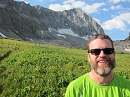
Mike and my FJ at the TH
There is a pit toilet at the TH
Walk across the road to the start of the trail
This appears to be a pretty popular trail. For the first mile or so, there are lots of ATV tracks and once the trail narrows, it appears a lot of mountain bikers use the trail.
It is a good trail The trail is well marked
It eventually turns into a single track about a mile and a half in or so in - just past an old mine dig. The start of the single track
The views west start getting pretty nice as you go along the trail.
You continue north on this trail for about another mile and then will encounter two intersections - one right after another. First intersection - stay right Closeup of the sign at the first intersection - stay right. Second intersection - stay right here, too. Heading east just after the second intersection. The trail gets much less use and is narrower here. And a closeup of the sign
Now, you head up a broad valley to a saddle. There is a trail all the way to the saddle
As you head up towards the saddle, be sure to look back at the views. Vew west The narrow trail continues to the saddle Nearing the saddle And when you get to the saddle, you get a great view of Mt. Ouray.
From here to the summit, there are various trail segments but all you really have to do is find the best path up. There is one false summit (Old Chipeta) but other than that, it is a very straight forward hike. A bit of a climber's trail And another nice view of Ouray
It was kinda fun coming across this cairn and sign... Chaffee County has pride!
The rest of the route continued to be pretty mellow. Summit is on the far right. But there is a false summit along the route - it is "old" Chipeta. Once on top of old Chipeta, you finally see the rest of the route. So - it's time to go up!
The views from the summit are really stellar. Looking south to Ouray. Looking northeast Looking northwest Looking southwest back at the route Ouray again - Antora in the background.
And a short 360 vid from the summit.
And, as I don't carry a GPS, this is an approximation of my route.
Thanks for taking the time to read this and as always, please be careful out there.
Thumbnails for uploaded photos (click to open slideshow):
You won't have any trouble with this one at all. It is a nice pleasant hike with very nice views. And there was more white quartz on this hike from the saddle to the summit than I think I've seen on just about any walk.
Reading TRs like this reminds me of days gone by when telling a story and giving beta without pretense or showing off was the focus of most TRs.
As I scanned each picture, somehow, I could remember how I felt following the same route up this peak in 2012. Since we were hung over after too much fun at FIBARK, I am shocked I remember anything at all...
It always blows my mind that I can't remember what I had for breakfast, but a single pic in a TR can fill my mind with memories of my own time at that spot.
Since these are usually great memories, thank you!
Matt - I appreciate your kind comments. And - like you - it's crazy how one picture can bring back so many memories. But in the end, all we really have are memories...
John - Yeah - there were swaths of beetle kill and then there was almost a demarcation line between them and what appeared to be healthy forest.
Jay,
Thank you for sharing, I really enjoyed this one. I've been to that pass for Ouray and now it looks like now I have to go back to meet his old lady! Isn't it interesting how the popularity of certain places rises and falls? I find that knowing a little history about an area (like Marshall Pass) can add a lot to one's adventure. Keep 'em coming!
Rob
Thanks for your kind words. I have been trying to hike and do TR's on lesser known peaks. There are a zillion Bierstadt reports (and I am guilty of writing 2 of them ) so I thought peaks like this one deserved a little love.
I have researched this one a bit and was wondering whether taking the CT or just gaining and following the ridge would be better. Your route looks like a good option and a nice day! So many peaks so little time....
Honestly, I think you could do it easily either way. The last time I was up that way (and didn't go all the way to old Chipeta), I took the ridge and it worked fine, too. Definitely a loop possibility.
I'm surprised at how little snow. Looked like a good outing. Via Marshall Pass seems to be the standard route and more straightforward. Before I climbed from Pass Creek, I couldn't find any info at all on approaching from that side. Definitely no signs of past usage above Pass Creek Lake. I have seen "Old Chipeta" referenced as "South Chipeta" once.
Jay! Long time, no talk! I have been off the radar for awhile, but just bought a new ski setup and looking to get out this winter! I'm down in Durango still so please let me know if you're in the area! Great trip report. It was so detailed I would use it as an aid when hiking this peak. Also, pics 22 and 23.... WOWOWOW!!!!! Awesome!!
@Tomcat - I honestly think your route looks like a lotta fun. I think I need to follow in your footsteps one of these days. I am certainly not opposed to repeating a peak (understatement..)
@Dillon - Thanks, man. I only wish I could do half the stuff you do. And yeah, I am kinda bummed they don't make the FJ's anymore. Most reliable and maintenance free vehicle I've ever owned. 180K and I have only done 1 brake job and replaced the battery. Amazing....
@Danielle - Great to hear from you! Thanks for your nice words. I will definitely give you a yell if I am anywhere near you. And please do the same if you are in my neck of the woods. I would love to do a little hike with you one day.
Nice TR. I'm heading to Ouray tomorrow. I'll have to add this to my to do list.
Caution: The information contained in this report may not be accurate and should not be the only resource used in preparation for your climb. Failure to have the necessary experience, physical conditioning, supplies or equipment can result in injury or death. 14ers.com and the author(s) of this report provide no warranties, either express or implied, that the information provided is accurate or reliable. By using the information provided, you agree to indemnify and hold harmless 14ers.com and the report author(s) with respect to any claims and demands against them, including any attorney fees and expenses. Please read the 14ers.com Safety and Disclaimer pages for more information.
Please respect private property: 14ers.com supports the rights of private landowners to determine how and by whom their land will be used. In Colorado, it is your responsibility to determine if land is private and to obtain the appropriate permission before entering the property.


")
 Mike and my FJ at the TH")
 Walk across the road to the start of the trail")
 The trail is well marked")
")
")
 The start of the single track")
")
")
")
")
 First intersection - stay right")
 Closeup of the sign at the first intersection - stay right.")
 Second intersection - stay right here, too.")
 Heading east just after the second intersection. The trail gets much less use and is narrower here.")
 And a closeup of the sign")
 There is a trail all the way to the saddle")
 Vew west")
 The narrow trail continues to the saddle")
 And when you get to the saddle, you get a great view of Mt. Ouray.")
 Nearing the saddle")
 A bit of a climber's trail")
 And another nice view of Ouray")
")
 Chaffee County has pride!")
 Summit is on the far right.")
 But there is a false summit along the route - it is \"old\" Chipeta.")
 Once on top of old Chipeta, you finally see the rest of the route.")
 So - it's time to go up!")
 Looking south to Ouray.")
 Looking northeast")
 Looking northwest")
 Looking southwest back at the route")
 Ouray again - Antora in the background.")
")