| Peak(s): |
Half Peak - 13,866 feet Unnamed 13179 - 13,179 feet Sunshine Peak - 14,004 feet Redcloud Peak - 14,037 feet |
| Date Posted: | 04/15/2018 |
| Modified: | 05/05/2018 |
| Date Climbed: | 04/14/2018 |
| Author: | bmcqueen |
| Peak(s): |
Half Peak - 13,866 feet Unnamed 13179 - 13,179 feet Sunshine Peak - 14,004 feet Redcloud Peak - 14,037 feet |
| Date Posted: | 04/15/2018 |
| Modified: | 05/05/2018 |
| Date Climbed: | 04/14/2018 |
| Author: | bmcqueen |
| Three and a Half Peaks; Zero People |
|---|
Three and a Half Peaks; Zero People I had been watching the weather and conditions hoping to get a shot at Gladstone & Vermillion, but the weather just wasn't looking promising. A spring storm was due to hit Thursday night and continue through the day Friday. The northern mountains would get the bulk of the snow, but the San Juans were still showing 6 to 10 inches between Thursday night and Friday. I decided to wait until a better weather window for Gladstone & Vermillion, but still wanted to get out. I loaded my car up Thursday morning and went to work, putting off the decision on where to go until that night. I really wanted a new Centennial and figured Half was going to be my best option there. Saturday's weather looked pretty nice actually, so the question was whether to go to Lake City and climb a 14er or two Friday or perhaps go to the Sangres and try the OB on Kit Carson Friday. I left work Thursday and started driving, finally calling Melissa a bit past Fairplay to tell her I had decided on Sunshine & Redcloud for Friday and Half, Pt 13,164 and maybe Quarter for Saturday. On the way down, I saw at least 50 deer and 30 elk in the stretch of CO 149 between Gunnison and Lake City - it was like they were feasting before the coming storm, which was already in the air. Day 1 - Friday the 13th - Sunshine & Redcloud The name seems ominous - as did the weather forecast (wind-chill values of something like -27 plus 6 to 10 inches of snow in the forecast). I needed spring grid slots on Sunshine and Redcloud and thought these would be the safest options given the crummy forecast. I had just done these two in mid-March, so the route was still fresh in my mind and I was not terribly concerned with avalanche danger given you are predominantly on ridges (CAIC forecast was yellow both Fri & Sat). It was going to be a full body armor kind of day though. My poor nose has taken a bit of a beating this winter and it was still a little tender. I assured Melissa I would keep it 100% covered on this trip. I wasn't in a huge hurry for an alpine start given I had nowhere to be except back at the Matterhorn Motel that night, so I slept in until 5. I looked out the window when I woke up and saw a bit of snow, but not a big accumulation yet. I scraped almost all of the ice off my windshield, leaving just a tiny bit below the wipers at the very bottom (enough to crack the length of my windshield while driving to the trailhead with the defroster on - oops). I started walking from the Mill Creek Campground at 6:36 AM, pretty surprised that I was walking on dirt with decent visibility.   When I came out of the trees, the strong winds out of the north met me head on. It was like running into my arch nemesis. This day was going to sting a bit after all. I was now in the clouds with very little visibility. There's not much to the route though - turn left and go uphill until you can't go up anymore. In 3:49, I was standing atop Sunshine. I took a quick picture so I could show Melissa how responsible I was being, then I turned right and made for Redcloud straight into the wind.   I got to Redcloud 5:04 after leaving the trailhead. It was snowing a bit harder now. Another quick photo and a message to Melissa, celebrating the fact that the wind was about to be at my back.  I scooted back across and went back up and over Sunshine, not wanting to mess with the bypass in zero visibility on fresh snow. Things started looking up once I was back down in the trees, and soon, I was below the cloud deck again, walking on dirt trail back to the valley floor. Weird weather day.  I missed my target 8 hour roundtrip time by 14 minutes, shrugged it off and went down into town for food and rest. With a French dip and fries from Cannibal Grill in my belly and a pizza in my hand for dinner later, I returned to the Matterhorn and worked for a couple hours before bed. Day 2 - Saturday April 14, 2018 - Half & Point 13,164 I woke up at 4:00 AM Saturday, made coffee, had breakfast and headed out. I wasn't exactly sure what the day would bring given that I had never been on these peaks and couldn't find a single trip report on them in the snowy months. I had really wanted to get Half & Quarter together, but everything I had read indicated this wasn't all that easy to do even in summer. I tried to warm myself to the idea that Quarter might not happen today - I needed to stay focused and make sure I at least got Half done to get down to 11 Centennials left. As I drove up the road in the dark, I stopped my car and did a double take when I saw that it looked like the road to the Silver Creek/Grizzly Gulch trailhead was now open. I chuckled remembering last November when I (and my car) was on the wrong side of that gate the day they closed it... I left the Cataract trailhead at 5:38 AM with more snow falling than I had seen the whole previous day. The forecast had the skies clearing by 8:00 AM. I hoped the forecast was right. The good trail was easy to follow even covered in snow and lacking fresh tracks. About the time I got to the half frozen, half running waterfall near tree line, the trail kind of went away. I saw a blue ribbon in a tree off to the right and figured that must be where I was supposed to be.   I made my way through a bit of snow covered deadfall and popped out of the trees at a large cairn just before the smooth snow led me up through the moraine. The snow was great - super supportive from two nights in a row of deep freezes. I found a couple more cairns before I entered the upper willow-strewn basin. I gave up on finding the trail and took the frozen stream bed up through the willows, eventually seeing a large flat area that I figured must be Cataract Lake.   I went up to the next lake at the 12,180 saddle and continued to contour around to the right. There is a giant (like Grays/Torreys size!) cairn about 100 feet below you in a drainage, providing the counterintuitive hint that you should descend a bit and providing a helpful landmark on your way back out. The ascending traverse out of the drainage led me to a large snow-filled expanse, devoid of any hints of where you might be going. I was almost five hours into the day, and not only had not summited a mountain yet, but frankly couldn't even tell if I was getting close to a mountain I might want to stand atop. I was enjoying the blue bird day, however - a nice change from yesterday. I kept chugging up hill, thinking I must be getting close to Point 13,164.  Boy was I wrong! I kept angling left thinking I was climbing Point 13,164. I was watching my altimeter closely - almost there, almost there. But wait, shouldn't that saddle be lower if this is a ranked 13er? Oh well...almost there, almost there. But when I got there, my heart sank as I looked to the west. At Point 13,164. Ugh.  I thought about just forgetting that one, but remembered Natalie saying it wasn't that far as a side trip. I hadn't scouted any great foolproof way of getting Quarter on my way in, so that was in doubt. At least this little peak was a sure thing. So I begrudgingly dropped south and west to go climb this fun little ranked 13er that supposedly had great views of Half and the Jones group. It did not disappoint.   I signed the register with the first summit in 2018 and just a few behind Otina's summit from last year's fall gathering, then reversed my tracks back towards Half. When I was just about back to what I originally thought was Point 13,164, I saw my first alpine jackrabbit. I was surprised to see him up here at about 13,000 feet, but not as surprised as he was to see me! I started to take out my phone to take a picture of him, but he freaked out. He ran frantically to the right, then to the left, then more left. He dove over the edge of the ridge out of sight for a moment. Then he popped back into view. He saw me again and that REALLY freaked him out. He bolted uphill as fast as I've seen a critter move and finally escaped his near death experience. He's probably in his burrow right now writing up his trip report about his encounter with the scary human with the funny-looking thing over his nose... I proved to him that I was no threat at all by walking my normal slow, steady pace up towards Half's crux between 13,500 and 13,660.   The exposure on the right was breath-taking. To the left was a series of steep, loose gullies. I know this section is supposed to be Class 2 if you take your time. I could tell where the summer trail went in a couple of places, but covered in snow, I wasn't loving the look of it. I stayed up towards the ridge crest and did the good old fashioned butt scoot in a few spots.  Once across, I made my way up to the summit cairn for Centennial #89. It was 2:00 PM - 8:22 elapsed time. Yikes! I looked across at Quarter, knowing I was going to orphan it today unfortunately. I had a quick discussion with myself on whether I should a) reverse course and go the longer south ridge I had just ascended or b) try to descend the shorter, but harder east face. I desperately wanted to take the shorter way down, but just didn't think it was a great idea given I had never ascended it and didn't even know exactly where it was (though I did have a .gpx loaded on my InReach that would theoretically get me close). I opted for the south ridge - I even threw my crampons on for 10 minutes crossing the crux - I figured I had carried them the whole way and knew I'd feel more secure if I had them on.     I cruised down, angling farther to my left as I did. I remembered a nice looking snow gully over there. A nice glissade got me down the first hill to the top of the gully, then I walked down the gully, thanking my lucky stars that the snow was still supporting me midway through the afternoon.  I turned the corner to go left, back over to the 12,180 saddle and remembered the giant cairn. That was incredibly helpful in making sure I didn't go crazy and descend way down into the wrong basin. I'll bet I wouldn't be the first to do it (something tells me there's a story behind the giant cairn).  I was hustling down hoping for another day where the snowshoes stay safely affixed to my pack all day. My luck gave out in the willows though. Ugh. Then I post holed for a bit even with the snowshoes. Serves me right for still being that high at 4:30 PM in April. I got back to my car at 6:15 PM - 12:37 round trip. My InReach says I did 17.74 miles, but that sounds too high to me. Sometimes I think it inflates mileage to make me feel better... I followed some human tracks down the lower part of the trail, but never saw another soul either day. After another stop at the Cannibal Grill, I crashed at the Matterhorn. When I popped awake at 3:44 AM this morning, I figured I might as well get up and drive home. My reward was seeing my first ever mountain lion as I was leaving Lake City. Now THAT Mr. Jackrabbit is what you should be afraid of! Thanks for reading. Thumbnails for uploaded photos (click to open slideshow): ")
 Not much of a blizzard...")
 Just a dusting of snow looking back down to the valley floor.")
 Sunshine summit - nose safely tucked away.")
 This kind of view is what keeps me coming back again and again....en route to Redcloud.")
 My R1 was wet all the way to the bottom of the zipper from breathing into it all day!")
 And the dusting of snow is gone...")
 Frozen waterfall on the way in.")
 And a side shot on my way out.")
 Looking up through the willows.")
 Cataract Lake. Probably cooler in summer.")
 Turning the corner and heading up.")
 The real Point 13,164 - looking awfully far away.")
 Almost to the top with Half in the background.")
 Fun to see my American Pie w/ Crowns route from two weeks ago! From left - Crown, N. Crown, Niagara, Jones and American (plu")
 Finally almost to Half!")
 Looking back down on what I thought was 13,164 on left and the real 13,164 right-center.")
 Looking back across the crux.")
 Summit of Half at last!")
 Quarter looking like a worthy challenge for another day.")
 Looking down the south ridge with RGP in the distance.")
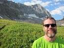
 The scary nose-covered human that will be villain in many bunny tales hence.")
 My descent gully.")
 Looking back around the corner with the massive cairn barely visible in the smaller drainage at center.")
|
| Comments or Questions | |||||||||||||||
|---|---|---|---|---|---|---|---|---|---|---|---|---|---|---|---|
|
Caution: The information contained in this report may not be accurate and should not be the only resource used in preparation for your climb. Failure to have the necessary experience, physical conditioning, supplies or equipment can result in injury or death. 14ers.com and the author(s) of this report provide no warranties, either express or implied, that the information provided is accurate or reliable. By using the information provided, you agree to indemnify and hold harmless 14ers.com and the report author(s) with respect to any claims and demands against them, including any attorney fees and expenses. Please read the 14ers.com Safety and Disclaimer pages for more information.