Download Agreement, Release, and Acknowledgement of Risk:
You (the person requesting this file download) fully understand mountain climbing ("Activity") involves risks and dangers of serious bodily injury, including permanent disability, paralysis, and death ("Risks") and you fully accept and assume all such risks and all responsibility for losses, costs, and damages you incur as a result of your participation in this Activity.
You acknowledge that information in the file you have chosen to download may not be accurate and may contain errors. You agree to assume all risks when using this information and agree to release and discharge 14ers.com, 14ers Inc. and the author(s) of such information (collectively, the "Released Parties").
You hereby discharge the Released Parties from all damages, actions, claims and liabilities of any nature, specifically including, but not limited to, damages, actions, claims and liabilities arising from or related to the negligence of the Released Parties. You further agree to indemnify, hold harmless and defend 14ers.com, 14ers Inc. and each of the other Released Parties from and against any loss, damage, liability and expense, including costs and attorney fees, incurred by 14ers.com, 14ers Inc. or any of the other Released Parties as a result of you using information provided on the 14ers.com or 14ers Inc. websites.
You have read this agreement, fully understand its terms and intend it to be a complete and unconditional release of all liability to the greatest extent allowed by law and agree that if any portion of this agreement is held to be invalid the balance, notwithstanding, shall continue in full force and effect.
By clicking "OK" you agree to these terms. If you DO NOT agree, click "Cancel"...
July 6: 4WD TH to South Colony Lakes Campsite. 4.3 miles, 1778 ft
July 7: South Colony Lakes Campsite to Crestone Peak. 5.4 miles, 3792 ft
(July 7 side photo trip to Humboldt Saddle for pictures). 2.5 miles, 1011 ft
July 8: South Colony Lakes Campsite to Crestone Peak. 2.9 miles, 2405 ft, (4.3 miles descent to 4WD TH)
Quick back story...I grew up going every summer to Horn Creek Family Camp (now Sky Ranch Horn Creek) at the base of Horn Peak. My knowledge of Colorado mountains began with the Sangre de Cristos, and my first mountain summit in junior high was Horn Peak. I can trace much of our outdoor adventure passions and eventual move to Colorado back to those family trips! I remember being told of the foreboding mountains just over from our spot....the CRESTONES (dum dum dum).
This trip was a long time in the works, and it was fun to see it finally come together. It didn't go exactly as planned, but it was still one of our favorites! Hopefully this photo-heavy trip report is useful.
My friend & coworker Sean and I had been plotting a few hikes that fell through, but the stars finally aligned for my wife, Sean, and I to head out, and leave our kids in the hands of my sister (thanks Katy!). We had been closely tracking the Spring Fire as well as potential afternoon storms as dewpoints had begun to point towards early Monsoon arrival. It looked dicey for the early hours of our trip, but every morning looked clear until mid afternoon.
Day 1: S. Colony Lakes Approach
We arrived at the 4WD TH and quickly got on our way, but about halfway up the trail some light rain began, which quickly turned into showers and eventually drenching rain and hail. We ducked under some trees for 5-10 minutes, but let's just say morale took a hit.
Eventually the rain let up and we continued on, though we never really dried out the first day. Thankfully, the views kept getting better, and the green scenery and popping wildflowers helped. In the end, it was probably nice that we didn't have to deal with head and sun in the middle of the afternoon.
We took the left fork at the trail split to stay closer to the Crestone side, and found one of the last campsite on a busy weekend. The views of the Needle over the lake were awesome! We set up tents, peeled off whatever wet clothes we could, made some warm food, and settled in for a few hours of sleep.
Day 2: Crestone Peak
We set 2:30am Alarms, and after gearing up, caffeinating, and oatmeal, we were on our way around 3:20am.
We had one 5 minute miscue in the dark getting off trail low on the boulders of Broken Hand Pass, but ended up getting back on track without issue. It felt good to get a little bit of scrambling started early in the morning.
We got to the top of the pass with the beginning of twilight, just enough to see down both sides of the pass. Wow, what an area!
Moving down the other side of BHP went quickly, and we took a short break at Cottonwood Lake. We talked through how this would also be an interesting place to pop through if arriving via Cottonwood pass.
We rounded the corner and saw the Peak itself and eventually the Red Gully.
The hike up to the Red Gully through grassy ledges, a great trail, and flowers as the alpenglow on the opposing peaks began...what a morning!
We took one more break at the entrance to the gully itself, then plowed ahead. For future information, despite the heavy rain the day before the route was in the usual condition - 90% dry with little streams of water that were easy to avoid. We had been worried about this but it was a non-issue.
I found the gully to be a mixture of easy class 3 scrambling and tedious loose steep class 2 hiking. While photos look impressive, it was never "spicy" in my opinion, except for a short off-route section that would have been easy to backtrack if we wanted. Mainly, it was important to keep an eye for occasional slick/loose rocks.
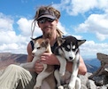
We had a great climbing crew - we alternated setting pace, communicated loose or questionable footing, and kept a positive vibe throughout. The views were fantastic, and it was hard not to enjoy even during some energy lulls.
Eventually, we popped into the sun as we exited the gully onto the short section of ascending ledges just below the summit. This relatively exposed portion took less than 10 minutes, but the sun felt great after hours in the shaded gully.
One quick heft over a short wall, and we were on top!
We lounged, snacked, watched the people on the needle, and began down.
It was clear that the loose rock and dirt have potential for bad outcomes with people below or if you aren't focusing, but we hiked/butt scootched our way down without incident. By the time we were back on level-ish ground, we were pretty hot and took a refreshing break at Cottonwood Lake.
Ascending BHP went by quickly. We also were able to watch a SAR team on the Needle training. You may barely be able to make out their neon yellow shirts traversing from the East to West Gully.
We had initially hoped to knock out the Needle on the same day, but with clear heads from Sean and Suzanne observing the weather and our energy levels, we headed back down to return the next morning. We made it back down the pass and to our tents without incident for snacks, naps, and some time to relax. We also heard some interesting stories from our campsite "friends" who had some...intestinal issues on the mountain...
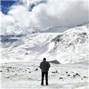
Day 2: (side trip) I had waited for year (years?) to get a milky way shot of the Crestones from Humboldt's saddle, so I did a quick trip out to shoot the photo at the beginning of this trip report. Interestingly, there was a couple that were benighted after climbing Ellingwood Arete and bivied on the Needle...we laughed about wondering who the other crazy person was wandering around in the dark!
Day 2: Crestone Needle
When I returned, we left around the same schedule, but made it to the top of BHP even faster! We lounged around for a while to allow more light so we weren't going up the more technical sections in the dark.
It was at this point that 4 bros came by with this story "we planned to climb the Peak, but it looks hard so can you tell us how to climb the Needle"? We tried to provide warnings, but then spent some time going over and over the route with them. We then let them get a 15 minute headstart as we shook our heads...this will come back as a factor later!
We eventually got back on our way and headed over to the East Gully as twilight began.
We started into the East Gully, and were maybe 10 feet up when we heard a monstrous series of crashes, then "Rock!". We jumped down and ran/tumbled over to the west side of gully in time to see a freezer? coffee table? size boulder crashing and flying on its way down where we had just been, and continue on down to Cottonwood. Needless to say, we were shaken up (and not happy) and remained there for a few minutes to regroup - had we been 50 feet higher, it would have been very difficult to escape. When we started up the bros seemed equally shaken up at having started the rockfall onto us, and wanted us to go ahead and lead (despite our route guidance, they had tried to cross over to the west gully about 200 feet too low). It wasn't exactly a group climb we were looking for, but we were happy to be above them.
Everything you read about that Crestone Conglomerate is right - it is beautiful, sticky, and has holds every 6 inches - you just reach up, and it'll be there!
We reached the crossover spot and spent a couple minutes strategizing, but in the end enjoyed a little extra climbing. It is definitely the crux, but the crux move doesn't have exposure to speak of, and can easily be spot by other people if needed. The photo below is from just on the west side of the crossover.
The light at this point was off the charts!
We continued on, with an increasingly steep but stable and "closed" west gully. Eventually, you pop out onto the ridge, and the views are amazing!
Note the sand dunes (through the smoke) in the upper right) below!
Once again, the summit weather was great, and we took it easy for a few minutes to relax, eat, and enjoy the gorgeous morning. While the mountain needs to be taken seriously, the shorter mileage and elevation made the quick summit very enjoyable, and we were all in great moods. We let the other parties start back down, and we began our descent.
The airy summit ridge was again a blast.
The photo below is from the small wall on the east side of the west gully at the crossover. Sean (in the green helmet) is 10-15 feet from cresting up onto the crossover itself and beginning back down into the east gully.
While the rock on the ascent felt locked into the mountain, it seemed like my pack scraped out every little loose pebble while crab walking/butt scootching down. Thankfully, there were no more boulder incidents on the descent, and we got to the bottom of the gully feeling great!
If you check my GPX, you would see that we took a somewhat higher trail from the gully back to BHP, slightly higher to skiers left - this was a very obvious trail (and that I saw others had taken in gaia GPS), though it differs from the 14ers.com trail. I'm not sure if it was easier, but it was nice variety.
Once back to the pass, it was a short climb down and back to the tents to pack up and start the hot trail back to the cars, and saw a Mr. Potato Head Thistle
Caption Here
This was a favorite outing for us! Despite the early weather and hijinks on the Needle (it was very clear several ways that the day could have gone badly because of other climbers issues), the gorgeous scenery, unique mountains, and good company made it a trip to remember.
My GPS Tracks on Google Maps (made from a .GPX file upload):
Especially the one with micro me wearing neon yellow. That's why neon yellow is our clothing color, so we can be seen from far far away. I think I'm the second or third neon yellow dot above the crossover. We took the crossover to the West Gully up and descended the entire East Gully from the summit down to give some new SAR members an East/West Gully tour. We also had some very close calls with other climbers sending rocks our direction without ever yelling rock. Did I meet you on your way out? I'm the one with the long funny looking hair. At the trail intersection below the lower lake we came across a woman who had an injured ankle and who also couldn't find her campsite so our little outing turned into a brief mission. Glad we were there and glad you had a fun and safe trip up both peaks.
We did see you! But it was from the trail while you all were relaxing - you're right the hair gives you away - and didn't want to disturb your chillaxing time. Impressed to hear you all actually do the route, and the extra credit east gully full route...good to know what good hands we are in.
We wondered if the woman ever found her campsite, other SAR members came by asking if we had any ideas.
That was a great trip man. Thanks for recapping it. Looking back at your awesome pictures confirms for me that this is one of my favorite areas in Colorado!
This is a fine report. I'm planning to climb Crestone/Needle the third week of August after my too-early attempt was aborted last season. I've got 9 summits left, and have done some of the purportedly more difficult peaks (Little Bear, Capitol), but I confess I've always been oddly unnerved by the exposure reports from these two. The fact that the rock is crazy solid, with plenty of hand/footholds, should give me comfort but ...
Anyway, thanks again. Especially with the photos, this gives me a lot of confidence going in.
For what it's worth, I never had any butterflies on either peak from the exposure...obviously they are peaks to take seriously, but all the trip report photos somehow exaggerate the steepness. It really is a non-stop take-your pick on holds until you are comfortable. I'm guessing from your experience you'll cruise up both mountains- and love them! Enjoy!!
Caution: The information contained in this report may not be accurate and should not be the only resource used in preparation for your climb. Failure to have the necessary experience, physical conditioning, supplies or equipment can result in injury or death. 14ers.com and the author(s) of this report provide no warranties, either express or implied, that the information provided is accurate or reliable. By using the information provided, you agree to indemnify and hold harmless 14ers.com and the report author(s) with respect to any claims and demands against them, including any attorney fees and expenses. Please read the 14ers.com Safety and Disclaimer pages for more information.
Please respect private property: 14ers.com supports the rights of private landowners to determine how and by whom their land will be used. In Colorado, it is your responsibility to determine if land is private and to obtain the appropriate permission before entering the property.