| Peak(s): |
Unnamed 13654 - 13,654 feet Unnamed 13577 - 13,577 feet California Peak - 13,854 feet Unnamed 13068 - 13,068 feet |
| Date Posted: | 02/07/2019 |
| Date Climbed: | 06/24/2018 |
| Author: | TakeMeToYourSummit |
| Peak(s): |
Unnamed 13654 - 13,654 feet Unnamed 13577 - 13,577 feet California Peak - 13,854 feet Unnamed 13068 - 13,068 feet |
| Date Posted: | 02/07/2019 |
| Date Climbed: | 06/24/2018 |
| Author: | TakeMeToYourSummit |
| Sweet & Spicy Sangre Scrambles |
|---|
|
In my humble opinion - it doesn't get any better than a fun day (or two) of scrambling in the Sangres on a perfect summer weekend. This trip began brewing when Adrian said he still needed Ellingwood Point. I'd mentioned that I'd climbed it from the South Zapata side a few years prior. He already had been leaning toward that route - so it made for an easy choice. Now, my catch, was that I would only share the trail with his girlfriend (Val) & him for the first few miles. My sights were set on a trio of neighboring 13ers. We all met after dark the night before our climbs at the Zapata Falls Campground. I bailed from the other two shortly after crossing the creek (past the North Fork Trail junction - the carved tree is pretty easy to spot). I kept the bushwhacking to a fair minimum on this part of the route. 


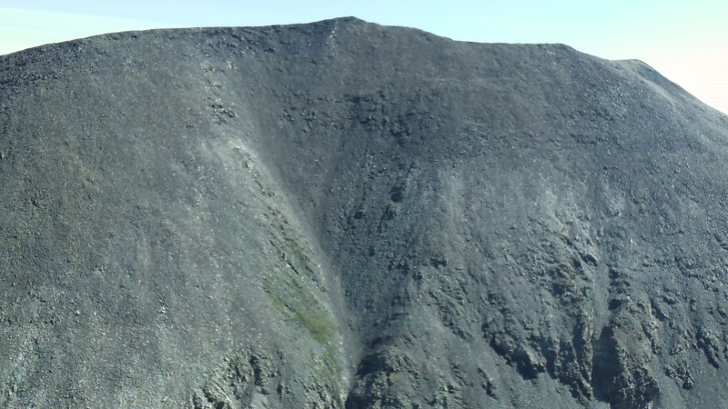
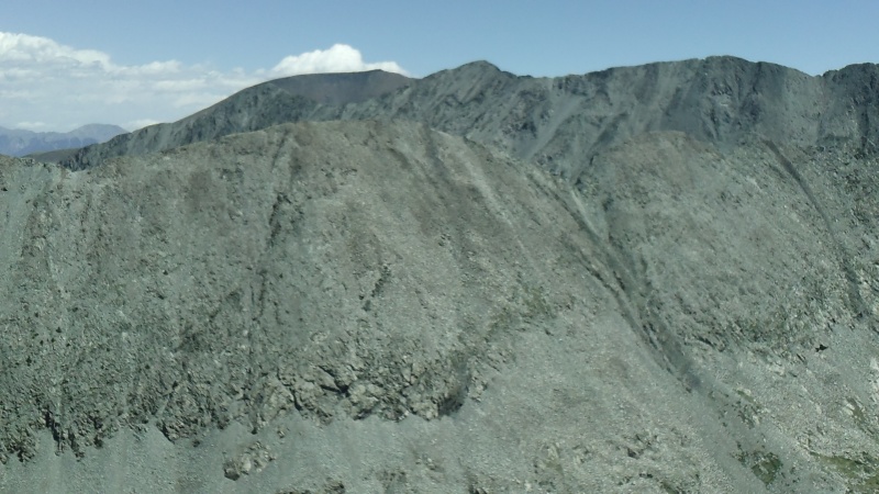
I'd enjoyed small breaks on the 3 summits & made my way down California's western slopes. Even though I usually make the small trek to the waterfall - I skipped it today, there were other plans with my afternoon... Arriving back at my truck, I noticed the other 2 had already made it back and had headed out. They went on to hike the trail up to Willow Lake that same afternoon! I too had more work to do with my remaining daylight - attempt to drive partway up the Lake Como Road! I managed to make it up to the 9,860 switchback & called it home for the night. I felt I could've made it a bit higher - but knew there was no guarantee that other parking spots would be open (I also had my switchback all to myself). After getting my rig set up the way I wanted - I grabbed a beer & started hiking the road. My plans for the following morning would be a lot smoother if I was able to scope it out that night. As I neared the 10,080 switchback I could hear voices & the sounds of an engine revving. I rounded a corner in time to see a couple of guys trying to guide their friend whose vehicle was sideways on the road above the switchback. I climbed up the embankment north of the road to watch the show. Without much delay the driver managed to crank the wheel & free himself from the boulders beneath him. Glad that ended well! I briefly chatted with them after they'd parked at the switchback (they got the last spot) & I headed back up the embankment to look at my early route the next morning; loose, steep, & eventually densely forested. After a bit I headed back to my truck to eat & rest before the day ahead of me. The next morning I began moving a bit before sunrise. The unranked & mysterious 13,100 was my destination for the day. I'd debated trying to get a start on the route by headlamp. In the end a little extra sleep & being able to best see what I was about to drop won out. Back at the 10,080 switchback I found the path of least resistance & started dropping down to Holbrook Creek. I came across a small cliff (class 3) which needed to be downclimbed (it may have had a bypass, I didn't look too hard). I got lucky & found a downed log across the creek almost right away. On the other side I found myself climbing up an eroding hillside to gain the ridge. Once atop the ridge it was prudent to look for the openings within the dense brush. A few scrambling sections were found & I steadily worked my way to treeline. Tedious class 2 sections made up the bulk of the route for a while. Then, as you pass the 12,839 bump on the ridge, the class 3 & 4 becomes much more frequent. The summit isn't immediately obvious as you work your way along - as much of the terrain is within a dozen or so feet of the same height. I worked my way over to the farthest section to the east (where the summit is marked on this website) & took a break to admire the wondrous peaks all around me. 


From the summit I carefully retraced my steps back toward the 12,839 ridge point. I wasn't feeling too good about the tedious class 2 rock hopping, the long bushwhack, or the re-ascent up to the 10,080 corner. I'd studied the area plenty using Google Earth & knew that some of the gullies could possibly "go". Some of the views on the way up the peak confirmed this as well. I was confident in my judgement, at least enough to go explore this option. Also - I always use the saying "don't downclimb something you can't upclimb or vice versa". I do not recommend this route to just anyone - you must be very comfortable on class 3 & 4 rock and be willing to stop & assess your situation frequently. Near the bottom it started to steepen (looking class 5). Oh no! Had I come down this far, just to cliff out!? A little poking around on my right led me out on a rock rib with views into an adjacent chimney! A way out! I carefully downclimbed the final moves. It felt so great to have my boots back on mellower terrain! I'd popped out just north of the farthest meadow west of Lake Como (about 0.3 miles). After adjusting some gear at the road - I continued on. A few fellow climbers were trooping down the road with full backpacking packs on. I struck up a conversation with them as we made our way out. Alex, Mike, & Jim... nice guys! They'd just done both the Little Bear - Blanca Traverse & the southwest ridge of Ellingwood in the past couple days. They had me rather jealous! Not that my past couple days weren't awesome in their own regards! Until next time - thanks for reading & stay safe out there! Oh & thank you Bill Middlebrook! This was my 1st report using your new program. It took some getting used to, but is super smooth & intuitive on the overall! |
| Comments or Questions | ||||||
|---|---|---|---|---|---|---|
|
Caution: The information contained in this report may not be accurate and should not be the only resource used in preparation for your climb. Failure to have the necessary experience, physical conditioning, supplies or equipment can result in injury or death. 14ers.com and the author(s) of this report provide no warranties, either express or implied, that the information provided is accurate or reliable. By using the information provided, you agree to indemnify and hold harmless 14ers.com and the report author(s) with respect to any claims and demands against them, including any attorney fees and expenses. Please read the 14ers.com Safety and Disclaimer pages for more information.
