Chiefs Head Peak via Wild Basin
TH: Sandbeach Lake
Distance: 15.77 miles
Elevation Gain: 5,265 feet
Start: 6:30 AM
Another RMNP 13er solo mission this weekend. I've been eyeing the Chiefs Head summit from Sandbeach Lake for a while now to add to my RMNP 13er climbs. After the recent snow this past week, I knew this would be a good bet as I've heard this approach is fairly wind blown on the SE slope. Got a late start today to save me from some bitter cold winds and because of the beautiful weather forecast in store. Got to the TH around 610 AM and I was the only one in the parking lot and did not see another soul until my descent past Sandbeach Lake.


These first 3 pictures above are at various points on the first part of the trail to Sandbeach. The great thing about fall and winter is you don't have to wake up so damn early to see the sunrise! Snow got a little deeper the closer I got to the lake but most of the trail was packed down from previous hikers. No traction was necessary.

Got to Sandbeach at 8:19 AM, 4.3 miles in. I've only ever been to here when it was completely frozen over so to see flowing water was refreshing. A little windy here but overall a pretty perfect start to the day.

This photo above is looking west of Sandbeach. Here you must bushwhack your way through the forest up towards Mount Orton. The clearing up on the slope is where you will end up, then ascend towards Orton from there. I used RMNP: The complete hiking guide by Lisa Foster and other posters on this site to help find my route from this point on. There was quite a bit more snow in the trees and of course I forgot my gaiters at home but I managed. Navigation to gain the open ridge was a little confusing in the snow but my GPS helped significantly.

This next photo is farther up after finding the clearing. There were a few snow drifts that were at most a foot and a half deep but most of them were pretty avoidable today. This is what the terrain looks like for the most part up to Orton.

I chose to skirt around the north side of Mount Orton. This is when the first full route up to Chiefs Head comes into view. A bit of some easy boulder hopping leads to more tundra. Made it to this point at 9:41 AM.

Awesome views of Chiefs Head, Pagoda, Longs and Meeker on this route. Even better with a light coat of snow on the slopes.

After Mount Orton the route is pretty easy. Just tundra walking on relatively level ground. This route gets much more strenuous farther up when you reach the final ascent. Minimal snow on the ridge today which made things easier. The wind was fierce at this point though and the wind chill was no joke.

Another view of Pagoda, Longs, Meeker.

At the base of the final ascent. Here it gets much more strenuous, starting with mixed tundra and eventually leading to class 2/3 rock. Nothing significantly exposed and snow was easily avoidable. It's about 1,700 vertical feet and about 1.1 miles from just below where the above picture was taken.

Taken farther up after gaining the first ridge and remainder of the ascent. Chiefs Head is the peak on the left.

Almost to the summit! I was a little fooled and thought it would be at the top of this but you actually must keep following the ridge toward the north and west for a bit. Gotta love those false summits.


Made the summit at 12:07 PM. The two pictures above are looking down at the snowy Wild Basin area.

Next pic looking down in the the Glacier Gorge Valley with the Mummy Range in the distance.

Incredible views of Longs, Pagoda and Meeker from the top. I climbed both Longs and Pagoda this summer so it was nice to bag this peak too.

Good view of the entire route along the ridge to Mount Orton from near the top on my descent. Wonderful views of the Wild Basin Peaks.

Mount Alice and Lion Lakes on the descent. The hourglass ridge to Mount Alice looked a little dicey today from a distance. Pretty good snowpack up to the pass where you access the ridge.

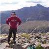
Until next time, Chief.

Last picture of Sandbeach shimmering in the sun on my way down. Cool and pleasant in the sun.
Another perfect day in the park. Got back to the truck just after 4 pm and about 9.5 hours after I started. This one was my 7th 13er in RMNP (6 ranked, 1 unranked). As with some of my other posts about the 13ers in the park, this one was another incredible physical challenge but these climbs have been some of my best experiences ever in my adventures around Colorado.