Download Agreement, Release, and Acknowledgement of Risk:
You (the person requesting this file download) fully understand mountain climbing ("Activity") involves risks and dangers of serious bodily injury, including permanent disability, paralysis, and death ("Risks") and you fully accept and assume all such risks and all responsibility for losses, costs, and damages you incur as a result of your participation in this Activity.
You acknowledge that information in the file you have chosen to download may not be accurate and may contain errors. You agree to assume all risks when using this information and agree to release and discharge 14ers.com, 14ers Inc. and the author(s) of such information (collectively, the "Released Parties").
You hereby discharge the Released Parties from all damages, actions, claims and liabilities of any nature, specifically including, but not limited to, damages, actions, claims and liabilities arising from or related to the negligence of the Released Parties. You further agree to indemnify, hold harmless and defend 14ers.com, 14ers Inc. and each of the other Released Parties from and against any loss, damage, liability and expense, including costs and attorney fees, incurred by 14ers.com, 14ers Inc. or any of the other Released Parties as a result of you using information provided on the 14ers.com or 14ers Inc. websites.
You have read this agreement, fully understand its terms and intend it to be a complete and unconditional release of all liability to the greatest extent allowed by law and agree that if any portion of this agreement is held to be invalid the balance, notwithstanding, shall continue in full force and effect.
By clicking "OK" you agree to these terms. If you DO NOT agree, click "Cancel"...
Capitol Peak Winter Ascent Solo, Single Push Saturday February 29th, 2020
Route Info: Trailhead: Maroon Snowmass Trailhead Approach: Followed Snowmass Creek to Moon Lake and up to K2 Climb: From K2 I climbed the ridge the whole way to the summit (East face of Capitol was loaded with snow, so staying on the ridge proper mitigated a lot of avalanche hazard and made for more fun climbing!) Overall Stats (As per Garmin Fenix 5s): Car-Car round Trip: 18 1/2 Hours Car to Summit: 12 1/2 Hours Summit to Car: 6 Hours Total Mileage: ~22 miles Total Vertical Gain: ~6,900'
Capitol Peak Video:
Prelude:
2 weeks prior, I had a successful solo, single push attempt on North Maroon Peak and was feeling quite satisfied with winter mountaineering objectives, as they are typically not my kind of thing. I felt North Maroon was a great challenge to myself, but I have no ambitions for doing all of the 14ers in winter (some of them would just be plain sucky haha)
After a fun weekend of ice climbing in Ouray/Vail, I decided that it might be a good weekend to attempt Capitol in winter again. I would be driving out to Salt Lake City for a week long ski trip with some friends and figured that Aspen was on the way, so why not?! I had made an attempt in January of 2019 with 3 others and my partner and I had been forced to turn around before the final steep segment due to moving way too slowly and not being comfortable with conditions on the steep snow traverse. After looking at weather and avalanche conditions, it was looking like Capitol Peak might surrender its summit to someone dumb enough to slog all the way to its flanks and attempt it. Sure enough, that person dumb enough was none other than ME! I again pulled the trigger on what I knew would be another episode of "Matt's Masochistic Misadventures"!
Arrival/Approach:
I finished up with work on Friday and was packed and ready to hit the road. The plan was to make it to Aspen and get a midnight start from the Maroon Snowmass Trailhead and again, do an overnight push to the summit and back via the Moon Lake basin to K2. I would attempt Capitol and then get some car camping rest before finishing the 6 hours of driving left to get to Salt Lake City for my trip. It was a dumb plan and possibly over ambitious, just my cup of tea!
I arrived to the trail head at 10:00 PM and decided it wouldn't hurt to forego the 1 hour nap and just get going by 11:00 PM. I ate my "last supper" and sipped the rest of my coffee, hoping it would keep my nervous system functioning through another long, dark night. By about 11:08 PM, I was geared up and on my way to a 18 1/2 hour sufferfest, my favorite!
11:08 PM:
The first 2 miles is very straight forward: follow the cross country trail to the actual Maroon Snowmass Trailhead and continue on a well packed out trail until you reach a spot on the trail where to your right, across the creek, is a large wide open field. This is where the river crossing is, although I accidentally crossed a little bit too early and had to navigate some awkward marshy, snow covered ground to get to the clearing. No biggie. I had saved some "pins" on my google maps to make sure I knew where the summer trail generally was, and I used this to navigate my way across the open field and quickly found the summer trail, which had a decent trench packed in, with about 6-8" of new snow on top. This made for quick travel as I negotiated the switchbacks up the slope to the north before the it heads Southwest to reconnect with West Snowmass Creek around 9,600'.
After getting over the first steep section on the switchbacks, I encountered a long and somewhat flat section that goes up till about 10,000'. I followed the quickly diminishing "trail" and it kept me on the Northwest edge of the flat section. After last year going up the gut to the flat area, this seemed to be the better option. I applaud and thank whoever put this "trail" in! At 10,000' I reached another steep section and it was here that I lost the "trail" and had to begin the character building activity that is known as breaking trail...
Based off of my printed out CalTopo map, the slopes to the East of West Snowmass Creek were the least steep, so I crossed the creek and began zigging my way up. The next mile or so took a ridiculously long time with trail breaking up steep slopes in the middle of a heavily wooded area, but eventually I came into a mostly clear area and could see the basin that holds Moon Lake just ahead! Yippie!
Red: My planned Route Blue: My refined route I would recommend (details on what I would have done differently are in TR below, though I maybe cost myself 30-45min max in total)
~9 mile approach, most of it breaking trail!
5:00 AM:
By this point, I was feeling the sleep deprivation, quite a bit more than I had felt it on North Maroon's approach 2 weeks prior... probably due to drinking a 6 pack to myself with my good friend Joe Pointer on Thursday night and not getting the greatest sleep... Totally worth it!
Knowing that the bushwhacking was pretty much done I decided to treat myself to a nice little nap before continuing my little stroll in the alpine. I laid my skis and pack down and broke off some pine tree branches to make a "nice" little bivy spot in a treed area. I laid myself down, set the alarm for 5:45 AM, and dozed in and out of sleep until my watches vibration brought my nervous system back to reality. Having not moved for 45 minutes, I was chilled to the bone and hastily got my gear back on and got moving.
Better than my mattress at home!
I had just reached Moon Lake when first light appeared and lit up the surrounding terrain. Something about alpine sunrises always gives me a huge burst of energy! Maybe it is the natural powers of Mother Nature gifting me with new energy for surviving another night... or maybe its the electromagnetic waves from the sun stimulates cells in my eyes/brain and exciting my nervous system like a natural clock... Whatever, it works!
First light looking back
Almost sunrise!!!
There was not a cloud in sight as I continued up the basin towards K2. I remembered this basin as having some very aesthetic terrain from last years attempt, and it sure didn't disappoint this year either!
Sunrise on Mt Daly last year, January 2019
Same terrain and landscape, different lighting. Also a little more snow coverage, but again, last year was in January so 2 months earlier haha
Ain't she a beaut?!?! Looks like some really cool skiing options too, wide open face into some fun looking chutes
On my way to the East slopes of K2, I did a few hasty hand pits to see what the snow pack composition was looking like, as the East slopes under K2 were my biggest concern for avalanche danger being close to a ridge line and east facing. Each hasty pit had a top layer of 2-3" of recycled/wind transported powder with the snow becoming much more consistent and compact underneath. Along with these observations and not having seen any other signs of avalanches in the area, I decided the risk was acceptable (for me) and aimed uphill with a quicker pace to minimize my exposure. As soon as I could, I diverted into shallow rocks as the slope eased up.
~9:00am
I reached K2 around 7:30 AM and that is when I got my first sight of Capitol. It looked quite loaded with snow on its East face which concerned me. We had attempted it last year with the plan to traverse the East face before going straight up towards the summit, and had been turned around by time and snow quality. Being tired and now somewhat concerned with the objective hazard of traversing a heavily loaded East face near ridge line, I wasn't feeling too optimistic about my chances of the snow traverse. On the flip side, I was increasingly excited about the snow coverage, as it was looking quite ski-able! Once the snow pack becomes iso-thermic on high elevation eastern slopes, I plan to make my "Masochistic" return! Capitol would be quite the mountain to ski!!!
First view of Capitol Peak. "Spring Matt" is STOKED, "Winter Matt" is concerned
Closer look at Capitol's East Face. The typical winter route crosses the steep snow slopes before going directly up to the start of the summit ridge. Having my concerns with avalanche danger possibilities, I opted to stay on the ridge proper and have more control over my fate. Some may think that is a poor choice, but (I hope) I will always chose the harder path with less objective and unknown danger in a similar situation. Rock is pretty easy to check for stability, snow, not so much.
Capitol Peak from K2. I absolutely love the contrast between rock, snow, and shadow! Mountains are pretty neat! HOT DAMN!
I cached my skis and one of my poles below "K2's" summit and donned my mountaineering ice axe / harness.. Once I got onto the summit of K2, I decided I would simply follow the ridge to where the snow traverse starts and make a decision there. I also began to consider taking the ridge line all the way to the summit from that spot, rather than do the snow traverse. From doing the ridge in summer, I knew there would be more difficult climbing, but at least that is more within my control. What isn't necessarily in my control is snow stability, which even if you are an expert, is always a guessing game, and I like to take guessing out of the picture if I can. As I thought on this longer and longer, I soon realized that I would much rather attempt the ridge than do the traverse.
I made a quick rappel off of K2 with the 30m rope I brought along and began making my way across the ridge. The snow on the South side of the ridge was pretty deep, but it was also pretty supportive. I tentatively crossed the sharp ridge line and eventually grew comfortable enough to simply walk across rather than slowly moving in a half squat, ready to self arrest should I lose my balance.
Walking across the "Knife Edge" was pretty cool, especially knowing what it looks like in the summer. Snow can make certain terrain much more difficult, and other terrain much easier!
Rappelling off of K2. Doesn't necessarily need a rappel, but I sure did feel cool doing it!
Looking back across the knife edge towards K2. With snow on it, it's basically a sidewalk haha
Looking back at K2 from somewhere near my "decision point"
Soon I was across the ridge and was at my "decision point", where the ridge steepens dramatically or the traverse on steep snow to the left begins.
To traverse left onto the steep snow or maintain my ridge direct route? My mind was already made!
#BetaPic of Satan's Ridge. Satan's Ridge is (possibly) on my radar for this summer, it is very long LONG and from what I hear, it is a very unstable ridge that is supposedly 5.8 in sections. Would be a sweet project, but the whole "unstable" thing doesn't sound great. Today I chose to climb harder but more stable ground to mitigate my risk, but that might not be an option on something like that! Food for thought
I had basically already made up my mind, and even though the snow seemed supportive, I'd rather keep more cards in my hand and so began to make my way up the steeper portion of the ridge. There were a few sections of near vertical climbing where I brushed off every piece of rock in order to find the best hand and foot holds. With my dual point aluminum crampons, I knew that I would need to have "silent feet" when moving, as any pivot or movement of my foot could result in my crampon point blowing out, which could have tragic results. I used small cracks and features to place my crampons on and double checked all of the viable hand holds. I had only one foot skid off of a foothold the entire day, which is still less than perfect, and a reminder to maintain razor edge focus when in situations that demand it. My progress was much slower than it had been on the ridge, but I was gaining altitude quick and could see the top of the ridge, where the short summit ridge begins.
My route, as seen from my "Decision point"/below the steep sections. Snow traverse goes to the left before pointing straight up to more-or-less link up with the ridge
Working my way upwards
Easy terrain leading to the final steep section
Looking back down towards the ridge from the easy ground before the final steep section. Fun climbing was had!
I got to the final steep section before it tops out onto the summit ridge. It was a nice looking chimney with rocks wedged in it, perfect for wedging yourself in and using the wedged rocks as foot/hand holds. A few moves later and I was on top, staring a few hundred feet away at the summit. I continued on, ensuring to keep alert on this easier terrain, well aware that a spill here would still be disastrous.
The final steep section before the summit ridge. Some have referred to this as the "crux", but I found it very straightforward and felt easier than much of the previous climbing
The chimney section. Nice big blocks to stand on and grab, even got a solid fist in one of the cracks haha
11:30 AM:
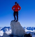
After almost 12 hours and 30 minutes exactly, I was on the summit of Capitol, and what a beautiful view I had! There were barely any clouds in sight and everywhere I looked there was stunning alpine terrain, painted with a white coat of snow and contrasted by dark rock and shadows. Even in my fatigued state, I decided to enjoy a few long minutes on the summit to soak this in! I got a few pictures of the surrounding environment and got a picture of the summit capsule (just in case anyone tries to argue the validity) and began to get my stuff together for the descent. I got a quick selfie (you can see the fatigue on my face haha) and was ready to get down and get some recovery in before Salt Lake City! Woot Woot!
Some of the other giants of the Elks looking quite dazzling. Wonder if anyone was on any of them at the same time???
Another look at Satan's Ridge from the summit. Quite the haul!!!
Proof
My helmet, repping the "Special Forces Foundation" with Mt Daly in the background.
If you are unfamiliar with the "Special Forces Foundation" and the fundraising I have done for them / am doing, check out the link below and please consider spreading the word or donating! They helped buy a modified 4Runner for my friend Justin Lascek who lost both of his legs to an IED in Afghanistan.
Also check out my friend Justin Lascek, he is a true inspiration! He lost his legs in March 2019 and he skied at Breckenridge this winter in prosthetics... what's your excuse???
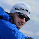
The look of a tired Jabroni after 12 hours and 30 minutes and a total of 45 minutes of freezing sleep. Wouldn't have had it any other way!
12:00 PM:
I prepped my 30m rope for the multiple rappels I planned to make on the descent and began making my way across the summit ridge. I knew that attempting to down climb all of the steep sections on the ridge would be a real pain in the butt, so I decided that I would rappel every steep section if I could find sturdy rock horns to loop my rope around.
I made quick work of the summit ridge and soon was above the chimney section. I found a good solid piece of rock, looped it, and began the first of 7 rappels down the steep ridge. For every rappel, I ensured to tie stopper knots at both ends of the rope so that I couldn't accidentally let an end of the rope go through my rappel device and send me into free fall. Before pulling my rope, I ensured to untie the stopper knot on the end of rope I was pulling through, knowing that a stuck rope would be a real annoyance when trying to descend quickly. I carefully made my way down to my "decision point" from earlier and stowed my rope in my pack, knowing that all of the rappel-able sections were behind me. I maintained my focused as I retraced my steps across the exposed ridge, re-climbed K2, and walked down its East slopes to my ski cache.
One of about 7 rappels.
I took an extended break here, knowing that 90% of the objective danger was behind me. All that remained ahead of me was the possibly avalanche prone East slope to ski down and the mellow but sketchy skiing out via a trench, which if you have done before, you know that it actually holds a decent amount of risk as you can get going too quickly and lose control without being able to bleed speed.
~2:30 PM:
The skiing down the East slope was pretty enjoyable down to Moon Lake! From Moon Lake, I skied down a large avalanche path into the gut of the gully and cursed myself for not taking this route on the ascent, can't win em all! If I were to recommend to someone making an attempt in the future, I would say to try and get into the gut of the gully (refer Caltopo map section below) if you are not concerned with higher elevation terrain being prone to avalanche. The gully itself is low angle, but it obviously is the path of large avalanches within the basin, so tread lightly and maybe stay on the side slopes if you are concerned with overhead avalanche danger. If conditions are somewhat stable, I'd imagine it would be a totally acceptable ascent/descent route. To each their own, choose your own adventure.
Got a few turns in to salvage the day as not being a total slog!!
Red: My ascent route Blue: My recommended ascent/descent route, the gully is pretty clear of trees and is relatively low angle once you get into it
Soon I was at the long flat section and threw the skins back on. I knew that as soon as I got to the creek crossing at ~9,200', it would all be downhill and I could ski out to the main creek crossing. I skinned across the flat section quickly and soon was sliding on snow/ice again.
The trench had refrozen slightly due to it being later in the day, which made for pretty sketchy skiing. It was quite hard to keep my speed under control and I admittedly lost control a few times and had to jump out of the trench and ride it out. I almost nailed a thigh sized tree with my right shoulder at one point, but managed to drop my shoulder enough to miss it, although it still ripped my backpack pretty good... Soon I was at the creek crossing and knowing I was about 2 miles away definitely increased my mood.... until my foot slipped on a rock during the crossing and I completely soaked my right boot haha "You're not done til you're at the car"
5:30 PM:
The remaining 2 miles went quickly, and after 18 hours and 30 minutes, I was back at my car! I felt pretty good, energy wise, so I decided to try and knock out a portion of the remaining 6hr drive to Salt Lake City, after an obligatory stop at city Market to get my recovery on (Trumoo Whole Chocolate Milk). A few hours and a few roadside naps later, I made it to Salt Lake City the next day around 11:00 AM and even got a few mellow backcountry laps in near Alta Ski Resort! These 18 hour days are becoming somewhat "routine", in a sickening way haha
Post Script:
I am very excited to have gotten this peak in winter, and to have done it solo and in a single push. Putting myself out there has an accompanying sense of fear (if something goes wrong, you're far from help), but I always come away with an immense sense of accomplishment, something that nobody can take away from me. I walked away from this one feeling immensely proud, and hopefully I will be back in Spring to try and ski this absolute beauty!
Thumbnails for uploaded photos (click to open slideshow):
Danny and I hit it a week and change after and really appreciated that skin track to just below Moon. We saw just enough ghost signs higher to suspect someone had been there! Congrats on a solo push and nice display of tactics!
â��¦& solo! A friend & I were up that direction a week later (3/7/20 - just to get the ski line off K2 - he can see it from his apartment). I'm sure your tracks made the 2 guys (they went Capitol) that went a bit earlier than we did that day's skin track easier (super easy for us by the time we were there). Thanks for the great TR & the skin track!
Monster5: Were you in the party that I saw on strava and commented on?
Will_E: Thanks! I love re-living the moments and getting to put them into writing/video! I don't have any stuff for sale that benefits me but you can go to https://advancedimpressionsinc.com/climbing-for-casualties/shop/products/sfcc_designs/denali?page=1 and help out 2 of my friends that are doing a fundraiser similar to the one I did in Pakistan!
Really enjoy reading your trip reports! You should feel proud, that's an incredible accomplishment. Question: do you consider bringing mountaineering boots for the sections after you cache your skis for better maneuverability on the difficult climbing sections? I noticed you wore ski boots with crampons all the way to the summit for both N Maroon and Capitol. Is it just not worth the weight to bring them?
David- how are you doing? Last time I saw you was randomly in Boulder near the flat irons correct?
4thPlaceAtFieldDay - 1) I don���t really own and have never worn mountaineering boots so that���s a big block for me haha and 2) my overall goal with ski mountaineering is to incorporate technical ascents with fun/technical descents. So climbing in ski boots is just another form of training for me. Plus I don���t think the additional weight over such a long day would be worth the benefit. I enjoy climbing in ski boots, the harder stuff isn���t so bad, it���s the easy/moderate rock that is hard since you can lose your balance pretty easy on rocks in ski boots if you aren���t getting good pole placements and aren���t using your hands
I'm in awe of your climbs this season, Matt. I've always looked at Capitol and North Maroon as the two winter peaks I'll never get and here you are crushing them solo in a single push. Very inspiring, congrats on the big climbs!
Nicely done and great job documenting it! I had a blast on the weeny little West Evans ridge recently - not sure if I'll ever be up to taking on Capitol in winter but if I ever do this will be a report I'll refer back to for sure!
Beast: Conditions lined up pretty darn well for me, so thats half the battle! You'll be fine! If you can manage a single push, it makes it much easier to take advantage of a small weather window for sure.
Daway8: Difficulty is both objective and subjective, as long as you're pushing yourself thats all that matters in my opinion! If you have any questions on the route and such, let me know!
Do it! To me it just makes more sense, efficiency-wise. I can move faster, farther, and easier without carrying overnight gear and I also enjoy the challenge! That���s not to say it doesn���t have it���s cons haha but I believe the pros outweigh the cons. Even if I had 2 days to do an objective, I think I would rather push for more of a challenge, although I don���t get to enjoy the surrounding terrain as much as if I did an overnight... win some, lose some
Congrats on the single effort push. These things are always a gamble, and victory is sweet if things align for the summit.
Caution: The information contained in this report may not be accurate and should not be the only resource used in preparation for your climb. Failure to have the necessary experience, physical conditioning, supplies or equipment can result in injury or death. 14ers.com and the author(s) of this report provide no warranties, either express or implied, that the information provided is accurate or reliable. By using the information provided, you agree to indemnify and hold harmless 14ers.com and the report author(s) with respect to any claims and demands against them, including any attorney fees and expenses. Please read the 14ers.com Safety and Disclaimer pages for more information.
Please respect private property: 14ers.com supports the rights of private landowners to determine how and by whom their land will be used. In Colorado, it is your responsibility to determine if land is private and to obtain the appropriate permission before entering the property.


 I will always chose the harder path with less objective and unknown danger in a similar situation.Rock is pretty easy to check for stability, snow, not so much.")


 on my radar for this summer, it is very long LONG and from what I hear, it is a very unstable ridge that is supposedly 5.8 in sections.Would be a sweet project, but the whole")


")