| Peak(s): |
US Grant Peak - 13,778 feet "V 2" - 13,319 feet |
| Date Posted: | 09/11/2020 |
| Modified: | 09/12/2020 |
| Date Climbed: | 08/14/2020 |
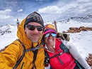
| Author: | Kiefer |
| Additional Members: | ReginaThomas |
| Peak(s): |
US Grant Peak - 13,778 feet "V 2" - 13,319 feet |
| Date Posted: | 09/11/2020 |
| Modified: | 09/12/2020 |
| Date Climbed: | 08/14/2020 |
| Author: | Kiefer |
| Additional Members: | ReginaThomas |
| Perseverance |
|---|

Trekking into Ice lakes Basin in the throes of tourist season can be a risky proposition. Much like hiking Mt. Bierstadt on a Saturday afternoon in August, the way is an obstacle course fraught with peril and hazards. All manner of risks can be encountered on the trail ranging from: running into very thoughtful people audibly sharing their Toby Keith, Taylor Swift or Kanye to unsuspecting fellow hikers to being peppered with relentless questions such as, “How much further is it?” to ducking those little, Skittle-blue, poo bags neatly tied shut like landmines. But I assure you, they are NOT Skittles; unless you’re another dog, then perhaps. Indeed, the trail is a dangerous place not for the faint-hearted. We left the trailhead (Clear Lake Turnout- that's MY TURNOUT, so DON'T use it) at the staggeringly awful and early hour of 6:30 am to hedge our bets in not seeing anyone. However, running into the homestretch of ‘off-season’ or as some locals call it, ‘mud-season,’ Regina and I were able to speed up Ice Lakes Trail relatively unharried and unobscured. Upon reaching the upper basin, we wasted no time in dawdling around at the lake. Although the views of Golden Horn, Fuller and Vermilion are always spectacular and never fail to impress. We immediately banked sharp right and cut across the tundra following the frayed filament of a social trail. We skipped across the outlet stream like a couple of skipped stones and hit the Island Lake Trail at a half gallop. We ascended to the old site of the Golden Gate Mine (12,188’), sped up the shoulder and out of view without ever being noticed. Full disclosure here, I have a problem with Ulysses S. Grant Peak. I have a problem with its name. And no, I am not a Stonewall, Davis or Confederacy sympathizer. Fact, I admire the man for his military and field acumen, especially for what he did at the bloody battle of Vicksburg. But when compared to everything else in Ice lakes and Island Lake Basins, the mountains name is just so random. Many of the peaks in the locale are either named after the old 15-minute quadrangles (Telluride, Sneffels, Vermilion) or after people associated with the San Juan Mountaineers. But Grant is an outlier. After much searching and yielding almost no answers, all I could come up with is that A.) US Grant was first climbed in 1932 by Mike Walters and a small CMC group (Jeff Golden, can you verify this?) and that B.) once the Civil War ended in 
1865 and the reconstruction began, many soldiers headed west in pursuit of a new life escaping the memories, guilt and abject death that rained down upon everyone in the eastern states. I’m assuming some of these lost souls, many now without families were employed by private mining companies in the Ice lakes, Mineral and Silverton mining districts, had laid eyes on this particular mountain and saw it fitting to name it after a respected general and man who would later, come to be the United States’ 18th president. The approach to the saddle of US Grant and V4 (13,540’) is fairly straight forward. The trail eventually peters out into grassy tundra suffering from alopecia which, in turn, gives way to the obstinacy of that delightful San Juan scree and rock we all know so much. The closer to the saddle we got, most of the talus turned into hardpan dirt, probably my least favorite terrain to be on. We took a small break at the saddle to layer up as the winds were making things a bit cold for just a T-shirt. The skies out west were thick with smoke but oddly, didn’t seem to navigate any further east than where they already were. I thought for sure in a couple hours time, that we would be choking inside a smoke bank. Thankfully, that never happened. From the saddle, V4 is easy pickings. It’s basically a loose 3rd class scramble, short at that. However, considering we were planning on descending Grant’s East Ridge (one of the worst routes I’ve ever done), I wanted the extra time for route finding & necessary exploration since there is approximately 2.61895% information out there on it. Leaving the saddle, the Southwest Ridge on Grant is relatively short. The lower half of the ridge is easy to follow, a bit loose (but nothing too crazy) and cairned more than I expected. The whole of the ridge is basically split into two sections. The 4th class cliff does the splintering. I’ve read plenty of descriptions and accounts of this ‘famous’ cliff labeling it everything from 3rd class to 5-easy. On ratings, I didn’t think the rock was that bad or loose, nothing like, say, what’s found on Teakettle, Dallas or Mears Peak. But I also ‘cut my teeth’ in the beginning as I was learning mountaineering in the Elks. So that has to be taken into consideration. That being said, ratings can only be trusted if there’s a large enough sample size of experience judging the routes single hardest move. The weighted average trumps (sorry, bad word), the weighted average surpasses any one singular opinion because experience in and of itself, can be a huge outlier. But it is in my 100% factual opinion, that this move is 4th class. After Regina and I cleared the crux, we traversed right on a cool ledge wide enough to pedal a red, Radio Flyer Tricycle across. And it was here, that the rock took on a wholly different character, reminiscent of what can be found on Trico Peak, T10 or to a lesser extent, Pilot Knob. We scrambled up shallow gullies and low-angle bulges on light gray, flaky volcanic rock. Pieces would easily come off in your grasp but the whole of the rock would stay put, a bit of an odd pairing, like Mike Pence and Alistair Crowley. After no more than a few minutes of this rather enjoyable scrambling, we arrived at the summit very satisfied. I thought Ulysses S. Grant was one of the finer summits in the whole of Ice Lakes Basin. Descent: This is where things get interesting. Grant’s East Ridge is the Edward Hyde to the Southwest Ridges’ Henry Jekyl. The mountain as a whole isn’t the worst for loose and dangerous rock. In fact, when compared to other peaks in the San Juan Mountains, it’s not bad. But the East Ridge is another beast entirely. Nothing about it was remotely enjoyable or safe. The only thing I can say that I liked about it, was that it was uncharted territory. And in Colorado, ascending or descending a face or ridge that few people have done or that little to no information is available, should be viewed as a reward. Most places in Colorado have been sliced, diced, vivisected and given their own Facebook page or chapters in some Falcon or CMC guidebook at this point. Despite the quality of the route, in hindsight, I’m happy to have scrambled something that I had no knowledge of, damn the results. 
We left the summit descending a loose patchwork of ledges switch-backing to where it was easiest taking our time. I stopped frequently studying the slope to make sure certain paths would go and that we weren’t cliffing ourselves out. We initially stuck to the crest and larger cropping of ‘solid’ rock, hugging anything that looked substantial or firm. But even then, we would end up inadvertently ripping pieces out. Sometimes only a fragment would come loose, sometimes the whole piece came out. So the question became, do we stay on the crest and traverse these smaller cliffs risking injury or do we delve down into the even looser gullies knowing full well what to expect with no surprises? We chose to rock ski and butt slide the gullies. Another factor in deciding to use the gullies…was height. At 6’0” feet tall, I have height to my advantage in climbing anything and reaching for holds. For those of a more shorter stature, like Regina, lacking that extra height and ability to reach can and does compound difficulties. It also increases a routes difficulty grade. And on already untrustworthy rock, we figured the gullies, even though time-consuming would be a much safer option. 
The switch-backing led us to a narrow cleft with stupid loose dirt and pebbles. Fortunately, enough rock was sticking out at sharp angles like the backs of buried vertebrae that we were able to, one at a time, gingerly walk on the rock edges and grab the side wall for balance. This led us to a wide open, somewhat tilted plateau of sorts. We traversed this easier terrain east towards V2. Not long, the plateau was divided by a massive bulge of rock. Drew Carey came out from hiding behind a rock with that creepy smile of his and presented us with three choices: we could take the curtain (traverse across the cliff face to regain the ridge crest), take door #1 (descend the right hand open-faced gully which, I didn’t have a good feeling about) or take what was in the box (the left hand gully that dropped down out of sight). I pushed Drew aside and climbed up the curtain a little bit to have a better look down the left gully. From the rock face, I could see that the gully actually plunged quite a ways down! It descended at a steep angle, but it cut through most of the vulgarities. ‘Drew, my man! Buddy! We’ll take the box!’ The narrow gully worked perfectly. It was loose as all hell, but hey, it was as advertised. What I didn’t expect was all the hardpan dirt overlaid with scree. This terrain type really tries my patience. Having ankle issues, I can only imagine what it must have been like for Regina. We took turns descending one at a time stopping at logical safe spots out of harms way from rockfall. When we got amount 3/4 the way down, I asked Regina to stay put for a minute. There was the option to traverse out onto the cliffs on what looked like an easy traverse. Plus, I could see part of another cleft at the bottom of the gully we were in and was curious about it. We could traverse left across the cliffs to rejoin the ridge crest and it looked like it would work, but for a shorter person, it might not have been so easy. And for a Smurf-sized person, you might get picked off by an errant ermine looking for dinner. So traversing wasn’t an option. I bounded back down into the gully and descended to the bottom to a kind of flat area. “A-ha! “ I yelled. I looked back up at Regina who was waiting patiently and yelled again, “It goes. Come down.” Then I moved off to the side to avoid being pummeled by rockfall. I looked right and knew instantly, that open-faced gully I spied earlier near the top of this thing, the one I didn’t have a good feeling about, ended in a horseshoe-shaped cliff that dropped into a funnel of sorts. We dodged a bullet on that one. Waiting for Regina to come down, I thought to myself, ‘the easiest path forward isn’t always the right one.’ We scrambled down the narrow cleft on vertical rock fins and loose hardpan dirt. I found leaning forward into the left rock wall proved to be a good way to stop and descend slower. Though Regina would beg to differ. This cleft emptied out into that massive couloir you can see from Island Lake that cuts the eastern ridge clean from the bottom to the top. We traversed across it to a partially solid rock cropping. I asked Regina at this point if she wante 
d to try ascending the couloir to the ridge and continuing. “You can get fu*cked. Keep going.” I turned around and started to laugh. This descent found Regina hitting her mental wall. Fact, she ran into it like a recently cleaned patio door. So her answer not only made my day, it made sense. I respected it and we kept traversing around the bastion of rock we were negotiating. We climbed up a dodgy low-rock bulge for about 30’ then traversed across the hardpan dirt to some tundra and took a short break. The miserable hardpan dirt/rock/scree/choss/kitty litter shit was over. WRONG! That small patch of grass we sat on lulled us into a stupor of easiness. Little did we know, more was to come. After some delightful and insightful profanities from Regina (think George Carlin and Andrew “Dice” Clay), I turned around after a short descending traverse and yelled back, “I think I see a faint climbers trail.” All I heard in response was a loud sigh. We followed the trail down a partial tundra shoulder to you guessed it, another cleft! How fortunate! We gingerly descended this one at a time until we came to the last obstacle. There was a 6’ cliff that we needed to climb down. The cliff itself wasn’t bad. But everything was loose. We turned in to face the rock and downclimbed to the slope. We were now on a regular trail of sorts. We made haste to the V2 saddle. At the saddle, there is a large rock with a brass plaque on it, an epitaph to fallen runner that frequented the Hardrock 100, Joel Zucker who died in 1998. We sat on the rock and chilled. Regina was pretty much mentally spent. 
We were going to head down and call it a day. The thing with Regina, is that she has been so focused and concentrated with finishing the Colorado Trail (which she and her mom have since done), that her neglect of all things class-3 and higher have taken a bit of a mental toll; understandable. So we chilled for a while on the rock eating a light lunch of: foie gras, haricot vert, Kaluga caviar and some goat-milk chilled sweetbreads massaged by Gordon Ramsay. We saw a couple of trail runners and quickly put away our spread and offered them some red hots, tuna fish and Clif Bars instead. Regina had composed herself and we decided to head up the social trail up to V2. This was a big moment because it proved that she (or anyone for that matter) can overcome being mentally taxed and persevere. We descended Swamp Pass Trail back to the main thoroughfare and called it a day with beers back in Silverton. I didn’t think Grant was that bad of a mountain. I didn’t much care for the Eastern Ridge but personally, my highlight for the day was seeing my wife pull her bootstraps up, get it together and realize she can do more than she thinks she can. She persevered though the day. That made me smile! Thumbnails for uploaded photos (click to open slideshow): 


|
| Comments or Questions | ||||||||||||
|---|---|---|---|---|---|---|---|---|---|---|---|---|
|
Caution: The information contained in this report may not be accurate and should not be the only resource used in preparation for your climb. Failure to have the necessary experience, physical conditioning, supplies or equipment can result in injury or death. 14ers.com and the author(s) of this report provide no warranties, either express or implied, that the information provided is accurate or reliable. By using the information provided, you agree to indemnify and hold harmless 14ers.com and the report author(s) with respect to any claims and demands against them, including any attorney fees and expenses. Please read the 14ers.com Safety and Disclaimer pages for more information.