Download Agreement, Release, and Acknowledgement of Risk:
You (the person requesting this file download) fully understand mountain climbing ("Activity") involves risks and dangers of serious bodily injury, including permanent disability, paralysis, and death ("Risks") and you fully accept and assume all such risks and all responsibility for losses, costs, and damages you incur as a result of your participation in this Activity.
You acknowledge that information in the file you have chosen to download may not be accurate and may contain errors. You agree to assume all risks when using this information and agree to release and discharge 14ers.com, 14ers Inc. and the author(s) of such information (collectively, the "Released Parties").
You hereby discharge the Released Parties from all damages, actions, claims and liabilities of any nature, specifically including, but not limited to, damages, actions, claims and liabilities arising from or related to the negligence of the Released Parties. You further agree to indemnify, hold harmless and defend 14ers.com, 14ers Inc. and each of the other Released Parties from and against any loss, damage, liability and expense, including costs and attorney fees, incurred by 14ers.com, 14ers Inc. or any of the other Released Parties as a result of you using information provided on the 14ers.com or 14ers Inc. websites.
You have read this agreement, fully understand its terms and intend it to be a complete and unconditional release of all liability to the greatest extent allowed by law and agree that if any portion of this agreement is held to be invalid the balance, notwithstanding, shall continue in full force and effect.
By clicking "OK" you agree to these terms. If you DO NOT agree, click "Cancel"...
La Plata Peak, being one of the easier winter 14ers, makes for a good early season starter peak. The summer trailhead is open, there's not much avalanche danger on the route, which is even shorter than the standard summer route, and it affords views of the heart of the Sawatch, all welcome features when gaining (or re-gaining) one's legs on snow. After doing Mount Princeton a couple of days earlier I stuck around in the area and decided to go get me some Silver. Some La Plata, I mean.
I started at the casual time of 6:52am. Usually in winter I would want to start earlier but I also like to sleep, and sleep obviously won the coin toss this time. From the summer trailhead I walked up Chaffee County Road 399 to the start of the trail, which was nicely packed. I had my snowshoes on for the traction anyway, and made frequent use of the heel riser bars on the steeper sections of trail. As I snowshoed I got brief glimpses of the toe of La Plata's northwest ridge, my immediate objective, in the distance.
Ah, winter in Colorado.
In winter the best route ascends the northwest ridge directly, and thus avoids avalanche prone slopes on the standard summer trail. At first I had a good beaten-in trail up the steep, forested slopes to the ridge, but at about 11,000 feet the trench started to fill with snow.
Steep trench. Thanks to those who came before me!Easy to follow but a bit harder to walk through than if it had been freshly packed.
Eventually I lost the trench entirely and simply powered my way straight up the slope through knee, then thigh, then waist deep sugar snow. Though there was only a few hundred feet of trail breaking it was exhausting and more like swimming with snowshoes on than hiking. Abruptly near 11,800 feet I popped out at treeline directly adjacent to the northwest ridge's Class 2+ headwall, the crux of the route.
The headwall. It's not as difficult as it looks.
I snowshoed under then up a large talus and boulder field and was awarded with stunning views of Sayres Benchmark far back in La Plata Gulch.
Sayres Benchmark in all its glory. The X-Rated couloir on its north face makes an excellent spring snow climb.
From the boulder field I was able to look across the ridge's western aspect, where the trail ran. There was far too much snow to have gone that way, of course.
Looking south along the ridge with Sayres Benchmark on the right.
Next up was the headwall. As I approached it I plunged into a trapdoor in the snow, caught the edge of my snowshoe on a large rock, and toppled over sideways, smashing my knee into the corner of another rock. I'm pretty sure the entire town of Twin Lakes heard me cursing in pain, and for a minute or two I could hardly bend my knee. I thought that was it for my La Plata climb, pitiful! I slowly recovered and limped over to the headwall, intent on getting up the peak. Ain't no stupid broken knee going to stop me!
The headwall.
I swapped snowshoes for microspikes at the bottom of the headwall. From below it didn't look too bad, but it was steep, appeared loose, and I wasn't sure how much snow there was in the little gullies nor what it's consistency or quality was like.
Up the ugly talus slope!
The initial half of the headwall was the worst, since it was just a pile of loose talus. After that I got into a couple of interconnected ribs and snow gullies and the difficulty went up to Class 2+, maybe Class 3 in spots. This was a lot more fun than the talus, though short lived.
Some of the fun scrambling on the headwall. It looks far steeper from up here!My tracks coming out of the forest, with State Highway 82 far below.
The headwall only took a few minutes to get up, and was the highlight of the climb. The remainder was just a ridge walk to the summit, albeit a long one.
Old trench from the top of the headwall.Ellingwood Ridge across La Plata Basin.Lil' peeky of a big peaky.
I hauled my snowshoes up with me on the ridge, since I wasn't sure what I'd find along the way. The initial third or so of ridge was snowy with small amounts of rock exposed. I booted all of it while avoiding the heavily loaded eastern side of the ridge, and eventually the ridge dried out into tundra, talus, and boulders, which ran for another third or so of the ridge.
Still bootin' scootin'.The summit's still farther away than it appears.Not really that much fun.
The final third of ridge made me lugging my snowshoes around worth it, as once I got past a good distance of dry-ish boulders and exposed rock, the snow returned in earnest. There was no good way to avoid it as best as I could tell, so I strapped back in and gratefully continued the easy ascent.
Plenty of snow to warrant snowshoes on.Snow zig-zagging to the final summit ridge.Sayres Benchmark once again.La Plata's long ridge with my tracks faintly visible in spots.
The final 100 or so feet dried out once again, likely due to higher winds whipping over the summit, so I took my snowshoes off and rock hopped to the top.
Summit talus and boulders.Final stroll to the summit.Southwest towards Winfield. The highest point was this cornice, which probably wasn't the actual high point.Northeast towards Mount Elbert and Mount Massive.Sayres Benchmark.
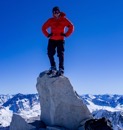
I had climbed most of the day in just a base layer and fleece but it was cold and windy enough on the summit to warrant a jacket and shell. I didn't stay very long, having to get over to Aspen for some thirteeners the next day.
Looking back down the northwest ridge; Sayres Gulch on the left, La Plata Basin on the right.
Reversing the ridge was much faster than ascending it, and I made the same use of flotation and footwear as before - snowshoes for the top third, boots for the bottom two thirds, spikes on the headwall, and snowshoes for the deproach.
Looking down the headwall, which seemed easier descending than ascending.Parting shot of the ridge.
Owing to the steep and direct nature of the ridge in the forest, I made it down lightning fast. Some parts were steep enough that I could practically just ski with my snowshoes on! Traction mattered little in the soft powder in the trench. Near the trailhead I noted an old cabin that I hadn't seen in the morning darkness.
Ancient miner's cabin with tree growing in the middle of it. Nature always wins.
When I arrived back at the trailhead there was one other person there, a cross-country skier. We chatted for a few minutes before she headed off. She had gone up the road a ways, content to see the peaks from below. A few minutes later she returned and asked if I could help a pair of boys who'd gotten their car stuck in the ditch. Since I have a 4x4 vehicle I assured her I would before she left again and I continued changing to more comfortable clothes. I found the boys a short distance down highway 82 and pulled them out of the ditch, then showed them a free place to camp near Twin Lakes. They were from Kansas and were just exploring Colorado - heck of a time of year to explore, boys!
All in all La Plata was a good early season peak, and a good winter peak overall. Not too hard but not too easy either, and with a fun bit of scrambling (though certainly not enough of it)! There's silver in them thar hills...
Statistics
Climbers: Ben Feinstein (myself) Trailhead: La Plata
Total distance: 9.68 miles Total elevation gain: 4,539 feet Total time: 7:55:06 Peaks: One fourteener
La Plata Peak, 14,336'
Splits:
Starting Location
Ending Location
Via Time (h:mm:ss)
Cumulative Time (h:mm:ss)
Rest Time (m:ss)
La Plata Trailhead
La Plata Peak
5:02:16
5:02:16
4:11
La Plata Peak
La Plata Trailhead
2:48:39
7:55:06
Trip End
Version history:
Date
Notes
January 25, 2021
Initial publication.
January 26, 2021
Added missing YDS colors.
My GPS Tracks on Google Maps (made from a .GPX file upload):
Haha, thanks Jay! I have to give some credit to the folks who came before me. I've done some slogging in my day and that would have sucked if I had to do it all myself!
@Teresa: My knee is doing well. It hurt like crazy for a while on the climb but the next day I did a pair of thirteeners near Aspen, so it was fine, just surface wounds. Here's a gross picture of it from the day after!
@Will: Thanks dude! It's a whole other animal in winter, and despite the increase in difficulty it's still one of the easier snowflakes! Gotta love 'em.
@Mike Lamb: Thank you! It's a fine Colorado summit all year, have fun!
Caution: The information contained in this report may not be accurate and should not be the only resource used in preparation for your climb. Failure to have the necessary experience, physical conditioning, supplies or equipment can result in injury or death. 14ers.com and the author(s) of this report provide no warranties, either express or implied, that the information provided is accurate or reliable. By using the information provided, you agree to indemnify and hold harmless 14ers.com and the report author(s) with respect to any claims and demands against them, including any attorney fees and expenses. Please read the 14ers.com Safety and Disclaimer pages for more information.
Please respect private property: 14ers.com supports the rights of private landowners to determine how and by whom their land will be used. In Colorado, it is your responsibility to determine if land is private and to obtain the appropriate permission before entering the property.