Download Agreement, Release, and Acknowledgement of Risk:
You (the person requesting this file download) fully understand mountain climbing ("Activity") involves risks and dangers of serious bodily injury, including permanent disability, paralysis, and death ("Risks") and you fully accept and assume all such risks and all responsibility for losses, costs, and damages you incur as a result of your participation in this Activity.
You acknowledge that information in the file you have chosen to download may not be accurate and may contain errors. You agree to assume all risks when using this information and agree to release and discharge 14ers.com, 14ers Inc. and the author(s) of such information (collectively, the "Released Parties").
You hereby discharge the Released Parties from all damages, actions, claims and liabilities of any nature, specifically including, but not limited to, damages, actions, claims and liabilities arising from or related to the negligence of the Released Parties. You further agree to indemnify, hold harmless and defend 14ers.com, 14ers Inc. and each of the other Released Parties from and against any loss, damage, liability and expense, including costs and attorney fees, incurred by 14ers.com, 14ers Inc. or any of the other Released Parties as a result of you using information provided on the 14ers.com or 14ers Inc. websites.
You have read this agreement, fully understand its terms and intend it to be a complete and unconditional release of all liability to the greatest extent allowed by law and agree that if any portion of this agreement is held to be invalid the balance, notwithstanding, shall continue in full force and effect.
By clicking "OK" you agree to these terms. If you DO NOT agree, click "Cancel"...
Well, I posted this on tgr like I usually do, but figured I could at least copy and paste it over here, too
Last week, Jordan and I headed up towards Evans based on a post that the Mt. Evans road was open. This turned out to be false, and a lesson was learned- don‘t believe everything you read on a message board ;) I did gather some valuable info, however- the road was plowed for at least 5 miles, so I knew a bike trip would work. (With thanks to Pam and Chris, who have done the ski-bike thing a couple of times:
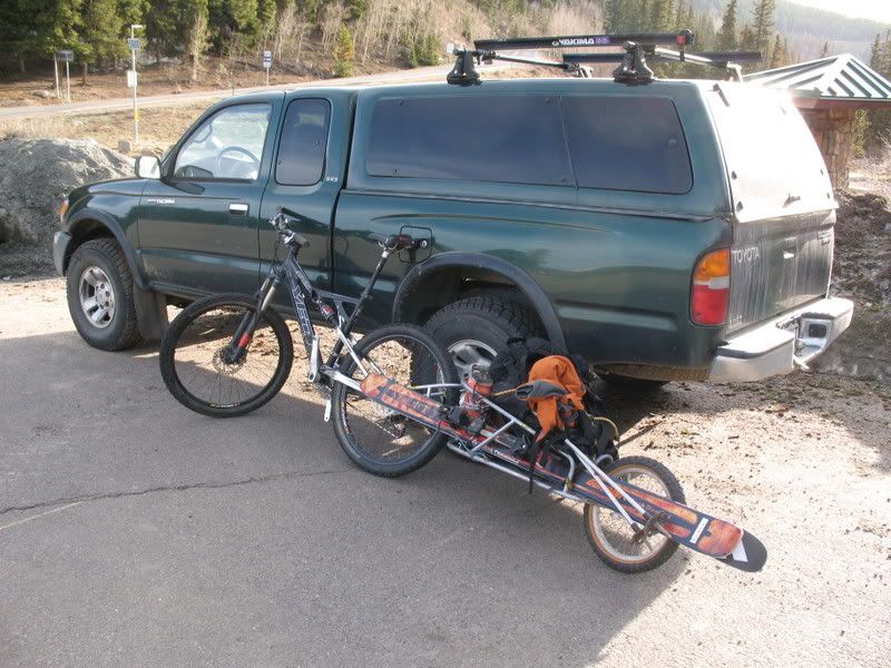
I knew from experience that carrying skis, boots, etc on a pack on a bike is pretty uncomfortable, so I borrowed my friend‘s BOB trailer instead. mtnbikerskierchick and I planned on hitting Evans on Sunday, but Tabeguache tired us out and it didn‘t happen: I thought I was going to start work on Monday, but the jobsite wasn‘t ready for us, so I decided I would just have to go it alone.
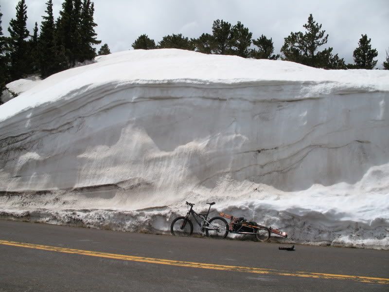
By about 7, I had gotten BOB packed up and was ready to hit the road from Echo Lake at 10,600‘.
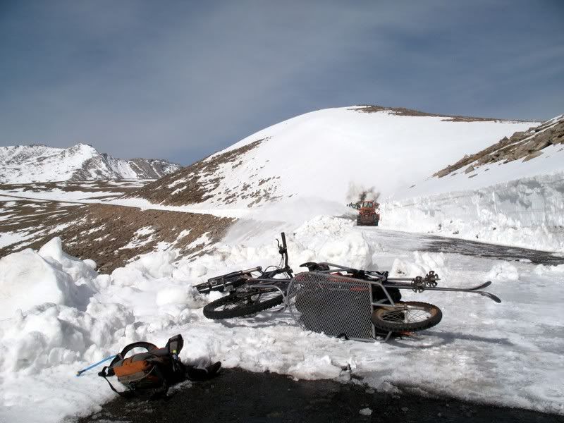
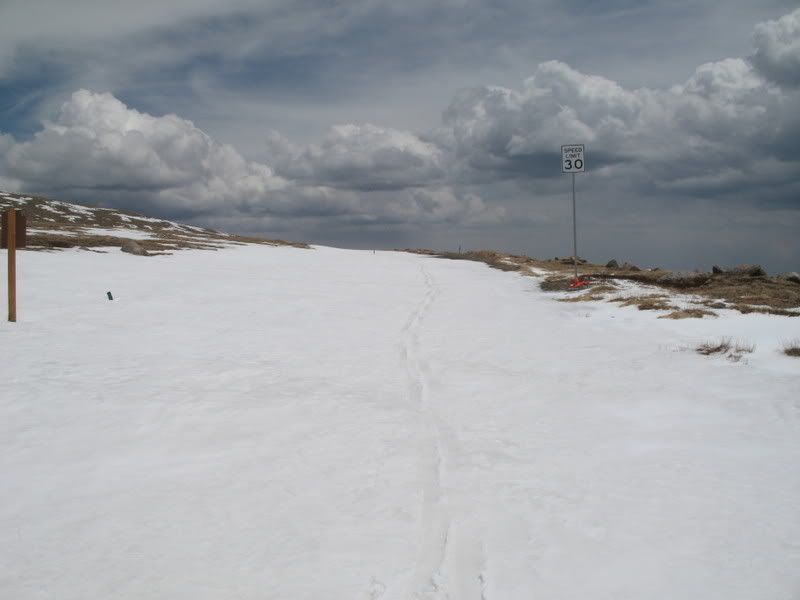
From there, it‘s about 9 miles and 2,250‘ to Summit lake and the base of the good skiing, Summit Lake bowl. After a little over 7 miles, I finally hit the end of the road, CDOT working hard to get the road open for the holiday weekend.
I stashed the bike and BOB, switched to the ski boots, and started skinning past the CDOT guys. The last mile and a half to Summit lake was pretty flat, and then I ditched the skins and started booting up the NE face. I got to the top a little later than I wanted- a little after 11, but clouds and a cool breeze had kept the N face snow from getting too warm.
Where is everyone?
It was so nice to be up there without hordes of people asking the standard "Where are you going to ski?" questions.
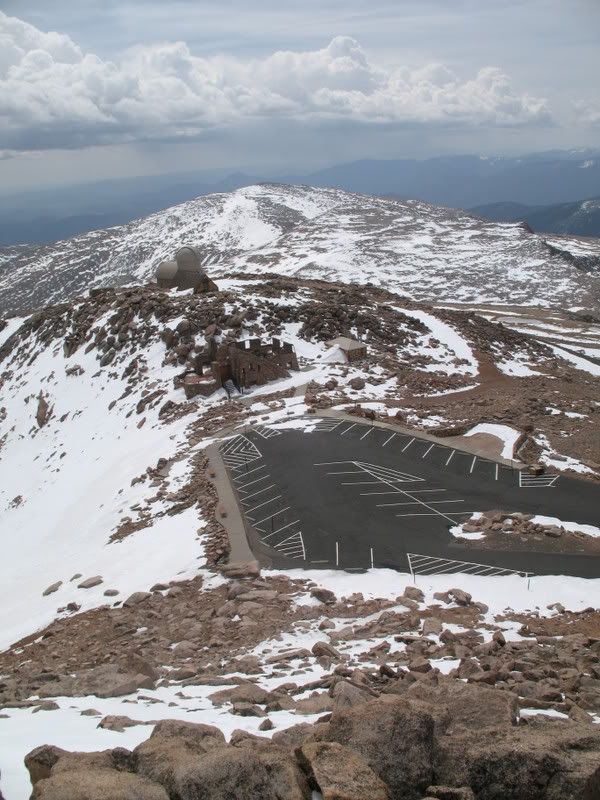
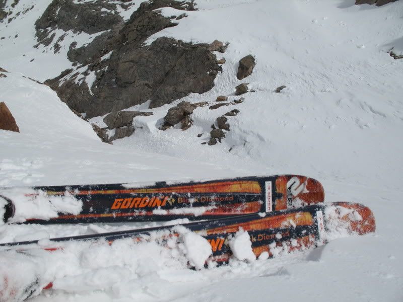
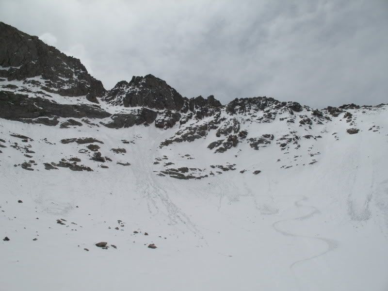
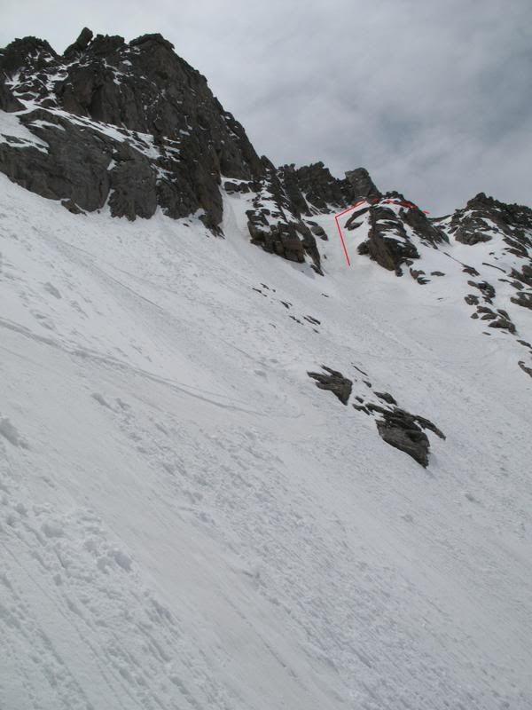
The North face of Evans offers up some awesome, albeit short, skiing. From where I grew up west of Golden, I could get to the top of the Evans road in under an hour, so I knew the area well. A look down my line:
And a look back up:
The clouds were building at this point and it was time to hightail it outta there. I didn‘t speed too much.
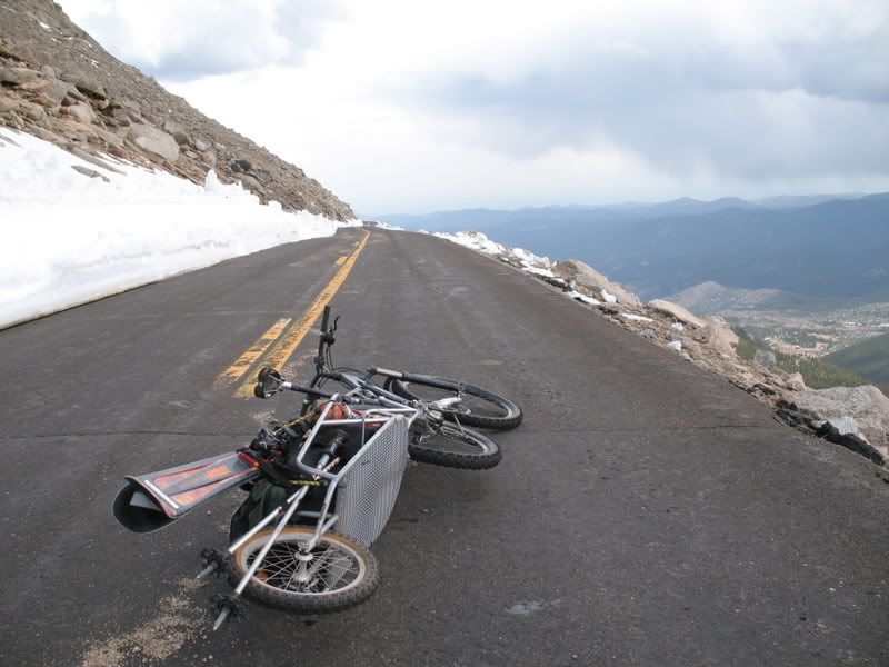
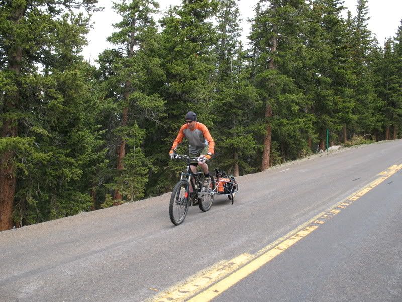
Another switch back to the bike, and it was time for some downhill cruising. I was pleased with my decision to go with the mountain bike and not the road bike- disc brakes are a good thing with BOB being a bit heavy.
Near the bottom, I passed some Euro tourists walking down the road, so I asked them to take a quick photo.
When the road opens to the top of Evans, it‘s definitely worth doing some laps on. It was also really nice to experience some solitude on Evans, considering that it usually has tourists all over it. I remember some really nice tourists one year picking me up at summit lake and giving me a sandwich and a soda while they drove me back up, though, so tourists are pretty cool too.
Ok, I thought you were ”crazy” for a minute there! Looks like you were near where I originally was thinking. That photo says it all - looked like pretty good conditions. I hope to be up there in the next week or so and your TR had me drooling.
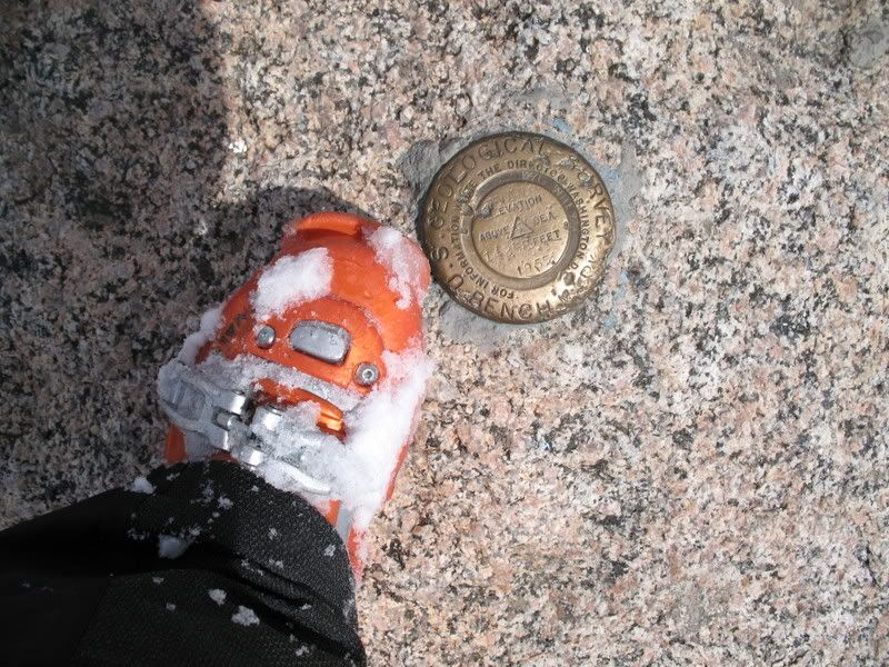
Skied right off the top (well, not off the summit boulder, but...) Then I reached some boulders I had to click out for, then a short stretch of snow, then 15' of scree, then all snow. Not super clean, but good enough.
When I lived in Evergreen, I skied the N Face a lot. One year, 2000 I think - I know it was before the Haymen drought year, there were similar conditions where I was able to ski off from the summit boulders and around to the N Face.
Did you happen to take a photo of the West (sunrise) gully between Evans and Spalding? That's a good one too.
Um, based on one of your photos, it looks like your line went down the steep gully between the main summits? That would have been the top of Roach's ”Snave” route. Is that were you dropped in? If so, that's quite the accomplishment. Seriously.
The one time I had almost continuous snow from the summit, it was from the summit and to the west (left when looking down over the N. Face) and then dropped into the N. face seen in the photo above.
I don't know what I skied. I just headed towards the W summit along the ridge, following snow patches. As soon as I hit a skiable line off the ridge, I took it. There were no lines to the East, that's for sure. I only have one other photo showing my tracks.
Way to get some biking into your ski frenzy dude. Looks good up there, were you able to ski to the North Face from the summit?
Caution: The information contained in this report may not be accurate and should not be the only resource used in preparation for your climb. Failure to have the necessary experience, physical conditioning, supplies or equipment can result in injury or death. 14ers.com and the author(s) of this report provide no warranties, either express or implied, that the information provided is accurate or reliable. By using the information provided, you agree to indemnify and hold harmless 14ers.com and the report author(s) with respect to any claims and demands against them, including any attorney fees and expenses. Please read the 14ers.com Safety and Disclaimer pages for more information.
Please respect private property: 14ers.com supports the rights of private landowners to determine how and by whom their land will be used. In Colorado, it is your responsibility to determine if land is private and to obtain the appropriate permission before entering the property.