Download Agreement, Release, and Acknowledgement of Risk:
You (the person requesting this file download) fully understand mountain climbing ("Activity") involves risks and dangers of serious bodily injury, including permanent disability, paralysis, and death ("Risks") and you fully accept and assume all such risks and all responsibility for losses, costs, and damages you incur as a result of your participation in this Activity.
You acknowledge that information in the file you have chosen to download may not be accurate and may contain errors. You agree to assume all risks when using this information and agree to release and discharge 14ers.com, 14ers Inc. and the author(s) of such information (collectively, the "Released Parties").
You hereby discharge the Released Parties from all damages, actions, claims and liabilities of any nature, specifically including, but not limited to, damages, actions, claims and liabilities arising from or related to the negligence of the Released Parties. You further agree to indemnify, hold harmless and defend 14ers.com, 14ers Inc. and each of the other Released Parties from and against any loss, damage, liability and expense, including costs and attorney fees, incurred by 14ers.com, 14ers Inc. or any of the other Released Parties as a result of you using information provided on the 14ers.com or 14ers Inc. websites.
You have read this agreement, fully understand its terms and intend it to be a complete and unconditional release of all liability to the greatest extent allowed by law and agree that if any portion of this agreement is held to be invalid the balance, notwithstanding, shall continue in full force and effect.
By clicking "OK" you agree to these terms. If you DO NOT agree, click "Cancel"...
Itinerary: From Three Elk Creek TH (~9300'), we did a counter-clockwise loop of the ridge above Three Elk Creek basin, including the summit of Mt. Columbia
Who: Nice Axe and myself
RT mileage: ~10 (mostly class 1 with some class 2)
Vertical climbed: ~4900' (including some ups and downs on the ridge)
Car-to-car time: 7:50
After a failed attempt of a summit ski descent of Emma Burr's (13538') north couloir on Saturday (turned around about 800' shy of the summit due to sugary wet snow that failed to freeze overnight), we decided to leave the skis on the car and do a good old-fashioned hike of Mt. Columbia on Sunday. (A light pack is such a luxury after a season of backcountry skiing.)
We found Roach's directions to be pretty accurate for the Three Elk Creek approach and hike. Roach waxes poetic about this route. He says this is the "cardinal CO climb" (not sure what he means nor do I agree if you take the literal meaning). He also says that the Three Elk Creek approach "furthers the fantasy that every dirt road in CO leads to a fourteener" (I love this quote and agree with him wholeheartedly).
We parked at a nice flat spot just west of where the trail leaves the logging road (about 0.2 mile beyond the "Three Elk Creek Trailhead" sign). There are several spots there to park and set up tents. We watched a DVD in the back of the car and then crashed out. It was raining lightly when we first arrived, but it was clear by the time we went to sleep. We were on the trail at 5:50am the next morning. Nice light in the trees early on:
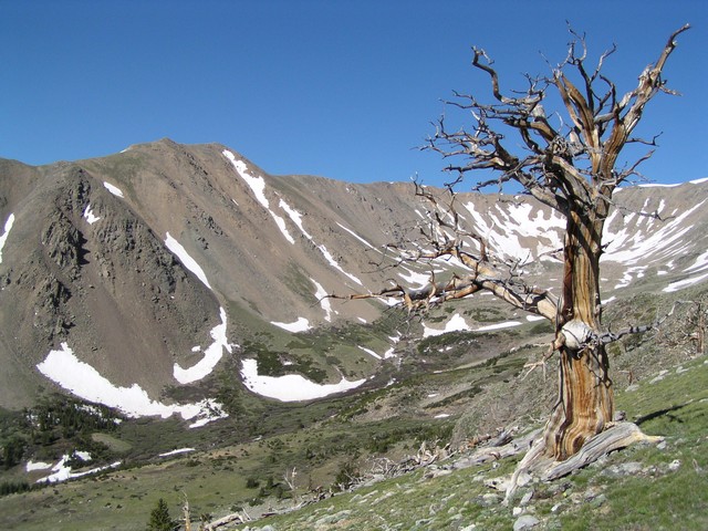
The trail was snow-free and easy to follow all the way to treeline (~11,300'). Along the way, there were several creek crossings (on footbridges in various states of disrepair and one log). After stepping on stones for the final creek crossing to the north side of Three Elk Creek near treeline, the trail becomes very faint and then disappears. But no matter, since nice bushwhack-free routes up to the ridge (on the north side of the Three Elk Creek drainage) are obvious from here. It took us a little over an hour to get to treeline (~3 miles so far). We stopped for a snack partway up the slope and then grunted up dry grassy slopes the rest of the way to the east ridge, angling NW.
View toward upper Elk Creek Basin:
We reached the ridge top at an elevation of ~12800'. It was very windy. The summit was socked in by clouds, but we were in the sun. It was a long ridge walk over several false summits toward the summit. Amy heading up one of the false summits:
Snow patches became more frequent. We had gaiters but never put them on. We entered clouds around 13200' and endured whipping winds, finally reaching the cloud-enshrouded summit around 10am.
Clouds rushing over the ridge from west to east were a sight to behold. We hunkered down just a few feet below and to the east of the summit and enjoyed a snack while being protected from the wicked wind. Somebody else walked up from the standard route just a few minutes after us. He said his grandfather went to Columbia and this hike was a tribute to his grandfather on father's day. I snapped a photo for him, and then he started his descent as suddenly as he arrived. (Turns out this was Greenhouseguy of 14ers.com.)
After about 20 minutes on the summit, we headed south along the ridge to continue our CCW loop of ridge surrounding Three Elk Creek basin. Soon the clouds opened up and we got spectacular views of Horn Fork Basin (to the west) and also Mt. Yale (to the south).
We passed a solo climber on the way up with two dogs. It was so windy I couldn't really hear what he said. It was a nice walk in the sun up high on the ridge. We were happy. The ridge turned to the east. Amy with Mt. Columbia in the background:
Mt. Yale:
We skirted to the north of PT 13298 where there was a little fun scrambling to be had. Around 12600', we started angling down gentle slopes to the NE. Layers quickly came off as we went from winter to spring to summer. We were hoping to find a long snowfield we eyed during the ascent for a fun, easy glissade down to treeline, but alas we started descending too early and missed the snowfield entirely. No matter, as it was a relatively pain-free and scree-free descent. Upon reaching the basin, we saw cairns which brought us right to the trail! I love it when that happens.
One of the footbridges in disrepair:
From here it was an easy march back to the car, where we arrived at 1:40pm in solitude. A fine day, and a fine route that we felt was worthy of Roach *classic* status. The only disappointment was the lack of elk sightings. Wildflowers are starting to appear and should populate the Three Elk Creek basin with colorful brilliance in another couple of weeks. Interestingly enough, a friend commented that he did this hike later in the summer, and he claims the views were "boring by CO standards" and all he saw before reaching the ridge was a "big gravel bowl" that was the Three Elk Creek basin. I guess the *classic* status should be season-dependent.
Thumbnails for uploaded photos (click to open slideshow):
Thanks for taking my summit pic. The weather was bad enough to worry me a little bit, but it cleared up by the time that I was halfway down the slope. The route you took looks much more scenic than the standard route; now I understand why so many people complain about the scree. The solo climber with two dogs had come up one of the gullies - it looked like an agonizing way to gain the ridge.
Three Elk is the way I went too, it was a nice scenic and peaceful route, definitely seems to be the way to go on this peak! Sorry your ski didn‘t work out the day before, but sometimes its nice to lighten the load and enjoy a dry trail
for the comments! Despite the extra ~700‘ vertical compared to the N. Cottonwood approach, I wonder why this route didn‘t become the ”standard route” up Columbia.
backpacking options near this route? 9/18/2009 5:00pm
Thanks for the TR. We‘re thinking of climbing this route to Columbia on Sunday but are hoping to backpack in on Saturday. Any decent camping within the first few miles?
Caution: The information contained in this report may not be accurate and should not be the only resource used in preparation for your climb. Failure to have the necessary experience, physical conditioning, supplies or equipment can result in injury or death. 14ers.com and the author(s) of this report provide no warranties, either express or implied, that the information provided is accurate or reliable. By using the information provided, you agree to indemnify and hold harmless 14ers.com and the report author(s) with respect to any claims and demands against them, including any attorney fees and expenses. Please read the 14ers.com Safety and Disclaimer pages for more information.
Please respect private property: 14ers.com supports the rights of private landowners to determine how and by whom their land will be used. In Colorado, it is your responsibility to determine if land is private and to obtain the appropriate permission before entering the property.


")
")
")
")
")
")
")
")
")
")