Download Agreement, Release, and Acknowledgement of Risk:
You (the person requesting this file download) fully understand mountain climbing ("Activity") involves risks and dangers of serious bodily injury, including permanent disability, paralysis, and death ("Risks") and you fully accept and assume all such risks and all responsibility for losses, costs, and damages you incur as a result of your participation in this Activity.
You acknowledge that information in the file you have chosen to download may not be accurate and may contain errors. You agree to assume all risks when using this information and agree to release and discharge 14ers.com, 14ers Inc. and the author(s) of such information (collectively, the "Released Parties").
You hereby discharge the Released Parties from all damages, actions, claims and liabilities of any nature, specifically including, but not limited to, damages, actions, claims and liabilities arising from or related to the negligence of the Released Parties. You further agree to indemnify, hold harmless and defend 14ers.com, 14ers Inc. and each of the other Released Parties from and against any loss, damage, liability and expense, including costs and attorney fees, incurred by 14ers.com, 14ers Inc. or any of the other Released Parties as a result of you using information provided on the 14ers.com or 14ers Inc. websites.
You have read this agreement, fully understand its terms and intend it to be a complete and unconditional release of all liability to the greatest extent allowed by law and agree that if any portion of this agreement is held to be invalid the balance, notwithstanding, shall continue in full force and effect.
By clicking "OK" you agree to these terms. If you DO NOT agree, click "Cancel"...
Skisotope and I arrived at the turnoff for the Lake Como road at 10:45 on Friday night, not knowing what to expect in terms of the road's conditions. I drive a Subaru Forester, and we learned rather quickly (as soon as the road shifted from dirt to loose rocks) that we would not be driving very far up the road"Subarus don't have the clearance and I didn't have the guts. We parked just after the scrub brush started and set up camp for the night. I was glad that I borrowed a friend's 0* bag when I woke up several hours later to the sound of snow hitting the tent.
The alarm went off at 4:30, and sometime after 5 we were on our way out of camp. About 30 minutes later, we began to realize just how far down the road we were... and how much longer we had to go. Hiking up loose rock in telemark boots is not the best way to start the day, and despite our frustration ("There is a part of Hell reserved for roads like this") we pressed on as fast as we could. As the sun rose, we both realized that we had started far too late for our intended route: the Ellingwood/Blanca combo. Fortunately, the view from the road across the San Luis valley was breathtaking:
Around 7 am we started to pass the 4X4's parked much higher up the road. Intense jealousy followed, along with a game plan to find one of those lucky people and convince/bribe them to drive us back down at the end of the day. From where the snow drifts started we were following the tracks of the two groups that had left before us: Long hike from the car in the valley.
It wasn't until 8 that we reached the established skin track. Bootpacking for three hours had taken a toll on my energy level, but it felt good to be skinning instead of carrying the skis:
9 am found us at Lake Como, and we took a much needed break and admired the tracks going up to Little Bear:
Fortunately, the weather was impeccable. We were worried about the snow softening, but cold temperatures overnight and a light wind were keeping things stable. Looking up the basin
The crux of the day came at Blue Lake, when both of us were feeling the long approach and questioning our ability to continue. However, the weather was holding and we hadn't come this far to turn around: At Blue Lakes, Ellingwood still looks so far away... Me skinning up the basin
Once we reached the top of the basin (approximately 11 am), it was decision time"take the established bootpack up Ellingwood or skin up the saddle for the traditional approach and then go for either peak. We chose Ellingwood (Blanca"we'll be back) and decided to give the established track a try. It was time to lash the skis back on.
About � way up, we realized that the group that had established the track obviously had no fear of heights. I was running on fumes in terms of energy, but Skisotope was getting a second wind and I couldn't turn around, so I focused on counting my steps and not looking down. I also wished that whoever had kicked in the steps had made the distance between them slightly smaller, but it was better than having to bust our own trail. Through the crux
At this point, we could see the other group skiing across the slope underneath the saddle. The other group at the base of their ascent to Blanca
Getting closer to the top: One step at a time
At the ridge, the exposure increased dramatically. Like the other group, this made for some tough decisions, and eventually we decided to pick our way up a version of their route. The snow was firm but the rocks were icy, and even though I was tired I made sure to check every boot placement and handhold before moving upward. A look down at the from the top ledge: Yikes!
By the time we reached the last ridge before the top, and the entrance to the couloir/our descent route, we both agreed that reaching the true summit that day was not an option. It was 1:30, we were exhausted, our nerves were shot from the exposed ridge climb, and weather was rolling in from the west. Time to go. Snow over the Crestones
We watched as the other group started up Blanca--clearly going the "take no prisoners" route.
View to Little Bear: Little Bear
Based on the experience on the way up, we knew that in the south-facing couloir the snow conditions were going to be variable. Sure enough, it wavered between several inches of powder over a layer of hardpack/dust layer, and slushy corn.
Skisotope unpacking at the top: Unpacking on the ledge
Making it look easy: Dropping in Some hard pack/dust layer ice underneath
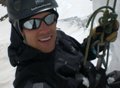
Me, in my better moments:
The exit chute was narrow, and jump turns were necessary:
Happy to be at the bottom, we stopped for a much-needed break and intake of calories. The weather rolled in just as we hit the end of the Blue Lakes:
We watched as a member of the second group, which we had seen summiting Little Bear, hiked down towards the lake. It was perfect timing to try to get a ride home, and we packed up our things and made our way across Lake Como. We met up with WD and BurningtheBushes as they were regrouping. They kindly and mercifully agreed to drive us down to our car. Hallelujah! It would have been an incredibly painful walk otherwise.
A last look at our route (ascent = red, descent = blue):
We were dropped off at the car at 4:30, and we quickly packed up camp to head back to Boulder/Golden via 285. We made a quick stop for food in Alamosa and were back in Golden by 10 pm. Thank you, WD and BurningtheBushes, for driving us down"it was a lifesaver, especially for my feet. Wesley & co., thanks for kicking in that track, the "ridge of unknown consequences" was exactly that.
Lesson learned: the Lake Como road is a very, very long approach from 8,500 ft.
Thumbnails for uploaded photos (click to open slideshow):
Way to hang in there and get up and down safely. That small couloir climb looked sweet. I‘m sure skisotope would have gladly broke trail all day if there was no one else around ... although you still would have to deal with some monstrous strides. I‘m also surprised he didn‘t want to finish with a death march out on the road ... is he loosing some hardcoreness? just kidding bud!
That ridge is indeed intense! Lord Helmut & I took the couloir on the other side of the Buttress (Img 24) and followed the ridge from there. It was exciting and at times freaky with snow (Brian‘s trip report on this site if you want to see the rest of the route). I agree with you on the road, it has a VERY special place in hell lol. It killed my feet last time I hoofed up it. Lesson learned on the approach shoes...I can empathize with the foot pain! Thanks for posting, way to play it safe, and awesome pics!
So does the standard route just continue higher up into the basin and then ascend the south face. Is it on the other side of the couloir that you guys skied? If you wanted to get it from the summit would have had to finish the ridge and then ski the other side? Just curious is all, looks like great conditions that you guys had. Way to go!
for the comments everyone! Approach shoes are a definite must the next time around. Schralp: exactly, the standard route is gaining the saddle at the end of the basin and hiking the opposite face to the one we skied, so you would have to descend the other side of the summit to enter the couloir.
Glad you guys got some good turns in that couloir! We were watching you climb from across the valley thinking, ”hopefully they‘re not too pissed off at us for luring them up that route.” Though we took that line to save time, in hindsight I think it‘s clear we would have spent less time on the standard route to the saddle and up, but oh well. It made for some interesting climbing right?
Nice work getting a ride down as well, oh and my apologies for the inconvenient spacing of the booter, everyone in our group is over 5‘11 which may or may not have been the problem 8).
starting at 8,500ft on lake como road! Pretty sure I wouldn't have made it as high as you did even with a boot track. Speaking of which, I echo Ben's comment in apologizing for luring you up that route. Fun climbing but it sure was time consuming. I remember thinking you guys made the right decision in turning around where you did because that last bit on the ridge was deceptively long. Nice TR and pics. Mind if I steal that one of us climbing Blanca?
Everyone out there that day had my respect. That line up Ellingwood was intense (for me).
I was wondering how my Forester would do on that road and when we drove down and saw you parked there I realized it wouldn‘t do too well. The group I was with had the 4Runner at 10.3. If it‘s any consolation, the drive down was rough!
Congratulations on a killer ski/climb.
Caution: The information contained in this report may not be accurate and should not be the only resource used in preparation for your climb. Failure to have the necessary experience, physical conditioning, supplies or equipment can result in injury or death. 14ers.com and the author(s) of this report provide no warranties, either express or implied, that the information provided is accurate or reliable. By using the information provided, you agree to indemnify and hold harmless 14ers.com and the report author(s) with respect to any claims and demands against them, including any attorney fees and expenses. Please read the 14ers.com Safety and Disclaimer pages for more information.
Please respect private property: 14ers.com supports the rights of private landowners to determine how and by whom their land will be used. In Colorado, it is your responsibility to determine if land is private and to obtain the appropriate permission before entering the property.


")
 Long hike from the car in the valley.")
")
")
 Looking up the basin")
 At Blue Lakes, Ellingwood still looks so far away...")
 Me skinning up the basin")
 Through the crux")
 The other group at the base of their ascent to Blanca")
 One step at a time")
 Snow over the Crestones")
")
 Little Bear")
 Unpacking on the ledge")
 Dropping in")
 Some hard pack/dust layer ice underneath")
")
")
")
")
")
")
")
")
 Yikes!")