| Peak(s): |
Kit Carson Peak - 14,167 feet Challenger Point - 14,086 feet |
| Date Posted: | 08/04/2010 |
| Modified: | 10/12/2012 |
| Date Climbed: | 08/02/2010 |
| Author: | jdorje |
| Peak(s): |
Kit Carson Peak - 14,167 feet Challenger Point - 14,086 feet |
| Date Posted: | 08/04/2010 |
| Modified: | 10/12/2012 |
| Date Climbed: | 08/02/2010 |
| Author: | jdorje |
| Kit Carson & Challenger, "standard" via Willow Creek |
|---|
|
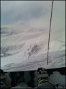
This is really my first climb of the season by a "standard" route. So many people...even on a weekday on a mountain far from population centers. Still, they were all cool people so I can't complain. Day 1: ~4.75 miles, ~2800' gain Day 2: Challenger Pt + Kit Carson, ~9.25 miles, ~3500' gain Willow LakeIt all began a few days prior, with a 14ers.com post seeking hiking partners for Kit Carson. tbnike27 (whose name I never really caught) and mcdbrendan (Brendan) ended up driving down from Boulder to camp at the lake and climb on Monday. I was torn between doing it as a day hike (over 6300' from the alternate trailhead would make for an awesome day) or hiking up to camp. I eventually decided to camp out and was planning to stay two nights, with an additional day of 13ers (most likely 13153+Adams+13580); however a few factors convinced me later to give up the second day. In hindsight I should just have done it all in one day. Anyway, I was planning to meet them at camp up by the lake but due to poor communication, never set a location to meet. They set off from the trailhead at 3:30 PM; I got off from the alternate TH at 4:30. A fast pace got me to the campground by 7:30, just as a bit of rain and hail was letting up. I took a lap around the campground but couldn't find them, and as the rain stopped completely set up camp instead. Afterwards, in another round of searching I spoke to another group of 3 (Eric, Derek, and Josh) who were planning the same climb. They said they were going to wake up at 5 and leave camp at 6-6:30 and welcomed me to join them. I figured that was a bit late to leave, so I set my alarm for 3:30 anyway but with a backup alarm at 4:55, and after a rice&bean&chicken&cheddar burrito, I went to bed. Challenger PointI slept quite poorly and went for the 4:55 wakeup. We didn't end up getting on the trail until 7:00. I hadn't spoken to these guys much the night before and it seemed to me like they were up here to camp, fish, and drink beer (they packed out a lot of empty cans) and just figured they'd climb the mountain for the hell of it. Still, they were cool guys. It was damn foggy early on and since I'd climbed Challenger before I took off leading at the start (and for once, I found a good way above the willows by the lake). The guys took their fishing poles, and dropped them off by the creek crossing above the waterfall. As we rounded the north ridge and started heading uphill, we stopped to discuss the route. We still couldn't see much at this point, so we just stuck to the trail and figured we'd adjust later if needed. Josh started leading and he took off. I struggled to keep up and they waited up a bit for me; I figured as we got higher they would lose some energy but it just didn't happen. At one point they discussed the route's similarity to one they'd done on Capitol, at which point I realized they weren't just fishermen out for an afternoon hike! I kept to a pace I thought I could sustain for a few hours, and it was fast enough to keep up. We had discussed taking the "alternate route" up to Challenger. I wish we could have, but in the fog we just stuck to the easiest-to-find route. The scree slope was somewhat tedious and some areas were wet which cut down on the available good routes up the slope, but at the speed we were going we didn't have much time to worry about it. On the way up the slope, the fog cleared and gave us spectacular views of Adams/13580/13517/13541. We ended up arriving at Challenger at 9:15 - about a 1200 ft/h pace or rather blazing fast by my standards. There we met four others, including my original hiking partners Brendan and tbnike who had apparently camped up by the lake itself rather than in the campground, as well as another guy and his rather tired 58-year-old ex-ultramarathoner father who were doing their 3rd and 4th 14ers in two days. All four of these left for Kit Carson right as we arrived at Challenger. We stuck around at Challenger only for about 15 minutes before heading over to KC. Unfortunately I didn't take any pictures at this point, as I was spending all my time eating and gulping down water; in fact I had yet to take a picture on the hike at all. Kit CarsonAt about 9:30 we left Challenger and headed down to the saddle with KC. From here we stuck to Kit Carson Avenue up and down and around Kit Carson. This was a cool walk, but halfway through a cloud came in and we were completely fogged in again...and would remain so the rest of the climb, basically. At the end of Kit Carson Avenue the clean trail sort of peters out. It heads downhill for quite a while, but at some point it just kept on going and I said "I don't want to go down there". Instead we looked around a rib that we were right up against, and saw a good-looking gully leading up. This gully is supposedly class 3 but I'd describe it as 2+; most of it was just scree climbing but the conglomerate rock sometimes made it easier to scramble over the more solid stuff. We were conscious of the danger of falling scree on this steep slope, and spread out to avoid dropping it on each other; oddly I was the only person on the mountain that chose to wear a helmet. Some reports say that it's more solid to the right, but if you stick to the left of the main gully it's also pretty solid (with some real class 3). The gully is wide though (hardly even a gully at all, really) so the biggest thing is probably just to spread out. We also took great care to check the place where we entered the gully, as many reports tell of people missing the exit. I can certainly see how that'd be easy to do, since the "avenue" is far from recognizable at this point. Fortunately there was a very distinctive flower right by the rock rib we'd crossed to enter. On arriving at the top, a couple was just heading down, including Kim for whom KC was her last 14er. (Everyone says "last fourteener" to mean their last one to complete on the list-of-all-fourteeners-everyone-wants-to-climb-for-some-reason, not the last one they'll ever climb in their lives.) We'd passed the elderly gentleman on the route up (he was going slowly at this point - unfortunately I never caught his or his son's name) but the other three people from Challenger were all here. It was now 10:00. Unfortunately in the clouds, not much was visible. The Willow Lake basin was clear but clouds were sweeping in from the west and we couldn't see anything other than Challenger and 13541 across the basin.    DescentDerek, Erik, and Josh were in a hurry to get back down and fish. Brendan and tbnike were in a hurry to get back down and drive back to Boulder. They all headed down while I stuck around for a bit. Finally the last two on the summit (father and son) headed down and I followed. They cut across to the left and headed down, and I lost sight of them for a while and thought they must be behind me...but somehow they made really good time and ended up well in front at the cutoff back to Kit Carson Avenue and I lagged behind all the way down to the KC-Challenger saddle. Here I did have time to snap a few photos, but in the fog there wasn't much to see. On the way I passed something that may or may not have been "The Prow"; it was an easy though ultra-exposed scramble up to the top so I climbed it. In the fog it was quite hard to tell what was where however.   ") By the time we were back up on Challenger, I'd caught up, and traveled the rest of the way down to the waterfall with these guys. It was a pretty slow descent, but after the speedy ascent gave me some helpful recovery time. All along Challenger Ridge we were completely encased in fog; if we hadn't known exactly where we were it would have been extremely disorienting. Fortunately we did, and we headed right back to the notch and down the standard route. As we got lower we came out of the cloud and had a few good views underneath the clouds: nothing spectacular, but after a day almost without pictures I took the opportunity to snap a few more.     About halfway down the slope all hell broke loose. I believe it was the coyotes that started it; about three of them below us to the right (toward the upper lake) started howling. Another coyote off to our left over a ridge joined in. Then all the pikas around started chirping like mad too. We looked at each other in confusion and considered whether an earthquake might be imminent - but eventually decided the coyotes were just yelling at each other and the pikas responding to them - maybe telling each other to hide. There are a lot of pikas up there by the way! After a couple minutes it subsided and we continued on our way, though the coyotes periodically howled out again. Once down at the waterfall, the view was spectacular. From here you can see the lake, the valley, and most of the surrounding peaks. For some reason I only took one random photo though. The guys were hanging out here trying (unsuccessfully) to fish and napping; I took a brief half-nap while a marmot snuck around trying to find something to eat. The cloud cover cleared off and for a brief while it looked like it would have been spectacular to be on top of the peaks again. Then a storm cloud started moving and and we all figured at the same time it'd be a good idea to get below treeline. (Side note: though these guys had waited for me on the way up and left me behind on the way back, I took some solace in their complaints about how much their knees hurt after the speedy descent. From everything I've read, knee pain on the downhill comes when your legs get tired and you no longer use your muscles to cushion your steps, putting the strain instead on the ligaments. I haven't had this problem since I started squatting. Say what you want about Mark Rippetoe, but the sonofabitch sure knows strength training.)   I had forgotten to tighten my shoelaces before descending, and perhaps as a result my right pinkie toe had gotten squished and felt like it was getting a big blister. On top of this, the weather report for the next day had gone downhill (partially borne out, as it was extremely overcast the following morning and rather dark by noon...but no storm until much later in the day). Anyway I decided to pack up camp and head back. I took my time, and didn't get off until about 4:00. As I was crossing the headwall, the weather got still darker. I hurried down past the exposed portion but shortly after the creek crossing it started to hail. I took brief shelter under a tree (aspen gives very little protection against hail btw), but as the quarter-inch pellets started coming down en masse I discovered a new use for my helmet. Unfortunately the bicycle helmet has gaps and a few pellets still came through. Ouch! I got moving again and after about half-an-inch of hail was built up on the ground, it finally subsided. I was back down to the alternate TH by 5:50. All in all, I'm disappointed at several straight clouded-in summits. I know it's unavoidable in monsoon season, and not necessarily dangerous as long as the morning clouds aren't hostile, but it still takes a lot of the fun away from hiking. Still, it was a fun day and good to finally get up to Kit Carson after seeing it out the back window of the house here for so long. Topo Credits* Bill Middlebrook's route descriptions on 14ers.com Thumbnails for uploaded photos (click to open slideshow):  Looking down at Willow Lake from Kit Carson")
 Challenger Point was still visible from Kit Carson, barely")
 Me, with Challenger in the background, from Kit Carson")
 Descending the gully back to Kit Carson Avenue")
 Is this \"The Prow\"? Hard to tell in the fog. This is the one I climbed though.")
 Or is this \"The Prow\"? It certainly looks cool whatever it is. (The mountain is to the right here.)")
 I believe this is near the top of Challenger ridge; we're about to descend.")
 Random shot over toward the Adams-13546 saddle.")
 Point 13517: from this angle, the north ridge looks insane.")
 Looking southeast, this is the ridge between 13541 and Obstruction Peak. From this angle it does not look friendly either.")
 Looking down from the waterfall at the north shore of the lake. Not sure why I took this picture rather than one out over th")
 Obligatory lake shot. Apparently Willow Lake is pretty or something. This is basically the reverse of the previous shot.")
 Very approximate topographic route")
|
| Comments or Questions | ||||||||||||
|---|---|---|---|---|---|---|---|---|---|---|---|---|
|
Caution: The information contained in this report may not be accurate and should not be the only resource used in preparation for your climb. Failure to have the necessary experience, physical conditioning, supplies or equipment can result in injury or death. 14ers.com and the author(s) of this report provide no warranties, either express or implied, that the information provided is accurate or reliable. By using the information provided, you agree to indemnify and hold harmless 14ers.com and the report author(s) with respect to any claims and demands against them, including any attorney fees and expenses. Please read the 14ers.com Safety and Disclaimer pages for more information.