Download Agreement, Release, and Acknowledgement of Risk:
You (the person requesting this file download) fully understand mountain climbing ("Activity") involves risks and dangers of serious bodily injury, including permanent disability, paralysis, and death ("Risks") and you fully accept and assume all such risks and all responsibility for losses, costs, and damages you incur as a result of your participation in this Activity.
You acknowledge that information in the file you have chosen to download may not be accurate and may contain errors. You agree to assume all risks when using this information and agree to release and discharge 14ers.com, 14ers Inc. and the author(s) of such information (collectively, the "Released Parties").
You hereby discharge the Released Parties from all damages, actions, claims and liabilities of any nature, specifically including, but not limited to, damages, actions, claims and liabilities arising from or related to the negligence of the Released Parties. You further agree to indemnify, hold harmless and defend 14ers.com, 14ers Inc. and each of the other Released Parties from and against any loss, damage, liability and expense, including costs and attorney fees, incurred by 14ers.com, 14ers Inc. or any of the other Released Parties as a result of you using information provided on the 14ers.com or 14ers Inc. websites.
You have read this agreement, fully understand its terms and intend it to be a complete and unconditional release of all liability to the greatest extent allowed by law and agree that if any portion of this agreement is held to be invalid the balance, notwithstanding, shall continue in full force and effect.
By clicking "OK" you agree to these terms. If you DO NOT agree, click "Cancel"...
Peak Z 13.245' (4037 m) Peak Z Prime 12,980' (3956 m)
Ever since discovering the Gore Range in 2007, I've been hooked. For the past three years, I've been gradually working my way north from Buffalo Peak. While climbing Red Mtn., the Silverthorne massif, Keller and the Grand Traverse, I studied the unique summit of Peak Z, and had been anticipating the climb of this remote peak, my first of the 'alphabet peaks'. Given a day off work and our prolonged Indian summer this year, I decided to give it a shot.
Z Prime and Z as seen from Keller Mtn, Feb. 2008
The preferred approach to Peak Z seems to be from the west (Vail side), over Usable Pass. I have an affinity for the Boulder Creek basin however, and figured that with a fast pace, it could be done from the Rock Creek TH in two days. Originally, I had planned to hike in to lower Boulder Lake with my friend Hallie Saturday afternoon, camp there, then summit and pack out the next day. Unfortunately, Hallie was dealing with a painful IT band from a summer of trail running and she decided not to push it on such a long day. So we just camped along the Rock Creek road Saturday night, and I decided to attempt the route solo, in one day. I set the alarm for 5 a.m. Sunday morning.
In the middle of the night I awoke to what sounded like a cross between an elk bugling and a coyote howling. Totally lost for a moment, I wondered where I was. I opened my eyes to a canopy of bright stars overhead. Right then, a brilliant meteor streaked across the sky. Ah yes, Rock Creek, sleeping out tonight. Then the coyotes started in again, this time an unmistakable, long, lonely howl. I shivered and went back to sleep.
Soon afterward, my cell phone woke me up from deep sleep. It took maybe two minutes to break camp: stuff my sleeping bag, roll up the pad, and drive away. It was a cold morning and I was thankful for the heat in my truck during the short drive to the trailhead. No other cars in the parking lot. I sat with the heater on for a while and ate breakfast, silently contemplating the day ahead. A few minutes before 6, I started up the trail.
The familiar Rock Creek trail passed quickly. Peak Z sits near the headwaters of Boulder Creek, direct access to which is blocked by private property. So the easiest access to Boulder Creek is from Rock Creek, one drainage to the south. This added mileage and vert. ensures that upper Boulder Creek sees few human visitors. After a quarter mile or so I interesected the Gore Range Trail, which runs parallel to the range, leading up over a ridge and down into the Boulder Creek valley.
The sky began to lighten as I started up the first climb of the day, listening to my gravelly footsteps, the only sound in the predawn stillness. At the top of the ridge I shed a layer and ate some more food, then dropped 500 feet down switchbacks to Boulder Creek, clouds turning orange overhead. Wait a minute. Clouds? The forecast had called for mostly sunny skies all day, no mention of thunderstorms. But sunrise revealed a sky full of puffy mid-level clouds. Hmm, oh well. Before long I reached lower Boulder Lake. Peak Z and Z Prime towered above the lake to the northwest. I reflected on how far away they looked. Once again the ridiculousness of trying to climb them from the east in a day occured to me. Neverless, after some photos, I carried on.
L to R: Keller, Solitude, Vista, Z' and Z from lower Boulder Lake
The first part of the trail above Boulder Lake passed uneventfully. Lots of birds and squirrels happily chattered away in the morning sun. Then I heard a deep grunting sound ahead. Standing at the edge of a marshy meadow I saw him, a massive bull moose. He lifted his huge head and looked directly at me, then began walking toward me. I stopped in my tracks. Bull moose are in their rut this time of year and I understand that this makes them more agressive. This particular moose fit that description well, alternately walking toward me and stopping to grunt and angrily rip willows out of the ground. Then I spotted another moose, also a bull, about 20 yards away from the first one, and even closer to the trail. They seemed to be having a standoff, which I didn't want any part of. As the first moose approached me, I tried talking my way out of the situation. "Hey there, big guy," I said. He snorted and took another step closer. "Listen,' I said, "we don't want no trouble.." Having grown up in Colorado and being around wildlife my whole life, I am rarely spooked by animals. But moose scare the crap out of me. They are f*king huge. I broke away from the trail and headed uphill, away from the meadow, until I could no longer see the moose. For a few hundred yards I continued up-valley, voluntarily bushwhacking and listening every few steps for the sound of a charging moose. Giving them a wide berth seemed to work. After some gnarly log-hopping I dropped back down to the trail.
Moose in the meadow
In another mile or two I reached the spot where the topo map shows that the Boulder Creek trail ends. The first time I hiked up to upper Boulder Lake in 2007, I assumed that no trail existed and fought my way up the valley for hours, bushwhacking over endless blowdown and some very rough terrain. Since then, I've made the trek to upper Boulder three or four more times and have discovered that there is, in fact, a trail. Faint at times, steep, overgrown, and hard to follow, it leads all the way to the upper lake. I hiked all the way up this valley to Lake Solitude ('Upper Upper Upper Boulder Lake') earlier this summer, so the route was fresh in my mind. I managed to only lose the trail once on the way to the lake. By 9:30 I was standing on the spectacular shore of upper Boulder Lake, 3.5 hrs after leaving the truck. Much faster than the 6 hours it took me to get here the first time.
Upper Boulder Lake
Having reached this point, my plan was to bushwhack up to Ormes' "Secret Lake" and then contour around the upper basin to the Peak Y- Peak Z saddle (in keeping with Gore Range tradition I will keep my route description fairly vague). This was new terrain for me-- I had looked at it from above, studied the topo maps and read the few existing trip reports online, but I've learned that things in the Gore rarely go the way you expect them to. I ended up overshooting Secret Lake and clearing out of the trees about 250 feet above it. By now the sun was beating down in full force and I had already gone through 2 of my 2.5 liters of water. I came across a beautiful little stream and took the opportunuty to filter more water. A few bites of sandwich, a few cookies, and I was off again with full water bottles. The upper Boulder Creek basin is an amazing place. The whole valley is filled with lakes, tarns, bonsai-looking trees and interesting cliffs. It is an incredibly lush area in mid-summer, but by early October the grasses and wildflowers have dried out and only memories of the buggy, humid summer remain.
Peak Z and Z Prime from upper Boulder Creek
Most of the XYZ ridge from below
I crunched my way across the tundra of N Boulder Creek and up to the bench which parallels beneath the X-Y-Z ridge. I walked around some more tarns and, finally, positioned myself below the Y-Z saddle. After some more sandwich, I put on the helmet and headed up to the saddle on steep, loose ground. At this point the clouds were beginning to thicken, and I was seriously doubting that I would make it all the way to the top. Even though thunderstorms weren't in the forecast, I didn't like the look of the blue-black clouds overhead, racing down from the north. But once I reached the ridge, I could see the rest of the sky and decided that it didn't look bad enough to turn around just yet.
Peak L "Necklace Peak" to the north
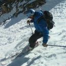
It was 12 p.m. when I reached the saddle. I gave myself a deadline of 2 hours to climb peak Z, scramble out to Z Prime and back, and return to the saddle. I continued quickly up to peak Z, staying as close to the ridge crest as I could, encountering everything from loose 2nd class to solid 4th class rock.
Z Prime from Peak Z, Grays and Torreys in the distance
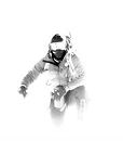
sunscreen-face
Peak X to the west, chillin'
Half an hour had passed since I reached the saddle when I arrived at the airy summit of Peak Z. The view was amazing, but I didn't stop for long. I wanted to stay there all day, but as I reflected on how remote my position was, high on this steep, obscure peak, I knew I needed to keep moving. I signed the register (congrats Sarah and Cooneys!), took some photos, and downclimbed back to the Z-Z Prime saddle. On this section of the route my right leg began to cramp up pretty intensely. The adductor muscles threatened to seize up with every step uphill, so I tried to slow down and stretch it some. The ridge out to Z Prime looked tricky, exposed, steep on both sides. Excitedly I engaged the difficulties straight away. The rock was more solid here than it was below, and I savored each moment on the exposed ridge. Slowly, checking every foot and handhold, I made my way out to the Z Prime summit, perched high above the Boulder Creek valley. There was just a little bit of snow in the shadows. Looking back down the valley, lower Boulder Lake looked impossibly far away. I think this image really stuck in my mind as a reminder of how far I still had to go, so my stay on the summit was super short. I immediately turned around and backtracked along the ridge.
Peak Z from Z'
The view to the east, lower Boulder Lake far below.
Fun little knife edge on Z Prime
On the return trip, I stayed on the crest nearly the whole time, enjoying a really fun bit of knife-edge action on perfect rock. Upon returning to the Peak Z saddle, I headed down to the south slopes, dropping down before the Y-Z saddle this time. I was hoping to find more solid ground but this route was just as loose. At one point I accidentally kicked a rock down and started a small rockslide which echoed around the valley for a long time. I reached the talus blocks below Peak Z's south slopes at exactly 2 p.m. I had been moving pretty much non-stop for 8 hours now. Finding a flat grassy area, I took off my pack and collapsed in the warm grass. For a few contended minutes I just lay there, motionless, listening to the profound silence all around me. As I felt myself beginning to fall asleep, I got up, ate some more sandwich, and continued down. I stopped again to filter another 2 liters of water at N. Boulder Creek.
Tarn below Peak Z
I followed roughly the same route down that I had taken up, only contouring a bit lower this time in order to come out at 'Secret Lake'. It worked, and I had the pleasure of exploring the shoreline of this pristine lake, one of the nicest places I have found in Colorado.
"Secret Lake"
Then it was back down to upper Boulder Lake, steep downhill bushwhacking, and another short rest on its sandy beach.
Upper Boulder Lake, part of Keller Mtn to the right
It was 4 p.m. when I started back down the Boulder Creek trail, stomach full of Red Bull, cookies, and ibuprofen. I lost the trail once, but quickly found it again and made very good time down the valley. I had been concerned that I would meet the moose again in the meadow, but luckily they had moved on. Finally I reached Boulder Lake as the sun was going down over Peak Z. It was 5:30. I wondered if I would need to break out the headlamp again before the day was done.
lower Boulder Lake at sunset
I prepared myself for the hike back up and over the ridge by eating some more sandwich and dried fruit, then, one step at a time, hiked up the switchbacks. It was easier than I expected, just one foot after the other, and I soon found myself heading downhill again, stepping carefully, making sure I didn't roll an ankle or trip over a rock in my exhausted state. Finally, I reached the Rock Creek trail and jogged back down to my truck, finally arriving just before dark at 6:30, 12.5 hours after leaving, (roughly 20 miles and 6,500'+ vert later). There, I saw the first 2 people I had seen all day, freshly returned from climbing Keller Mountain. They hadn't seen anyone all day either. We chatted for a few minutes, then I headed home, tired but content with another incredible day in the Gore Range.
Thumbnails for uploaded photos (click to open slideshow):
Hey Jesse! Great TR! I am one of the two guys you met in the parking lot at the end of your VERY long day. It was nice chatting with you. And, like you, the Gores will be on my short list for quite a while.
I climbed Peaks Z and X from Boulder Creek in August as an overnighter. I camped by one one the tarns in the basin under Z an X. One of the absolute nicest places I have ever camped. Nice work doing this in one day, its quite an adventure just getting up to the headwaters of that drainage!
That's a great report! I would like to check this area out in the future. Looks like that close encounter with the moose was quite hairy! Man, that's why I never hesitate to bring a gun. a .38 may be a small caliber, but with .357 loaded and 5 rounds on target, it would do something. I couldn't imagine getting charged. Good job on breaking trail and getting out of there. Can't wait to visit these peaks.
Wow, that basin rivals, if not exceeds, the pristine-ness and solitude of Slate Creek to the North. Thats a nice shot of Pk.L and the Gore Thumb ridgeline. That 2nd pic is a classic Gore shot, you should post that over on the Gore homepage on SP. Thanks for making up my mind as to how I'll approach these peaks. All I've got to say is f**k Usable Pass. I'd say the eastern approaches from rt.9 are the most scenic drainages in Colorado, atleast from what I've seen, very Weminuche Wilderness esque with less foot traffic if thats possible. And way to keep up with the Gore tradition of vague reports, the pictures do all the talking anyway.
I'll be up in the J/P/Q/Partner region this weekend, now I'm uber pumped.
That is an impressive place and you took some great photos to go with it. Pic 2 is outstanding. The downed wood and grass in the foreground frame that shot. And the last photo is a nice way to end it. You've written a TR that does the Gores justice. Mysterious, rugged, untouched. Thanks for posting.
lordhelmut- I agree, Boulder Creek is incredible, love the east side approaches. Hoping to do a winter expedition up there this year. Been wanting to explore the Slate Crk. drainage for some time now. Your TR from Pk. L earlier this year was sweet, really made me want to go there even more. Am also contemplating taking the next 10 yrs off work to explore the Gores. Just posted this over on SP as well.
kimo- Thanks man. Your photos are always great, truly inspiring stuff. That is a very good way of describing the Gores.
Caution: The information contained in this report may not be accurate and should not be the only resource used in preparation for your climb. Failure to have the necessary experience, physical conditioning, supplies or equipment can result in injury or death. 14ers.com and the author(s) of this report provide no warranties, either express or implied, that the information provided is accurate or reliable. By using the information provided, you agree to indemnify and hold harmless 14ers.com and the report author(s) with respect to any claims and demands against them, including any attorney fees and expenses. Please read the 14ers.com Safety and Disclaimer pages for more information.
Please respect private property: 14ers.com supports the rights of private landowners to determine how and by whom their land will be used. In Colorado, it is your responsibility to determine if land is private and to obtain the appropriate permission before entering the property.


 Z Prime and Z as seen from Keller Mtn, Feb. 2008")
 L to R: Keller, Solitude, Vista, Z' and Z from lower Boulder Lake")
 Moose in the meadow")
 Upper Boulder Lake")
 Peak Z and Z Prime from upper Boulder Creek")
 Most of the XYZ ridge from below")
 Peak L \"Necklace Peak\" to the north")
 Z Prime from Peak Z, Grays and Torreys in the distance")
 Peak X to the west, chillin'")
 sunscreen-face")
 Peak Z from Z'")
 The view to the east, lower Boulder Lake far below.")
 Fun little knife edge on Z Prime")
 Tarn below Peak Z")
 \"Secret Lake\"")
 Upper Boulder Lake, part of Keller Mtn to the right")
 lower Boulder Lake at sunset")