Download Agreement, Release, and Acknowledgement of Risk:
You (the person requesting this file download) fully understand mountain climbing ("Activity") involves risks and dangers of serious bodily injury, including permanent disability, paralysis, and death ("Risks") and you fully accept and assume all such risks and all responsibility for losses, costs, and damages you incur as a result of your participation in this Activity.
You acknowledge that information in the file you have chosen to download may not be accurate and may contain errors. You agree to assume all risks when using this information and agree to release and discharge 14ers.com, 14ers Inc. and the author(s) of such information (collectively, the "Released Parties").
You hereby discharge the Released Parties from all damages, actions, claims and liabilities of any nature, specifically including, but not limited to, damages, actions, claims and liabilities arising from or related to the negligence of the Released Parties. You further agree to indemnify, hold harmless and defend 14ers.com, 14ers Inc. and each of the other Released Parties from and against any loss, damage, liability and expense, including costs and attorney fees, incurred by 14ers.com, 14ers Inc. or any of the other Released Parties as a result of you using information provided on the 14ers.com or 14ers Inc. websites.
You have read this agreement, fully understand its terms and intend it to be a complete and unconditional release of all liability to the greatest extent allowed by law and agree that if any portion of this agreement is held to be invalid the balance, notwithstanding, shall continue in full force and effect.
By clicking "OK" you agree to these terms. If you DO NOT agree, click "Cancel"...
My first trip report here so hopefully this goes well.
I had been wanting to do this route for a while, but it requires a shuttle so I had to wait for a good partner. A few 14ers.com people expressed interest back in August but I wasn't able to find a date that worked for a group of people. Then Unclegar sent me a PM that he wanted to do it and we settled on September 30th.
Here's the route. Start at Chapin Pass TH and end at Lawn Lake TH, so you need to set up a shuttle. From Chapin Pass TH, traverse the Mummy Range to Hagues Peak, hitting the summits of Mt Chapin, Chiquita Mountain, Ypsilon Mountain, and Fairchild Mountain on the way. From Hagues, you have the option to hit Rowe Peak and Rowe Mountain (and, as it turns out, unranked, unofficially named "Gibralter Mountain") before going over to Mummy Mountain. Then you descend east and south to the Lawn Lake trail for a 6 mile hike back to the Lawn Lake TH. Our total distance was about 18 miles, we hit seven 13ers (four ranked) and one 12er. Total climbing?? Using the track from my Garmin and Basecamp elevation profile, I'd say it was at least 5100 feet.
We met at the Lawn Lake TH at about 5am, left my car there, and drove up Old Fall River Rd to the Chapin Pass TH, where we donned our headlamps and started hiking at about 5:55 am. First light and sunrise lit the way before we reached our first peak, Mount Chapin (12,454 ft). There was a well-established trail most of the way.
First light
After Chapin, we descended a bit before starting the climb up Chiquita's talus and tundra slope. All Class II to this point.
Unclegar on Chiquita Wind shelter on Chiquita, Rawah mountains in the distance
From Chiquita, it's a small descent and then a longer climb up to Ypsilon Mountain, our first ranked 13er of the day. Still all class II. The sun was well up over the horizon by now and so the views were great. We got nice views of the well hidden Spectacle Lakes along the way.
Spectacle Lakes (photo by Unclegar)
The route from Ypsilon to Fairchild crosses a nice little ridge with some mild Class III down-climbing and some minor exposure, especially if you follow the crest of the ridge. The ascent up Fairchild is steep with occasional loose rock, but nothing too complicated. Along the way you get some great views of the Desolation Peaks to the west.
Unclegar on the ridge between Chiquita and Fairchild Me on the ridge (photo by Unclegar) Ascending Fairchild Desolation Peaks
From the descent down Fairchild, you get a great view of the next task on the route, the steep ascent up Hagues Peak, which involved some Class III scrambling.
Unclegar descending Fairchild Hagues and Mummy Unclegar ascending Hagues with Crystal lakes in the background Signing the register on Hagues, smoke from the Cow Creek fire in the distance
From Hagues Peak we had to make a decision. You can either descend toward the east and head straight toward Mummy Mountain, or you can descend north in order to bag Rowe Peak and Rowe Mountain. I was feeling tired and not totally confident in the ability of my knees to handle the extra climbing and descending, but Unclegar convinced me to go for it. And then I goofed up the route finding. We made it over to Rowe Peak, just above Rowe Glacier and Rowe Glacier Lake.
Rowe Glacier and Lake
And then without thinking and without checking my GPS which contained all the key waypoints, I directed us east toward the unranked and unofficially named "Gibralter Mountain." By the time we realized my error, we were on Gibralter and I wasn't real keen on correcting the mistake and heading over to Rowe Mountain (another unranked 13er) since it was already getting pretty late. So we skipped Rowe Mountain and started to head toward Mummy Mountain, our last climb of the day.
Note: "Gibralter Mountain" Not Rowe Mountain! Cow Creek Fire Lawn Lake from Mummy Mountain
From Mummy we descended toward the Black Canyon Trail, and then to the Lawn Lake Trail. We reached the trail with some daylight left. We made it about half way to the car before it got dark.
Total hiking time was over 14 hours, more than I thought it would take us, but it was worth it.
Here's a 30 second video of the view from Hagues Peak
Thumbnails for uploaded photos (click to open slideshow):
Love the pic of Spectacle lakes...very nice area!
Strong work on a long day!
Well, I can see now Gary's not headed for the rocking chair and fuzzy slippers after finishing the 14ers this summer! In fact, the fuzzy slippers are hiding and quivering in fear!!
Nice 1st TR, Llamaman! Keep 'em coming!
Nice report.... Rowe lake and glacier looks pretty neat. Looks like you had an excellent day to tag all of these peaks. The drive up from Denver will never be quite the same as you look at these on the way up.
Looks like it was a great trip with great weather and even better views. Congrats and nice TR!
Caution: The information contained in this report may not be accurate and should not be the only resource used in preparation for your climb. Failure to have the necessary experience, physical conditioning, supplies or equipment can result in injury or death. 14ers.com and the author(s) of this report provide no warranties, either express or implied, that the information provided is accurate or reliable. By using the information provided, you agree to indemnify and hold harmless 14ers.com and the report author(s) with respect to any claims and demands against them, including any attorney fees and expenses. Please read the 14ers.com Safety and Disclaimer pages for more information.
Please respect private property: 14ers.com supports the rights of private landowners to determine how and by whom their land will be used. In Colorado, it is your responsibility to determine if land is private and to obtain the appropriate permission before entering the property.


")

")


 First light")
 Unclegar on Chiquita")
 Wind shelter on Chiquita, Rawah mountains in the distance")
 Spectacle Lakes (photo by Unclegar)")
 Unclegar on the ridge between Chiquita and Fairchild")
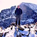
 Me on the ridge (photo by Unclegar)")
 Ascending Fairchild")
 Desolation Peaks")
 Unclegar descending Fairchild")
 Hagues and Mummy")
 Unclegar ascending Hagues with Crystal lakes in the background")
 Signing the register on Hagues, smoke from the Cow Creek fire in the distance")
 Rowe Glacier and Lake")
 Note: \"Gibralter Mountain\" Not Rowe Mountain!")
 Cow Creek Fire")
 Lawn Lake from Mummy Mountain")
 the last of our daylight on Mummy Mountain")