If you're embarking on your first climb of a 14er, start by reviewing the Climbing 14ers: Getting Started guide. It's best to begin with one of the easier 14ers, though "easier" is a relative term as every 14er demands good physical fitness. The easier climbs are shorter in distance and have a trail all or most of the way to the summit. While some hikers may attempt a more challenging peak like Longs Peak right away, this is not recommended. Build your skills and endurance by tackling less demanding peaks first. It's important to understand how your body reacts to long hikes at high altitude before attempting a peak as challenging as Longs.
So, here's a list of the easiest 14er routes. They have trails, are fairly short, and the hiking is about as easy as you're going to find on a Colorado 14er. Each route is assigned a difficulty rating with CLASS 1 being the easiest because they have a defined trail all the way to the summit. Check out the complete guidebook of 14er routes here on 14ers.com.
|
Routes |
Difficulty |
Gain |
Round-Trip
Distance |
|
Grays Peak: North Slopes |
Class 1 |
3,000' |
7.5 mi |
|
Torreys Peak: South Slopes |
Class 1 |
3,000' |
7.75 mi |
|
Quandary Peak: East Ridge |
Class 1 |
3,450' |
6.75 mi |
|
Combo: Grays and Torreys |
Class 1 |
3,600' |
8.25 mi |
|
Handies Peak: Southwest Slopes |
Class 1 |
2,500' |
5.75 mi |
|
Mt. Sherman: Southwest Ridge |
Class 1 |
2,100' |
5.25 mi |
|
Mt. Bierstadt: West Slopes |
Class 2 |
2,850' |
7.25 mi |
|
Huron Peak: Northwest Slopes |
Class 2 |
3,500' |
7 mi |
| |
A bit more difficult/longer: |
|
|
|
|
Mt. Elbert: Northeast Ridge |
Class 1 |
4,500' |
9.75 mi |
|
San Luis Peak: Northeast Ridge |
Class 1 |
3,600' |
13.5 mi |
When selecting a route from the list above or exploring other routes, it’s essential to evaluate the Overall Difficulty of the route. There are several factors to take into account, so let’s break down the elements that contribute to the overall difficulty of a 14er route:
- Difficulty Rating: The most important thing to keep in mind when your starting out is Class 1 and Class 2 are hikes, where you're walking. The terrain might be rough on a Class 2 route, but you're still gaining ground using your legs albeit on some steeper or more-rugged terrain, possibly without a trail. This requires more time and effort.
- Distance: A hike under 8 miles roundtrip is considered relatively short. If you want to hike a longer one, like Mt. Elbert, make sure you've trained well enough to have the required endurance. If you're in very good physical shape and have a few hikes under your belt, you could tackle Pikes Peak's - East Ridge route which is 24 miles roundtrip. Yikes!
- Elevation Gain: Only after a few hikes will you determine how much elevation gain your body can tolerate. You'll also get an idea of how much gain you climb per hour, allowing you to better estimate the time required on future hikes. A route with less than 3,000 feet of gain means you're parking higher and it should be a relatively short hike. On routes with 4,000+ feet of gain, you need to be in good shape.
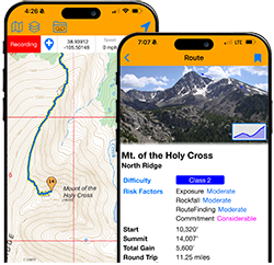
- Risk Factors: Once you progress past a few of the easiest 14ers, there are risk factors that come into play. Pay close attention to these as you beyond the easiest Class 2 routes. If you get to Class 3 or Class 4 routes, evaluating the risk factors is critical:
- Exposure: Exposure is the empty space below you that could result in injury or death if you fall. If you're "afraid of heights," the exposure risk might be an important factor when selecting a route. A LOW exposure route would be walking up the standard trail on Quandary peak. HIGH exposure is crossing the knife-edge on Capitol Peak. EXTREME exposure is climbing the final wall after traversing from Crestone Peak to Crestone Needle.
- Rockfall: Is there a risk of rockfall or instability along the route? Walking up a Class 1 trail would likely have a LOW rockfall risk, but climbing Maroon Peak or Little Bear Peak has High risk of dangerous rockfall.
- Route-Finding: How big is the risk of getting off-route due to a lack of trail, confusing terrain, misplaced cairns, etc.?
- Commitment: How big is the commitment to get to the summit? Are there complex sections high on the mountain that require a lot of time on your ascent AND descent? If so, the risk of getting caught in bad weather or without adequate supplies is higher. For Example, Capitol Peak's standard route has been given an EXTREME commitment rating because once you're past K2 and working you're way closer to the summit, there's no escape from the ridge and you're a long way away from flat terrain and tree line. If weather rolls in when you're climbing high on Capitol, you're in trouble and the only way back is via the same route.