| Elk |
 |
Castle Peak
North Face Couloir
Range: Elk
Difficulty: Difficult Class 2 Moderate Snow
RT Distance: 13
Elevation Gain: 4,600', Grade: 13.40%
|
Diff. Class 2 |
13mi |
4,600' |
13.40% |
 |
Considerable Exposure: Considerable
Rockfall Potential: Considerable
Route-Finding: Moderate
Commitment: Moderate
|
Elk,,Castle Peak,North Face Couloir,Difficult Class 2,Moderate Snow,13.00,4600,13.40,Considerable,Considerable,Moderate,Moderate,,https://www.14ers.com/route.php?route=cast3 |
| Elk |
|
Castle Peak
Northwest Ridge
Range: Elk
Difficulty: Difficult Class 2 Moderate Snow
RT Distance: 13.5
Elevation Gain: 4,600', Grade: 12.91%
|
Diff. Class 2 |
13.5mi |
4,600' |
12.91% |
|
Considerable Exposure: Considerable
Rockfall Potential: Considerable
Route-Finding: Moderate
Commitment: Moderate
|
Elk,,Castle Peak,Northwest Ridge,Difficult Class 2,Moderate Snow,13.50,4600,12.91,Considerable,Considerable,Moderate,Moderate,,https://www.14ers.com/route.php?route=cast2 |
| Elk |
|
Castle Peak
Northeast Ridge
Range: Elk
Difficulty: Difficult Class 2
RT Distance: 13.5
Elevation Gain: 4,600', Grade: 12.91%
|
Diff. Class 2 |
13.5mi |
4,600' |
12.91% |
|
Considerable Exposure: Considerable
Rockfall Potential: Considerable
Route-Finding: Considerable
Commitment: Considerable
|
Elk,Standard,Castle Peak,Northeast Ridge,Difficult Class 2,,13.50,4600,12.91,Considerable,Considerable,Considerable,Considerable,,https://www.14ers.com/route.php?route=cast1 |
| Elk |
|
Conundrum Peak
South Ridge
Range: Elk
Difficulty: Difficult Class 2
RT Distance: 13.5
Elevation Gain: 4,400', Grade: 12.35%
|
Diff. Class 2 |
13.5mi |
4,400' |
12.35% |
|
Considerable Exposure: Considerable
Rockfall Potential: Considerable
Route-Finding: Moderate
Commitment: Moderate
|
Elk,Standard,Conundrum Peak,South Ridge,Difficult Class 2,,13.50,4400,12.35,Considerable,Considerable,Moderate,Moderate,,https://www.14ers.com/route.php?route=conu1 |
| Elk |
|
Combination Route
Castle and Conundrum
Range: Elk
Difficulty: Difficult Class 2
RT Distance: 14.5
Elevation Gain: 4,850', Grade: 12.67%
|
Diff. Class 2 |
14.5mi |
4,850' |
12.67% |
|
Considerable Exposure: Considerable
Rockfall Potential: Considerable
Route-Finding: Considerable
Commitment: Considerable
|
Elk,Standard,Combo),Castle and Conundrum,Difficult Class 2,,14.50,4850,12.67,Considerable,Considerable,Considerable,Considerable,,https://www.14ers.com/route.php?route=cast4 |
| Elk |
|
Snowmass Mountain
West Slope
Range: Elk
Difficulty: Class 3
RT Distance: 9
Elevation Gain: 4,500', Grade: 18.94%
|
Class 3 |
9mi |
4,500' |
18.94% |
 |
High Exposure: High
Rockfall Potential: High
Route-Finding: High
Commitment: High
|
Elk,,Snowmass Mountain,West Slope,Class 3,,9.00,4500,18.94,High,High,High,High,,https://www.14ers.com/route.php?route=snow2 |
| Elk |
|
Conundrum Peak
Conundrum Couloir
Range: Elk
Difficulty: Class 3 Steep Snow
RT Distance: 12
Elevation Gain: 4,400', Grade: 13.89%
|
Class 3 |
12mi |
4,400' |
13.89% |
|
High Exposure: High
Rockfall Potential: Considerable
Route-Finding: Moderate
Commitment: Considerable
|
Elk,,Conundrum Peak,Conundrum Couloir,Class 3,Steep Snow,12.00,4400,13.89,High,Considerable,Moderate,Considerable,,https://www.14ers.com/route.php?route=conu5 |
| Elk |
|
Maroon Peak
South Ridge
Range: Elk
Difficulty: Class 3
RT Distance: 12
Elevation Gain: 4,800', Grade: 15.15%
|
Class 3 |
12mi |
4,800' |
15.15% |
 |
Extreme Exposure: High
Rockfall Potential: High
Route-Finding: Extreme
Commitment: Extreme
|
Elk,Standard,Maroon Peak,South Ridge,Class 3,,12.00,4800,15.15,High,High,Extreme,Extreme,,https://www.14ers.com/route.php?route=maro1 |
| Elk |
|
Snowmass Mountain
East Slopes
Range: Elk
Difficulty: Class 3
RT Distance: 22
Elevation Gain: 5,800', Grade: 9.99%
|
Class 3 |
22mi |
5,800' |
9.99% |
 |
High Exposure: High
Rockfall Potential: Considerable
Route-Finding: Considerable
Commitment: High
|
Elk,Standard,Snowmass Mountain,East Slopes,Class 3,,22.00,5800,9.99,High,Considerable,Considerable,High,,https://www.14ers.com/route.php?route=snow1 |
| Elk |
|
Maroon Peak
Bell Cord Couloir
Range: Elk
Difficulty: Class 4 Steep Snow
RT Distance: 8
Elevation Gain: 4,556', Grade: 21.57%
|
Class 4 |
8mi |
4,556' |
21.57% |
|
High Exposure: High
Rockfall Potential: High
Route-Finding: High
Commitment: High
|
Elk,,Maroon Peak,Bell Cord Couloir,Class 4,Steep Snow,8.00,4556,21.57,High,High,High,High,,https://www.14ers.com/route.php?route=maro3 |
| Elk |
|
Pyramid Peak
Northeast Ridge
Range: Elk
Difficulty: Class 4
RT Distance: 8.25
Elevation Gain: 4,500', Grade: 20.66%
|
Class 4 |
8.25mi |
4,500' |
20.66% |
|
High Exposure: High
Rockfall Potential: High
Route-Finding: High
Commitment: High
|
Elk,Standard,Pyramid Peak,Northeast Ridge,Class 4,,8.25,4500,20.66,High,High,High,High,,https://www.14ers.com/route.php?route=pyra1 |
| Elk |
|
North Maroon Peak
Northeast Ridge
Range: Elk
Difficulty: Class 4
RT Distance: 9.25
Elevation Gain: 4,600', Grade: 18.84%
|
Class 4 |
9.25mi |
4,600' |
18.84% |
|
High Exposure: High
Rockfall Potential: High
Route-Finding: High
Commitment: High
|
Elk,Standard,North Maroon Peak,Northeast Ridge,Class 4,,9.25,4600,18.84,High,High,High,High,,https://www.14ers.com/route.php?route=nmar2 |
| Elk |
|
Capitol Peak
Northeast Ridge
Range: Elk
Difficulty: Class 4
RT Distance: 17
Elevation Gain: 5,300', Grade: 11.81%
|
Class 4 |
17mi |
5,300' |
11.81% |
 |
Extreme Exposure: High
Rockfall Potential: High
Route-Finding: High
Commitment: Extreme
|
Elk,Standard,Capitol Peak,Northeast Ridge,Class 4,,17.00,5300,11.81,High,High,High,Extreme,,https://www.14ers.com/route.php?route=capi1 |
| Elk |
|
Combination Route
Bells Traverse
Range: Elk
Difficulty: Class 5
RT Distance: 9.5
Elevation Gain: 4,850', Grade: 19.34%
|
Class 5 |
9.5mi |
4,850' |
19.34% |
|
Extreme Exposure: Extreme
Rockfall Potential: High
Route-Finding: Extreme
Commitment: Extreme
|
Elk,,Combo),Bells Traverse,Class 5,,9.50,4850,19.34,Extreme,High,Extreme,Extreme,,https://www.14ers.com/route.php?route=nmar4 |
| Front |
|
Grays Peak
North Slopes
Range: Front
Difficulty: Class 1
RT Distance: 7.5
Elevation Gain: 3,000', Grade: 15.15%
|
Class 1 |
7.5mi |
3,000' |
15.15% |
 |
Low Exposure: Low
Rockfall Potential: Low
Route-Finding: Low
Commitment: Low
|
Front,Standard,Grays Peak,North Slopes,Class 1,,7.50,3000,15.15,Low,Low,Low,Low,,https://www.14ers.com/route.php?route=gray1 |
| Front |
|
Torreys Peak
South Slopes
Range: Front
Difficulty: Class 1
RT Distance: 7.75
Elevation Gain: 3,000', Grade: 14.66%
|
Class 1 |
7.75mi |
3,000' |
14.66% |
|
Low Exposure: Low
Rockfall Potential: Low
Route-Finding: Low
Commitment: Low
|
Front,Standard,Torreys Peak,South Slopes,Class 1,,7.75,3000,14.66,Low,Low,Low,Low,,https://www.14ers.com/route.php?route=torr2 |
| Front |
|
Combination Route
Grays and Torreys
Range: Front
Difficulty: Class 1
RT Distance: 8.25
Elevation Gain: 3,600', Grade: 16.53%
|
Class 1 |
8.25mi |
3,600' |
16.53% |
|
Moderate Exposure: Low
Rockfall Potential: Low
Route-Finding: Low
Commitment: Moderate
|
Front,Standard,Combo),Grays and Torreys,Class 1,,8.25,3600,16.53,Low,Low,Low,Moderate,,https://www.14ers.com/route.php?route=torr5 |
| Front |
|
Pikes Peak
East Slopes
Range: Front
Difficulty: Class 1
RT Distance: 24
Elevation Gain: 7,600', Grade: 11.99%
|
Class 1 |
24mi |
7,600' |
11.99% |
|
Moderate Exposure: Low
Rockfall Potential: Low
Route-Finding: Low
Commitment: Moderate
|
Front,Standard,Pikes Peak,East Slopes,Class 1,,24.00,7600,11.99,Low,Low,Low,Moderate,,https://www.14ers.com/route.php?route=pikeeast |
| Front |
|
Mt. Blue Sky
West Ridge from Summit Lake
Range: Front
Difficulty: Class 2
RT Distance: 5.5
Elevation Gain: 2,000', Grade: 13.77%
|
Class 2 |
5.5mi |
2,000' |
13.77% |
|
Moderate Exposure: Moderate
Rockfall Potential: Moderate
Route-Finding: Moderate
Commitment: Moderate
|
Front,Standard,Mt. Blue Sky,West Ridge from Summit Lake,Class 2,,5.50,2000,13.77,Moderate,Moderate,Moderate,Moderate,,https://www.14ers.com/route.php?route=evan2 |
| Front |
|
Grays Peak
South Ridge
Range: Front
Difficulty: Class 2
RT Distance: 6.5
Elevation Gain: 3,250', Grade: 18.94%
|
Class 2 |
6.5mi |
3,250' |
18.94% |
|
Moderate Exposure: Moderate
Rockfall Potential: Moderate
Route-Finding: Moderate
Commitment: Moderate
|
Front,,Grays Peak,South Ridge,Class 2,,6.50,3250,18.94,Moderate,Moderate,Moderate,Moderate,,https://www.14ers.com/route.php?route=gray3 |
| Front |
|
Mt. Bierstadt
West Slopes
Range: Front
Difficulty: Class 2
RT Distance: 7.25
Elevation Gain: 2,850', Grade: 14.89%
|
Class 2 |
7.25mi |
2,850' |
14.89% |
|
Moderate Exposure: Low
Rockfall Potential: Moderate
Route-Finding: Low
Commitment: Low
|
Front,Standard,Mt. Bierstadt,West Slopes,Class 2,,7.25,2850,14.89,Low,Moderate,Low,Low,,https://www.14ers.com/route.php?route=bier1 |
| Front |
|
Mt. Blue Sky
West Ridge from Guanella Pass
Range: Front
Difficulty: Class 2
RT Distance: 9.25
Elevation Gain: 3,100', Grade: 12.69%
|
Class 2 |
9.25mi |
3,100' |
12.69% |
|
Considerable Exposure: Moderate
Rockfall Potential: Considerable
Route-Finding: Considerable
Commitment: Considerable
|
Front,,Mt. Blue Sky,West Ridge from Guanella Pass,Class 2,,9.25,3100,12.69,Moderate,Considerable,Considerable,Considerable,,https://www.14ers.com/route.php?route=evan3 |
| Front |
|
Torreys Peak
West Ridge
Range: Front
Difficulty: Class 2
RT Distance: 10
Elevation Gain: 5,500', Grade: 20.83%
|
Class 2 |
10mi |
5,500' |
20.83% |
|
Considerable Exposure: Moderate
Rockfall Potential: Moderate
Route-Finding: Moderate
Commitment: Considerable
|
Front,,Torreys Peak,West Ridge,Class 2,,10.00,5500,20.83,Moderate,Moderate,Moderate,Considerable,,https://www.14ers.com/route.php?route=torr11 |
| Front |
|
Grays Peak
Southwest Ridge
Range: Front
Difficulty: Class 2
RT Distance: 10.25
Elevation Gain: 3,800', Grade: 14.04%
|
Class 2 |
10.25mi |
3,800' |
14.04% |
|
Moderate Exposure: Moderate
Rockfall Potential: Moderate
Route-Finding: Moderate
Commitment: Moderate
|
Front,,Grays Peak,Southwest Ridge,Class 2,,10.25,3800,14.04,Moderate,Moderate,Moderate,Moderate,,https://www.14ers.com/route.php?route=gray8 |
| Front |
|
Pikes Peak
Northwest Slopes
Range: Front
Difficulty: Class 2
RT Distance: 14
Elevation Gain: 4,300', Grade: 11.63%
|
Class 2 |
14mi |
4,300' |
11.63% |
|
Moderate Exposure: Low
Rockfall Potential: Moderate
Route-Finding: Low
Commitment: Moderate
|
Front,,Pikes Peak,Northwest Slopes,Class 2,,14.00,4300,11.63,Low,Moderate,Low,Moderate,,https://www.14ers.com/route.php?route=pike1 |
| Front |
|
Mt. Bierstadt
South Ridge
Range: Front
Difficulty: Class 2
RT Distance: 14.25
Elevation Gain: 4,500', Grade: 11.96%
|
Class 2 |
14.25mi |
4,500' |
11.96% |
|
Considerable Exposure: Moderate
Rockfall Potential: Moderate
Route-Finding: Considerable
Commitment: Moderate
|
Front,,Mt. Bierstadt,South Ridge,Class 2,,14.25,4500,11.96,Moderate,Moderate,Considerable,Moderate,,https://www.14ers.com/route.php?route=bier6 |
| Front |
|
Mt. Blue Sky
West Ridge from Echo Lake
Range: Front
Difficulty: Class 2
RT Distance: 17
Elevation Gain: 5,600', Grade: 12.48%
|
Class 2 |
17mi |
5,600' |
12.48% |
|
Considerable Exposure: Moderate
Rockfall Potential: Moderate
Route-Finding: Moderate
Commitment: Considerable
|
Front,,Mt. Blue Sky,West Ridge from Echo Lake,Class 2,,17.00,5600,12.48,Moderate,Moderate,Moderate,Considerable,,https://www.14ers.com/route.php?route=evan1 |
| Front |
|
Torreys Peak
NW Face/Tuning Fork
Range: Front
Difficulty: Difficult Class 2 Moderate Snow
RT Distance: 10.5
Elevation Gain: 4,500', Grade: 16.23%
|
Diff. Class 2 |
10.5mi |
4,500' |
16.23% |
|
Considerable Exposure: Moderate
Rockfall Potential: Considerable
Route-Finding: Considerable
Commitment: Considerable
|
Front,,Torreys Peak,NW Face/Tuning Fork,Difficult Class 2,Moderate Snow,10.50,4500,16.23,Moderate,Considerable,Considerable,Considerable,,https://www.14ers.com/route.php?route=torr9 |
| Front |
|
Mt. Blue Sky
North Face Moderate
Range: Front
Difficulty: Class 3 Moderate Snow
RT Distance: 2
Elevation Gain: 1,500', Grade: 28.41%
|
Class 3 |
2mi |
1,500' |
28.41% |
|
Considerable Exposure: Considerable
Rockfall Potential: Considerable
Route-Finding: Low
Commitment: Moderate
|
Front,,Mt. Blue Sky,North Face Moderate,Class 3,Moderate Snow,2.00,1500,28.41,Considerable,Considerable,Low,Moderate,,https://www.14ers.com/route.php?route=evan7 |
| Front |
|
Mt. Blue Sky
North Face Steep
Range: Front
Difficulty: Class 3 Steep Snow
RT Distance: 2
Elevation Gain: 1,500', Grade: 28.41%
|
Class 3 |
2mi |
1,500' |
28.41% |
|
High Exposure: High
Rockfall Potential: Considerable
Route-Finding: Moderate
Commitment: Moderate
|
Front,,Mt. Blue Sky,North Face Steep,Class 3,Steep Snow,2.00,1500,28.41,High,Considerable,Moderate,Moderate,,https://www.14ers.com/route.php?route=evan8 |
| Front |
|
Mt. Bierstadt
East Ridge
Range: Front
Difficulty: Class 3
RT Distance: 5
Elevation Gain: 3,000', Grade: 22.73%
|
Class 3 |
5mi |
3,000' |
22.73% |
|
Considerable Exposure: Considerable
Rockfall Potential: Considerable
Route-Finding: Considerable
Commitment: Considerable
|
Front,,Mt. Bierstadt,East Ridge,Class 3,,5.00,3000,22.73,Considerable,Considerable,Considerable,Considerable,,https://www.14ers.com/route.php?route=bier3 |
| Front |
|
Mt. Blue Sky
West Gully
Range: Front
Difficulty: Class 3 Steep Snow
RT Distance: 5.25
Elevation Gain: 1,650', Grade: 11.90%
|
Class 3 |
5.25mi |
1,650' |
11.90% |
|
High Exposure: High
Rockfall Potential: Considerable
Route-Finding: Moderate
Commitment: Moderate
|
Front,,Mt. Blue Sky,West Gully,Class 3,Steep Snow,5.25,1650,11.90,High,Considerable,Moderate,Moderate,,https://www.14ers.com/route.php?route=evan4 |
| Front |
|
Combination Route
Tour de Abyss Loop
Range: Front
Difficulty: Class 3
RT Distance: 5.75
Elevation Gain: 3,000', Grade: 19.76%
|
Class 3 |
5.75mi |
3,000' |
19.76% |
|
High Exposure: Considerable
Rockfall Potential: Considerable
Route-Finding: Considerable
Commitment: High
|
Front,,Combo),Tour de Abyss Loop,Class 3,,5.75,3000,19.76,Considerable,Considerable,Considerable,High,,https://www.14ers.com/route.php?route=bier5 |
| Front |
|
Torreys Peak
Dead Dog Couloir
Range: Front
Difficulty: Class 3 Steep Snow
RT Distance: 6
Elevation Gain: 3,000', Grade: 18.94%
|
Class 3 |
6mi |
3,000' |
18.94% |
|
Considerable Exposure: Considerable
Rockfall Potential: Considerable
Route-Finding: Moderate
Commitment: Considerable
|
Front,,Torreys Peak,Dead Dog Couloir,Class 3,Steep Snow,6.00,3000,18.94,Considerable,Considerable,Moderate,Considerable,,https://www.14ers.com/route.php?route=torr7 |
| Front |
|
Grays Peak
Lost Rat Couloir
Range: Front
Difficulty: Class 3 Steep Snow
RT Distance: 6.5
Elevation Gain: 3,000', Grade: 17.48%
|
Class 3 |
6.5mi |
3,000' |
17.48% |
|
Considerable Exposure: Considerable
Rockfall Potential: Considerable
Route-Finding: Moderate
Commitment: Considerable
|
Front,,Grays Peak,Lost Rat Couloir,Class 3,Steep Snow,6.50,3000,17.48,Considerable,Considerable,Moderate,Considerable,,https://www.14ers.com/route.php?route=gray6 |
| Front |
|
Torreys Peak
Kelso Ridge
Range: Front
Difficulty: Class 3
RT Distance: 6.75
Elevation Gain: 3,100', Grade: 17.40%
|
Class 3 |
6.75mi |
3,100' |
17.40% |
|
High Exposure: High
Rockfall Potential: Considerable
Route-Finding: Considerable
Commitment: Considerable
|
Front,,Torreys Peak,Kelso Ridge,Class 3,,6.75,3100,17.40,High,Considerable,Considerable,Considerable,,https://www.14ers.com/route.php?route=torr4 |
| Front |
|
Torreys Peak
Emperor Couloir
Range: Front
Difficulty: Class 3 Steep Snow
RT Distance: 9.5
Elevation Gain: 4,500', Grade: 17.94%
|
Class 3 |
9.5mi |
4,500' |
17.94% |
|
Considerable Exposure: Considerable
Rockfall Potential: Considerable
Route-Finding: Considerable
Commitment: Considerable
|
Front,,Torreys Peak,Emperor Couloir,Class 3,Steep Snow,9.50,4500,17.94,Considerable,Considerable,Considerable,Considerable,,https://www.14ers.com/route.php?route=torr10 |
| Front |
|
Combination Route
Bierstadt, Sawtooth, Blue Sky
Range: Front
Difficulty: Class 3
RT Distance: 10.5
Elevation Gain: 3,900', Grade: 14.07%
|
Class 3 |
10.5mi |
3,900' |
14.07% |
|
High Exposure: Considerable
Rockfall Potential: Considerable
Route-Finding: Considerable
Commitment: High
|
Front,Standard,Combo),Bierstadt+Sawtooth+Blue Sky,Class 3,,10.50,3900,14.07,Considerable,Considerable,Considerable,High,,https://www.14ers.com/route.php?route=bier4 |
| Front |
|
Longs Peak
Loft Route
Range: Front
Difficulty: Class 3
RT Distance: 13
Elevation Gain: 5,300', Grade: 15.44%
|
Class 3 |
13mi |
5,300' |
15.44% |
|
High Exposure: High
Rockfall Potential: Considerable
Route-Finding: High
Commitment: High
|
Front,,Longs Peak,Loft Route,Class 3,,13.00,5300,15.44,High,Considerable,High,High,,https://www.14ers.com/route.php?route=long2 |
| Front |
|
Longs Peak
Keyhole Route
Range: Front
Difficulty: Class 3
RT Distance: 14.5
Elevation Gain: 5,100', Grade: 13.32%
|
Class 3 |
14.5mi |
5,100' |
13.32% |
|
High Exposure: High
Rockfall Potential: Considerable
Route-Finding: Considerable
Commitment: High
|
Front,Standard,Longs Peak,Keyhole Route,Class 3,,14.50,5100,13.32,High,Considerable,Considerable,High,,https://www.14ers.com/route.php?route=long1 |
| Front |
|
Longs Peak
Keplinger Couloir
Range: Front
Difficulty: Class 3
RT Distance: 16
Elevation Gain: 5,900', Grade: 13.97%
|
Class 3 |
16mi |
5,900' |
13.97% |
|
High Exposure: High
Rockfall Potential: Considerable
Route-Finding: Considerable
Commitment: Considerable
|
Front,,Longs Peak,Keplinger Couloir,Class 3,,16.00,5900,13.97,High,Considerable,Considerable,Considerable,,https://www.14ers.com/route.php?route=long5 |
| Mosquito |
|
Mt. Sherman
West Slopes
Range: Mosquito
Difficulty: Class 1
RT Distance: 4.5
Elevation Gain: 2,150', Grade: 18.10%
|
Class 1 |
4.5mi |
2,150' |
18.10% |
|
Moderate Exposure: Moderate
Rockfall Potential: Moderate
Route-Finding: Low
Commitment: Low
|
Mosquito,,Mt. Sherman,West Slopes,Class 1,,4.50,2150,18.10,Moderate,Moderate,Low,Low,,https://www.14ers.com/route.php?route=sher2 |
| Mosquito |
|
Mt. Sherman
Southwest Ridge
Range: Mosquito
Difficulty: Class 1
RT Distance: 5.25
Elevation Gain: 2,100', Grade: 15.15%
|
Class 1 |
5.25mi |
2,100' |
15.15% |
|
Moderate Exposure: Moderate
Rockfall Potential: Moderate
Route-Finding: Low
Commitment: Low
|
Mosquito,Standard,Mt. Sherman,Southwest Ridge,Class 1,,5.25,2100,15.15,Moderate,Moderate,Low,Low,,https://www.14ers.com/route.php?route=sher1 |
| Mosquito |
|
Mt. Bross
East Slopes
Range: Mosquito
Difficulty: Class 1
RT Distance: 9
Elevation Gain: 2,900', Grade: 12.21%
|
Class 1 |
9mi |
2,900' |
12.21% |
|
Low Exposure: Low
Rockfall Potential: Low
Route-Finding: Low
Commitment: Low
|
Mosquito,,Mt. Bross,East Slopes,Class 1,,9.00,2900,12.21,Low,Low,Low,Low,,https://www.14ers.com/route.php?route=bros1 |
| Mosquito |
|
Mt. Bross
West Slopes
Range: Mosquito
Difficulty: Class 2
RT Distance: 3.25
Elevation Gain: 2,250', Grade: 26.22%
|
Class 2 |
3.25mi |
2,250' |
26.22% |
|
Moderate Exposure: Moderate
Rockfall Potential: Moderate
Route-Finding: Low
Commitment: Low
|
Mosquito,Standard,Mt. Bross,West Slopes,Class 2,,3.25,2250,26.22,Moderate,Moderate,Low,Low,,https://www.14ers.com/route.php?route=bros2 |
| Mosquito |
|
Mt. Democrat
East Slope
Range: Mosquito
Difficulty: Class 2
RT Distance: 4
Elevation Gain: 2,150', Grade: 20.36%
|
Class 2 |
4mi |
2,150' |
20.36% |
|
Moderate Exposure: Moderate
Rockfall Potential: Moderate
Route-Finding: Low
Commitment: Low
|
Mosquito,Standard,Mt. Democrat,East Slope,Class 2,,4.00,2150,20.36,Moderate,Moderate,Low,Low,,https://www.14ers.com/route.php?route=demo1 |
| Mosquito |
|
Mt. Bross
Dolly Varden Gully
Range: Mosquito
Difficulty: Class 2 Easy Snow
RT Distance: 4
Elevation Gain: 2,900', Grade: 27.46%
|
Class 2 |
4mi |
2,900' |
27.46% |
|
Moderate Exposure: Low
Rockfall Potential: Moderate
Route-Finding: Moderate
Commitment: Moderate
|
Mosquito,,Mt. Bross,Dolly Varden Gully,Class 2,Easy Snow,4.00,2900,27.46,Low,Moderate,Moderate,Moderate,,https://www.14ers.com/route.php?route=bros4 |
| Mosquito |
|
Mt. Cameron
West Ridge
Range: Mosquito
Difficulty: Class 2
RT Distance: 4.75
Elevation Gain: 2,250', Grade: 17.94%
|
Class 2 |
4.75mi |
2,250' |
17.94% |
|
Moderate Exposure: Moderate
Rockfall Potential: Moderate
Route-Finding: Low
Commitment: Low
|
Mosquito,Standard,Mt. Cameron,West Ridge,Class 2,,4.75,2250,17.94,Moderate,Moderate,Low,Low,,https://www.14ers.com/route.php?route=came1 |
| Mosquito |
|
Mt. Lincoln
Lincoln Amphitheater
Range: Mosquito
Difficulty: Class 2
RT Distance: 4.75
Elevation Gain: 3,400', Grade: 27.11%
|
Class 2 |
4.75mi |
3,400' |
27.11% |
|
Considerable Exposure: Moderate
Rockfall Potential: Considerable
Route-Finding: Moderate
Commitment: Moderate
|
Mosquito,,Mt. Lincoln,Lincoln Amphitheater,Class 2,,4.75,3400,27.11,Moderate,Considerable,Moderate,Moderate,,https://www.14ers.com/route.php?route=linc2 |
| Mosquito |
|
Mt. Lincoln
West Ridge
Range: Mosquito
Difficulty: Class 2
RT Distance: 6
Elevation Gain: 2,600', Grade: 16.41%
|
Class 2 |
6mi |
2,600' |
16.41% |
|
Moderate Exposure: Moderate
Rockfall Potential: Moderate
Route-Finding: Low
Commitment: Low
|
Mosquito,Standard,Mt. Lincoln,West Ridge,Class 2,,6.00,2600,16.41,Moderate,Moderate,Low,Low,,https://www.14ers.com/route.php?route=linc1 |
| Mosquito |
|
Mt. Lincoln
East Slopes
Range: Mosquito
Difficulty: Class 2
RT Distance: 6.5
Elevation Gain: 2,650', Grade: 15.44%
|
Class 2 |
6.5mi |
2,650' |
15.44% |
|
Moderate Exposure: Low
Rockfall Potential: Moderate
Route-Finding: Low
Commitment: Low
|
Mosquito,,Mt. Lincoln,East Slopes,Class 2,,6.50,2650,15.44,Low,Moderate,Low,Low,,https://www.14ers.com/route.php?route=linc3 |
| Mosquito |
|
Combination Route
Decalibron
Range: Mosquito
Difficulty: Class 2
RT Distance: 7.5
Elevation Gain: 3,500', Grade: 17.68%
|
Class 2 |
7.5mi |
3,500' |
17.68% |
|
Moderate Exposure: Moderate
Rockfall Potential: Moderate
Route-Finding: Low
Commitment: Moderate
|
Mosquito,Standard,Combo),Decalibron,Class 2,,7.50,3500,17.68,Moderate,Moderate,Low,Moderate,,https://www.14ers.com/route.php?route=bros6 |
| Mosquito |
|
Mt. Sherman
South Slope
Range: Mosquito
Difficulty: Class 2 Easy Snow
RT Distance: 8.5
Elevation Gain: 3,100', Grade: 13.81%
|
Class 2 |
8.5mi |
3,100' |
13.81% |
|
Moderate Exposure: Low
Rockfall Potential: Moderate
Route-Finding: Moderate
Commitment: Moderate
|
Mosquito,,Mt. Sherman,South Slope,Class 2,Easy Snow,8.50,3100,13.81,Low,Moderate,Moderate,Moderate,,https://www.14ers.com/route.php?route=sher3 |
| Mosquito |
|
Mt. Bross
S Gully
Range: Mosquito
Difficulty: Class 2 Easy Snow
RT Distance: 9.5
Elevation Gain: 2,600', Grade: 10.37%
|
Class 2 |
9.5mi |
2,600' |
10.37% |
|
Moderate Exposure: Moderate
Rockfall Potential: Moderate
Route-Finding: Moderate
Commitment: Moderate
|
Mosquito,,Mt. Bross,S Gully,Class 2,Easy Snow,9.50,2600,10.37,Moderate,Moderate,Moderate,Moderate,,https://www.14ers.com/route.php?route=bros3 |
| Mosquito |
|
Mt. Democrat
South Slope
Range: Mosquito
Difficulty: Difficult Class 2 Moderate Snow
RT Distance: 2.5
Elevation Gain: 2,150', Grade: 32.58%
|
Diff. Class 2 |
2.5mi |
2,150' |
32.58% |
|
Considerable Exposure: Considerable
Rockfall Potential: Moderate
Route-Finding: Considerable
Commitment: Moderate
|
Mosquito,,Mt. Democrat,South Slope,Difficult Class 2,Moderate Snow,2.50,2150,32.58,Considerable,Moderate,Considerable,Moderate,,https://www.14ers.com/route.php?route=demo2 |
| San Juan |
|
Handies Peak
Southwest Slopes
Range: San Juan
Difficulty: Class 1
RT Distance: 5.75
Elevation Gain: 2,500', Grade: 16.47%
|
Class 1 |
5.75mi |
2,500' |
16.47% |
|
Moderate Exposure: Moderate
Rockfall Potential: Low
Route-Finding: Low
Commitment: Low
|
San Juan,Standard,Handies Peak,Southwest Slopes,Class 1,,5.75,2500,16.47,Moderate,Low,Low,Low,,https://www.14ers.com/route.php?route=hand1 |
| San Juan |
|
Approach Route
Kilpacker Approach
Range: San Juan
Difficulty: Class 1
RT Distance: 6
Elevation Gain: 800', Grade: 5.05%
|
Class 1 |
6mi |
800' |
5.05% |
|
Low Exposure: Low
Rockfall Potential: Low
Route-Finding: Low
Commitment: Low
|
San Juan,,Approach),Kilpacker Approach,Class 1,,6.00,800,5.05,Low,Low,Low,Low,,https://www.14ers.com/route.php?route=kilp0 |
| San Juan |
|
Approach Route
Rock of Ages Approach
Range: San Juan
Difficulty: Class 1
RT Distance: 8.5
Elevation Gain: 2,800', Grade: 12.48%
|
Class 1 |
8.5mi |
2,800' |
12.48% |
|
Moderate Exposure: Moderate
Rockfall Potential: Low
Route-Finding: Low
Commitment: Low
|
San Juan,,Approach),Rock of Ages Approach,Class 1,,8.50,2800,12.48,Moderate,Low,Low,Low,,https://www.14ers.com/route.php?route=silv0 |
| San Juan |
|
Approach Route
Woods Lake Approach
Range: San Juan
Difficulty: Class 1
RT Distance: 9
Elevation Gain: 2,115', Grade: 8.90%
|
Class 1 |
9mi |
2,115' |
8.90% |
|
Low Exposure: Low
Rockfall Potential: Low
Route-Finding: Low
Commitment: Low
|
San Juan,,Approach),Woods Lake Approach,Class 1,,9.00,2115,8.90,Low,Low,Low,Low,,https://www.14ers.com/route.php?route=wood0 |
| San Juan |
|
Approach Route
Navajo Lake Approach
Range: San Juan
Difficulty: Class 1
RT Distance: 9.5
Elevation Gain: 2,000', Grade: 7.97%
|
Class 1 |
9.5mi |
2,000' |
7.97% |
|
Low Exposure: Low
Rockfall Potential: Low
Route-Finding: Low
Commitment: Low
|
San Juan,,Approach),Navajo Lake Approach,Class 1,,9.50,2000,7.97,Low,Low,Low,Low,,https://www.14ers.com/route.php?route=nava0 |
| San Juan |
|
San Luis Peak
South Ridge
Range: San Juan
Difficulty: Class 1
RT Distance: 11.25
Elevation Gain: 3,400', Grade: 11.45%
|
Class 1 |
11.25mi |
3,400' |
11.45% |
|
Moderate Exposure: Low
Rockfall Potential: Moderate
Route-Finding: Moderate
Commitment: Low
|
San Juan,,San Luis Peak,South Ridge,Class 1,,11.25,3400,11.45,Low,Moderate,Moderate,Low,,https://www.14ers.com/route.php?route=sanl2 |
| San Juan |
|
Approach Route
Chicago Basin Approach
Range: San Juan
Difficulty: Class 1
RT Distance: 12
Elevation Gain: 2,800', Grade: 8.84%
|
Class 1 |
12mi |
2,800' |
8.84% |
|
Low Exposure: Low
Rockfall Potential: Low
Route-Finding: Low
Commitment: Low
|
San Juan,,Approach),Chicago Basin Approach,Class 1,,12.00,2800,8.84,Low,Low,Low,Low,,https://www.14ers.com/route.php?route=chib1 |
| San Juan |
|
San Luis Peak
Northeast Ridge
Range: San Juan
Difficulty: Class 1
RT Distance: 13.5
Elevation Gain: 3,600', Grade: 10.10%
|
Class 1 |
13.5mi |
3,600' |
10.10% |
|
Low Exposure: Low
Rockfall Potential: Low
Route-Finding: Low
Commitment: Low
|
San Juan,Standard,San Luis Peak,Northeast Ridge,Class 1,,13.50,3600,10.10,Low,Low,Low,Low,,https://www.14ers.com/route.php?route=sanl1 |
| San Juan |
|
Handies Peak
West Slopes
Range: San Juan
Difficulty: Class 2 Moderate Snow
RT Distance: 5
Elevation Gain: 2,800', Grade: 21.21%
|
Class 2 |
5mi |
2,800' |
21.21% |
|
Considerable Exposure: Moderate
Rockfall Potential: Moderate
Route-Finding: Considerable
Commitment: Moderate
|
San Juan,,Handies Peak,West Slopes,Class 2,Moderate Snow,5.00,2800,21.21,Moderate,Moderate,Considerable,Moderate,,https://www.14ers.com/route.php?route=hand3 |
| San Juan |
|
Sunshine Peak
East Ridge
Range: San Juan
Difficulty: Class 2
RT Distance: 7
Elevation Gain: 4,600', Grade: 24.89%
|
Class 2 |
7mi |
4,600' |
24.89% |
|
Considerable Exposure: Moderate
Rockfall Potential: Considerable
Route-Finding: Considerable
Commitment: Moderate
|
San Juan,,Sunshine Peak,East Ridge,Class 2,,7.00,4600,24.89,Moderate,Considerable,Considerable,Moderate,,https://www.14ers.com/route.php?route=suns4 |
| San Juan |
|
Uncompahgre Peak
South Ridge
Range: San Juan
Difficulty: Class 2
RT Distance: 7.5
Elevation Gain: 3,000', Grade: 15.15%
|
Class 2 |
7.5mi |
3,000' |
15.15% |
|
Considerable Exposure: Moderate
Rockfall Potential: Considerable
Route-Finding: Moderate
Commitment: Moderate
|
San Juan,Standard,Uncompahgre Peak,South Ridge,Class 2,,7.50,3000,15.15,Moderate,Considerable,Moderate,Moderate,,https://www.14ers.com/route.php?route=unco1 |
| San Juan |
|
Handies Peak
East Slopes
Range: San Juan
Difficulty: Class 2
RT Distance: 8
Elevation Gain: 3,650', Grade: 17.28%
|
Class 2 |
8mi |
3,650' |
17.28% |
|
Moderate Exposure: Moderate
Rockfall Potential: Moderate
Route-Finding: Low
Commitment: Moderate
|
San Juan,,Handies Peak,East Slopes,Class 2,,8.00,3650,17.28,Moderate,Moderate,Low,Moderate,,https://www.14ers.com/route.php?route=hand2 |
| San Juan |
|
Redcloud Peak
Northeast Ridge
Range: San Juan
Difficulty: Class 2
RT Distance: 9
Elevation Gain: 3,700', Grade: 15.57%
|
Class 2 |
9mi |
3,700' |
15.57% |
|
Moderate Exposure: Moderate
Rockfall Potential: Moderate
Route-Finding: Low
Commitment: Low
|
San Juan,Standard,Redcloud Peak,Northeast Ridge,Class 2,,9.00,3700,15.57,Moderate,Moderate,Low,Low,,https://www.14ers.com/route.php?route=redc1 |
| San Juan |
|
Sunshine Peak
Via Redcloud Peak
Range: San Juan
Difficulty: Class 2
RT Distance: 12.25
Elevation Gain: 4,800', Grade: 14.84%
|
Class 2 |
12.25mi |
4,800' |
14.84% |
|
Considerable Exposure: Moderate
Rockfall Potential: Moderate
Route-Finding: Low
Commitment: Considerable
|
San Juan,Standard,Sunshine Peak,Via Redcloud Peak,Class 2,,12.25,4800,14.84,Moderate,Moderate,Low,Considerable,,https://www.14ers.com/route.php?route=suns2 |
| San Juan |
|
Windom Peak
West Ridge
Range: San Juan
Difficulty: Difficult Class 2
RT Distance: 6
Elevation Gain: 3,000', Grade: 18.94%
|
Diff. Class 2 |
6mi |
3,000' |
18.94% |
|
Considerable Exposure: Considerable
Rockfall Potential: Considerable
Route-Finding: Moderate
Commitment: Moderate
|
San Juan,Standard,Windom Peak,West Ridge,Difficult Class 2,,6.00,3000,18.94,Considerable,Considerable,Moderate,Moderate,,https://www.14ers.com/route.php?route=wind1 |
| San Juan |
|
Sunshine Peak
Northwest Face
Range: San Juan
Difficulty: Difficult Class 2
RT Distance: 8.5
Elevation Gain: 3,800', Grade: 16.93%
|
Diff. Class 2 |
8.5mi |
3,800' |
16.93% |
|
Considerable Exposure: Moderate
Rockfall Potential: Considerable
Route-Finding: Considerable
Commitment: Moderate
|
San Juan,,Sunshine Peak,Northwest Face,Difficult Class 2,,8.50,3800,16.93,Moderate,Considerable,Considerable,Moderate,,https://www.14ers.com/route.php?route=suns3 |
| San Juan |
|
Mt. Sneffels
South Slopes
Range: San Juan
Difficulty: Easy Class 3
RT Distance: 6
Elevation Gain: 2,900', Grade: 18.31%
|
Easy Class 3 |
6mi |
2,900' |
18.31% |
|
Considerable Exposure: Considerable
Rockfall Potential: Considerable
Route-Finding: Moderate
Commitment: Moderate
|
San Juan,Standard,Mt. Sneffels,South Slopes,Easy Class 3,,6.00,2900,18.31,Considerable,Considerable,Moderate,Moderate,,https://www.14ers.com/route.php?route=snef1 |
| San Juan |
|
North Eolus
South Ridge
Range: San Juan
Difficulty: Class 3
RT Distance: 0.2
Elevation Gain: 250', Grade: 47.35%
|
Class 3 |
0.2mi |
250' |
47.35% |
|
Considerable Exposure: Considerable
Rockfall Potential: Moderate
Route-Finding: Moderate
Commitment: Moderate
|
San Juan,Standard,North Eolus,South Ridge,Class 3,,0.20,250,47.35,Considerable,Moderate,Moderate,Moderate,,https://www.14ers.com/route.php?route=neol4 |
| San Juan |
|
Mt. Eolus
Northeast Ridge
Range: San Juan
Difficulty: Class 3
RT Distance: 6
Elevation Gain: 3,100', Grade: 19.57%
|
Class 3 |
6mi |
3,100' |
19.57% |
|
High Exposure: High
Rockfall Potential: Considerable
Route-Finding: Considerable
Commitment: Considerable
|
San Juan,Standard,Mt. Eolus,Northeast Ridge,Class 3,,6.00,3100,19.57,High,Considerable,Considerable,Considerable,,https://www.14ers.com/route.php?route=eolu3 |
| San Juan |
|
Wetterhorn Peak
East Face
Range: San Juan
Difficulty: Class 3 Steep Snow
RT Distance: 6.5
Elevation Gain: 3,300', Grade: 19.23%
|
Class 3 |
6.5mi |
3,300' |
19.23% |
|
High Exposure: High
Rockfall Potential: Considerable
Route-Finding: Considerable
Commitment: Considerable
|
San Juan,,Wetterhorn Peak,East Face,Class 3,Steep Snow,6.50,3300,19.23,High,Considerable,Considerable,Considerable,,https://www.14ers.com/route.php?route=wett2 |
| San Juan |
|
Mt. Sneffels
Southwest Ridge
Range: San Juan
Difficulty: Class 3
RT Distance: 6.5
Elevation Gain: 2,950', Grade: 17.19%
|
Class 3 |
6.5mi |
2,950' |
17.19% |
|
Considerable Exposure: Considerable
Rockfall Potential: Considerable
Route-Finding: Considerable
Commitment: Considerable
|
San Juan,,Mt. Sneffels,Southwest Ridge,Class 3,,6.50,2950,17.19,Considerable,Considerable,Considerable,Considerable,,https://www.14ers.com/route.php?route=snef2 |
| San Juan |
|
Wetterhorn Peak
Southeast Ridge
Range: San Juan
Difficulty: Class 3
RT Distance: 7
Elevation Gain: 3,300', Grade: 17.86%
|
Class 3 |
7mi |
3,300' |
17.86% |
|
High Exposure: High
Rockfall Potential: Considerable
Route-Finding: Considerable
Commitment: Considerable
|
San Juan,Standard,Wetterhorn Peak,Southeast Ridge,Class 3,,7.00,3300,17.86,High,Considerable,Considerable,Considerable,,https://www.14ers.com/route.php?route=wett1 |
| San Juan |
|
Wilson Peak
Southwest Ridge
Range: San Juan
Difficulty: Class 3
RT Distance: 10
Elevation Gain: 3,900', Grade: 14.77%
|
Class 3 |
10mi |
3,900' |
14.77% |
|
High Exposure: High
Rockfall Potential: Considerable
Route-Finding: Considerable
Commitment: Considerable
|
San Juan,Standard,Wilson Peak,Southwest Ridge,Class 3,,10.00,3900,14.77,High,Considerable,Considerable,Considerable,,https://www.14ers.com/route.php?route=wils1 |
| San Juan |
|
El Diente Peak
South Slopes
Range: San Juan
Difficulty: Class 3
RT Distance: 12
Elevation Gain: 4,400', Grade: 13.89%
|
Class 3 |
12mi |
4,400' |
13.89% |
|
High Exposure: Considerable
Rockfall Potential: Considerable
Route-Finding: High
Commitment: Considerable
|
San Juan,Standard,El Diente Peak,South Slopes,Class 3,,12.00,4400,13.89,Considerable,Considerable,High,Considerable,,https://www.14ers.com/route.php?route=eldi4 |
| San Juan |
|
Mt. Wilson
East Face
Range: San Juan
Difficulty: Class 3 Moderate Snow
RT Distance: 12
Elevation Gain: 4,900', Grade: 15.47%
|
Class 3 |
12mi |
4,900' |
15.47% |
|
High Exposure: High
Rockfall Potential: Considerable
Route-Finding: High
Commitment: High
|
San Juan,,Mt. Wilson,East Face,Class 3,Moderate Snow,12.00,4900,15.47,High,Considerable,High,High,,https://www.14ers.com/route.php?route=mwil7 |
| San Juan |
|
Mt. Wilson
Southwest Slopes
Range: San Juan
Difficulty: Class 3
RT Distance: 12.5
Elevation Gain: 4,400', Grade: 13.33%
|
Class 3 |
12.5mi |
4,400' |
13.33% |
|
High Exposure: High
Rockfall Potential: Considerable
Route-Finding: Considerable
Commitment: Considerable
|
San Juan,Standard,Mt. Wilson,Southwest Slopes,Class 3,,12.50,4400,13.33,High,Considerable,Considerable,Considerable,,https://www.14ers.com/route.php?route=mwil6 |
| San Juan |
|
El Diente Peak
North Slopes
Range: San Juan
Difficulty: Class 3
RT Distance: 15
Elevation Gain: 5,000', Grade: 12.63%
|
Class 3 |
15mi |
5,000' |
12.63% |
|
High Exposure: Considerable
Rockfall Potential: Considerable
Route-Finding: High
Commitment: Considerable
|
San Juan,,El Diente Peak,North Slopes,Class 3,,15.00,5000,12.63,Considerable,Considerable,High,Considerable,,https://www.14ers.com/route.php?route=eldi3 |
| San Juan |
|
Combination Route
Mt. Wilson + El Diente Traverse
Range: San Juan
Difficulty: Class 4
RT Distance: 1
Elevation Gain: 500', Grade: 18.94%
|
Class 4 |
1mi |
500' |
18.94% |
|
High Exposure: High
Rockfall Potential: High
Route-Finding: High
Commitment: High
|
San Juan,,Combo),Mt. Wilson + El Diente Traverse,Class 4,,1.00,500,18.94,High,High,High,High,,https://www.14ers.com/route.php?route=mwil5 |
| San Juan |
|
El Diente Peak
North Buttress
Range: San Juan
Difficulty: Class 4
RT Distance: 5
Elevation Gain: 3,200', Grade: 24.24%
|
Class 4 |
5mi |
3,200' |
24.24% |
|
High Exposure: High
Rockfall Potential: Considerable
Route-Finding: High
Commitment: High
|
San Juan,,El Diente Peak,North Buttress,Class 4,,5.00,3200,24.24,High,Considerable,High,High,,https://www.14ers.com/route.php?route=eldi8 |
| San Juan |
|
Sunlight Peak
South Face
Range: San Juan
Difficulty: Class 4
RT Distance: 6
Elevation Gain: 3,000', Grade: 18.94%
|
Class 4 |
6mi |
3,000' |
18.94% |
|
Extreme Exposure: Extreme
Rockfall Potential: Considerable
Route-Finding: Considerable
Commitment: Considerable
|
San Juan,Standard,Sunlight Peak,South Face,Class 4,,6.00,3000,18.94,Extreme,Considerable,Considerable,Considerable,,https://www.14ers.com/route.php?route=sunl2 |
| San Juan |
|
Mt. Wilson
North Slopes
Range: San Juan
Difficulty: Class 4
RT Distance: 16
Elevation Gain: 5,100', Grade: 12.07%
|
Class 4 |
16mi |
5,100' |
12.07% |
|
High Exposure: High
Rockfall Potential: High
Route-Finding: High
Commitment: Considerable
|
San Juan,,Mt. Wilson,North Slopes,Class 4,,16.00,5100,12.07,High,High,High,Considerable,,https://www.14ers.com/route.php?route=mwil2 |
| Sangres |
|
Approach Route
Willow Creek Approach
Range: Sangres
Difficulty: Class 1
RT Distance: 9.5
Elevation Gain: 2,850', Grade: 11.36%
|
Class 1 |
9.5mi |
2,850' |
11.36% |
|
Low Exposure: Low
Rockfall Potential: Low
Route-Finding: Low
Commitment: Low
|
Sangre de Cristo,,Approach),Willow Creek Approach,Class 1,,9.50,2850,11.36,Low,Low,Low,Low,,https://www.14ers.com/route.php?route=will0 |
| Sangres |
|
Approach Route
Lake Como Approach
Range: Sangres
Difficulty: Class 1
RT Distance: 11
Elevation Gain: 3,900', Grade: 13.43%
|
Class 1 |
11mi |
3,900' |
13.43% |
") |
Low Exposure: Low
Rockfall Potential: Low
Route-Finding: Low
Commitment: Low
|
Sangre de Cristo,,Approach),Lake Como Approach,Class 1,,11.00,3900,13.43,Low,Low,Low,Low,,https://www.14ers.com/route.php?route=como0 |
| Sangres |
|
Culebra Peak
Northwest Ridge
Range: Sangres
Difficulty: Class 2
RT Distance: 5
Elevation Gain: 2,750', Grade: 20.83%
|
Class 2 |
5mi |
2,750' |
20.83% |
|
Moderate Exposure: Moderate
Rockfall Potential: Moderate
Route-Finding: Moderate
Commitment: Moderate
|
Sangre de Cristo,Standard,Culebra Peak,Northwest Ridge,Class 2,,5.00,2750,20.83,Moderate,Moderate,Moderate,Moderate,,https://www.14ers.com/route.php?route=cule1 |
| Sangres |
|
Humboldt Peak
Southeast Gully
Range: Sangres
Difficulty: Class 2 Moderate Snow
RT Distance: 8
Elevation Gain: 5,400', Grade: 25.57%
|
Class 2 |
8mi |
5,400' |
25.57% |
|
Considerable Exposure: Moderate
Rockfall Potential: Moderate
Route-Finding: Considerable
Commitment: Moderate
|
Sangre de Cristo,,Humboldt Peak,Southeast Gully,Class 2,Moderate Snow,8.00,5400,25.57,Moderate,Moderate,Considerable,Moderate,,https://www.14ers.com/route.php?route=humb3 |
| Sangres |
|
Humboldt Peak
East Ridge
Range: Sangres
Difficulty: Class 2
RT Distance: 8
Elevation Gain: 4,300', Grade: 20.36%
|
Class 2 |
8mi |
4,300' |
20.36% |
|
Considerable Exposure: Moderate
Rockfall Potential: Moderate
Route-Finding: Considerable
Commitment: Moderate
|
Sangre de Cristo,,Humboldt Peak,East Ridge,Class 2,,8.00,4300,20.36,Moderate,Moderate,Considerable,Moderate,,https://www.14ers.com/route.php?route=humb2 |
| Sangres |
|
Mt. Lindsey
North Couloir
Range: Sangres
Difficulty: Class 2 Moderate Snow
RT Distance: 8.75
Elevation Gain: 3,900', Grade: 16.88%
|
Class 2 |
8.75mi |
3,900' |
16.88% |
|
Considerable Exposure: Moderate
Rockfall Potential: Moderate
Route-Finding: Considerable
Commitment: Considerable
|
Sangre de Cristo,,Mt. Lindsey,North Couloir,Class 2,Moderate Snow,8.75,3900,16.88,Moderate,Moderate,Considerable,Considerable,,https://www.14ers.com/route.php?route=lind3 |
| Sangres |
|
Humboldt Peak
West Ridge
Range: Sangres
Difficulty: Class 2
RT Distance: 11
Elevation Gain: 4,200', Grade: 14.46%
|
Class 2 |
11mi |
4,200' |
14.46% |
|
Moderate Exposure: Moderate
Rockfall Potential: Moderate
Route-Finding: Moderate
Commitment: Low
|
Sangre de Cristo,Standard,Humboldt Peak,West Ridge,Class 2,,11.00,4200,14.46,Moderate,Moderate,Moderate,Low,,https://www.14ers.com/route.php?route=humb1 |
| Sangres |
|
Challenger Point
North Slope
Range: Sangres
Difficulty: Difficult Class 2
RT Distance: 13.5
Elevation Gain: 5,400', Grade: 15.15%
|
Diff. Class 2 |
13.5mi |
5,400' |
15.15% |
|
Considerable Exposure: Considerable
Rockfall Potential: Considerable
Route-Finding: Considerable
Commitment: Moderate
|
Sangre de Cristo,Standard,Challenger Point,North Slope,Difficult Class 2,,13.50,5400,15.15,Considerable,Considerable,Considerable,Moderate,,https://www.14ers.com/route.php?route=chal1 |
| Sangres |
|
Blanca Peak
Northwest Ridge
Range: Sangres
Difficulty: Difficult Class 2
RT Distance: 17
Elevation Gain: 6,500', Grade: 14.48%
|
Diff. Class 2 |
17mi |
6,500' |
14.48% |
|
Considerable Exposure: Considerable
Rockfall Potential: Considerable
Route-Finding: Moderate
Commitment: Considerable
|
Sangre de Cristo,Standard,Blanca Peak,Northwest Ridge,Difficult Class 2,,17.00,6500,14.48,Considerable,Considerable,Moderate,Considerable,,https://www.14ers.com/route.php?route=blan1 |
| Sangres |
|
Ellingwood Point
South Face
Range: Sangres
Difficulty: Difficult Class 2
RT Distance: 17
Elevation Gain: 6,200', Grade: 13.81%
|
Diff. Class 2 |
17mi |
6,200' |
13.81% |
|
Considerable Exposure: Considerable
Rockfall Potential: Considerable
Route-Finding: Considerable
Commitment: Considerable
|
Sangre de Cristo,Standard,Ellingwood Point,South Face,Difficult Class 2,,17.00,6200,13.81,Considerable,Considerable,Considerable,Considerable,,https://www.14ers.com/route.php?route=elli2 |
| Sangres |
|
Mt. Lindsey
Northwest Gully
Range: Sangres
Difficulty: Easy Class 3
RT Distance: 8.25
Elevation Gain: 3,500', Grade: 16.07%
|
Easy Class 3 |
8.25mi |
3,500' |
16.07% |
|
Considerable Exposure: Considerable
Rockfall Potential: Considerable
Route-Finding: Considerable
Commitment: Moderate
|
Sangre de Cristo,Standard,Mt. Lindsey,Northwest Gully,Easy Class 3,,8.25,3500,16.07,Considerable,Considerable,Considerable,Moderate,,https://www.14ers.com/route.php?route=lind1 |
| Sangres |
|
Ellingwood Point
North Ridge via South Zapata Creek
Range: Sangres
Difficulty: Easy Class 3
RT Distance: 12.5
Elevation Gain: 5,200', Grade: 15.76%
|
Easy Class 3 |
12.5mi |
5,200' |
15.76% |
|
High Exposure: Considerable
Rockfall Potential: High
Route-Finding: High
Commitment: High
|
Sangre de Cristo,,Ellingwood Point,North Ridge via South Zapata Creek,Easy Class 3,,12.50,5200,15.76,Considerable,High,High,High,,https://www.14ers.com/route.php?route=elli5 |
| Sangres |
|
Kit Carson Peak
Via Challenger Point
Range: Sangres
Difficulty: Easy Class 3
RT Distance: 15
Elevation Gain: 6,250', Grade: 15.78%
|
Easy Class 3 |
15mi |
6,250' |
15.78% |
|
Considerable Exposure: Considerable
Rockfall Potential: Considerable
Route-Finding: Considerable
Commitment: Considerable
|
Sangre de Cristo,Standard,Kit Carson Peak,Via Challenger Point,Easy Class 3,,15.00,6250,15.78,Considerable,Considerable,Considerable,Considerable,,https://www.14ers.com/route.php?route=kitc2 |
| Sangres |
|
Mt. Lindsey
Northwest Ridge
Range: Sangres
Difficulty: Class 3
RT Distance: 8.25
Elevation Gain: 3,500', Grade: 16.07%
|
Class 3 |
8.25mi |
3,500' |
16.07% |
|
High Exposure: High
Rockfall Potential: Moderate
Route-Finding: Considerable
Commitment: Considerable
|
Sangre de Cristo,,Mt. Lindsey,Northwest Ridge,Class 3,,8.25,3500,16.07,High,Moderate,Considerable,Considerable,,https://www.14ers.com/route.php?route=lind2 |
| Sangres |
|
Challenger Point
Kirk Couloir
Range: Sangres
Difficulty: Class 3 Steep Snow
RT Distance: 12.75
Elevation Gain: 5,400', Grade: 16.04%
|
Class 3 |
12.75mi |
5,400' |
16.04% |
|
Considerable Exposure: Considerable
Rockfall Potential: Moderate
Route-Finding: Considerable
Commitment: Considerable
|
Sangre de Cristo,,Challenger Point,Kirk Couloir,Class 3,Steep Snow,12.75,5400,16.04,Considerable,Moderate,Considerable,Considerable,,https://www.14ers.com/route.php?route=chal5 |
| Sangres |
|
Kit Carson Peak
Outward Bound Couloir
Range: Sangres
Difficulty: Class 3 Steep Snow
RT Distance: 13.75
Elevation Gain: 5,500', Grade: 15.15%
|
Class 3 |
13.75mi |
5,500' |
15.15% |
|
Considerable Exposure: Considerable
Rockfall Potential: Moderate
Route-Finding: Considerable
Commitment: Considerable
|
Sangre de Cristo,,Kit Carson Peak,Outward Bound Couloir,Class 3,Steep Snow,13.75,5500,15.15,Considerable,Moderate,Considerable,Considerable,,https://www.14ers.com/route.php?route=kitc6 |
| Sangres |
|
Crestone Peak
South Face
Range: Sangres
Difficulty: Class 3
RT Distance: 14
Elevation Gain: 5,700', Grade: 15.42%
|
Class 3 |
14mi |
5,700' |
15.42% |
|
High Exposure: High
Rockfall Potential: Considerable
Route-Finding: Considerable
Commitment: Considerable
|
Sangre de Cristo,Standard,Crestone Peak,South Face,Class 3,,14.00,5700,15.42,High,Considerable,Considerable,Considerable,,https://www.14ers.com/route.php?route=cpea2 |
| Sangres |
|
Kit Carson Peak
East Ridge
Range: Sangres
Difficulty: Class 3
RT Distance: 14.5
Elevation Gain: 5,900', Grade: 15.41%
|
Class 3 |
14.5mi |
5,900' |
15.41% |
|
High Exposure: High
Rockfall Potential: Considerable
Route-Finding: High
Commitment: High
|
Sangre de Cristo,,Kit Carson Peak,East Ridge,Class 3,,14.50,5900,15.41,High,Considerable,High,High,,https://www.14ers.com/route.php?route=kitc3 |
| Sangres |
|
Ellingwood Point
Southwest Ridge
Range: Sangres
Difficulty: Class 3
RT Distance: 15
Elevation Gain: 2,200', Grade: 5.56%
|
Class 3 |
15mi |
2,200' |
5.56% |
|
High Exposure: High
Rockfall Potential: High
Route-Finding: Considerable
Commitment: Considerable
|
Sangre de Cristo,,Ellingwood Point,Southwest Ridge,Class 3,,15.00,2200,5.56,High,High,Considerable,Considerable,,https://www.14ers.com/route.php?route=elli4 |
| Sangres |
|
Combination Route
Blanca and Ellingwood
Range: Sangres
Difficulty: Class 3
RT Distance: 18
Elevation Gain: 6,800', Grade: 14.31%
|
Class 3 |
18mi |
6,800' |
14.31% |
|
Considerable Exposure: Considerable
Rockfall Potential: Considerable
Route-Finding: Considerable
Commitment: Considerable
|
Sangre de Cristo,,Combo),Blanca and Ellingwood,Class 3,,18.00,6800,14.31,Considerable,Considerable,Considerable,Considerable,,https://www.14ers.com/route.php?route=elli3 |
| Sangres |
|
Kit Carson Peak
North Ridge
Range: Sangres
Difficulty: Class 4
RT Distance: 11.4
Elevation Gain: 5,315', Grade: 17.66%
|
Class 4 |
11.4mi |
5,315' |
17.66% |
|
High Exposure: High
Rockfall Potential: Considerable
Route-Finding: Considerable
Commitment: High
|
Sangre de Cristo,,Kit Carson Peak,North Ridge,Class 4,,11.40,5315,17.66,High,Considerable,Considerable,High,,https://www.14ers.com/route.php?route=kitc4 |
| Sangres |
|
Crestone Needle
South Face
Range: Sangres
Difficulty: Class 4
RT Distance: 12
Elevation Gain: 4,400', Grade: 13.89%
|
Class 4 |
12mi |
4,400' |
13.89% |
|
High Exposure: High
Rockfall Potential: Considerable
Route-Finding: High
Commitment: Considerable
|
Sangre de Cristo,Standard,Crestone Needle,South Face,Class 4,,12.00,4400,13.89,High,Considerable,High,Considerable,,https://www.14ers.com/route.php?route=cnee1 |
| Sangres |
|
Little Bear Peak
West Ridge and Hourglass
Range: Sangres
Difficulty: Class 4
RT Distance: 14
Elevation Gain: 6,200', Grade: 16.77%
|
Class 4 |
14mi |
6,200' |
16.77% |
|
High Exposure: High
Rockfall Potential: High
Route-Finding: High
Commitment: High
|
Sangre de Cristo,Standard,Little Bear Peak,West Ridge and Hourglass,Class 4,,14.00,6200,16.77,High,High,High,High,,https://www.14ers.com/route.php?route=litt6 |
| Sangres |
|
Little Bear Peak
West Ridge Indirect
Range: Sangres
Difficulty: Class 4
RT Distance: 14
Elevation Gain: 6,200', Grade: 16.77%
|
Class 4 |
14mi |
6,200' |
16.77% |
|
Extreme Exposure: Extreme
Rockfall Potential: Considerable
Route-Finding: High
Commitment: High
|
Sangre de Cristo,,Little Bear Peak,West Ridge Indirect,Class 4,,14.00,6200,16.77,Extreme,Considerable,High,High,,https://www.14ers.com/route.php?route=litt8 |
| Sangres |
|
Crestone Needle
Ellingwood Arete/Ledges
Range: Sangres
Difficulty: Class 5
RT Distance: 11.25
Elevation Gain: 4,400', Grade: 14.81%
|
Class 5 |
11.25mi |
4,400' |
14.81% |
|
Extreme Exposure: Extreme
Rockfall Potential: High
Route-Finding: High
Commitment: Extreme
|
Sangre de Cristo,,Crestone Needle,Ellingwood Arete/Ledges,Class 5,,11.25,4400,14.81,Extreme,High,High,Extreme,,https://www.14ers.com/route.php?route=cnee5 |
| Sangres |
|
Combination Route
Crestones Traverse
Range: Sangres
Difficulty: Class 5
RT Distance: 14
Elevation Gain: 5,300', Grade: 14.34%
|
Class 5 |
14mi |
5,300' |
14.34% |
|
Extreme Exposure: Extreme
Rockfall Potential: Considerable
Route-Finding: High
Commitment: High
|
Sangre de Cristo,,Combo),Crestones Traverse,Class 5,,14.00,5300,14.34,Extreme,Considerable,High,High,,https://www.14ers.com/route.php?route=cnee3 |
| Sangres |
|
Combination Route
Little Bear + Blanca Traverse
Range: Sangres
Difficulty: Class 5
RT Distance: 17
Elevation Gain: 8,000', Grade: 17.83%
|
Class 5 |
17mi |
8,000' |
17.83% |
|
Extreme Exposure: Extreme
Rockfall Potential: Considerable
Route-Finding: High
Commitment: Extreme
|
Sangre de Cristo,,Combo),Little Bear + Blanca Traverse,Class 5,,17.00,8000,17.83,Extreme,Considerable,High,Extreme,,https://www.14ers.com/route.php?route=litt3 |
| Sawatch |
|
Mt. Elbert
Northeast Ridge
Range: Sawatch
Difficulty: Class 1
RT Distance: 9.75
Elevation Gain: 4,500', Grade: 17.48%
|
Class 1 |
9.75mi |
4,500' |
17.48% |
|
Low Exposure: Low
Rockfall Potential: Low
Route-Finding: Low
Commitment: Low
|
Sawatch,Standard,Mt. Elbert,Northeast Ridge,Class 1,,9.75,4500,17.48,Low,Low,Low,Low,,https://www.14ers.com/route.php?route=elbe1 |
| Sawatch |
|
Mt. Elbert
East Ridge
Range: Sawatch
Difficulty: Class 1
RT Distance: 11.25
Elevation Gain: 4,200', Grade: 14.14%
|
Class 1 |
11.25mi |
4,200' |
14.14% |
|
Moderate Exposure: Low
Rockfall Potential: Low
Route-Finding: Low
Commitment: Moderate
|
Sawatch,,Mt. Elbert,East Ridge,Class 1,,11.25,4200,14.14,Low,Low,Low,Moderate,,https://www.14ers.com/route.php?route=elbe2 |
| Sawatch |
|
Mt. Princeton
East Slopes
Range: Sawatch
Difficulty: Class 2
RT Distance: 6.5
Elevation Gain: 3,200', Grade: 18.65%
|
Class 2 |
6.5mi |
3,200' |
18.65% |
|
Moderate Exposure: Moderate
Rockfall Potential: Moderate
Route-Finding: Moderate
Commitment: Moderate
|
Sawatch,Standard,Mt. Princeton,East Slopes,Class 2,,6.50,3200,18.65,Moderate,Moderate,Moderate,Moderate,,https://www.14ers.com/route.php?route=prin1 |
| Sawatch |
|
Mt. Belford
Northwest Gully
Range: Sawatch
Difficulty: Class 2 Easy Snow
RT Distance: 7
Elevation Gain: 4,500', Grade: 24.35%
|
Class 2 |
7mi |
4,500' |
24.35% |
|
Considerable Exposure: Moderate
Rockfall Potential: Considerable
Route-Finding: Moderate
Commitment: Moderate
|
Sawatch,,Mt. Belford,Northwest Gully,Class 2,Easy Snow,7.00,4500,24.35,Moderate,Considerable,Moderate,Moderate,,https://www.14ers.com/route.php?route=belf8 |
| Sawatch |
|
Huron Peak
Northwest Slopes
Range: Sawatch
Difficulty: Class 2
RT Distance: 7
Elevation Gain: 3,500', Grade: 18.94%
|
Class 2 |
7mi |
3,500' |
18.94% |
|
Moderate Exposure: Moderate
Rockfall Potential: Moderate
Route-Finding: Low
Commitment: Low
|
Sawatch,Standard,Huron Peak,Northwest Slopes,Class 2,,7.00,3500,18.94,Moderate,Moderate,Low,Low,,https://www.14ers.com/route.php?route=huro1 |
| Sawatch |
|
La Plata Peak
Southwest Ridge
Range: Sawatch
Difficulty: Class 2
RT Distance: 7.5
Elevation Gain: 3,600', Grade: 18.18%
|
Class 2 |
7.5mi |
3,600' |
18.18% |
|
Considerable Exposure: Moderate
Rockfall Potential: Considerable
Route-Finding: Considerable
Commitment: Moderate
|
Sawatch,,La Plata Peak,Southwest Ridge,Class 2,,7.50,3600,18.18,Moderate,Considerable,Considerable,Moderate,,https://www.14ers.com/route.php?route=lapl2 |
| Sawatch |
|
Mt. Belford
Northwest Ridge
Range: Sawatch
Difficulty: Class 2
RT Distance: 8
Elevation Gain: 4,500', Grade: 21.31%
|
Class 2 |
8mi |
4,500' |
21.31% |
|
Moderate Exposure: Low
Rockfall Potential: Moderate
Route-Finding: Low
Commitment: Moderate
|
Sawatch,Standard,Mt. Belford,Northwest Ridge,Class 2,,8.00,4500,21.31,Low,Moderate,Low,Moderate,,https://www.14ers.com/route.php?route=belf1 |
| Sawatch |
|
Mt. Massive
Southwest Slopes
Range: Sawatch
Difficulty: Class 2
RT Distance: 8
Elevation Gain: 4,000', Grade: 18.94%
|
Class 2 |
8mi |
4,000' |
18.94% |
|
Moderate Exposure: Moderate
Rockfall Potential: Moderate
Route-Finding: Low
Commitment: Moderate
|
Sawatch,,Mt. Massive,Southwest Slopes,Class 2,,8.00,4000,18.94,Moderate,Moderate,Low,Moderate,,https://www.14ers.com/route.php?route=mass2 |
| Sawatch |
|
Mt. Shavano
Angel of Shavano
Range: Sawatch
Difficulty: Class 2 Easy Snow
RT Distance: 8
Elevation Gain: 4,600', Grade: 21.78%
|
Class 2 |
8mi |
4,600' |
21.78% |
|
Considerable Exposure: Moderate
Rockfall Potential: Moderate
Route-Finding: Considerable
Commitment: Moderate
|
Sawatch,,Mt. Shavano,Angel of Shavano,Class 2,Easy Snow,8.00,4600,21.78,Moderate,Moderate,Considerable,Moderate,,https://www.14ers.com/route.php?route=shav4 |
| Sawatch |
|
Tabeguache Peak
West Ridge
Range: Sawatch
Difficulty: Class 2
RT Distance: 8
Elevation Gain: 4,000', Grade: 18.94%
|
Class 2 |
8mi |
4,000' |
18.94% |
|
Considerable Exposure: Moderate
Rockfall Potential: Considerable
Route-Finding: Considerable
Commitment: Considerable
|
Sawatch,,Tabeguache Peak,West Ridge,Class 2,,8.00,4000,18.94,Moderate,Considerable,Considerable,Considerable,,https://www.14ers.com/route.php?route=tabe3w |
| Sawatch |
|
Huron Peak
North Ridge from Lulu Gulch
Range: Sawatch
Difficulty: Class 2
RT Distance: 8.4
Elevation Gain: 3,980', Grade: 17.95%
|
Class 2 |
8.4mi |
3,980' |
17.95% |
|
Considerable Exposure: Moderate
Rockfall Potential: Moderate
Route-Finding: Moderate
Commitment: Considerable
|
Sawatch,,Huron Peak,North Ridge from Lulu Gulch,Class 2,,8.40,3980,17.95,Moderate,Moderate,Moderate,Considerable,,https://www.14ers.com/route.php?route=huro4 |
| Sawatch |
|
Huron Peak
Southwest Slopes
Range: Sawatch
Difficulty: Class 2
RT Distance: 9
Elevation Gain: 3,600', Grade: 15.15%
|
Class 2 |
9mi |
3,600' |
15.15% |
|
Considerable Exposure: Moderate
Rockfall Potential: Moderate
Route-Finding: Considerable
Commitment: Moderate
|
Sawatch,,Huron Peak,Southwest Slopes,Class 2,,9.00,3600,15.15,Moderate,Moderate,Considerable,Moderate,,https://www.14ers.com/route.php?route=huro2 |
| Sawatch |
|
La Plata Peak
Northwest Ridge
Range: Sawatch
Difficulty: Class 2
RT Distance: 9.25
Elevation Gain: 4,400', Grade: 18.02%
|
Class 2 |
9.25mi |
4,400' |
18.02% |
|
Moderate Exposure: Moderate
Rockfall Potential: Moderate
Route-Finding: Low
Commitment: Moderate
|
Sawatch,Standard,La Plata Peak,Northwest Ridge,Class 2,,9.25,4400,18.02,Moderate,Moderate,Low,Moderate,,https://www.14ers.com/route.php?route=lapl1 |
| Sawatch |
|
Mt. Yale
Southwest Slopes
Range: Sawatch
Difficulty: Class 2
RT Distance: 9.5
Elevation Gain: 4,300', Grade: 17.15%
|
Class 2 |
9.5mi |
4,300' |
17.15% |
|
Moderate Exposure: Moderate
Rockfall Potential: Moderate
Route-Finding: Low
Commitment: Moderate
|
Sawatch,Standard,Mt. Yale,Southwest Slopes,Class 2,,9.50,4300,17.15,Moderate,Moderate,Low,Moderate,,https://www.14ers.com/route.php?route=yale1 |
| Sawatch |
|
Mt. Shavano
East Slopes
Range: Sawatch
Difficulty: Class 2
RT Distance: 10
Elevation Gain: 4,500', Grade: 17.05%
|
Class 2 |
10mi |
4,500' |
17.05% |
|
Moderate Exposure: Moderate
Rockfall Potential: Moderate
Route-Finding: Low
Commitment: Moderate
|
Sawatch,Standard,Mt. Shavano,East Slopes,Class 2,,10.00,4500,17.05,Moderate,Moderate,Low,Moderate,,https://www.14ers.com/route.php?route=shav1 |
| Sawatch |
|
Mt. Elbert
Southeast Ridge
Range: Sawatch
Difficulty: Class 2
RT Distance: 10.5
Elevation Gain: 5,300', Grade: 19.12%
|
Class 2 |
10.5mi |
5,300' |
19.12% |
|
Moderate Exposure: Low
Rockfall Potential: Moderate
Route-Finding: Moderate
Commitment: Moderate
|
Sawatch,,Mt. Elbert,Southeast Ridge,Class 2,,10.50,5300,19.12,Low,Moderate,Moderate,Moderate,,https://www.14ers.com/route.php?route=elbe3 |
| Sawatch |
|
Missouri Mountain
Northwest Ridge
Range: Sawatch
Difficulty: Class 2
RT Distance: 10.5
Elevation Gain: 4,500', Grade: 16.23%
|
Class 2 |
10.5mi |
4,500' |
16.23% |
|
Considerable Exposure: Considerable
Rockfall Potential: Considerable
Route-Finding: Low
Commitment: Moderate
|
Sawatch,Standard,Missouri Mountain,Northwest Ridge,Class 2,,10.50,4500,16.23,Considerable,Considerable,Low,Moderate,,https://www.14ers.com/route.php?route=miss1 |
| Sawatch |
|
Mt. Yale
East Ridge
Range: Sawatch
Difficulty: Class 2
RT Distance: 10.5
Elevation Gain: 5,000', Grade: 18.04%
|
Class 2 |
10.5mi |
5,000' |
18.04% |
|
Considerable Exposure: Moderate
Rockfall Potential: Considerable
Route-Finding: Considerable
Commitment: Considerable
|
Sawatch,,Mt. Yale,East Ridge,Class 2,,10.50,5000,18.04,Moderate,Considerable,Considerable,Considerable,,https://www.14ers.com/route.php?route=yale2 |
| Sawatch |
|
Mt. Belford
Southwest Slopes
Range: Sawatch
Difficulty: Class 2
RT Distance: 11
Elevation Gain: 4,500', Grade: 15.50%
|
Class 2 |
11mi |
4,500' |
15.50% |
|
Moderate Exposure: Low
Rockfall Potential: Low
Route-Finding: Low
Commitment: Moderate
|
Sawatch,,Mt. Belford,Southwest Slopes,Class 2,,11.00,4500,15.50,Low,Low,Low,Moderate,,https://www.14ers.com/route.php?route=belf9 |
| Sawatch |
|
Mt. Oxford
Via Mt. Belford
Range: Sawatch
Difficulty: Class 2
RT Distance: 11
Elevation Gain: 5,900', Grade: 20.32%
|
Class 2 |
11mi |
5,900' |
20.32% |
|
Considerable Exposure: Moderate
Rockfall Potential: Moderate
Route-Finding: Low
Commitment: Considerable
|
Sawatch,Standard,Mt. Oxford,Via Mt. Belford,Class 2,,11.00,5900,20.32,Moderate,Moderate,Low,Considerable,,https://www.14ers.com/route.php?route=oxfo2 |
| Sawatch |
|
Mt. Columbia
Southeast Ridge
Range: Sawatch
Difficulty: Class 2
RT Distance: 11.25
Elevation Gain: 4,800', Grade: 16.16%
|
Class 2 |
11.25mi |
4,800' |
16.16% |
|
Considerable Exposure: Moderate
Rockfall Potential: Moderate
Route-Finding: Considerable
Commitment: Moderate
|
Sawatch,,Mt. Columbia,Southeast Ridge,Class 2,,11.25,4800,16.16,Moderate,Moderate,Considerable,Moderate,,https://www.14ers.com/route.php?route=colu5 |
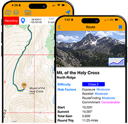
| Sawatch |
|
Mt. of the Holy Cross
North Ridge
Range: Sawatch
Difficulty: Class 2
RT Distance: 11.25
Elevation Gain: 5,600', Grade: 18.86%
|
Class 2 |
11.25mi |
5,600' |
18.86% |
|
Considerable Exposure: Moderate
Rockfall Potential: Moderate
Route-Finding: Moderate
Commitment: Considerable
|
Sawatch,Standard,Mt. of the Holy Cross,North Ridge,Class 2,,11.25,5600,18.86,Moderate,Moderate,Moderate,Considerable,,https://www.14ers.com/route.php?route=holy1 |
| Sawatch |
|
Missouri Mountain
West Ridge
Range: Sawatch
Difficulty: Class 2
RT Distance: 11.75
Elevation Gain: 4,250', Grade: 13.70%
|
Class 2 |
11.75mi |
4,250' |
13.70% |
|
Considerable Exposure: Considerable
Rockfall Potential: Considerable
Route-Finding: Moderate
Commitment: Moderate
|
Sawatch,,Missouri Mountain,West Ridge,Class 2,,11.75,4250,13.70,Considerable,Considerable,Moderate,Moderate,,https://www.14ers.com/route.php?route=miss2 |
| Sawatch |
|
Mt. Columbia
West Slopes
Range: Sawatch
Difficulty: Class 2
RT Distance: 12
Elevation Gain: 4,250', Grade: 13.42%
|
Class 2 |
12mi |
4,250' |
13.42% |
|
Considerable Exposure: Moderate
Rockfall Potential: Considerable
Route-Finding: Moderate
Commitment: Moderate
|
Sawatch,Standard,Mt. Columbia,West Slopes,Class 2,,12.00,4250,13.42,Moderate,Considerable,Moderate,Moderate,,https://www.14ers.com/route.php?route=colu2 |
| Sawatch |
|
Tabeguache Peak
Via Mt. Shavano
Range: Sawatch
Difficulty: Class 2
RT Distance: 12
Elevation Gain: 5,600', Grade: 17.68%
|
Class 2 |
12mi |
5,600' |
17.68% |
|
Considerable Exposure: Moderate
Rockfall Potential: Moderate
Route-Finding: Moderate
Commitment: Considerable
|
Sawatch,Standard,Tabeguache Peak,Via Mt. Shavano,Class 2,,12.00,5600,17.68,Moderate,Moderate,Moderate,Considerable,,https://www.14ers.com/route.php?route=tabe2 |
| Sawatch |
|
Mt. Columbia
Southwest Couloir
Range: Sawatch
Difficulty: Class 2 Moderate Snow
RT Distance: 13.5
Elevation Gain: 4,800', Grade: 13.47%
|
Class 2 |
13.5mi |
4,800' |
13.47% |
|
Considerable Exposure: Moderate
Rockfall Potential: Moderate
Route-Finding: Considerable
Commitment: Moderate
|
Sawatch,,Mt. Columbia,Southwest Couloir,Class 2,Moderate Snow,13.50,4800,13.47,Moderate,Moderate,Considerable,Moderate,,https://www.14ers.com/route.php?route=colu6 |
| Sawatch |
|
Mt. Harvard
South Slopes
Range: Sawatch
Difficulty: Class 2
RT Distance: 13.75
Elevation Gain: 4,600', Grade: 12.67%
|
Class 2 |
13.75mi |
4,600' |
12.67% |
|
Moderate Exposure: Moderate
Rockfall Potential: Moderate
Route-Finding: Moderate
Commitment: Moderate
|
Sawatch,Standard,Mt. Harvard,South Slopes,Class 2,,13.75,4600,12.67,Moderate,Moderate,Moderate,Moderate,,https://www.14ers.com/route.php?route=harv1 |
| Sawatch |
|
Mt. Harvard
South Face
Range: Sawatch
Difficulty: Class 2 Moderate Snow
RT Distance: 13.75
Elevation Gain: 4,600', Grade: 12.67%
|
Class 2 |
13.75mi |
4,600' |
12.67% |
|
Considerable Exposure: Moderate
Rockfall Potential: Moderate
Route-Finding: Considerable
Commitment: Considerable
|
Sawatch,,Mt. Harvard,South Face,Class 2,Moderate Snow,13.75,4600,12.67,Moderate,Moderate,Considerable,Considerable,,https://www.14ers.com/route.php?route=harv3 |
| Sawatch |
|
Mt. Massive
East Slopes
Range: Sawatch
Difficulty: Class 2
RT Distance: 13.75
Elevation Gain: 4,500', Grade: 12.40%
|
Class 2 |
13.75mi |
4,500' |
12.40% |
|
Moderate Exposure: Moderate
Rockfall Potential: Moderate
Route-Finding: Moderate
Commitment: Moderate
|
Sawatch,Standard,Mt. Massive,East Slopes,Class 2,,13.75,4500,12.40,Moderate,Moderate,Moderate,Moderate,,https://www.14ers.com/route.php?route=mass1 |
| Sawatch |
|
Combination Route
Harvard and Columbia Traverse
Range: Sawatch
Difficulty: Class 2
RT Distance: 15
Elevation Gain: 6,100', Grade: 15.40%
|
Class 2 |
15mi |
6,100' |
15.40% |
|
High Exposure: Moderate
Rockfall Potential: Considerable
Route-Finding: High
Commitment: High
|
Sawatch,,Combo),Harvard and Columbia Traverse,Class 2,,15.00,6100,15.40,Moderate,Considerable,High,High,,https://www.14ers.com/route.php?route=harv4 |
| Sawatch |
|
Combination Route
Belford, Oxford and Missouri
Range: Sawatch
Difficulty: Class 2
RT Distance: 15
Elevation Gain: 7,600', Grade: 19.19%
|
Class 2 |
15mi |
7,600' |
19.19% |
|
Considerable Exposure: Considerable
Rockfall Potential: Considerable
Route-Finding: Moderate
Commitment: Moderate
|
Sawatch,,Combo),Belford+Oxford and Missouri,Class 2,,15.00,7600,19.19,Considerable,Considerable,Moderate,Moderate,,https://www.14ers.com/route.php?route=miss4 |
| Sawatch |
|
Mt. Antero
West Slopes
Range: Sawatch
Difficulty: Class 2
RT Distance: 15.5
Elevation Gain: 5,200', Grade: 12.71%
|
Class 2 |
15.5mi |
5,200' |
12.71% |
|
Moderate Exposure: Moderate
Rockfall Potential: Moderate
Route-Finding: Low
Commitment: Moderate
|
Sawatch,Standard,Mt. Antero,West Slopes,Class 2,,15.50,5200,12.71,Moderate,Moderate,Low,Moderate,,https://www.14ers.com/route.php?route=ante1 |
| Sawatch |
|
Mt. Antero
Via Little Browns Creek
Range: Sawatch
Difficulty: Class 2
RT Distance: 16.25
Elevation Gain: 5,550', Grade: 12.94%
|
Class 2 |
16.25mi |
5,550' |
12.94% |
|
Moderate Exposure: Moderate
Rockfall Potential: Moderate
Route-Finding: Moderate
Commitment: Moderate
|
Sawatch,,Mt. Antero,Via Little Browns Creek,Class 2,,16.25,5550,12.94,Moderate,Moderate,Moderate,Moderate,,https://www.14ers.com/route.php?route=ante2 |
| Sawatch |
|
La Plata Peak
North Face
Range: Sawatch
Difficulty: Difficult Class 2 Moderate Snow
RT Distance: 8.75
Elevation Gain: 4,500', Grade: 19.48%
|
Diff. Class 2 |
8.75mi |
4,500' |
19.48% |
|
High Exposure: Considerable
Rockfall Potential: Considerable
Route-Finding: High
Commitment: Considerable
|
Sawatch,,La Plata Peak,North Face,Difficult Class 2,Moderate Snow,8.75,4500,19.48,Considerable,Considerable,High,Considerable,,https://www.14ers.com/route.php?route=lapl4 |
| Sawatch |
|
Missouri Mountain
North Face Couloirs
Range: Sawatch
Difficulty: Difficult Class 2 Moderate Snow
RT Distance: 9
Elevation Gain: 4,500', Grade: 18.94%
|
Diff. Class 2 |
9mi |
4,500' |
18.94% |
|
Considerable Exposure: Considerable
Rockfall Potential: Moderate
Route-Finding: Considerable
Commitment: Considerable
|
Sawatch,,Missouri Mountain,North Face Couloirs,Difficult Class 2,Moderate Snow,9.00,4500,18.94,Considerable,Moderate,Considerable,Considerable,,https://www.14ers.com/route.php?route=miss3 |
| Sawatch |
|
Mt. Elbert
Box Creek Couloirs
Range: Sawatch
Difficulty: Difficult Class 2 Moderate Snow
RT Distance: 10
Elevation Gain: 4,150', Grade: 15.72%
|
Diff. Class 2 |
10mi |
4,150' |
15.72% |
|
Considerable Exposure: Considerable
Rockfall Potential: Moderate
Route-Finding: Moderate
Commitment: Considerable
|
Sawatch,,Mt. Elbert,Box Creek Couloirs,Difficult Class 2,Moderate Snow,10.00,4150,15.72,Considerable,Moderate,Moderate,Considerable,,https://www.14ers.com/route.php?route=elbe4 |
| Sawatch |
|
Mt. Massive
East Ridge
Range: Sawatch
Difficulty: Difficult Class 2
RT Distance: 14
Elevation Gain: 5,000', Grade: 13.53%
|
Diff. Class 2 |
14mi |
5,000' |
13.53% |
|
Considerable Exposure: Moderate
Rockfall Potential: Moderate
Route-Finding: Considerable
Commitment: Considerable
|
Sawatch,,Mt. Massive,East Ridge,Difficult Class 2,,14.00,5000,13.53,Moderate,Moderate,Considerable,Considerable,,https://www.14ers.com/route.php?route=mass3 |
| Sawatch |
|
Mt. of the Holy Cross
Halo Ridge
Range: Sawatch
Difficulty: Difficult Class 2
RT Distance: 15
Elevation Gain: 5,210', Grade: 13.16%
|
Diff. Class 2 |
15mi |
5,210' |
13.16% |
|
High Exposure: Considerable
Rockfall Potential: Considerable
Route-Finding: Considerable
Commitment: High
|
Sawatch,,Mt. of the Holy Cross,Halo Ridge,Difficult Class 2,,15.00,5210,13.16,Considerable,Considerable,Considerable,High,,https://www.14ers.com/route.php?route=holy3 |
| Sawatch |
|
La Plata Peak
Ellingwood Ridge
Range: Sawatch
Difficulty: Class 3
RT Distance: 9.5
Elevation Gain: 5,900', Grade: 23.52%
|
Class 3 |
9.5mi |
5,900' |
23.52% |
|
High Exposure: High
Rockfall Potential: High
Route-Finding: High
Commitment: High
|
Sawatch,,La Plata Peak,Ellingwood Ridge,Class 3,,9.50,5900,23.52,High,High,High,High,,https://www.14ers.com/route.php?route=lapl3 |
| Sawatch |
|
Mt. of the Holy Cross
Cross Couloir
Range: Sawatch
Difficulty: Class 3 Steep Snow
RT Distance: 12.25
Elevation Gain: 5,600', Grade: 17.32%
|
Class 3 |
12.25mi |
5,600' |
17.32% |
|
High Exposure: Considerable
Rockfall Potential: Considerable
Route-Finding: Considerable
Commitment: High
|
Sawatch,,Mt. of the Holy Cross,Cross Couloir,Class 3,Steep Snow,12.25,5600,17.32,Considerable,Considerable,Considerable,High,,https://www.14ers.com/route.php?route=holy2 |
| Tenmile |
|
Quandary Peak
East Ridge
Range: Tenmile
Difficulty: Class 1
RT Distance: 6.75
Elevation Gain: 3,450', Grade: 19.36%
|
Class 1 |
6.75mi |
3,450' |
19.36% |
|
Low Exposure: Low
Rockfall Potential: Low
Route-Finding: Low
Commitment: Low
|
Tenmile,Standard,Quandary Peak,East Ridge,Class 1,,6.75,3450,19.36,Low,Low,Low,Low,,https://www.14ers.com/route.php?route=quan1 |
| Tenmile |
|
Quandary Peak
South Gully aka Cristo Couloir
Range: Tenmile
Difficulty: Difficult Class 2 Moderate Snow
RT Distance: 3.5
Elevation Gain: 2,900', Grade: 31.39%
|
Diff. Class 2 |
3.5mi |
2,900' |
31.39% |
|
Considerable Exposure: Moderate
Rockfall Potential: Considerable
Route-Finding: Moderate
Commitment: Low
|
Tenmile,,Quandary Peak,South Gully aka Cristo Couloir,Difficult Class 2,Moderate Snow,3.50,2900,31.39,Moderate,Considerable,Moderate,Low,,https://www.14ers.com/route.php?route=quan2 |
| Tenmile |
|
Quandary Peak
West Ridge
Range: Tenmile
Difficulty: Class 3
RT Distance: 4
Elevation Gain: 2,650', Grade: 25.09%
|
Class 3 |
4mi |
2,650' |
25.09% |
|
High Exposure: High
Rockfall Potential: Considerable
Route-Finding: Considerable
Commitment: High
|
Tenmile,,Quandary Peak,West Ridge,Class 3,,4.00,2650,25.09,High,Considerable,Considerable,High,,https://www.14ers.com/route.php?route=quan3 |
| Tenmile |
|
Quandary Peak
North Gully aka Quandary Couloir
Range: Tenmile
Difficulty: Class 3 Steep Snow
RT Distance: 5.25
Elevation Gain: 3,250', Grade: 23.45%
|
Class 3 |
5.25mi |
3,250' |
23.45% |
|
Considerable Exposure: Considerable
Rockfall Potential: Considerable
Route-Finding: Moderate
Commitment: Considerable
|
Tenmile,,Quandary Peak,North Gully aka Quandary Couloir,Class 3,Steep Snow,5.25,3250,23.45,Considerable,Considerable,Moderate,Considerable,,https://www.14ers.com/route.php?route=quan4 |