Mount Evans Trailhead Options
Forum rules
- This is a mountaineering forum, so please keep your posts on-topic. Posts do not all have to be related to the 14ers but should at least be mountaineering-related.
- Personal attacks and confrontational behavior will result in removal from the forum at the discretion of the administrators.
- Do not use this forum to advertise, sell photos or other products or promote a commercial website.
- Posts will be removed at the discretion of the site administrator or moderator(s), including: Troll posts, posts pushing political views or religious beliefs, and posts with the purpose of instigating conflict within the forum.
-
TSV543
- Posts: 1
- Joined: 8/2/2024
- 14ers: 2
- Trip Reports (0)
Mount Evans Trailhead Options
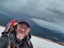
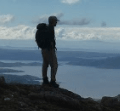
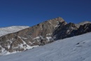
Starting at Summit Lake Trailhead won't allow you to hit the "3,000-foot rule" according to CFI. Is the only other option to hike from Echo Lake Trailhead or is there a way to get to and park at Chicago Lake Trail? Trying to calculate mileage/time to summit.
-
peter303
- Posts: 3574
- Joined: 6/17/2009
- 14ers: 34
- 13ers: 12
- Trip Reports (3)
Re: Mount Evans Trailhead Options
Can start from Echo Lake, west end to Chicago end.
Or from Bierstadt trailhead.
Blue Sky road will close all summer 2025 for reconstruction near broken Summit Lake part.
Or from Bierstadt trailhead.
Blue Sky road will close all summer 2025 for reconstruction near broken Summit Lake part.
-
jrbren_vt
- Posts: 712
- Joined: 2/18/2006
- 14ers: 17
- 13ers: 40
- Trip Reports (0)
Re: Mount Evans Trailhead Options
*****************
Best Regards
*****************
Best Regards
*****************
-
pw
- Posts: 549
- Joined: 7/10/2006
- 14ers: 45
- 13ers: 70
- Trip Reports (1)
Re: Mount Evans Trailhead Options
You can do it from Guanella Pass, and bypass the Sawtooth. The hard part is navigating that boggy area immediately off the pass. Once you clear that it's relatively straightforward. The route is labeled E3 on the topo map at the link below.
https://www.14ers.com/route.php?route=evan3
https://www.14ers.com/route.php?route=evan3
http://www.flickr.com/photos/pwahl/" onclick="window.open(this.href);return false;
Re: Mount Evans Trailhead Options
Guanella from the winter TH (by the Naylor Lake Road) gets you a "CO 3000ft" summit to either of Bierstadt or Blue Sky/Evans (that parking area is at ~10,900'). It's also a great winter route when the willows are buried (up Scott Gomer Creek towards Spaulding to avoid the gully) 
-
pw
- Posts: 549
- Joined: 7/10/2006
- 14ers: 45
- 13ers: 70
- Trip Reports (1)
Re: Mount Evans Trailhead Options
I did Gray Wolf in late October, that's a good time to do this because the ground is mostly frozen, so easier to get past the muddy sections, and snow hasn't started to pile up yet. I think the road is still open to the top too.madmattd wrote: ↑Mon Aug 12, 2024 12:02 pm Guanella from the winter TH (by the Naylor Lake Road) gets you a "CO 3000ft" summit to either of Bierstadt or Blue Sky/Evans (that parking area is at ~10,900'). It's also a great winter route when the willows are buried (up Scott Gomer Creek towards Spaulding to avoid the gully)
http://www.flickr.com/photos/pwahl/" onclick="window.open(this.href);return false;
-
Alison65
- Posts: 1
- Joined: 8/16/2024
- Trip Reports (0)
Re: Mount Evans Trailhead Options
Frankly, the 3,000-foot rule may look good on paper, but in the field it's a different story. If you're already well equipped and have a good sense of direction, you could try tracing your own route via the Chicago Lake Trail, but be prepared for a little treasure hunting. There are corners where you feel a bit like an explorer lost in the middle of an Aztec carpet here, but that's part of the charm, isn't it? Otherwise, Echo Lake Trailhead remains a sure bet... but where's the fun in that?!
Last edited by Alison65 on Mon Sep 09, 2024 11:54 pm, edited 1 time in total.
-
Dan_Suitor

- Posts: 793
- Joined: 4/23/2012
- 14ers: 58 4
- 13ers: 96
- Trip Reports (3)
Re: Mount Evans Trailhead Options
If you really want a challenge, start at Deer Creek Trailhead. Gain Rosalie, then Epaulie, then Epaulet ( https://www.14ers.com/route.php?route=2 ... 1957562344 ), then continue to Blue Sky. It’s a long hike but your elevation gain will be way over 3,000 feet.
Century Bound, eventually.
-
nyker

- Posts: 3367
- Joined: 12/5/2007
- 14ers: 58
- 13ers: 25
- Trip Reports (69)
Re: Mount Evans Trailhead Options
Start from further down the road and walk up another 1,000 vert ft.
Re: Mount Evans Trailhead Options
This is a good option several other 14ers as well.

Re: Mount Evans Trailhead Options
Did this on Saturday - it is indeed a LONG day! I clocked just under 20 miles with skipping the 13er summits on the return by skirting around them.Dan_Suitor wrote: ↑Fri Aug 16, 2024 10:45 am If you really want a challenge, start at Deer Creek Trailhead. Gain Rosalie, then Epaulie, then Epaulet ( https://www.14ers.com/route.php?route=2 ... 1957562344 ), then continue to Blue Sky. It’s a long hike but your elevation gain will be way over 3,000 feet.
Very pretty and outside of Blue Sky only saw 2 people all day until very close back to the trailhead.
-
Dan_Suitor
- Posts: 793
- Joined: 4/23/2012
- 14ers: 58 4
- 13ers: 96
- Trip Reports (3)
Re: Mount Evans Trailhead Options
Nice! Did you catch how many vertical feet? I'm assuming somewhere over 6,000 feet of total gain.hberry wrote: ↑Tue Aug 20, 2024 8:37 amDid this on Saturday - it is indeed a LONG day! I clocked just under 20 miles with skipping the 13er summits on the return by skirting around them.Dan_Suitor wrote: ↑Fri Aug 16, 2024 10:45 am If you really want a challenge, start at Deer Creek Trailhead. Gain Rosalie, then Epaulie, then Epaulet ( https://www.14ers.com/route.php?route=2 ... 1957562344 ), then continue to Blue Sky. It’s a long hike but your elevation gain will be way over 3,000 feet.
Very pretty and outside of Blue Sky only saw 2 people all day until very close back to the trailhead.
Century Bound, eventually.

