


They are most certainly not equal. With enough precision and enough digits past the decimal point, they are sure to be unequal. The only problem is that it is unclear which one is higher even with today’s technology. The only way (at the moment) to ensure reaching the summit is to tag both. Otherwise, if you only choose just one to tag, you have a 50-50 chance that you haven’t submitted it. Not that I think it’s really worth the bother of going back anyways if you went up only one, but ultra-serious peakbaggers will want that perfect certainty.onebyone wrote: ↑Wed Jul 22, 2026 3:55 pmMore like either one counts. Since they are equal. It's more similar to a ridge with each side equal. Probably should have left it alone. Now you will have people adding and removing rocks just for kicks and the joy of messing with A type personalities.timewarp01 wrote: ↑Tue Jul 21, 2026 8:25 pmOk, but now you have two 14ers where there used to be one so now anyone who didn't hit both peaks is not a finisher
East Crestone Second dGPS Survey
Forum rules
- This is a mountaineering forum, so please keep your posts on-topic. Posts do not all have to be related to the 14ers but should at least be mountaineering-related.
- Personal attacks and confrontational behavior will result in removal from the forum at the discretion of the administrators.
- Do not use this forum to advertise, sell photos or other products or promote a commercial website.
- Posts will be removed at the discretion of the site administrator or moderator(s), including: Troll posts, posts pushing political views or religious beliefs, and posts with the purpose of instigating conflict within the forum.
For more details, please see the Terms of Use you agreed to when joining the forum.
-
ScottLovesRMNP
- Posts: 89
- Joined: 3/11/2016
- 14ers: 58 7
- 13ers: 391 4
- Trip Reports (1)
Re: East Crestone Second dGPS Survey
-
XterraRob

- Posts: 1204
- Joined: 7/20/2015
- 14ers: 42 7
- 13ers: 14
- Trip Reports (4)
Re: East Crestone Second dGPS Survey
What makes it your favorite 14er, Bill?BillMiddlebrook wrote: ↑Wed Jul 22, 2026 4:20 pm I hope to be up Crestone Peak in August and I can't wait to see both summits and if rocks have been stacked since I was last there, 4 years ago.
I can't tell you how much I love that my favorite CO 14er is in the spotlight.
RIP - M56
Re-introduce Grizzly Bears into the Colorado Wilderness™
Re-introduce Grizzly Bears into the Colorado Wilderness™
-
bdloftin77

- Posts: 1434
- Joined: 9/23/2013
- 14ers: 58 1
- 13ers: 99
- Trip Reports (2)
Re: East Crestone Second dGPS Survey
I’ve been curious about this, too.XterraRob wrote: ↑Wed Jul 22, 2026 8:59 pmWhat makes it your favorite 14er, Bill?BillMiddlebrook wrote: ↑Wed Jul 22, 2026 4:20 pm I hope to be up Crestone Peak in August and I can't wait to see both summits and if rocks have been stacked since I was last there, 4 years ago.
I can't tell you how much I love that my favorite CO 14er is in the spotlight.

Re: East Crestone Second dGPS Survey
Most people up there on a busy summer weekend went to both summits. I do think the common practice is becoming to go summit both now--which thankfully is not a huge ask since each summit is a relatively quick jaunt from the top of the gully. These continued discussions, publications, social media buzz, etc. if nothing else will make it more widely known to just go to both summits on crestone.Veory wrote: ↑Wed Jul 22, 2026 3:05 pmI've been answering a lot of the questions because I was there for the first survey, not because he's leaving it up in the air. He's super busy and spends a lot of time (like currently) out of country where this website can't be accessed. If a bunch of people go up there and decide to alter the summit there's really not much we can do about that.skyrme17 wrote: ↑Tue Jul 21, 2026 6:10 pm We begin to see why a majority of experiments do not get reproduced, in this case pertaining to the East Crestone elevation measurement! It pays to note that Eric Gilbertson never answered a legitimate question asked by several members related to how the summit point was chosen. It was left somehow for others to address, even if tepidly.
Columbia was in fact solid bedrock/hardpan at both the summit and saddle. Even if it was debatable, any movement of the summit would make it less ranked. That survey is pretty confidence inspiring.
Anyways, I think the correct answer is really that both summits are equal. Even if we don't prove E is definitively higher due to people moving rocks, we've proved they are effectively of the same importance as summits. Tag both!

Re: East Crestone Second dGPS Survey
i saw just one group of people heading that way when i summited in 2024. and even though it's so close, it never even crossed my mind to venture to the other summit-- i think my soul may have briefly left my body in the red gully.kyrawhitworth wrote: ↑Thu Jul 23, 2026 9:58 am Most people up there on a busy summer weekend went to both summits. I do think the common practice is becoming to go summit both now--which thankfully is not a huge ask since each summit is a relatively quick jaunt from the top of the gully. These continued discussions, publications, social media buzz, etc. if nothing else will make it more widely known to just go to both summits on crestone.
1. navigation | 2. illumination | 3. sun protection | 4. first aid | 5. shelter | 6. insulation | 7. fire | 8. repair | 9. water | 10. food | 11. hot sauce
-
CraigE
- Posts: 1
- Joined: 7/10/2015
- Trip Reports (0)
Re: East Crestone Second dGPS Survey
I’m going to stir the pot a little: The area between Crestone Peak and East Crestone is roughly the same size as the large flat summit of Longs Peak, or the summit ridge of Conundrum Peak.
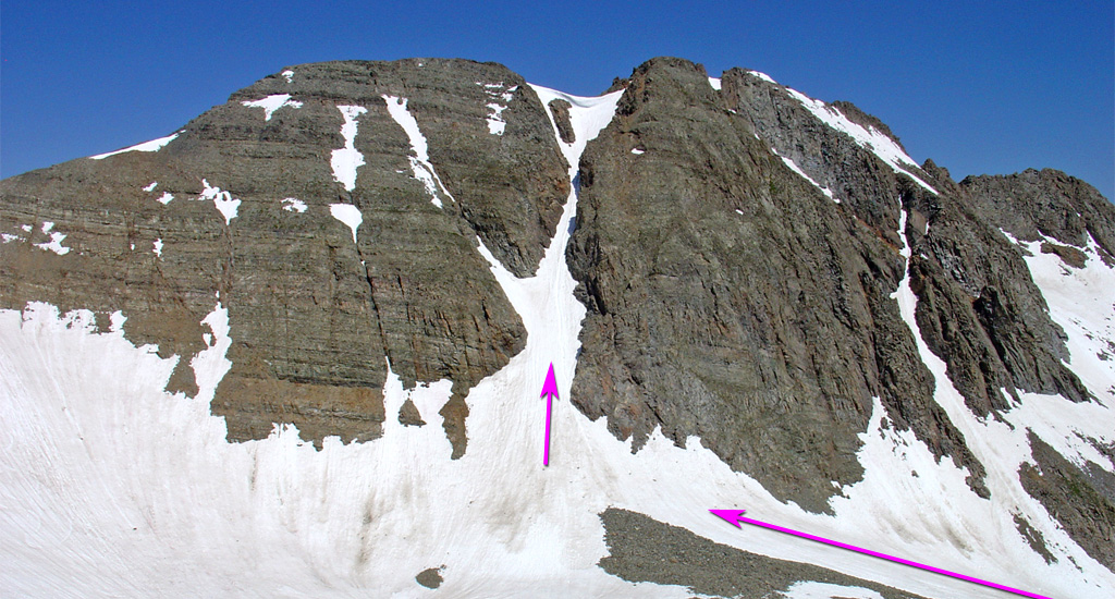
The comparison to Conundrum is especially interesting. There’s conflicting information about which side of Conundrum Couloir is the highest point: most maps place the summit marker on the south point, as does List of John https://listsofjohn.com/mapf?lat=39.015 ... 16&t=c&d=y, but the route description on this site directs you to the north point. I understand that the latest LIDAR measurement found the south point to be a couple feet higher https://ns1.14ers.com/forum/viewtopic.php?t=62495. Peakbagger.com shows a 67 foot drop between Conundrum Peak and "North Conundrum", which isn't that much less than the 113 foot drop between Crestone and East Crestone https://www.peakbagger.com/List.aspx?li ... &cid=44107.
Here’s my take: Aesthetically, Crestone and East Crestone look like distinct summits (from a certain angle). But geographically, they’re essentially two points on the same summit block, within inches of the same height. I think that if someone reaches either point, they can confidently say they summited Crestone Peak. I don’t think it’s much different than someone who crests the summit plateau on Longs and walks around a bit but doesn’t quite reach the far NE edge, or someone who climbs Conundrum Couloir but turns right instead of left, or someone who finds the official USGS marker on dozens of other peaks but doesn’t touch their boot to the highest rock around. In the sport I'm engaged in, that all counts as summiting.
(Edit: Despite all I said above, I'm definitely hitting East Crestone next time I'm up there! Crestone Peak is a contender for my favorite 14er, and I'm glad for a reason to climb it again.)
The comparison to Conundrum is especially interesting. There’s conflicting information about which side of Conundrum Couloir is the highest point: most maps place the summit marker on the south point, as does List of John https://listsofjohn.com/mapf?lat=39.015 ... 16&t=c&d=y, but the route description on this site directs you to the north point. I understand that the latest LIDAR measurement found the south point to be a couple feet higher https://ns1.14ers.com/forum/viewtopic.php?t=62495. Peakbagger.com shows a 67 foot drop between Conundrum Peak and "North Conundrum", which isn't that much less than the 113 foot drop between Crestone and East Crestone https://www.peakbagger.com/List.aspx?li ... &cid=44107.
Here’s my take: Aesthetically, Crestone and East Crestone look like distinct summits (from a certain angle). But geographically, they’re essentially two points on the same summit block, within inches of the same height. I think that if someone reaches either point, they can confidently say they summited Crestone Peak. I don’t think it’s much different than someone who crests the summit plateau on Longs and walks around a bit but doesn’t quite reach the far NE edge, or someone who climbs Conundrum Couloir but turns right instead of left, or someone who finds the official USGS marker on dozens of other peaks but doesn’t touch their boot to the highest rock around. In the sport I'm engaged in, that all counts as summiting.
(Edit: Despite all I said above, I'm definitely hitting East Crestone next time I'm up there! Crestone Peak is a contender for my favorite 14er, and I'm glad for a reason to climb it again.)
-
Flips

- Posts: 223
- Joined: 9/7/2009
- 14ers: 58
- 13ers: 106 2
- Trip Reports (0)
Re: East Crestone Second dGPS Survey
Precisely why I went back and summited East this summer. I now do not have to care and this is more enjoyment reading about the measurement and learning about the process. My only worry is running out of popcorn.josephnephi wrote: ↑Tue Jun 23, 2026 4:10 pm I'm just going the preface this by saying I don't have an opinion one way or the other (you should climb both!).
…
If you just climb both that all of this summit cairn business is a moot point. It takes 10 extra minutes, both summits are interesting, and then you don't have to care which is higher.
I did have one fun moment when we reached the saddle between the two summits. A young couple had just descended the west summit and were clearly headed down. We asked if they had summited the east summit. They had not and were kinda like “meh”. After explaining about the measurement, they decided to climb the easy 100 feet to East. They were very appreciative and I felt I had done my good deed for the day.
Flips Law of Summits: All summits are false summits until proven otherwise.
-
skyrme17
- Posts: 73
- Joined: 7/8/2018
- 14ers: 33
- 13ers: 3
- Trip Reports (1)
Re: East Crestone Second dGPS Survey
This discussion should not be about "you should climb this, or that, or both". It's about due diligence in promoting correct information, acquired with due diligence as opposed generating headlines in newspapers, like this one: https://www.summitdaily.com/news/colora ... tone-peak/. This community is amazing in defining, and refining the safest routes on mountains. Why not exercise the same standard in measurements that require common sense, i.e. a method that would allow anyone else to reproduce the measurements that generated such headlines?
Re: East Crestone Second dGPS Survey
I mean, I agree, but it's not like we're writing those headlines. I think the paper on Eric's site is really pretty clear on his methodology, and you are free to agree, disagree, or critique as you wish, that's the scientific method right there.
The method that was used to determine the summit has been clearly stated many times. If you don't agree with it, that's ok. Do what you wish with the information, it's my (our?) goal to make the information available. If i was trying to craft a story I wouldn't have pointed out the statistical inconsistency between the two measurements.
The method that was used to determine the summit has been clearly stated many times. If you don't agree with it, that's ok. Do what you wish with the information, it's my (our?) goal to make the information available. If i was trying to craft a story I wouldn't have pointed out the statistical inconsistency between the two measurements.
-
Scott P

- Posts: 9893
- Joined: 5/4/2005
- 14ers: 58 16
- 13ers: 57 14
- Trip Reports (16)
Re: East Crestone Second dGPS Survey
The method used is the only method available to measure such a small difference and was confirmed twice. How is this not due diligence?
Many other people have tried to determine which is higher using a hand level and have said that it was too close to call.
If you think you can do better, go make your own measurement.
I'm old, slow and fat. Unfortunately, those are my good qualities.
-
CheapCigarMan

- Posts: 646
- Joined: 12/10/2014
- 14ers: 58 2
- 13ers: 159 2
- Trip Reports (1)
Re: East Crestone Second dGPS Survey
This issue isn't so much about instrumentation. It's what the instruments are measuring. Unstable, moving dirt and rocks. They're not measuring stable steel or concrete.Scott P wrote: ↑Fri Jul 24, 2026 4:55 amThe method used is the only method available to measure such a small difference and was confirmed twice. How is this not due diligence?
Many other people have tried to determine which is higher using a hand level and have said that it was too close to call.
If you think you can do better, go make your own measurement.
I get the desire to chase precision and accuracy. I also agree with CraigE. These elements are in near constant flux and changing.
There should be a paradigm shift in how we think about the peaks.
Instead of hard ranking in order, when there are close calls, such as in this case the Crestones. You could list all of the Crestones. As Ben and others have stated numerous times, climb them all. I agree with that sentiment. If a list of the highest is what you're going for and you are super anal and nerdy, as I am, about it, then climb them all to make sure you got all of the highest peaks.
My proposal would be to somehow annotate that here. It's already done with other sub peaks on this site. Simply add the Crestones on the peak and sub peak list. Somehow annotate that they are too close to call.
In another year when someone else decides to measure them they could switch again. Otherwise, the rocks and dirt will change and the list will need to be updated again. List them tied for 7th place and add a note.
I should be on a mountain
-
bdloftin77
- Posts: 1434
- Joined: 9/23/2013
- 14ers: 58 1
- 13ers: 99
- Trip Reports (2)
Re: East Crestone Second dGPS Survey
Eric said that the highest rock on East Crestone was large enough that it would have taken at least two people to move. He said this would count as a legit summit rock, and measured it. I was up there last summer before the measurement, had confirmed that it was the highest rock, and that it was too heavy for me to move by myself.
Since then, the summit has obviously been tampered with. Some strong people, or people with tools, could tamper with almost any summit. The larger the summit, the larger the tools needed (see Bartlet). The smaller the summit or summit rocks, the smaller the tools needed (possibly just a crowbar to leverage existing cracks in the case of East Crestone).
Now the summit is less straightforward than it used to be due to the tampering, and is even closer in elevation to West Crestone. But I agree with Eric’s original choice of the summit rock, the survey methodology, and the pre-tampered survey results.
I think it’s possible the original summit rock was solid, then the freeze thaw process slowly formed a crack which subsequently broke. Afterward, since it would take at least two ordinary people to move it, I’d still say that was the summit.
But I would agree with others that “smaller, loose rock” would not constitute a summit block, and one might have to find some sort of bedrock, partially buried “larger” rock, or even dirt (think vegetated summits) to define the summit top. Yes, this could get subjective, and yes, it might not be 100% agreed upon (how heavy does a “moveable” rock have to be to be a candidate summit rock?) Given tools and especially electric or combustion powered ones, one can’t simply use the argument of whether a rock is “moveable” or not. Some people are also larger and stronger than others, though
there’s probably statistically a certain weight that “the average person” would be unable to move.
That’s not to say the entire process of surveying summits is fruitless. Some are relatively straightforward. And I’d argue that the Crestones survey was definitive and straightforward until the summit was tampered with.
Since then, the summit has obviously been tampered with. Some strong people, or people with tools, could tamper with almost any summit. The larger the summit, the larger the tools needed (see Bartlet). The smaller the summit or summit rocks, the smaller the tools needed (possibly just a crowbar to leverage existing cracks in the case of East Crestone).
Now the summit is less straightforward than it used to be due to the tampering, and is even closer in elevation to West Crestone. But I agree with Eric’s original choice of the summit rock, the survey methodology, and the pre-tampered survey results.
I think it’s possible the original summit rock was solid, then the freeze thaw process slowly formed a crack which subsequently broke. Afterward, since it would take at least two ordinary people to move it, I’d still say that was the summit.
But I would agree with others that “smaller, loose rock” would not constitute a summit block, and one might have to find some sort of bedrock, partially buried “larger” rock, or even dirt (think vegetated summits) to define the summit top. Yes, this could get subjective, and yes, it might not be 100% agreed upon (how heavy does a “moveable” rock have to be to be a candidate summit rock?) Given tools and especially electric or combustion powered ones, one can’t simply use the argument of whether a rock is “moveable” or not. Some people are also larger and stronger than others, though
there’s probably statistically a certain weight that “the average person” would be unable to move.
That’s not to say the entire process of surveying summits is fruitless. Some are relatively straightforward. And I’d argue that the Crestones survey was definitive and straightforward until the summit was tampered with.