I plan to hike San Luis peak at the second half of July or in August. Therefore, few questions.
As far as I understand, choosing between Stewart Creek TH and West Willow Creek TH, the former is easier?
Is it doable to combine San Luis Peak with some of the 13ers like Mt. Organ, Baldy Alto, or Stewart peak, or I would better plan those as separate trips?
San Luis Peak and vicinity questions.
Forum rules
- This is a mountaineering forum, so please keep your posts on-topic. Posts do not all have to be related to the 14ers but should at least be mountaineering-related.
- Personal attacks and confrontational behavior will result in removal from the forum at the discretion of the administrators.
- Do not use this forum to advertise, sell photos or other products or promote a commercial website.
- Posts will be removed at the discretion of the site administrator or moderator(s), including: Troll posts, posts pushing political views or religious beliefs, and posts with the purpose of instigating conflict within the forum.
For more details, please see the Terms of Use you agreed to when joining the forum.
-
Alex
- Posts: 291
- Joined: 9/6/2005
- 14ers: 33
- 13ers: 39
- Trip Reports (0)
San Luis Peak and vicinity questions.
The only thing better than mountains are mountains to which you have never been!
-
huffy13

- Posts: 1055
- Joined: 8/2/2007
- 14ers: 23
- 13ers: 8
- Trip Reports (31)
Re: San Luis Peak and vicinity questions.
Both routes, I would say, are equally easy, the only difference being that the standard route is a couple miles longer, but very easy. There are several trip reports on the site that give really good detail for a combo hike that you're looking into. Seems like it's pretty doable if you are a relatively swift hiker, you start early and have a good weather day. I will say from experience that the Stewart Creek route takes a lot longer to drive to and is at least 45 mins to an hour from any town, whereas the West Willow Creek approach took a lot less time or effort and Creede is not far away. Both routes are incredibly scenic though.
Seems like the times that I need a mountain the most are the times that I can not get to them.
-
Alex
- Posts: 291
- Joined: 9/6/2005
- 14ers: 33
- 13ers: 39
- Trip Reports (0)
Re: San Luis Peak and vicinity questions.
Sorry, I didn't express myself clear. My concern is not the hiking part, at the end of the day, class I is always class I - obvious trail up to the summit. My concern was driving to the TH.
The only thing better than mountains are mountains to which you have never been!
-
huffy13
- Posts: 1055
- Joined: 8/2/2007
- 14ers: 23
- 13ers: 8
- Trip Reports (31)
Re: San Luis Peak and vicinity questions.
West Willow Creek is an easier drive, though there are some rough spots and the drive to Stewart Creek is much longer on dirt, washboarded roads. Both can be done with good clearance, 2WD vehicles, but I remember not having a signal for a lot of the drive to Stewart Creek, so if you were to need assistance, it could be tough to get help in a timely manner.
Seems like the times that I need a mountain the most are the times that I can not get to them.
-
Choss Plate
- Posts: 10
- Joined: 1/2/2024
- 14ers: 58 3 1
- 13ers: 174 1 4
- Trip Reports (0)
Re: San Luis Peak and vicinity questions.
If you're looking to add on some 13ers, don't sleep on the option of hitting the unnamed ones from WWC. That doesn't add on as much mileage since you're heading the same direction, just traversing the Divide above and to the south of the trail. Obviously, some extra effort from the vert, and a little Class 3 added in.
As for the road, I was just up at WWC yesterday and pleasantly surprised by the ease of the drive to 2WD trailhead. You can even take Bachelor Rd to avoid the toughest spots in the canyon. Getting to the upper TH is a little more challenging, but I thought the trickiest bit was the very first climb, so you can decide go/no-go right there and not get in over your head.
As for the road, I was just up at WWC yesterday and pleasantly surprised by the ease of the drive to 2WD trailhead. You can even take Bachelor Rd to avoid the toughest spots in the canyon. Getting to the upper TH is a little more challenging, but I thought the trickiest bit was the very first climb, so you can decide go/no-go right there and not get in over your head.
-
Alex
- Posts: 291
- Joined: 9/6/2005
- 14ers: 33
- 13ers: 39
- Trip Reports (0)
Re: San Luis Peak and vicinity questions.
Thank you.
So, looking at the map and other sources I see few unnamed 13ers East/South-East from the WWC trail to San Luis. Do you mean those ones, or going North toward Colorado Trail and West from there?
On the other hand, it looks like Organ, Baldy Alto, and Stewart peak should be started from the Stewart Creek TH.
Sorry for so many questions, I am just planning my trip including number of days, what hotels to stay, and so on.
The only thing better than mountains are mountains to which you have never been!
-
wineguy
- Posts: 359
- Joined: 7/12/2009
- 14ers: 58 3
- 13ers: 164
- Trip Reports (8)
Re: San Luis Peak and vicinity questions.
I totally disagree. WWC is much rougher. I drove there in my Acura RDX and was pushing it's limits. When I told a friend I'd driven there he didn't believe me. When I sent him a photo of my vehicle at the TH he accused me of photoshopping. Stewart Creek is longer, but accessible in a sedan, though I'd worry about the creek crossing, depending on the season.
"Eventually, all things merge into one, and a river runs through it. The river was cut by the world's great flood and runs over rocks from the basement of time. On some of the rocks are timeless raindrops. Under the rocks are the words, and some of the words are theirs. I am haunted by waters." - Norman Maclean
Re: San Luis Peak and vicinity questions.
https://www.14ers.com/php14ers/triprepo ... trip=20414
Did this trip 5 years ago. Stewart is best accessed from Cebolla unless you're a very fit and fast hiker and get good weather.
Organ can be sequenced with San Luis if you like class 3 scrambling. To keep the difficulty at class 1 go up via Hondo Cañon.
Doing Organ, San Luis, and Baldy Alto on the same day would be ~18 miles of hiking and 4800 ft of gain, 8 of those miles would be above 12k. Not a fun place to loiter in weather.
When I did it I went from Cebolla and got Baldy Chato, Column Ridge, Stewart; next day was Organ, several days later (came from the opposite side) I got San Luis and Baldy Alto.
Plenty of people have done other linkups out there. And the Cebolla or Stewart trail heads are a very easy drive. West Willow creek is difficult even in a high clearance 4wd.
May the odds be ever in your favor.
-
bdloftin77

- Posts: 1215
- Joined: 9/23/2013
- 14ers: 58 1
- 13ers: 71
- Trip Reports (2)
- Contact:
Re: San Luis Peak and vicinity questions.
I did San Luis, Baldy Alto, and Stewart from the Stewart Creek TH. Just over 16 mi. I added the GPX to the GPX library if you search San Luis Peak. Right now it's number 19 and titled San Luis, Baldy Alto, and Stewart.
https://www.14ers.com/php14ers/gpxlib_locator.php
https://www.14ers.com/php14ers/gpxlib_locator.php
-
dwoodward13
- Posts: 851
- Joined: 3/26/2011
- 14ers: 58 12
- 13ers: 170 6
- Trip Reports (1)
Re: San Luis Peak and vicinity questions.
You can pretty easily keep a Baldy Alto->San Luis->Organ loop at class 2 if you are ok with some extra gain. Hike up Stewart Creek to ~12,200 and pick your line up Baldy. Mostly grass with rock mixed in depending on your line. Run the ridge (or close to it) over to Stewart. Descend the standard route to around 12,400 and contour E until hitting Organ's N/NW rib. Upon descent, I found it easy to find a spot to cross the creek back to the trail. I logged just shy of 17 miles and 6,100' vert.
Agree Stewart from Cebolla is a gem of a hike, highly recommend.
Agree Stewart from Cebolla is a gem of a hike, highly recommend.
-
Choss Plate
- Posts: 10
- Joined: 1/2/2024
- 14ers: 58 3 1
- 13ers: 174 1 4
- Trip Reports (0)
Re: San Luis Peak and vicinity questions.
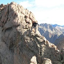
Yup! I'm specifically referring to 13,308, (unranked) 13,179, and 13,166. Traversing their ridge is just an alternate route to/from San Luis's S Ridge. I did it on the way there, but I can't think of a reason why you couldn't do it on the return, which would give you a chance to judge weather and energy level before attempting the extra peaks. I thought the views were excellent, and I remember seeing a HUGE herd of elk to the south moving around and making a ton of noise.
Then, if you later want Stewart, Baldy Alto, and Organ, you can just skirt below San Luis while linking them up, and it makes that day at least a little bit more reasonable.
-
mnsebourn

- Posts: 118
- Joined: 12/31/2011
- 14ers: 28
- 13ers: 6
- Trip Reports (6)
Re: San Luis Peak and vicinity questions.
Let me second this. I’m in Creede as I type this, having driven part of the way up WWC Road about an hour ago.wineguy wrote: ↑Mon Jun 23, 2025 10:01 pmI totally disagree. WWC is much rougher. I drove there in my Acura RDX and was pushing it's limits. When I told a friend I'd driven there he didn't believe me. When I sent him a photo of my vehicle at the TH he accused me of photoshopping. Stewart Creek is longer, but accessible in a sedan, though I'd worry about the creek crossing, depending on the season.
To me, it’s misleading to label the first few miles of this road as “2wd.” Heck, there’s a sign 30 seconds out of Creede that specifically states that 4x4 is recommended—and there’s a loose incline shortly before the mining ruins in which I spun a tire a time or two even in 4H.
It eased up after that. But still—that’s a narrow, loose, rough road. And I definitely think you want something high off the ground with 4WD/AWD to manage it comfortably.

