
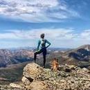
We probably spent an hour wandering around the summit area looking at various cairns trying to figure out the highest one.
Largest 'flat' summit?
Forum rules
- This is a mountaineering forum, so please keep your posts on-topic. Posts do not all have to be related to the 14ers but should at least be mountaineering-related.
- Personal attacks and confrontational behavior will result in removal from the forum at the discretion of the administrators.
- Do not use this forum to advertise, sell photos or other products or promote a commercial website.
- Posts will be removed at the discretion of the site administrator or moderator(s), including: Troll posts, posts pushing political views or religious beliefs, and posts with the purpose of instigating conflict within the forum.
Re: Largest 'flat' summit?
We probably spent an hour wandering around the summit area looking at various cairns trying to figure out the highest one.
"A couple more shots of whiskey,
the women 'round here start looking good"
the women 'round here start looking good"
-
12ersRule

- Posts: 2303
- Joined: 6/18/2007
- 14ers: 58
- 13ers: 160
- Trip Reports (4)
Re: Largest 'flat' summit?
In those situations, I usually just go to what the loj coordinates say.
I have spent a lot of time on ridges, though, when there are highpoints that all look about the same just to have my bases covered.
Didn't hit the other towers west of this one, because the other hps looked scary to me: https://listsofjohn.com/peak/2217
-
12ersRule
- Posts: 2303
- Joined: 6/18/2007
- 14ers: 58
- 13ers: 160
- Trip Reports (4)
Re: Largest 'flat' summit?
-
seannunn
- Posts: 258
- Joined: 3/6/2024
- 14ers: 48
- 13ers: 2
- Trip Reports (1)
Re: Largest 'flat' summit?
Well I for one am not going back for that.
Sean Nunn
Peculiar, MO
"Thy righteousness is like the great mountains."
--Psalm 36:6
--Psalm 36:6
-
XterraRob

- Posts: 1179
- Joined: 7/20/2015
- 14ers: 42 7
- 13ers: 14
- Trip Reports (4)
Re: Largest 'flat' summit?
I wonder what the flattest 14er summit is, Bross?
RIP - M56
Re-introduce Grizzly Bears into the Colorado Wilderness™
Re-introduce Grizzly Bears into the Colorado Wilderness™
-
denvermikey

- Posts: 545
- Joined: 8/9/2007
- 14ers: 51
- 13ers: 201
- Trip Reports (12)
Re: Largest 'flat' summit?
Could be. Longs might be real close too.
"Every man dies, not every man really lives" - William Wallace
"Because it's there" - George Mallory
"In the end it's not the years in your life that count, it's the life in your years" - Abraham Lincoln
"You only live once but if you do it right, once is enough" - Mae West
"Climb mountains not so the world can see you, but so you can see the world." - David McCullough Jr.
-
Wentzl

- Posts: 1144
- Joined: 7/29/2008
- 14ers: 58 22
- 13ers: 55
- Trip Reports (49)
Re: Largest 'flat' summit?
Largest flat 14er summit?
Massive
Massive
Shorter of Breath and One Day Closer . . .
https://www.youtube.com/watch?v=YZXKgl8turY
https://www.youtube.com/watch?v=wiQJGgZ ... rt_radio=1
https://www.youtube.com/watch?v=YZXKgl8turY
https://www.youtube.com/watch?v=wiQJGgZ ... rt_radio=1
Re: Largest 'flat' summit?
Massive likely has the largest area above 14K, but i don't recall that summit being particularly "flat" as compared to Longs, which i personally think is flatter than Bross.
“To walk in nature is to witness a thousand miracles.” – Mary Davis
-
jrbren_vt
- Posts: 711
- Joined: 2/18/2006
- 14ers: 17
- 13ers: 41
- Trip Reports (0)
Re: Largest 'flat' summit?
Of the Colorado peaks I have been on, Square Top above Guanella pass and Colony Baldy come to mind as summit areas where you could have a soccer game. I still wouldn't want to be the one who has to retrieve the ball when it goes out of bounds though. Massive was definitely not in this class to me, more of a long ridge. Back east Mt. Mooselauke come to mind. I don't know when a flat summit becomes a Mesa or a Butte. There are several of them on the drive between Denver and Colorado Springs.
*****************
Best Regards
*****************
Best Regards
*****************
-
bdloftin77

- Posts: 1227
- Joined: 9/23/2013
- 14ers: 58 1
- 13ers: 76
- Trip Reports (2)
Re: Largest 'flat' summit?
If you want to get technical, I posted these 14er summit steepness lists on LoJ a while back. One method - take the summit, create a circle of a certain radius around the summit, and take the average elevation along that circle. 100, 200, and 400 m are probably good local metrics of flatness, though I also posted 800 m and 1600 m lists. The average circle/ring elevation idea is from Tim Worth.
Bross, Pikes, and Oxford are at the bottom of the first three lists.
Colorado 14ers: Average elevation along surrounding circle at "X" distance
100 m radius
200 m radius
400 m radius
-----
800 m radius
1 mi radius
Another metric Joe Grim and John came up with is finding the contour area that is 300' below the summit (300' seemed like a good number when looking at ranked summits). I have an email from Joe from a while back with all the ranked CO results, including unanalyzed ones.
For 14ers, the largest contour area winner is Bross at 0.259 square miles, followed by Sherman at 0.248.
Joe noted that the least steep ranked summit in Colorado by all the metrics we've come up with is Tower Benchmark in the northern plains. Its contour area at 300' below the summit is a huge 189.993 miles. Other notable flat summits at the bottom of the list are Great Divide Benchmark at 78.772 mi, Big Arroyo Hills at 27.12 mi, and Holcolm Hills at 21.751 mi.
To get a finer resolution analysis of steepness, we'd probably re-analyze using contour area at 100' and 200' below the summit as well. This would favor smaller spires at the low end of the contour area, and more locally flat summits at the high end.
=====
For any who are curious, here's the top average drop lists in all of Colorado (largest average drop at "x" distance - smaller distances favor spires, larger distances favor high-rising, isolated mountains)
Top 100 Colorado Peaks with Largest Average Drop along a Surrounding Circle at "X" Distance
100 m radius
200 m radius
400 m radius
800 m radius
1 mi radius
And under New Content + LiDAR, John made a new steepness page with smallest contour at 300' below the summit, as well as shallowest angle to a 300' drop below the summit. He decided the smallest area at 300' below the summit made a bit more sense in determining the steepest peaks. Here's a list of the 100 steepest by that metric, as well as the 200 steepest. And a map of the 100 steepest.
It's cool to see where the steep, jagged peaks are clustered. Some of my favorite areas in Colorado are near these clusters.
-
madmattd
- Posts: 337
- Joined: 12/2/2017
- 14ers: 48 15
- 13ers: 95 5
- Trip Reports (2)
Re: Largest 'flat' summit?
The issue with this method (and admittedly any method will have something to be nit-picked over) as it relates to the discussion of "flattest summit" is if a peak's high point is near the edge of a cliff, but is on an otherwise large, flat area. Longs is a great example of this: it's summit is just a few yards from the cliffs down to Chasm Lake, but off to the West it is pretty flat for >1/10mi. I think the "pick a contour X feet below the summit area and measure the area" is the best reasonable approximation to address this. I'd be curious to see what that whole contour-area list looks like if it ever is shared in full.bdloftin77 wrote: ↑Wed Oct 16, 2024 10:01 am If you want to get technical, I posted these 14er summit steepness lists on LoJ a while back. One method - take the summit, create a circle of a certain radius around the summit, and take the average elevation along that circle.
-
bdloftin77
- Posts: 1227
- Joined: 9/23/2013
- 14ers: 58 1
- 13ers: 76
- Trip Reports (2)
Re: Largest 'flat' summit?
Yep! Definitely agree. I think it'd be cool to use other contour areas as well, just to see what things look like (i.e. 200', 100', and maybe 50' or even less). Longs is definitely a prime candidate as one of the flatter summits if the drop to the contour is a lot less than 300'. It's very flat, but then has huge cliffs around the edges. The 300' metric captures the cliffs around the edges a bit more than the flatness of the large summit - relative to other summits - putting it up higher in the list than otherwise. But I think 100' or 50' might capture the local flatness, just like 100' or 50' (or possibly 200') might capture jutting ranked rock formations better that only have a couple hundred feet of drop before ending in relative flatness (like Big Rock Candy Mtn or Noddle Heads North, two I've climbed that didn't rank very highly with the 300' drop metric).madmattd wrote: ↑Wed Oct 16, 2024 12:03 pmThe issue with this method (and admittedly any method will have something to be nit-picked over) as it relates to the discussion of "flattest summit" is if a peak's high point is near the edge of a cliff, but is on an otherwise large, flat area. Longs is a great example of this: it's summit is just a few yards from the cliffs down to Chasm Lake, but off to the West it is pretty flat for >1/10mi. I think the "pick a contour X feet below the summit area and measure the area" is the best reasonable approximation to address this. I'd be curious to see what that whole contour-area list looks like if it ever is shared in full.bdloftin77 wrote: ↑Wed Oct 16, 2024 10:01 am If you want to get technical, I posted these 14er summit steepness lists on LoJ a while back. One method - take the summit, create a circle of a certain radius around the summit, and take the average elevation along that circle.
I might ask Joe to see if he can perform an analysis on the ranked CO peaks on contour areas with less drop from the summit, just to see how that compares and what's added/removed from the top 100/200.
Here's the list that Joe sent me. If a summit hasn't been analyzed, the resulting drop and therefore area could change, possibly drastically, when the true elevation is input. So only the first couple hundred are more final, whereas the unanalyzed ones, as well as the order, are approximate.
EDIT: Was about to send the list, but looks like csvs or xls aren't supported file extensions. I could email it to you if you'd like.

