
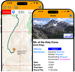


And there's more! Registered users AND guests can now use 3D mode to view the 14ers.com topo and satellite maps. You can toggle 14er routes, 14ers, 13ers, and trailheads.
https://www.14ers.com/map.php
Since we have our own custom map server, with Colorado map tiles, this doesn't cost the site anything other than bandwidth, so I'm able to pass it on to guests who don't have a login. If you're browsing as a guest, you'll just have to pass the "I'm Human" challenge to see the 3D button
3D Map View
Forum rules
- This is a mountaineering forum, so please keep your posts on-topic. Posts do not all have to be related to the 14ers but should at least be mountaineering-related.
- Personal attacks and confrontational behavior will result in removal from the forum at the discretion of the administrators.
- Do not use this forum to advertise, sell photos or other products or promote a commercial website.
- Troll posts will be removed.
-
BillMiddlebrook

- Site Administrator
- Posts: 6792
- Joined: 7/25/2004
- 14ers: 58 47 19
- 13ers: 174 45 37
- Trip Reports (5)
3D Map View
You do not have the required permissions to view the files attached to this post.
Think snow!

Re: 3D Map View
Super cool! I love that the peak names appear as you zoom in. Crazy that this just works, we're living in the future I guess.
I was thinking this might replace my need to flip between the .com map and google maps, but it seems the satellite imagery on your new map isn't quite as high a resolution, thought not sure this can be remedied.
Also I noticed that there is no way to filter between ranked/unranked 13ers or show the 14er subsummits, like the 2D map allows.
Slightly related, I noticed the checklist map lost its fullscreen map a little while back (I think that used to be there?). Wondering if that could get added back in?
I was thinking this might replace my need to flip between the .com map and google maps, but it seems the satellite imagery on your new map isn't quite as high a resolution, thought not sure this can be remedied.
Also I noticed that there is no way to filter between ranked/unranked 13ers or show the 14er subsummits, like the 2D map allows.
Slightly related, I noticed the checklist map lost its fullscreen map a little while back (I think that used to be there?). Wondering if that could get added back in?
-
BillMiddlebrook
- Site Administrator
- Posts: 6792
- Joined: 7/25/2004
- 14ers: 58 47 19
- 13ers: 174 45 37
- Trip Reports (5)
Re: 3D Map View
I'll take a look at that checklist issue - thanks.9patrickmurphy wrote: ↑Mon Oct 05, 2026 8:32 am Super cool! I love that the peak names appear as you zoom in. Crazy that this just works, we're living in the future I guess.
I was thinking this might replace my need to flip between the .com map and google maps, but it seems the satellite imagery on your new map isn't quite as high a resolution, thought not sure this can be remedied.
Also I noticed that there is no way to filter between ranked/unranked 13ers or show the 14er subsummits, like the 2D map allows.
Slightly related, I noticed the checklist map lost its fullscreen map a little while back (I think that used to be there?). Wondering if that could get added back in?
For the 3D map, yeah I'll be adding a bit more functionality to it. And the lower-res satellite tiles are from the 14ersSat map layer which is custom .com stuff and served directly from the site, at no cost to us. That means I can provide it to guests who don't have a login. If I were to use the Google higher-res satellite tiles, we'd have to pay for that when we hit thresholds, which happens fast. Currently, the 14ersSat layer uses 0.6meter resolution satellite scans from government satellites. It's then converted into millions of web tiles just for Colorado, requiring a lot of disk space. If I were to go to sub 0.3meter (higher res), the amount of space required is far more than I have available. Maybe in the future, after our next server upgrade cycle...
Think snow!
-
BillMiddlebrook
- Site Administrator
- Posts: 6792
- Joined: 7/25/2004
- 14ers: 58 47 19
- 13ers: 174 45 37
- Trip Reports (5)
Re: 3D Map View
Ideally, the 3D map will utilize the same main map window, instead of opening a new 3D-only overlay. Then the controls on the left, mapwork, and other stuff can be used in 3D. It will likely take me some time to get to that point due to the complexity and amount of time I'll have to spend on it
Think snow!
-
BillMiddlebrook
- Site Administrator
- Posts: 6792
- Joined: 7/25/2004
- 14ers: 58 47 19
- 13ers: 174 45 37
- Trip Reports (5)
Re: 3D Map View
I added the "G Satellite" base layer to the 3D viewing. It's the same Google Photorealistic satellite imagery and will only show up in the selection list when the user is logged in.9patrickmurphy wrote: ↑Mon Oct 05, 2026 8:32 am I was thinking this might replace my need to flip between the .com map and google maps, but it seems the satellite imagery on your new map isn't quite as high a resolution, thought not sure this can be remedied.

I'll just have to keep an eye on the month costs next summer because we do pay some large bills to Google for high-res satellite tile use
Yes, that was removed after I changed the full screen functionality to a custom design, instead of the limited Google fullscreen button. For the checklist map view, I can't use the custom one right now, so I've added the google button back in there just for that page. I hope this helps9patrickmurphy wrote: ↑Mon Oct 05, 2026 8:32 am Slightly related, I noticed the checklist map lost its fullscreen map a little while back (I think that used to be there?). Wondering if that could get added back in?
Think snow!
-
Jim Davies

- Posts: 7746
- Joined: 6/8/2006
- 14ers: 58 1
- 13ers: 68
- Trip Reports (5)
Re: 3D Map View
This is spectacular...I'm already spotting trails on Pikes Peak that I didn't know existed from the satellite photos.
Is there a way to display imported GPX tracks on this view?
Is there a way to display imported GPX tracks on this view?
Climbing at altitude is like hitting your head against a brick wall — it's great when you stop. -- Chris Darwin
I'm pretty tired. I think I'll go home now. -- Forrest Gump
I'm pretty tired. I think I'll go home now. -- Forrest Gump
-
BillMiddlebrook
- Site Administrator
- Posts: 6792
- Joined: 7/25/2004
- 14ers: 58 47 19
- 13ers: 174 45 37
- Trip Reports (5)
Re: 3D Map View
^There will be. Right now, 3D mode opens a separate overlay and has limited overlay options. My plan is to integrate it fully into the main map so it has access to all of the other map overlays, tools and Map Workspace functionality, which would include any gpx imports you have, plus custom map work.
Winter project!
In the meantime, you can view all of your Map Workspace stuff over the 2D satellite layers, including the high-res "Google Satellite" layer. From a trip report or the GPX Library, there are now buttons to directly "Copy to My Map Workspace" so you can easily just pop open a site GPX file in the workspace and view on on the 2D map layers
Winter project!
In the meantime, you can view all of your Map Workspace stuff over the 2D satellite layers, including the high-res "Google Satellite" layer. From a trip report or the GPX Library, there are now buttons to directly "Copy to My Map Workspace" so you can easily just pop open a site GPX file in the workspace and view on on the 2D map layers
Think snow!
Re: 3D Map View
Thanks for those tweaks Bill! Hopefully the google satellite isn't too pricey for you.
Some more tweaks for you to consider adding to your laundry list:
Some more tweaks for you to consider adding to your laundry list:
- The 13er pins vanish when you zoom out too far, but the 14er pins stay there.
- The 13er pins are all the same color, unlike the 2D map which has different colors for different ranges
- Checkmarks on the pins like the 2D map has would be awesome
-
BillMiddlebrook
- Site Administrator
- Posts: 6792
- Joined: 7/25/2004
- 14ers: 58 47 19
- 13ers: 174 45 37
- Trip Reports (5)
Re: 3D Map View
^Yessir, when I integrate the 3D mode into the main map (instead of an overlay with exit button), it will share the same pin functionality and most everything else. Thanks!
Think snow!