Pikes Peak Alternate THs
Forum rules
- This is a mountaineering forum, so please keep your posts on-topic. Posts do not all have to be related to the 14ers but should at least be mountaineering-related.
- Personal attacks and confrontational behavior will result in removal from the forum at the discretion of the administrators.
- Do not use this forum to advertise, sell photos or other products or promote a commercial website.
- Posts will be removed at the discretion of the site administrator or moderator(s), including: Troll posts, posts pushing political views or religious beliefs, and posts with the purpose of instigating conflict within the forum.
-
AndrewLyonsGeibel
- Posts: 441
- Joined: 7/3/2015
- 14ers: 9
- Trip Reports (0)
Pikes Peak Alternate THs
What alternative trailheads exist for Pikes? A recent thread mentioned the Heizer TH which I wasn’t aware of. A quick google search is flooded with Barr and NW slopes. Just looking for ways to avoid the crowds, especially the incline, and the drive to the Crags TH.
-
zoomie83
- Posts: 226
- Joined: 4/17/2007
- 14ers: 40
- 13ers: 25
- Trip Reports (1)
-
Dakota

- Posts: 171
- Joined: 2/27/2009
- 14ers: 25
- Trip Reports (0)
Re: Pikes Peak Alternate THs
This is coming if you haven't already seen this,
http://gazette.com/long-dreamed-pikes-p ... le/1611997
http://gazette.com/long-dreamed-pikes-p ... le/1611997
If the facts don't fit the theory, change the facts.
-Albert Einstein
-Albert Einstein
-
pmeadco

- Posts: 301
- Joined: 6/21/2015
- 14ers: 58 2
- Trip Reports (0)
Re: Pikes Peak Alternate THs
Horsethief Park is another route that gets mentioned a lot.
That isn't a summit route. It could be used as a base for a bushwack up Windy Point.Dakota wrote:This is coming if you haven't already seen this,
http://gazette.com/long-dreamed-pikes-p ... le/1611997
-
AndrewLyonsGeibel
- Posts: 441
- Joined: 7/3/2015
- 14ers: 9
- Trip Reports (0)
Re: Pikes Peak Alternate THs
I saw that Justin used horsethief on his adventure. Maybe I should clarify that I’m more of a summer hiker in terms of 14ers.
-
Dakota
- Posts: 171
- Joined: 2/27/2009
- 14ers: 25
- Trip Reports (0)
Re: Pikes Peak Alternate THs
pmeadco wrote:Horsethief Park is another route that gets mentioned a lot.That isn't a summit route. It could be used as a base for a bushwack up Windy Point.Dakota wrote:This is coming if you haven't already seen this,
http://gazette.com/long-dreamed-pikes-p ... le/1611997
"The trail will allow a new route to the 14,115-foot summit for users who enter through North Cheyenne Cañon Park and connect with Barr Trail." My point in mentioning it was he (OP) could skip the Incline and not drive to Crags.
If the facts don't fit the theory, change the facts.
-Albert Einstein
-Albert Einstein
-
Oldskool70

- Posts: 180
- Joined: 7/18/2011
- 14ers: 28 1 1
- Trip Reports (4)
Re: Pikes Peak Alternate THs
I knew I never shoulda mentioned Heizer! 
Just funnin' I used to keep it my lil' secret from my Land surveying days up Ute Pass but this whole Interweb thang jacked it all up. Don't park at the end of the road though by the TH. The Cascade NYMB's will roast you. Park your vehicle at the few spots at the park.
Just funnin' I used to keep it my lil' secret from my Land surveying days up Ute Pass but this whole Interweb thang jacked it all up. Don't park at the end of the road though by the TH. The Cascade NYMB's will roast you. Park your vehicle at the few spots at the park.
If you're not moshing, it's NOT music.
-
justiner

- Posts: 4693
- Joined: 8/28/2010
- 14ers: 3 1
- Trip Reports (37)
Re: Pikes Peak Alternate THs
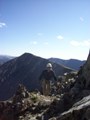
I thought Horsethief was great - a bit more adventurous than Barr or Crags; a little longer than Crags. You start off on fairly easy, albeit steep terrain, until things level off a bit. That could all be potentially rideable by MTB if you wanna cut down time a bit. The route kicks up steeply, and the trail becomes much less defined, as you search for cairns. This'll keep up until after treeline, where it becomes a talus hop up a drainage, with some waterfall action (very pretty). There's some potential rock climbing route development in the area around this, if it hasn't been developed already - good looking granite crags with cracks all over the place. A nice place to scramble about if one wants to get a feel of Class 3 terrain without the commitment I guess. Once you crest the slope up the drainage, you quickly meet up with the Crags/NW slopes route. The route really does change characteristics at this point, as the highway comes into view, and it becomes a bit less idyllic with the # of people and bustling/noise of cars.
(https://www.strava.com/activities/1091982160)
The Missing Link trail looks promising! Although it doesn't fully Ring the Peak, which is what I thought it may do at first reading. Here's a really rough map:
http://www.medwheel.org/missing-link/
Could be a nice way to avoid the highway/Manitou.
I'm looking forward to a true Ring the Peak (however unrealistic it is). It seems like it would be a really cool beginner multi-day backpack destination right outside of CO Springs.
http://gazette.com/hickenlooper-colorad ... le/1586950
http://gazette.com/months-after-gov.-hi ... le/1584529
It won't be no Wonderland Trail, but I guess it doesn't have to be.
Long May You Range! Purveyors of fine bespoke adventures
-
Oldskool70
- Posts: 180
- Joined: 7/18/2011
- 14ers: 28 1 1
- Trip Reports (4)
Re: Pikes Peak Alternate THs
I dunno man. When it is 'official/legal' all the way around, I'm sure it will be VERY popular. Think Incline. Careful about what you wish for. Ask Manitou Springs.I'm looking forward to a true Ring the Peak
I'm sure El Paso SAR is cringing for that day.
I did the RTP last fall and it was a blast! Yes, I had to take Hwy 24, 67 & Gold Camp for a few miles to not step on anyone's toes, but most of the time I didn't see folks except near the 'portals'. Actually wanted to do it before it was official.
If you're not moshing, it's NOT music.
-
Jim Davies

- Posts: 7680
- Joined: 6/8/2006
- 14ers: 58 1
- 13ers: 68
- Trip Reports (5)
Re: Pikes Peak Alternate THs
Climbing Pikes Peak via the Missing Link would basically just be a much longer way to start up Barr Trail (hitting it less than halfway up). There are few other ways you could accomplish the same thing, like Heizer or Ute and Longs Ranch Road, but all of them wind up longer.
There are a few alternate ways possible up the south and west side, but they generally involve bushwacking and/or trespassing, and aren't going to save you any driving time. Most of the terrain back there is pretty benign, but CS Utilities and various other private and public entities own a lot of it, which is why closing the Ring the Peak gap is such a problem. Horsethief Park looks like the most feasible to me, but it just joins up with Crags route for the last few miles.
There are a few alternate ways possible up the south and west side, but they generally involve bushwacking and/or trespassing, and aren't going to save you any driving time. Most of the terrain back there is pretty benign, but CS Utilities and various other private and public entities own a lot of it, which is why closing the Ring the Peak gap is such a problem. Horsethief Park looks like the most feasible to me, but it just joins up with Crags route for the last few miles.
Climbing at altitude is like hitting your head against a brick wall — it's great when you stop. -- Chris Darwin
I'm pretty tired. I think I'll go home now. -- Forrest Gump
I'm pretty tired. I think I'll go home now. -- Forrest Gump
-
AndrewLyonsGeibel
- Posts: 441
- Joined: 7/3/2015
- 14ers: 9
- Trip Reports (0)
Re: Pikes Peak Alternate THs
I’d be interested in info about any alternate that don’t involve trespassing, even if that means a longer drive. The last time I did the crags route I took two days and cycled there the night before.
-
jrs1965

- Posts: 746
- Joined: 1/3/2010
- 14ers: 58 1 3
- 13ers: 10
- Trip Reports (0)
Re: Pikes Peak Alternate THs
You could always park for free at Green Mountain Falls and then take the Catamount Trail up to Catamount Reservoir? From Catamount Reservoir, I assume you could cut over to Barr Trail, Y-Col or Crags Route? Lengthens an already long route but makes for easy parking. Doesn't completely eliminate crowds...
Edit: Very non-standard route, and I've yet to successfully do it, but could cut over to the South Cirque route. Eliminates crowds on Barr. Another not so legal route but possible perhaps would be to follow the Cog Train tracks up. The cog train is closed for track maintenance right now until April. Doubt that opens it up for hikers tho. Northeast Ridge and East Gulley are two more winter routes.
Edit: Very non-standard route, and I've yet to successfully do it, but could cut over to the South Cirque route. Eliminates crowds on Barr. Another not so legal route but possible perhaps would be to follow the Cog Train tracks up. The cog train is closed for track maintenance right now until April. Doubt that opens it up for hikers tho. Northeast Ridge and East Gulley are two more winter routes.

