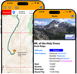


Referring to strictly class 2 routes, I've noticed one of my weaknesses is finding my way through class 2 terrain higher up on a mountain. I'll follow what seems to be a trail through class 2 areas, only to come to a dead end. Then I'll have to boulder hop to the next cairn, re-locate the trail, and the process repeats itself over and over. But I'll summit. Then on the descent, the trail seems obvious, and it's easy to follow all the way down. A perfect example of this was Princeton last week. Scrambled up the final ridge, sometimes being on trail segments, but hiked the whole trail down.
Is this a common thing...difficult trail-spotting on the way up, and easy trail-spotting on the way down? Or is there just something wrong with my brain? If you're going to answer that last question, please be nice.
Route-finding: ascent vs descent
Forum rules
- This is a mountaineering forum, so please keep your posts on-topic. Posts do not all have to be related to the 14ers but should at least be mountaineering-related.
- Personal attacks and confrontational behavior will result in removal from the forum at the discretion of the administrators.
- Do not use this forum to advertise, sell photos or other products or promote a commercial website.
- Posts will be removed at the discretion of the site administrator or moderator(s), including: Troll posts, posts pushing political views or religious beliefs, and posts with the purpose of instigating conflict within the forum.
For more details, please see the Terms of Use you agreed to when joining the forum.
-
colospgs

- Posts: 39
- Joined: 9/4/2014
- 14ers: 29 1
- 13ers: 22 3
- Trip Reports (0)
-
LarryM
- Posts: 415
- Joined: 5/11/2008
- 14ers: 29
- 13ers: 37
- Trip Reports (3)
Re: Route-finding: ascent vs descent
Can't say for sure that it's common, but I've noticed this for myself as well.
-
greenonion

- Posts: 2161
- Joined: 10/3/2012
- 14ers: 52 1
- 13ers: 2
- Trip Reports (0)
Re: Route-finding: ascent vs descent
It may have something to do with being able to look down on things, such as a trail/route, from above while descending. Whereas you can’t look down on anything when looking up, ascending. All about the point of view and perspective from that POV. That makes sense to me but I can see where it might not for others.
Shifting time of day/shadows etc can change things too.
Shifting time of day/shadows etc can change things too.
-
nyker

- Posts: 3528
- Joined: 12/5/2007
- 14ers: 58
- 13ers: 25
- Trip Reports (69)
Re: Route-finding: ascent vs descent
Maybe you're following false cairns leading to nowhere? On some routes, many cairns are not on the trail proper but put there by other hikers trying to find their own way then left there making finding the correct route confusing.
On less travelled routes or in bad weather that's happened to me too, and it can get unnerving. Try and retrace your steps back rather than continuing on in unknown terrain.
If above treeline, sometimes getting first a line of sight to where you want to be, then trying to match where you are on the map could help get your bearings and locate the trail proper.
In addition to the above, knowing elevation would help too coupled with visible landmarks to find the trail. One day I'll get a GPS and learn to travel with that as I've seen many folks just follow that, but admittedly part of my doesn't want to stare at a screen walking up a mountain...but with that said if you have one or any of the apps, suppose they could help.

Re: Route-finding: ascent vs descent
On lower class terrain you can see the route when you're looking down upon it. The main trail is obvious compared to game trails or social braids and you can often distinguish between the two. When you're going up, you don't have that big picture view to create a mental map. If a game/unsanctioned trail continues on from the main trail but the main trail switches back, it's not always apparent until the unsanctioned trail peters out.
It's kind of the opposite of more difficult terrain. Handholds and footholds are obvious climbing up but become harder to identify when terrain rolls over and/or you're facing inward.
It's kind of the opposite of more difficult terrain. Handholds and footholds are obvious climbing up but become harder to identify when terrain rolls over and/or you're facing inward.
Traveling light is the only way to fly.
IG: @colorado_invasive
Strava: Brent Herring
IG: @colorado_invasive
Strava: Brent Herring
-
seannunn
- Posts: 385
- Joined: 3/6/2024
- 14ers: 51
- 13ers: 3
- Trip Reports (1)
Re: Route-finding: ascent vs descent
+1. Jorts called it spot on. Faint trails through talus are almost always easier to see from above and below.Jorts wrote: ↑Sun Jun 14, 2026 7:58 pm On lower class terrain you can see the route when you're looking down upon it. The main trail is obvious compared to game trails or social braids and you can often distinguish between the two. When you're going up, you don't have that big picture view to create a mental map. If a game/unsanctioned trail continues on from the main trail but the main trail switches back, it's not always apparent until the unsanctioned trail peters out.
It's kind of the opposite of more difficult terrain. Handholds and footholds are obvious climbing up but become harder to identify when terrain rolls over and/or you're facing inward.
Hand and foot holds on class 3 and 4 (and I'm guessing class 5 also) are usually much easier to see from below.
So I am not sure you can do a lot about it. GPX tracks would help, but I am not a big fan of overtechnology.
Sean Nunn
Peculiar, MO
"Thy righteousness is like the great mountains."
--Psalm 36:6
--Psalm 36:6
-
mtree
- Posts: 1697
- Joined: 6/16/2010
- Trip Reports (0)
Re: Route-finding: ascent vs descent
All these being equal, the route is far more obvious looking down during your descent than looking up during the ascent. Different viewpoints.
- I didn't say it was your fault. I said I was blaming you.
-
daway8

- Posts: 1636
- Joined: 8/24/2017
- 14ers: 58 31
- 13ers: 179 30
- Trip Reports (83)
Re: Route-finding: ascent vs descent
GPS is super helpful, especially if you've downloaded the GPX tracks and offline maps in advance, but it's ideal to try to use it more as a backup rather than be lazy and rely on it totally (make sure you bring a backup battery pack if you expect heavy usage).
Another lower tech approach that's not very common but I've found useful at times, is take a series of photos as you go along - often you can spot portions of the trail in wide open places down low and, once you learn to train your eyes, you can spot landmarks in your earlier photos and recognize as you go past them. This time of year especially you can sometimes spot that one lingering patch a snow marking a turn in the trail or maybe an especially pointed or unusually light colored boulder that stands out from the surroundings just above or below the trail.
But yes, generally speaking, it's most often easier to pick out the trail from above for class 2 (as others have stated, that flips as you get into steeper/harder terrain).
-
d_baker
- Posts: 3263
- Joined: 11/18/2007
- 14ers: 58 17
- 13ers: 388 13
- Trip Reports (59)
Re: Route-finding: ascent vs descent
I'm not surprised it was Princeton and the "standard" route that was brought up as an example. It's been over 20 years since I did that route, but I remember the same problem going up!
These days, if I lose a trail, or there's not a trail, I go with what seems the path of least resistance or less shifty underfoot. Sometimes, those don't exist!
Seeking out game trails help too.
These days, if I lose a trail, or there's not a trail, I go with what seems the path of least resistance or less shifty underfoot. Sometimes, those don't exist!
Seeking out game trails help too.